

Slieau Ruy
Good walks are even better shared.
SC3282 : Cairn at the summit of Slieau Ruy
Adie Jackson Photo source
Overview
Slieau Ruy
Nestled in the heart of the Isle of Man, Slieau Ruy stands proud at an elevation of 624 meters. Although modest in height compared to some of the behemoths on the mainland, it offers a delightful hike with breathtaking views.
Geography and Geology
Slieau Ruy is predominantly comprised of basalt and sandstone, remnants of ancient volcanic activity that formed much of the Isle of Man's landscape. This gives the area a striking geological variety that will have rock enthusiasts itching to explore.
Routes
There are two popular routes that cater to various levels of hiking prowess. The Foxdale Start spans approximately 7.5 km and is classified as a moderate hike, allowing for a friendly challenge to seasoned walkers or an enjoyable ascend for newbies. Alternatively, the Ballagawne Start provides a gentler approach, measuring 5 km, perfect for a family day out or a leisurely stroll.
Summit Features
Upon reaching the summit, hikers will find a humble cairn that stands in tribute to fellow adventurers. Don't forget to take a selfie with the trig point—it’s a great conversation starter!
Terrain and Views
Expect grassy trails mixed with rocky sections. As you ascend, each step rewards you more than the last, culminating in stunning views over the southern coastline of the Isle of Man. On a clear day, you can even spot the peaks of Snaefell, just teasing you to conquer them next.
Hazards
Hikers should be aware of rapidly changing weather—always dress in layers and keep an eye on those clouds. Uneven terrain is also a common feature, so watch your step. We’d hate for you to trip while admiring the scenery!
Nearby Summits
Do consider visiting Snaefell, a neighbour at 621 meters, or Cronk ny Arrey Laa, standing at 475 meters. Short of cash? Just walk back down and try your luck at being a local!
Access
For those driving, head to Foxdale where you will find ample parking; a short distance from your starting route. Public transport is also an option, with regular bus services from Douglas.
Facilities
Though the mountain itself is devoid of amenities, the nearby villages provide a few comforts; a local pub and shop in Foxdale are ripe for rewarding your conquering spirit with a pint and a pasty!
History
The name 'Slieau Ruy' carries significance—meaning 'Red Mountain'—and hints at the area’s historic use as grazing land for sheep. Feel free to pretend you’re a shepherd surveying your flock if it adds to your experience!
Whether you’re out for a casual day or looking to challenge your limits, Slieau Ruy welcomes all adventurers with open promenades. So lace up your boots, grab your walking stick, and make the most of your day in this beautiful spot!
Conclusion
So there you have it, Slieau Ruy in all its glory. When you’re ready to hit the trails, it promises to be a memorable ascent with views to boot. Happy hiking!
Explore routes near Slieau Ruy
Walks starting near this hill. Open a route to check its map, distance and full itinerary.
Kilsture Forest Woodpecker Trail
View route
Kirkcudbright Harbour to Barrhill Woods Circuit
View route
Route planning notes
These notes describe possible approaches. Check a route's map and access information when planning your walk.
Foxdale Start
A picturesque route starting from Foxdale that takes hikers through lush fields and local wildlife spotting opportunities.
Ballagawne Start
This alternative route from Ballagawne leads up through a scenic glen, providing excellent views as you ascend.
Make a day of it, together
Find someone to share the walk with, or organise a day out along a route you like.
Photo Gallery
View all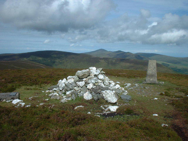 Photo could not load
SC3282 : Cairn at the summit of Slieau Ruy
Adie Jackson
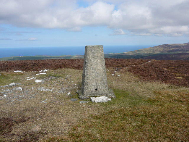 Photo could not load
SC3282 : Trig point on the summit of Slieau Ruy
Colin Park
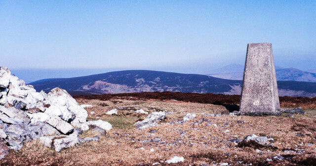 Photo could not load
SC3282 : Summit area of Slieau Ruy
Trevor Littlewood
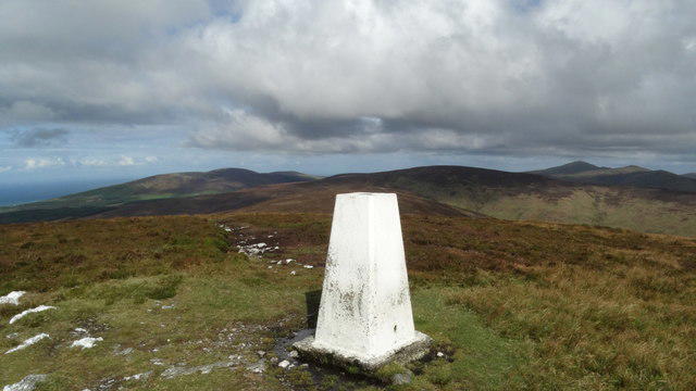 Photo could not load
SC3282 : Trig Point on Slieau Ruy above Crosby
Colin Park
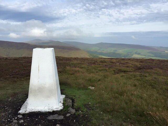 Photo could not load
SC3282 : Slieau Ruy Trig Point Flush Bracket 10853
thejackrustles
Hill facts and local notes
Classifications
Elevation
479m
1,572 ft
Prominence
93m
Coordinates
54.2095, -4.5651
SC328823
OS Map
95
Explorer: IoM OL
At the Summit
The summit features a well-maintained cairn commemorating the ascent, along with a small trig point which might make you feel like you've aced your navigation skills.
Terrain & Geology
Primarily composed of basalt and sandstone, Slieau Ruy offers visitors a peek into the geological history shaped by volcanic activity millions of years ago.
Views & Scenery
From the summit, admire panoramic views of the southern coastline of the Isle of Man, with peaks of the nearby Snaefell visible on a clear day.
History & Heritage
Name Origin
The name 'Slieau Ruy' translates roughly to 'Red Mountain' in Manx, hinting possibly at the reddish hues found in some of its geological features.
Historical Significance
Historically, Slieau Ruy has been used for grazing sheep, and its heights would have provided vantage points for watching for incoming weather or invaders.
Getting There & Facilities
Parking
Parking at Foxdale village offers easy access to the starting routes, with ample spaces available.
Public Transport
The nearest bus service runs from Douglas to Foxdale, so a bit of planning and a pocket full of change should see you there.
Nearby Facilities
There are no facilities directly on the mountain, but nearby Foxdale has a few local pubs and a shop.
Safety Information
Known Hazards
- Be cautious of sudden weather changes, as well as uneven terrain in some areas.
General Safety Tips
- Check weather conditions before setting out
- Carry appropriate clothing and equipment
- Let someone know your planned route
- Take a map, compass, and GPS device
- Carry emergency supplies: food, water, first aid kit, torch
Hills
Some common questions about the hills answered
Are there group walks up Slieau Ruy?
Many walkers use Walkmates to join or organise walks with others. You can check for group walks around Slieau Ruy through the maps
Are there other walkers around Slieau Ruy?
Activity varies by location and time, but Walkmates lets you see whether others have shared walks or shown interest in this area. Find other people through the walking friends search walking friends for Slieau Ruy search or of course create your own walk for Slieau Ruy
Can I organise a walk to Slieau Ruy?
Yes. If there aren’t any walks listed already, you can create a walk and make it available for others to join.
If you're signed up to Walkmates, you can create a walk to Slieau Ruy.
How do I find a walk up this hill?
There are often multiple ways to walk this hill, depending on experience and route preference. Walkmates helps you explore walks and routes that others have shared.
Can I suggest a new route up Slieau Ruy?
Yes. You can suggest or create routes to share with others. Walkmates focuses on the social side of walking, so routes are used to help people organise walks and explore areas together, rather than as detailed navigation tools or route libraries.
Other uses really appreciate knowledgeable walkers sharing their routes. Share your favourite route to Slieau Ruy here
The is an error or something incorrect about this hill. How do I let you know?
We always strive to keep the information on Walkmates as accurate as possible. If you find an error, please let us know through the contact form and we'll aim to correct it as quickly as possible
Community Discussion
Comments
Location
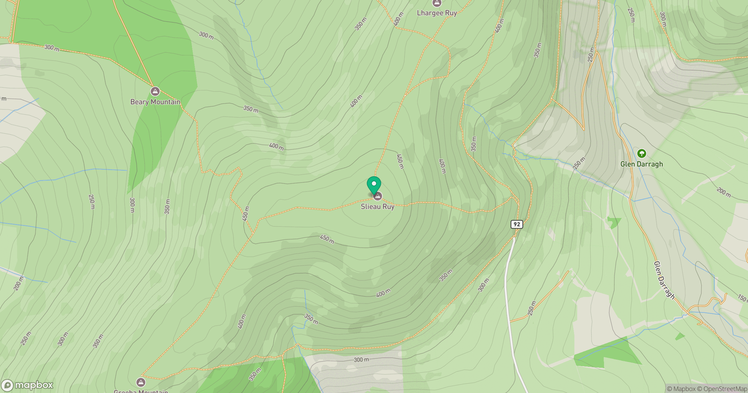
Grid reference: SC328823
View on OpenStreetMapOpens a map in a new tab, centred on the hill.
Nearby Hills
Snaefell
621m
Merrick
843m
Cairnsmore of Carsphairn
797m
Great Orme [Y Gogarth]
207m
Ailsa Craig
339m
No comments yet. Be the first.