

Bradda Hill
Good walks are even better shared.
SC1971 : Bradda Hill, Isle of Man
kevin rothwell Photo source
Overview
Bradda Hill: The Jewel of the Isle of Man
Bradda Hill, standing at an elevation of 203 meters, is a striking Marilyn located on the Isle of Man's southern coast, just near the charming village of Port Erin. This hill may not reach the dizzying heights of the British Munros, but it does offer a fantastic day out for walkers and outdoor enthusiasts alike.
Geology
Bradda Hill is primarily composed of limestone and slate, which may not sound exciting for most, but these rocks tell the fascinating story of the island’s geological past. The rugged cliffs and ridges reveal layers of sedimentary history, resulting from million-year-old environmental changes. Just remember, though: that rocky path might have a story of its own and is best left untouched!
Routes
One of the most popular hikes is the Bradda Head Circular Walk, a moderately challenging jaunt of 4.5 km that takes approximately 2 hours. Starting at Port Erin, this route offers spectacular coastal views, lush greenery, and keeps your heart pumping as you ascend. Perfect for those looking to stretch their legs and enjoy some fresh sea breezes – just watch out for the occasional peckish seagull!
Summit Features
At the summit, you'll find a trig point marking your achievement, along with panoramic views that are worth every breath taken on the way up. On a clear day, look out for the Calf of Man to the south and the sprawling Port Erin Bay. It’s the perfect backdrop for that Facebook profile picture update!
Terrain
Expect a mixed terrain with rocky paths that could challenge your balance (and your shoes!) and grassy slopes that are as inviting as promises of a warm scone with clotted cream. Don’t forget to soak in the spectacular scenes while you navigate the path.
Views
The views from Bradda Hill are absolutely stunning, showcasing the dramatic coastline of the Isle of Man. Key landmarks like the Calf of Man and distant Welsh hills can sometimes be seen peeking through the clouds, particularly memorable during spring and autumn – so time your trip right for a visual feast. Evening sunsets can also paint the sky in vibrant hues for those daring enough to stay until dusk.
Hazards
Like most outdoor areas, Bradda Hill has its risks. Be cautious of loose rocks and remember it’s not wise to edge too close to the cliffs during windy conditions. Sudden weather changes are also common, so pack that waterproof jacket just in case!
Nearby Summits
Just a stone's throw away are other stunning footholds including Cronk ny Arrey Laa (241 m) and Slieu Asht (282 m). Each offers its unique views and routes, ideal for the keen hiker who can’t get enough of nature's wonders.
Access
Getting to Bradda Hill is as easy as pie – or should I say, as easy as a well-placed parking spot? The public car park at Port Erin is conveniently located, and you can hop onto a bus from Douglas without breaking a sweat. The nearest town, Port Erin, has all the facilities you need, from cafes serving up proper coffee to public toilets for those 'urgent' moments.
Facilities
After your hike, reward yourself! There are various cafes in Port Erin where you can refuel with some local delicacies. And yes, those toilets you might have been wondering about – they’re nearby, ensuring you leave no trace on your adventure.
History
The name 'Bradda' harks back to Old Norse roots, meaning 'hill'—a simple yet perfect descriptor for this lovely bump. Historically, this area has served as a strategic lookout through the ages, adding a layer of intrigue to your hike. It’s like walking through history while keeping an eye on modern-day adventures.
In conclusion, Bradda Hill is an inviting adventure waiting to be explored. Whether you're a serious hiker or just chasing views with a side of scone, it's an experience not to be missed!
Happy hiking!
Explore routes near Bradda Hill
Walks starting near this hill. Open a route to check its map, distance and full itinerary.
Newcastle, Co. Down (NI) with Men Walking & Talking
View route
Tollymore Forest Park: River Trail near Newcastle
View route
Castlewellan Forest Park: Lake, Arboretum and Mitchell's Lake Circuit
View route
Route planning notes
These notes describe possible approaches. Check a route's map and access information when planning your walk.
Bradda Head Circular Walk
A picturesque circular route starting at Port Erin, taking you along coastal paths and up to the summit, providing stunning views of the surrounding area.
Make a day of it, together
Find someone to share the walk with, or organise a day out along a route you like.
Photo Gallery
View all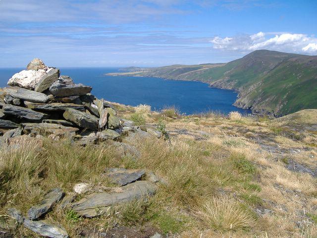 Photo could not load
SC1971 : Bradda Hill, Isle of Man
kevin rothwell
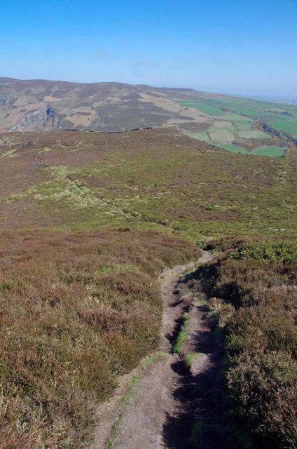 Photo could not load
SC1971 : The Descent From Bradda Hill
Glyn Baker
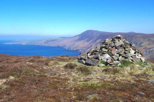 Photo could not load
SC1971 : Cairn On Braddock Hill
Glyn Baker
Hill facts and local notes
Classifications
Elevation
233m
764 ft
Prominence
196m
Coordinates
54.1044, -4.7635
SC194711
OS Map
95
Explorer: IoM OL
At the Summit
The summit features a trig point with breathtaking views over the southern coast of the Isle of Man and the surrounding emerald landscape.
Terrain & Geology
Bradda Hill is primarily composed of limestone and slate. Its rugged cliffs form stunning features that reveal the geological history of the Isle of Man, formed through various sedimentary processes over millions of years.
Views & Scenery
Visible from the summit are iconic landmarks such as the Calf of Man, Port Erin Bay, and, on a clear day, even the distant hills of Wales.
History & Heritage
Name Origin
The name 'Bradda' is derived from the Old Norse term for 'hill'.
Historical Significance
Bradda Hill has historical significance related to Manx heritage, providing strategic lookout points during the Viking and later periods.
Getting There & Facilities
Parking
There is a public car park located at Port Erin, just a short walk from the trailhead.
Public Transport
Frequent bus services operate from Douglas to Port Erin, making it accessible for visitors without transport.
Nearby Facilities
Village facilities include cafes, restaurants, and public toilets, ideal for a pre- or post-hike snack.
Safety Information
Known Hazards
- Loose rocks on steep paths, sudden weather changes, and coastal cliffs should be approached with caution.
General Safety Tips
- Check weather conditions before setting out
- Carry appropriate clothing and equipment
- Let someone know your planned route
- Take a map, compass, and GPS device
- Carry emergency supplies: food, water, first aid kit, torch
Hills
Some common questions about the hills answered
Are there group walks up Bradda Hill?
Many walkers use Walkmates to join or organise walks with others. You can check for group walks around Bradda Hill through the maps
Are there other walkers around Bradda Hill?
Activity varies by location and time, but Walkmates lets you see whether others have shared walks or shown interest in this area. Find other people through the walking friends search walking friends for Bradda Hill search or of course create your own walk for Bradda Hill
Can I organise a walk to Bradda Hill?
Yes. If there aren’t any walks listed already, you can create a walk and make it available for others to join.
If you're signed up to Walkmates, you can create a walk to Bradda Hill.
How do I find a walk up this hill?
There are often multiple ways to walk this hill, depending on experience and route preference. Walkmates helps you explore walks and routes that others have shared.
Can I suggest a new route up Bradda Hill?
Yes. You can suggest or create routes to share with others. Walkmates focuses on the social side of walking, so routes are used to help people organise walks and explore areas together, rather than as detailed navigation tools or route libraries.
Other uses really appreciate knowledgeable walkers sharing their routes. Share your favourite route to Bradda Hill here
The is an error or something incorrect about this hill. How do I let you know?
We always strive to keep the information on Walkmates as accurate as possible. If you find an error, please let us know through the contact form and we'll aim to correct it as quickly as possible
Community Discussion
Comments
Location
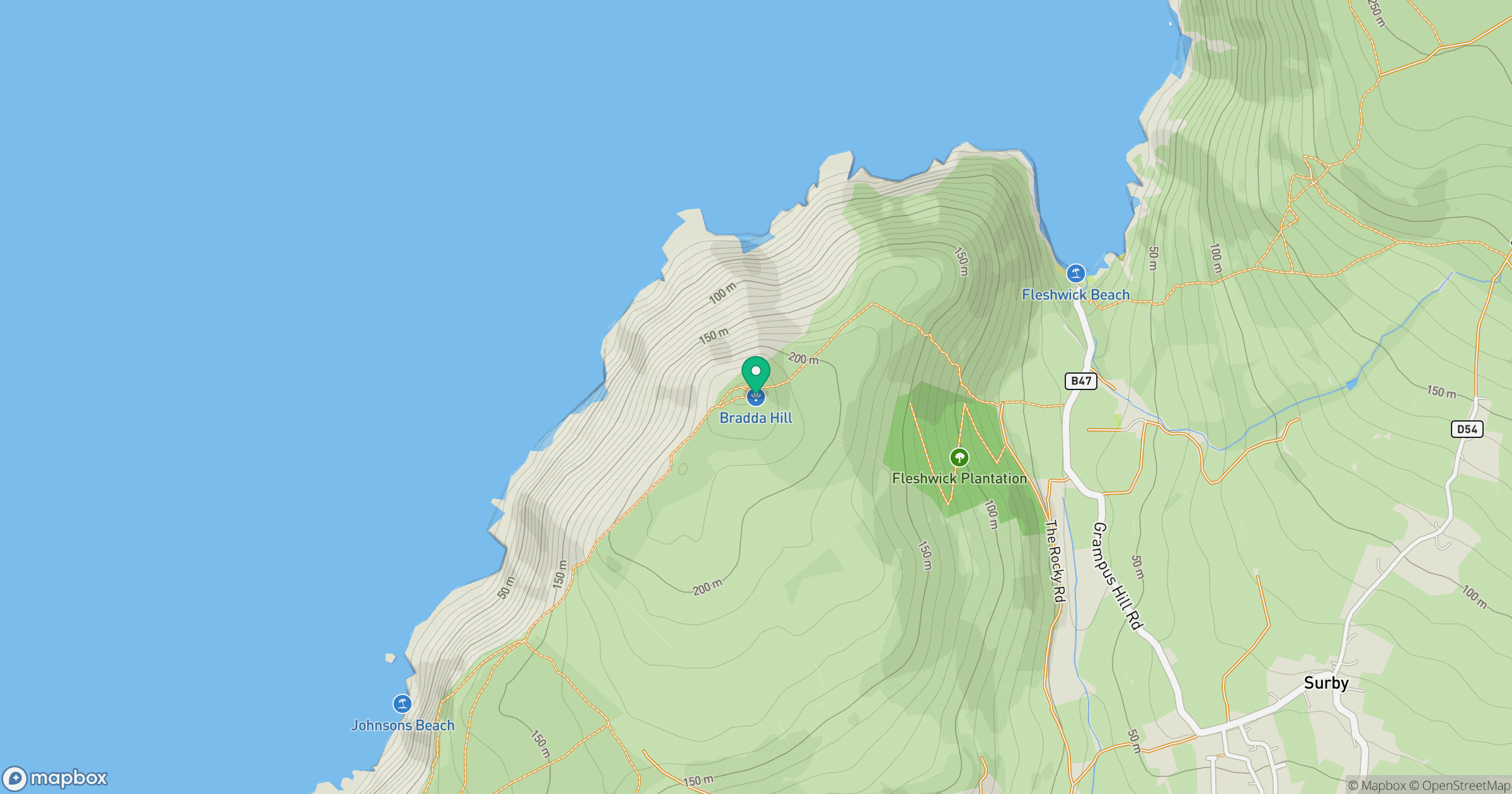
Grid reference: SC194711
View on OpenStreetMapOpens a map in a new tab, centred on the hill.
No comments yet. Be the first.