

Slieau Freoaghane
Good walks are even better shared.
SC3388 : From the ridge of Slieau Freoaghane
Andy Stephenson Photo source
Explore routes near Slieau Freoaghane
Walks starting near this hill. Open a route to check its map, distance and full itinerary.
Kilsture Forest Woodpecker Trail
View route
Kirkcudbright Harbour to Barrhill Woods Circuit
View route
Kirroughtree Little Bruntis Lochs and Woodland Trail
View route
Knockman Wood Cairn and Woodland Trail
View route
Route planning notes
These notes describe possible approaches. Check a route's map and access information when planning your walk.
Braddan Road to Summit
A scenic ascent that meanders through the lush countryside before making a steep push up to the summit.
Make a day of it, together
Find someone to share the walk with, or organise a day out along a route you like.
Photo Gallery
View all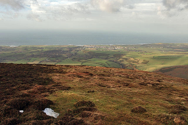 Photo could not load
SC3388 : From the ridge of Slieau Freoaghane
Andy Stephenson
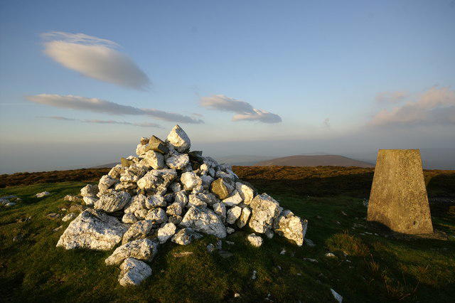 Photo could not load
SC3488 : Slieau Freoaghane Summit
Peter Standing
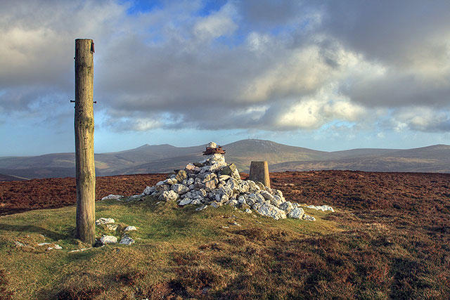 Photo could not load
SC3488 : Slieau Freoaghane
Andy Stephenson
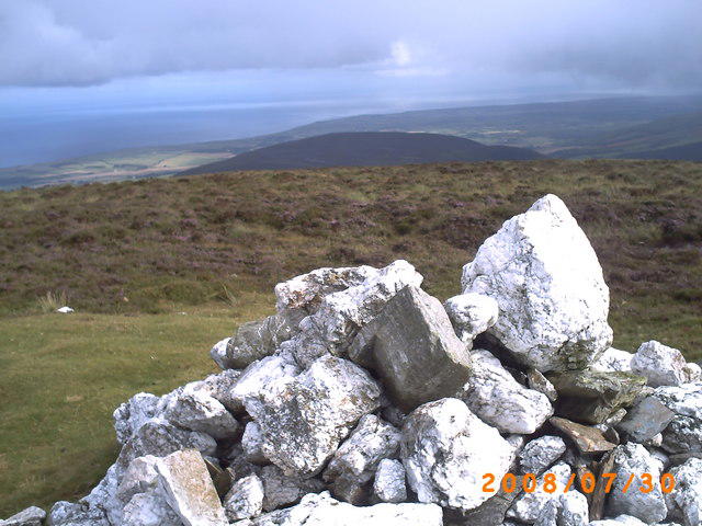 Photo could not load
SC3488 : Slieau Freoaghane
Tom Cubbon
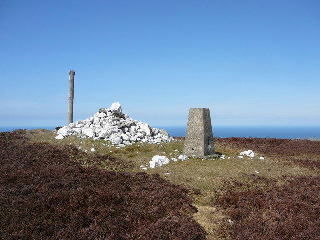 Photo could not load
SC3488 : The summit of Slieau Freoaghane
Colin Park
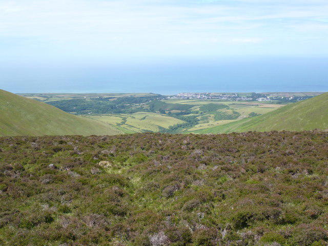 Photo could not load
SC3488 : The view north west from Slieau Freoghane
Phil Catterall
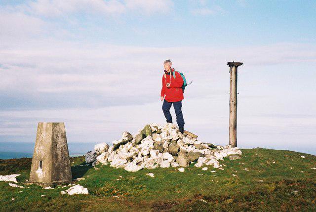 Photo could not load
SC3488 : Slieau Freoaghane
Rude Health
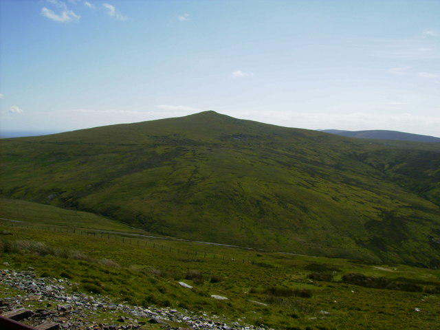 Photo could not load
SC3488 : The summit of Slieau Freoaghane
Phil Catterall
Hill facts and local notes
Classifications
Elevation
488m
1,601 ft
Prominence
153m
Coordinates
54.2639, -4.5490
SC340883
OS Map
95
Explorer: IoM OL
At the Summit
The summit features a modest cairn, along with breathtaking panoramic views over the surrounding landscape. It’s the perfect place for a selfie—if nobody’s looking, that is!
Terrain & Geology
Composed predominantly of slate and sandstone, Slieau Freoaghane is a great example of the region's geological diversity. The slopes are interspersed with minor outcrops that tell the tale of millennia gone by.
Views & Scenery
From the top, you can see the distant peaks of the North Barrule and the picturesque Laxey coastline. If you squint hard enough, you might just catch a glimpse of the legendary Manx fairies.
History & Heritage
Name Origin
Slieau Freoaghane translates to 'Mountain of the Grey Stones' in Manx, which is fitting given the rocky outcrops that dot the landscape.
Historical Significance
This mountain is steeped in local folklore, including tales of fairies and mystical creatures that are said to inhabit the area.
Getting There & Facilities
Parking
Parking is available at the Braddan Church pull-in, which is well signposted.
Public Transport
The local bus service from Douglas often has routes to Braddan, but check the schedule, as it varies!
Nearby Facilities
While there are no facilities directly on the mountain, nearby Douglas has plenty of cafes, pubs, and public toilets available to refresh after your hike.
Safety Information
Known Hazards
- Beware of unpredictable weather changes; conditions can shift from sunny to rainy in the blink of an eye. Also watch out for muddy patches after heavy rainfall.
General Safety Tips
- Check weather conditions before setting out
- Carry appropriate clothing and equipment
- Let someone know your planned route
- Take a map, compass, and GPS device
- Carry emergency supplies: food, water, first aid kit, torch
Hills
Some common questions about the hills answered
Are there group walks up Slieau Freoaghane?
Many walkers use Walkmates to join or organise walks with others. You can check for group walks around Slieau Freoaghane through the maps
Are there other walkers around Slieau Freoaghane?
Activity varies by location and time, but Walkmates lets you see whether others have shared walks or shown interest in this area. Find other people through the walking friends search walking friends for Slieau Freoaghane search or of course create your own walk for Slieau Freoaghane
Can I organise a walk to Slieau Freoaghane?
Yes. If there aren’t any walks listed already, you can create a walk and make it available for others to join.
If you're signed up to Walkmates, you can create a walk to Slieau Freoaghane.
How do I find a walk up this hill?
There are often multiple ways to walk this hill, depending on experience and route preference. Walkmates helps you explore walks and routes that others have shared.
Can I suggest a new route up Slieau Freoaghane?
Yes. You can suggest or create routes to share with others. Walkmates focuses on the social side of walking, so routes are used to help people organise walks and explore areas together, rather than as detailed navigation tools or route libraries.
Other uses really appreciate knowledgeable walkers sharing their routes. Share your favourite route to Slieau Freoaghane here
The is an error or something incorrect about this hill. How do I let you know?
We always strive to keep the information on Walkmates as accurate as possible. If you find an error, please let us know through the contact form and we'll aim to correct it as quickly as possible
Community Discussion
Comments
Location
View the hill's mapped position and surrounding paths.
Grid reference: SC340883
View on OpenStreetMapOpens a map in a new tab, centred on the hill.
Nearby Hills
Snaefell
621m
Merrick
843m
Cairnsmore of Carsphairn
797m
Ailsa Craig
339m
Great Orme [Y Gogarth]
207m
No comments yet. Be the first.