

Slieau Whallian
Good walks are even better shared.
Overview
Slieau Whallian: The Jewel of the Isle of Man
Nestled in the heart of the Isle of Man, Slieau Whallian stands proud at an elevation of 451 meters, offering enjoyment and challenge to hikers and outdoor enthusiasts alike.
Geology
Slieau Whallian's intriguing geological composition speaks of history and transformation; primarily made of slate, its steep slopes offer not just a rigorous ascent but also stunning vistas. The presence of limestone patches adds to the area's ecological richness.
Routes
Hikers have multiple options to reach the summit, each providing unique perspectives. The Glen Dhoo Route is a moderate path that winds through lush greenery, while the Cregneash to Slieau Whallian Trail is a more challenging ascent but well worth it for its jaw-dropping coastal views.
Summit Features
At the summit, you'll discover a trig point standing tall, alongside a friendly cairn that welcomes all who reach it. Perfect for a quick selfie or a chat with fellow walkers!
Terrain Type
Expect a delightful mix of heather-covered slopes and some rocky outcrops—ideal for those seeking a bit of adventure, but mind your footing when the ground is wet!
Views
The summit rewards your efforts with panoramic views of the surrounding hills and coastal stretches. Clear days unveil the distant Lake District, making you feel on top of the world. Spring and autumn are the prime seasons for sweeping views, while mid-summer can be a lovely experience if you don’t mind sharing the path with other ardent hikers.
Hazards
Take note: the weather can change faster than you can say “cup of tea.” Sudden rain showers can make paths slippery, so it's wise to be cautious!
Nearby Summits
If you're feeling adventurous, nearby summits such as Snaefell and Greeba Mountain also await your exploration, offering more of the stunning Manx landscape.
Access
Conveniently, there's parking available at Cregneash, along with regular bus services connecting Douglas to this picturesque village. Just make sure to carry some change for the bus!
Facilities
Post-hike, reward yourself at the local café in Cregneash, where you can indulge in some delicious homemade cakes—and you’ve earned it!
History
The name 'Slieau Whallian' adds a touch of intrigue, meaning 'mountain', while the exact roots of 'Whallian' are delightfully elusive. Historically, this area has been ripe with local folklore and significance, making your trek not just a physical journey, but a cultural one too.
In conclusion, Slieau Whallian offers a splendid blend of challenge, beauty, and history. So lace up those hiking boots and get ready for an adventure that blends the thrill of the climb with the rich tapestry of Manx culture!
Explore routes near Slieau Whallian
Public walks starting within 80 km of this hill. Nearby does not mean a route reaches the summit; check its map and access before setting out.
Castle Ward: full Boundary Trail from the shore
View route
Kilsture Forest Woodpecker Trail
View route
Newcastle, Co. Down (NI) with Men Walking & Talking
View route
Route planning notes
These notes describe possible approaches, not verified navigable routes or permission to cross land. Check current paths, local access rules and conditions before setting out.
Glen Dhoo Route
A scenic approach beginning at Glen Dhoo, winding through lush greenery before ascending the slopes of Slieau Whallian.
Cregneash to Slieau Whallian Trail
Starting from the picturesque Cregneash, this route leads directly to the summit, providing stunning coastal views.
Make a day of it, together
Find someone to share the walk with, or organise a day out along a route you like.
Photo Gallery
View all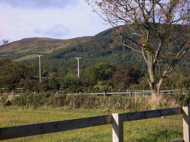 Photo could not load
SC2680 : Steam Heritage Trail on the Isle of Man (48)
Shazz
Hill facts and local notes
Classifications
Elevation
333m
1,093 ft
Prominence
116m
Coordinates
54.1901, -4.6610
SC264804
OS Map
95
Explorer: IoM OL
At the Summit
At the summit, hikers are greeted with a robust trig point, alongside a weathered stone cairn that sits like a beacon for wanderers in the mist.
Terrain & Geology
Slieau Whallian is primarily composed of slate, a metamorphic rock that provides stunning views due to its steep slopes and distinctive terrain. The area also features patches of limestone, contributing to the unique ecological diversity.
Views & Scenery
From the summit, enjoy panoramic views of the surrounding hills, stunning coastal stretches, and on clear days, the distant silhouette of the Lake District.
History & Heritage
Name Origin
The name 'Slieau Whallian' derives from the Manx language, with 'slieau' meaning 'mountain', but the specific meaning of 'Whallian' remains a bit of a mystery.
Historical Significance
Historically, the area has been significant as a meeting point for the local community and is filled with folklore relating to the ancient Celtic culture that once thrived here.
Getting There & Facilities
Check current local access restrictions, parking rules and transport timetables before travelling. These notes do not confirm public access to the summit.
Parking
Parking is available at the Cregneash car park, providing an excellent starting point for hikes, with ample space for several vehicles.
Public Transport
Regular bus services run from Douglas to Cregneash, making it relatively easy to access the area without a car. Just check the timetable to avoid a long wait.
Nearby Facilities
Nearby, there are basic facilities at Cregneash, including a café that serves delightful homemade cakes, perfect for a post-hike treat.
Safety Information
Known Hazards
- Be wary of sudden weather changes; the Isle of Man's weather can be as unpredictable as a cat on a hot tin roof. Slippery paths in wet conditions can make for tricky footing.
General Safety Tips
- Check weather conditions before setting out
- Carry appropriate clothing and equipment
- Let someone know your planned route
- Take a map, compass, and GPS device
- Carry emergency supplies: food, water, first aid kit, torch
Hills
Some common questions about the hills answered
Are there group walks up Slieau Whallian?
Many walkers use Walkmates to join or organise walks with others. You can check for group walks around Slieau Whallian through the maps
Are there other walkers around Slieau Whallian?
Activity varies by location and time, but Walkmates lets you see whether others have shared walks or shown interest in this area. Find other people through the walking friends search walking friends for Slieau Whallian search or of course create your own walk for Slieau Whallian
Can I organise a walk to Slieau Whallian?
Yes. If there aren’t any walks listed already, you can create a walk and make it available for others to join.
If you're signed up to Walkmates, you can create a walk to Slieau Whallian.
How do I find a walk up this hill?
There are often multiple ways to walk this hill, depending on experience and route preference. Walkmates helps you explore walks and routes that others have shared.
Can I suggest a new route up Slieau Whallian?
Yes. You can suggest or create routes to share with others. Walkmates focuses on the social side of walking, so routes are used to help people organise walks and explore areas together, rather than as detailed navigation tools or route libraries.
Other uses really appreciate knowledgeable walkers sharing their routes. Share your favourite route to Slieau Whallian here
The is an error or something incorrect about this hill. How do I let you know?
We always strive to keep the information on Walkmates as accurate as possible. If you find an error, please let us know through the contact form and we'll aim to correct it as quickly as possible
Community Discussion
Comments
Location
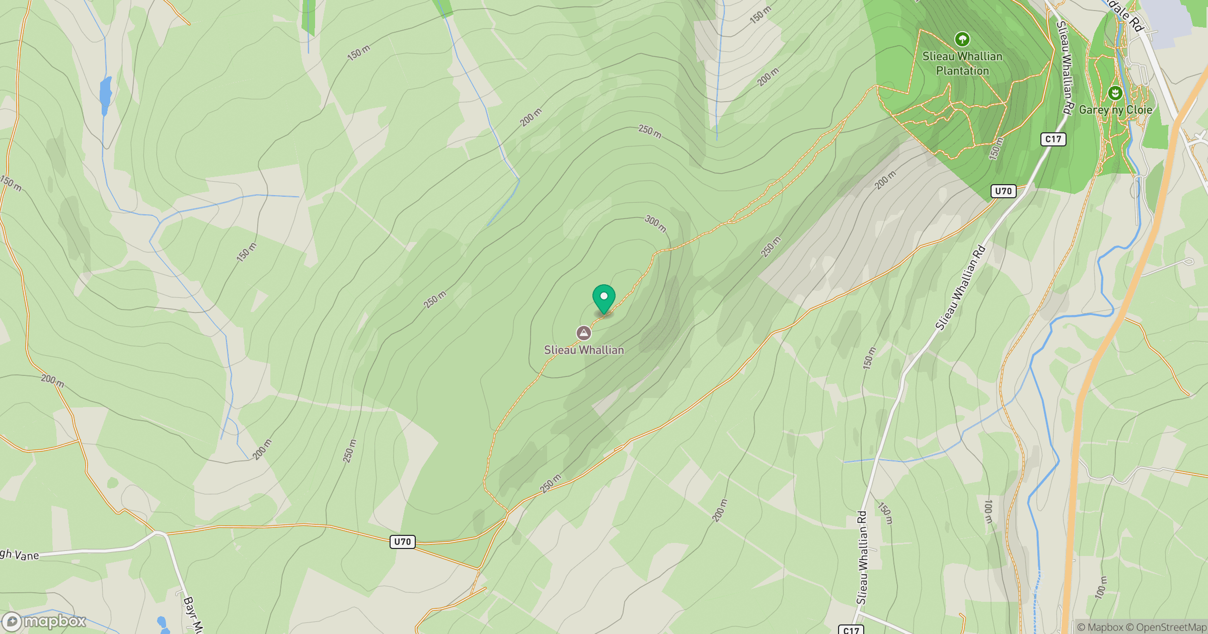
Grid reference: SC264804
View on OpenStreetMapOpens a map in a new tab, centred on the hill.
Hills within 30 km
Straight-line distance, not a walking route or confirmation of access.
No comments yet. Be the first.