
Shipton Hill
Good walks are even better shared.
Overview
Shipton Hill
Introduction
Nestled in the heart of Herefordshire, Shipton Hill may not be the tallest titan, but it packs a punch when it comes to charm and unbeatable vistas. Standing at 295 meters, it’s a Marilyn, a classification that means it’s worth a gander if you’re in the area.
Geology
Shipton Hill boasts Old Red Sandstone, a geological feature that’s not only interesting to look at but can also tell tales of ancient marine environments. You might find some interesting fossils if you keep your eyes peeled! Just remember, no fossil bingo games allowed—let the finds stay for other hikers to enjoy.
Routes
The most popular route starts in the charming village of Shipton. It’s a mere 3.5 km trek with a gentle incline that anyone can handle. Whether you’re an experienced climber looking for a warmup or a family with children, this route makes for a delightful outing. Be sure to pack a snack—the summit is an excellent picnic spot!
Summit Features
At the summit, you will find a modest stone cairn that has served as a resting point for many a hiker, perfect for that all-important selfie. Don’t forget to sign the unofficial register by jotting down your name in your mind, as there aren’t any pens up there!
Terrain Type
Expect a mix of grassy slopes and rocky patches. The grass is soft underfoot but watch out for the few rocks trying to trip you up—like sneaky little gremlins.
Views
From the top, you can take in magnificent views of the Black Mountains and Malvern Hills. The best seasons for vistas are spring and autumn when the colours are at their peak and visibility is often crystal clear.
Hazards
While the hike is mainly a stroll in the park, keep an eye out for slick rocks and occasional muddy patches, particularly after a good rain. Live on the edge, but not too much!
Nearby Summits
If you fancy extending your adventure, consider a quick jaunt over to Bredwardine Hill, standing at 260 meters, which offers more than just a passing glance, and is just a hop, skip, and jump away.
Access
Parking is available on the village roads, perfect for a few cars—just don’t block the sheep! If you're relying on public transport, there's a bus service coming from Hereford, so keep an eye out for the specifics. The nearest town is Hereford, about 15 km south, where you can stock up on supplies or have a bite before your journey up.
Facilities
In the village, there’s a lovely pub where you can grab a bite to eat, although facilities are basic, so plan accordingly!
History
The name 'Shipton' translates to 'sheep farm' from Old English, indicating its agricultural roots. It has long been a beloved escape for locals and visitors, inspiring tales of pastoral life and nature's beauty.
Conclusion
Whether you're in it for the views, the history, or a good walk, Shipton Hill has something to offer everyone. Don’t forget your camera and a hearty appetite for the delicious pub fare awaiting you after your hike. Enjoy the journey and happy hiking!
Explore routes near Shipton Hill
Walks starting near this hill. Open a route to check its map, distance and full itinerary.
Carding Mill Valley and The Long Mynd walk
View route
Lightspout Waterfall via Carding Mill Valley Circular
View route
Benthall Hall: chestnut avenue and meadow circuit
View route
Ironbridge, Old Railway and Dale End Park
View route
Route planning notes
These notes describe possible approaches. Check a route's map and access information when planning your walk.
From the Village of Shipton
A quaint route starting from the village of Shipton, offering a gentle incline with stunning views of the surrounding countryside.
Make a day of it, together
Find someone to share the walk with, or organise a day out along a route you like.
Hill facts and local notes
Classifications
Elevation
274m
898 ft
Prominence
31m
Coordinates
52.5253, -2.6660
SO549921
OS Map
137 138
Explorer: 217
At the Summit
The summit is marked by a small stone cairn, whispering tales of hikers past who stopped for a breather (and maybe a snack).
Terrain & Geology
Primarily composed of Old Red Sandstone, this hill features fascinating sedimentary structures and fossilized remains, a treasure trove for budding geologists.
Views & Scenery
On a clear day, you can see the Black Mountains to the west and the Malvern Hills to the east, both dazzling treats for the eyes.
History & Heritage
Name Origin
The name 'Shipton' derives from Old English, meaning 'sheep farm,' indicating the area's historical agricultural significance.
Historical Significance
The hill has been frequented by shepherds for centuries, offering local folklore and stunning views that have inspired many artists and poets alike.
Getting There & Facilities
Parking
There is limited roadside parking available in the Village of Shipton, with enough room for a few cars. Just don't block the sheep.
Public Transport
The nearest bus stop is in the village, with services running from Hereford several times a day, but check schedules as they tend to play hide and seek.
Nearby Facilities
The village has a charming pub that serves hearty meals, but ideal bathroom facilities are few and far; it's best to plan ahead.
Safety Information
Known Hazards
- Watch out for slippery rocks and the occasional patch of mud, which can turn your hike from a leisurely stroll into a slapstick comedy.
General Safety Tips
- Check weather conditions before setting out
- Carry appropriate clothing and equipment
- Let someone know your planned route
- Take a map, compass, and GPS device
- Carry emergency supplies: food, water, first aid kit, torch
Hills
Some common questions about the hills answered
Are there group walks up Shipton Hill?
Many walkers use Walkmates to join or organise walks with others. You can check for group walks around Shipton Hill through the maps
Are there other walkers around Shipton Hill?
Activity varies by location and time, but Walkmates lets you see whether others have shared walks or shown interest in this area. Find other people through the walking friends search walking friends for Shipton Hill search or of course create your own walk for Shipton Hill
Can I organise a walk to Shipton Hill?
Yes. If there aren’t any walks listed already, you can create a walk and make it available for others to join.
If you're signed up to Walkmates, you can create a walk to Shipton Hill.
How do I find a walk up this hill?
There are often multiple ways to walk this hill, depending on experience and route preference. Walkmates helps you explore walks and routes that others have shared.
Can I suggest a new route up Shipton Hill?
Yes. You can suggest or create routes to share with others. Walkmates focuses on the social side of walking, so routes are used to help people organise walks and explore areas together, rather than as detailed navigation tools or route libraries.
Other uses really appreciate knowledgeable walkers sharing their routes. Share your favourite route to Shipton Hill here
The is an error or something incorrect about this hill. How do I let you know?
We always strive to keep the information on Walkmates as accurate as possible. If you find an error, please let us know through the contact form and we'll aim to correct it as quickly as possible
Community Discussion
Comments
Location
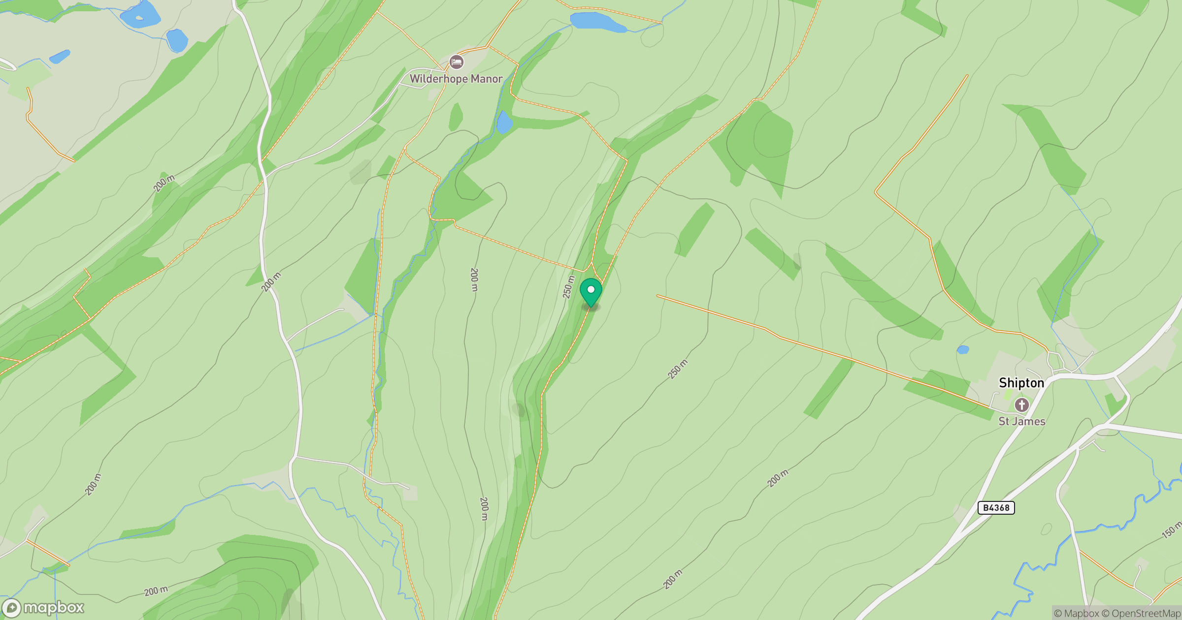
Grid reference: SO549921
View on OpenStreetMapOpens a map in a new tab, centred on the hill.
Nearby Hills
Titterstone Clee Hill
533m

The Wrekin
407m
Long Mynd - Pole Bank
517m
Stiperstones
537m
Worcestershire Beacon
425m
No comments yet. Be the first.