

Caer Caradoc Hill
Good walks are even better shared.
SO4795 : Squall about to hit Caer Caradoc summit
Jeremy Bolwell Photo source
Overview
Caer Caradoc Hill is a 459.5 m Marilyn above Church Stretton in the Shropshire Hills. Its rocky ridge is crowned by an Iron Age hillfort, with views across the valley to the Long Mynd and towards The Lawley and the Wrekin. Routes range from a short, steep circuit to full-day outings linking the surrounding hills.
Caer Caradoc Hill
Overview
Caer Caradoc Hill rises to 459.5 m above Church Stretton in the Shropshire Hills. Its craggy ridge, Iron Age hillfort and views over the Stretton valley make it a distinctive local walk. The summit is a natural rock outcrop at SO477953. Short approaches are steep, while circuits linking the surrounding hills can make a full day.
Summit and views
The high point lies within the hillfort, whose ramparts incorporate the natural rock outcrops. Look west to the Long Mynd, southeast towards the Hope Bowdler hills and northeast towards The Lawley and the Wrekin in clear weather. Three Fingers Rock is on the southwestern descent. Caractacus’ Cave lies beside the northwestern ramparts and is a separate feature from the summit.
Geology and history
The hill is made from Precambrian Uriconian volcanic rocks. BGS mapping identifies rhyolite across the summit, basalt on the northern ridge and andesite farther south. Faulting, folding and erosion have shaped the present ridge.
The Iron Age hillfort is protected as scheduled monument 1010723. Its multiple ramparts and engineered eastern approach make use of the steep natural hilltop. The hillfort and cave have a traditional association with Caradoc, or Caractacus; this does not establish the site of his final battle.
The National Landscape’s Fix the Fort project repaired visitor erosion in 2022–23, including stepped crossings of the ramparts. Use these established crossings and leave the earthworks and rocks undisturbed.
Walking routes
Caer Caradoc short circuit from the A49 lay-by
Start and finish at the east-side A49 lay-by north of Church Stretton (SO466954). Walking Britain's full circuit is 5.7 km, with 291 m of ascent and an allowance of 2 hours 30 minutes. Cross pasture and woodland, contour north along the western flank and climb from the Little Caradoc col to Caer Caradoc's summit. Descend southwest past Three Fingers Rock; turn right before the lower stile to contour back to the outward stile, then return through woodland to the same lay-by. The ascent and descent are steep. The approach uses the A49 grass verge: take care with traffic and check parking restrictions. Starting in town would lengthen this itinerary.
Caer Caradoc and Hope Bowdler circuit from Church Stretton
Start and finish in Church Stretton at SO454936. Walking Britain's full circuit is 14.6 km, with 470 m of ascent and an allowance of 5 hours 40 minutes. Use the signed route from Essex Road across the railway and A49, then the New House Farm approach to Caer Caradoc's south ridge and summit. Descend north, turn onto the eastern flank and follow field paths to the Willstone Hill col. Continue along the bridleway through the Hope Bowdler hills, returning via the B4371, village and Gaer Stone field paths, the edge of Helmeth Hill and the outward approach to town. Take particular care at the railway and A49 crossings and on B4371 road sections; some field paths are faint.
The Lawley and Caer Caradoc full circuit from Church Stretton
Start and finish in Church Stretton at SO454936. Walking Britain's complete circuit is 16.3 km, with 752 m of ascent and an allowance of 7 hours. After the railway and A49 crossings, go via Cwms Cottage, the Wilderness, Enchmarsh and Hoar Edge to the north end of The Lawley. Cross its summit and descend towards Comley Farm, then climb Little Caradoc and Caer Caradoc. Descend southwest past Three Fingers Rock to the outward footbridge and retrace the approach to town. Allow energy for the steep Caer Caradoc climb late in the day. This route includes lanes, road and railway crossings and several easily confused path junctions.
Terrain and safety
Expect steep grass and rocky ground on the upper ridge, with woodland, pasture, stiles and gates below. Wet paths can be muddy and slippery, and fog or strong wind makes the exposed upper ground more demanding. Carry a map and choose a route that fits the daylight and conditions. Take special care at the A49, railway crossings and road sections described for each circuit. Keep dogs under close control around livestock and follow local signs.
Access, parking and facilities
Church Stretton is the main base. Easthope 1–4 on Easthope Road, SY6 6BL, offers town-centre council parking; check the current charges and signs. The short circuit uses a different A49 lay-by start and includes verge walking. Moving that walk to a town or station start changes its length.
Church Stretton station is served by Transport for Wales; consult current journey information. The National Landscape also lists bus 435 between Shrewsbury and Ludlow via Church Stretton. The station has no toilets. Public toilets are on Easthope Road and Lutwyche Road, and cafés, pubs and shops are available in town. Carry supplies for the walk.
Follow current access notices. The old Fix the Fort closure notice concerned the 2022 works; the project subsequently records completion. Keep to established hillfort paths and repaired steps.
Nearby hills
The Lawley is 377 m and Ragleth Hill is 397.5 m. The Lawley can be combined with Caer Caradoc using the complete circuit above; reaching nearby hills requires its own route planning.
Explore routes near Caer Caradoc Hill
Walks starting near this hill. Open a route to check its map, distance and full itinerary.
Carding Mill Valley and The Long Mynd walk
View route
Lightspout Waterfall via Carding Mill Valley Circular
View route
Attingham Park Deer Park and River Tern
View route
Benthall Hall: chestnut avenue and meadow circuit
View route
Route planning notes
These notes describe possible approaches. Check a route's map and access information when planning your walk.
Caer Caradoc short circuit from the A49 lay-by
Start and finish at the east-side A49 lay-by north of Church Stretton (SO466954). Walking Britain's full circuit is 5.7 km, with 291 m of ascent and an allowance of 2 hours 30 minutes. Cross pasture and woodland, contour north along the western flank and climb from the Little Caradoc col to Caer Caradoc's summit. Descend southwest past Three Fingers Rock; turn right before the lower stile to contour back to the outward stile, then return through woodland to the same lay-by. The ascent and descent are steep. The approach uses the A49 grass verge: take care with traffic and check parking restrictions. Starting in town would lengthen this itinerary.
Caer Caradoc and Hope Bowdler circuit from Church Stretton
Start and finish in Church Stretton at SO454936. Walking Britain's full circuit is 14.6 km, with 470 m of ascent and an allowance of 5 hours 40 minutes. Use the signed route from Essex Road across the railway and A49, then the New House Farm approach to Caer Caradoc's south ridge and summit. Descend north, turn onto the eastern flank and follow field paths to the Willstone Hill col. Continue along the bridleway through the Hope Bowdler hills, returning via the B4371, village and Gaer Stone field paths, the edge of Helmeth Hill and the outward approach to town. Take particular care at the railway and A49 crossings and on B4371 road sections; some field paths are faint.
The Lawley and Caer Caradoc full circuit from Church Stretton
Start and finish in Church Stretton at SO454936. Walking Britain's complete circuit is 16.3 km, with 752 m of ascent and an allowance of 7 hours. After the railway and A49 crossings, go via Cwms Cottage, the Wilderness, Enchmarsh and Hoar Edge to the north end of The Lawley. Cross its summit and descend towards Comley Farm, then climb Little Caradoc and Caer Caradoc. Descend southwest past Three Fingers Rock to the outward footbridge and retrace the approach to town. Allow energy for the steep Caer Caradoc climb late in the day. This route includes lanes, road and railway crossings and several easily confused path junctions.
Make a day of it, together
Find someone to share the walk with, or organise a day out along a route you like.
Photo Gallery
View all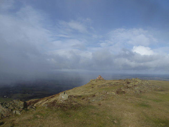 Photo could not load
SO4795 : Squall about to hit Caer Caradoc summit
Jeremy Bolwell
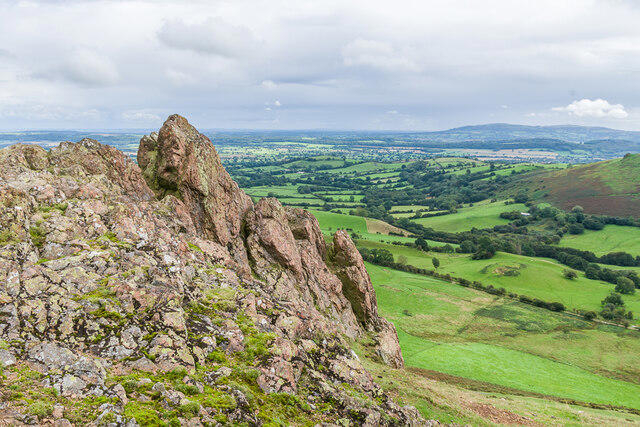 Photo could not load
SO4795 : Caer Caradoc
Ian Capper
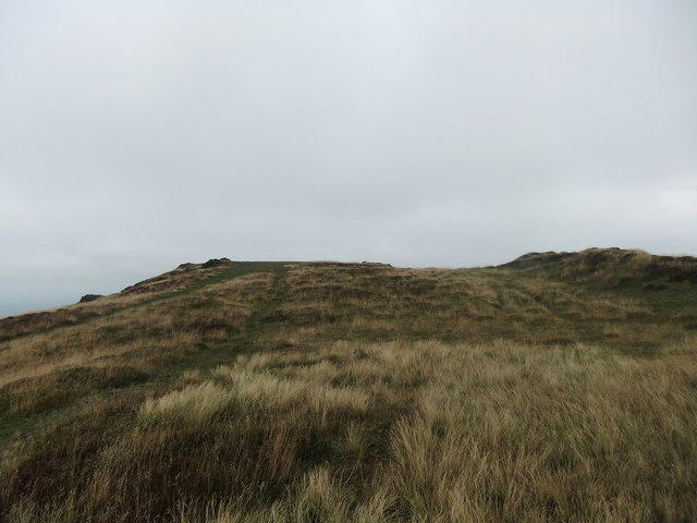 Photo could not load
SO4795 : Top of Caer Caradoc
David Brown
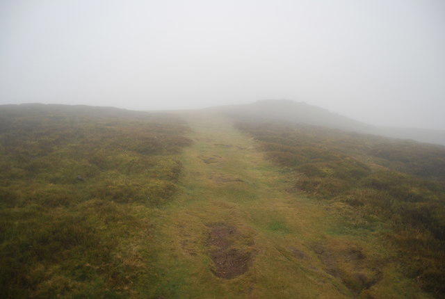 Photo could not load
SO4795 : Path across the summit of Caer Caradoc
N Chadwick
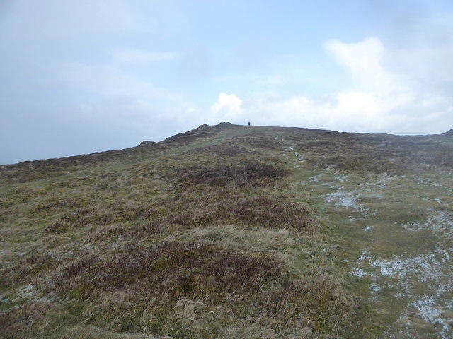 Photo could not load
SO4795 : Caer Caradoc summit in winter
Jeremy Bolwell
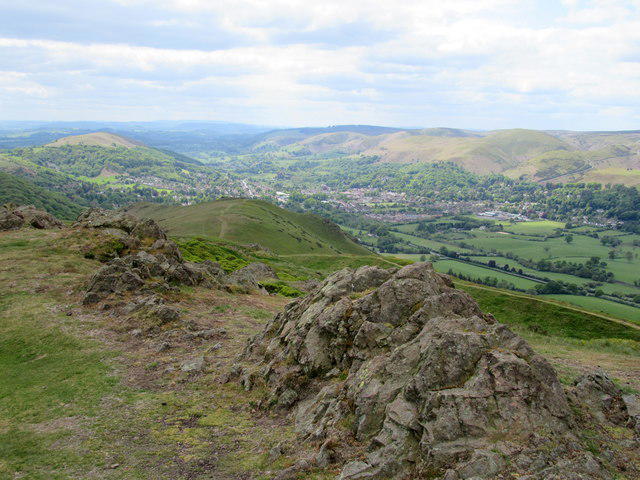 Photo could not load
SO4795 : Rocks on the summit of Caer Caradoc
John H Darch
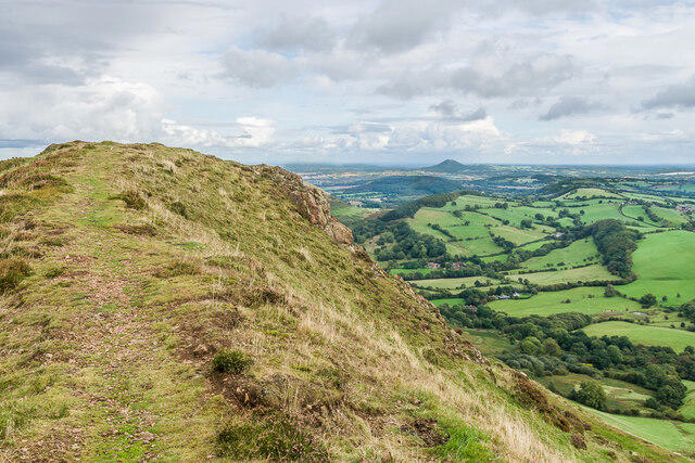 Photo could not load
SO4795 : On Caer Caradoc
Ian Capper
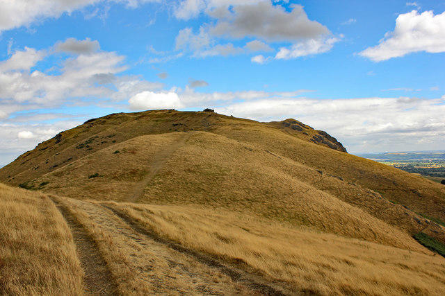 Photo could not load
SO4795 : Caer Caradoc Hill
Jeff Buck
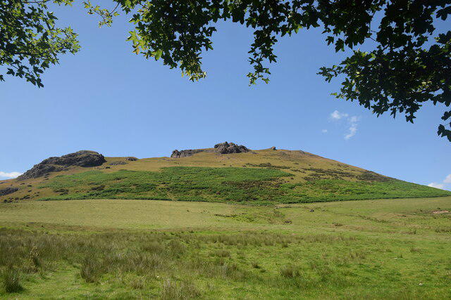 Photo could not load
SO4795 : Caer Caradoc: view from the south east
Bill Harrison
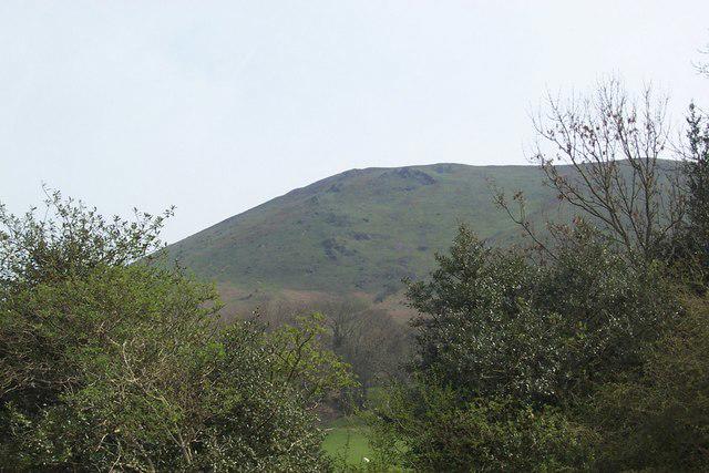
SO4795 : Looking up Caer Caradoc Hill
Chris Carlson
Hill facts and local notes
Classifications
Elevation
460m
1,508 ft
Prominence
274m
Coordinates
52.5538, -2.7721
SO477953
OS Map
137 138
Explorer: 217
At the Summit
A natural rock outcrop at SO477953 (precise grid SO 47748 95394), within the Iron Age hillfort. The ramparts incorporate the rocky hilltop. Caractacus’ Cave lies by the northwestern ramparts, separate from the summit outcrop.
Terrain & Geology
Caer Caradoc is formed from Precambrian Uriconian volcanic rocks. British Geological Survey mapping places rhyolite across the summit, basalt lavas on the northern ridge and andesite south of the summit. The varied lavas and volcanic ash deposits have been faulted, folded and eroded into the present craggy ridge.
Views & Scenery
The summit looks west across the Church Stretton valley to the Long Mynd, southeast towards the Hope Bowdler hills, and northeast towards The Lawley and, in clear conditions, the Wrekin.
History & Heritage
Name Origin
The hillfort and Caractacus’ Cave are traditionally associated with Caradoc, also known as Caractacus, the first-century leader who resisted Rome.
Historical Significance
Caer Caradoc’s Iron Age hillfort is a scheduled monument (Historic England 1010723). Its ramparts incorporate natural rock outcrops, with an engineered approach to the eastern entrance. The association with Caractacus is a tradition rather than proof that his final battle occurred here. The Fix the Fort project repaired eroded ramparts in 2022–23 and created stepped crossings to help protect the archaeology; use the established paths and steps.
Getting There & Facilities
Parking
Church Stretton has town-centre parking at the council’s Easthope 1–4 car parks, Easthope Road, SY6 6BL. Check the council’s current charges and signs. The short Walking Britain circuit starts separately at an east-side A49 lay-by at SO466954; its approach includes verge walking, and space and restrictions must be checked on arrival. The town-centre circuits start at SO454936.
Public Transport
Church Stretton station (CTT) is the rail gateway; check Transport for Wales or National Rail for current journeys. The National Landscape also lists bus 435 between Shrewsbury and Ludlow via Church Stretton. Town and station starts are longer than the short A49 lay-by circuit. The station has no toilets.
Nearby Facilities
Church Stretton has cafés, pubs and shops, with public toilets on Easthope Road and Lutwyche Road. Use town facilities before setting out and carry food and water for the chosen route. Transport for Wales lists no toilets or buffet at Church Stretton station.
Safety Information
Known Hazards
- Steep ascents and descents, with slippery grass, mud and rock in wet conditions.
- Rocky upper slopes and steep hill sides require care, especially in poor visibility or strong wind.
- The A49 lay-by circuit uses a grass verge beside fast traffic. The longer town circuits cross both the railway and A49 and include other road sections.
- Numerous path junctions and faint field paths on the longer circuits make careful navigation important.
- Protect the hillfort by using established paths and repaired steps. Follow local access notices and keep dogs under close control around livestock.
General Safety Tips
- Check weather conditions before setting out
- Carry appropriate clothing and equipment
- Let someone know your planned route
- Take a map, compass, and GPS device
- Carry emergency supplies: food, water, first aid kit, torch
Hills
Some common questions about the hills answered
Are there group walks up Caer Caradoc Hill?
Many walkers use Walkmates to join or organise walks with others. You can check for group walks around Caer Caradoc Hill through the maps
Are there other walkers around Caer Caradoc Hill?
Activity varies by location and time, but Walkmates lets you see whether others have shared walks or shown interest in this area. Find other people through the walking friends search walking friends for Caer Caradoc Hill search or of course create your own walk for Caer Caradoc Hill
Can I organise a walk to Caer Caradoc Hill?
Yes. If there aren’t any walks listed already, you can create a walk and make it available for others to join.
If you're signed up to Walkmates, you can create a walk to Caer Caradoc Hill.
How do I find a walk up this hill?
There are often multiple ways to walk this hill, depending on experience and route preference. Walkmates helps you explore walks and routes that others have shared.
Can I suggest a new route up Caer Caradoc Hill?
Yes. You can suggest or create routes to share with others. Walkmates focuses on the social side of walking, so routes are used to help people organise walks and explore areas together, rather than as detailed navigation tools or route libraries.
Other uses really appreciate knowledgeable walkers sharing their routes. Share your favourite route to Caer Caradoc Hill here
The is an error or something incorrect about this hill. How do I let you know?
We always strive to keep the information on Walkmates as accurate as possible. If you find an error, please let us know through the contact form and we'll aim to correct it as quickly as possible
Community Discussion
Comments
Location
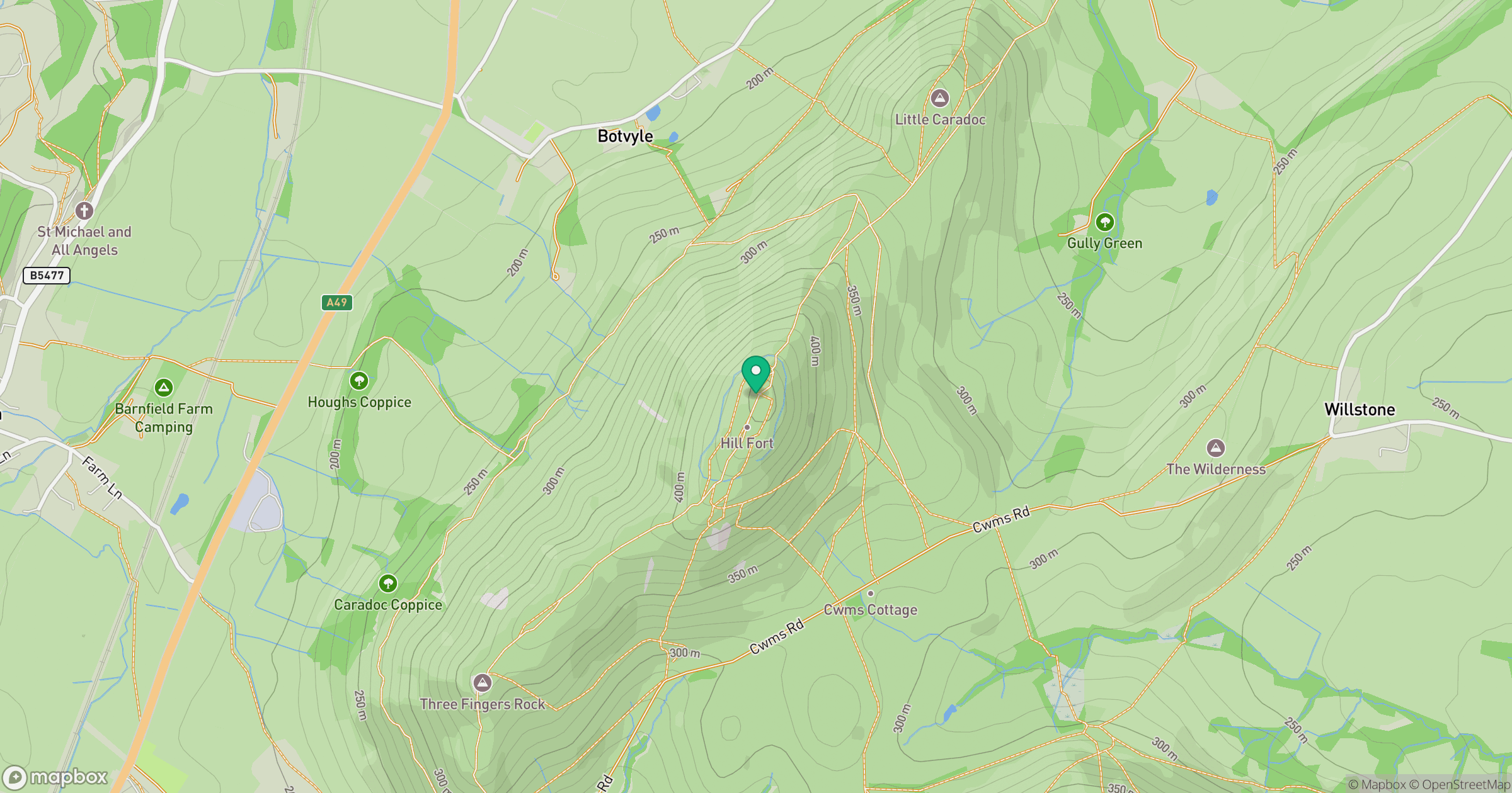
Grid reference: SO477953
View on OpenStreetMapOpens a map in a new tab, centred on the hill.
Nearby Hills
Long Mynd - Pole Bank
517m
Stiperstones
537m
Titterstone Clee Hill
533m

The Wrekin
407m
Worcestershire Beacon
425m
No comments yet. Be the first.