

Sgurr nan Gillean Third Pinnacle
Good walks are even better shared.
NG4725 : Looking to the south from the top of Sgùrr nan Gillean
Didier Silberstein Photo source
Overview
Sgurr nan Gillean Third Pinnacle
Sgurr nan Gillean is not just any peak; it’s a Munro that stands tall at 964 meters, making it an enticing target for both seasoned and ambitious hikers. Nestled in the rugged landscape of the Scottish Highlands, this third pinnacle offers not only a satisfying climb but also a breathtaking reward at its summit.
Geology
This majestic mountain is composed of gabbro—a hardy rock that provides remarkable grip and stability. That’s right! If you’re looking to get a foothold, this is the stuff for you. Just be sure your footwear is up to the challenge—ballet shoes are probably not recommended!
Routes
The most popular route is a circular route from Sgurr nan Gillean, covering approximately 9.0 km with an estimated time of around 4.5 hours. Expect a bit of a challenge, but the scenic views will make every step worth your while.
Summit Features
The summit is adorned with a rugged rocky pinnacle and a modest cairn that serves as a perfect backdrop for that triumphant shot you’ll want to share with friends. The views from up here can be simply magical, especially on a clear day when you can see all the way to the Hebrides.
Terrain Type
Prepare for a combination of rocky and grassy terrains. As you ascend, you might find yourself navigating through some challenging rocky sections, so sturdy hiking boots are a must—don’t bring your Sunday best!
Views
From the summit, the vistas are nothing short of spectacular, featuring sights of the Black Cuillin range and the breathtaking landscapes of the Isle of Skye. If you want to capture the best light and views, aim to tackle this climb in the summer or autumn, preferably in the morning.
Hazards
As is the case with many Highland climbs, be mindful of steep drops and loose stones. Always keep an eye on the weather, as conditions can change quicker than a rabbit in a hat, catching even experienced hikers off guard!
Nearby Summits
While you are conquering Sgurr nan Gillean, don’t forget about nearby peaks like Bidein Druim nan Ramh (942 m) and the main Sgurr nan Gillean itself (965 m). There are plenty of adventures to be had in close proximity!
Access
For access, find a suitable parking area at the end of the public road close to the mountain’s base, and Portree is your nearest town. Public transport does run here, so you can leave the car behind and enjoy your well-earned pint after all that hiking.
Facilities
After your hike, make your way back to Portree, where you can indulge in a well-deserved meal or a hot drink. There are various facilities like cafes, shops, and toilets to refresh your spirits.
History
The name “Sgurr nan Gillean,” meaning “Peak of the Boys,” evokes a sense of local lore and history that adds to the charm of this majestic mountain. Being a popular hiking destination since the 19th century, it’s an icon of both adventure and Scottish culture.
In summary, Sgurr nan Gillean Third Pinnacle is a splendid peak, inviting all who are ready to embrace its challenges for unforgettable views and experiences. Happy hiking!
Explore routes near Sgurr nan Gillean Third Pinnacle
Walks starting near this hill. Open a route to check its map, distance and full itinerary.
Fairy Lochs Liberator Wreckage Circuit
View route
Beinn Eighe Lancaster Wreckage at Coire Mhic Fhearchair
View route
Dun Mhulan Broch Quick Walk
View route
Berneray Community Hall to the beautiful beach
View route
Route planning notes
These notes describe possible approaches. Check a route's map and access information when planning your walk.
Tourist Route via Coire Riabhach
This is the most common and accessible route to Sgurr nan Gillean's Third Pinnacle. Starting from the Sligachan Hotel, follow the footpath towards Coire Riabhach. Ascend the scree slopes leading to the ridge, then scramble up the northern flank to reach the Third Pinnacle. This route features stunning views of the Cuillin Ridge and is a great introduction to scrambling in the Skye Cuillin.
West Ridge Scramble from Sligachan
Begin at the Sligachan Hotel and head along the well-established path towards Coire a’ Bhasteir. From here, ascend the West Ridge via a series of scrambles, navigating some exposed sections to reach Sgurr nan Gillean's Third Pinnacle. This is a more challenging route, suitable for experienced scramblers, with incredible views along the ridge.
Am Basteir and Third Pinnacle Traverse
Start at Sligachan and follow the path to Coire a’ Bhasteir. Scramble up to Am Basteir, then continue along the knife-edged ridge to the Third Pinnacle of Sgurr nan Gillean. This thrilling traverse offers a technical challenge and requires a good head for heights, but rewards with stunning panoramic views of the Cuillin.
South-East Ridge Ascent
This less-travelled route begins from Glen Sligachan. Ascend towards Coire nan Each and tackle the South-East Ridge. This route involves significant scrambling and route-finding, leading to the summit of the Third Pinnacle. The quieter ascent provides a more solitary mountain experience, with dramatic views of the surrounding peaks.
The Pinnacle Ridge Full Traverse
This is a full day’s adventure, starting at the Sligachan Hotel and tackling the entire Pinnacle Ridge. This highly technical route involves multiple pitches of climbing and considerable exposure. The Third Pinnacle is reached as part of this traverse, making it a route for only the most experienced mountaineers. A rope and climbing gear are essential.
Make a day of it, together
Find someone to share the walk with, or organise a day out along a route you like.
Photo Gallery
View all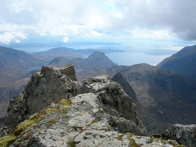 Photo could not load
NG4725 : Looking to the south from the top of Sgùrr nan Gillean
Didier Silberstein
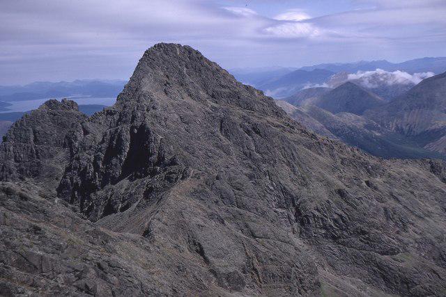 Photo could not load
NG4725 : Sgurr nan Gillean, Skye
Jim Barton
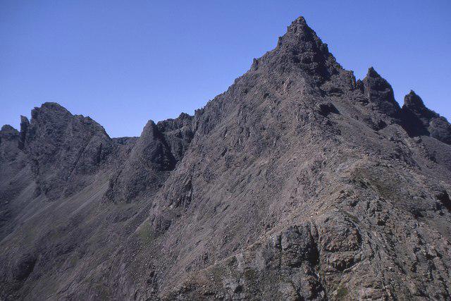 Photo could not load
NG4725 : A pioneering route, Sgurr nan Gillean
Jim Barton
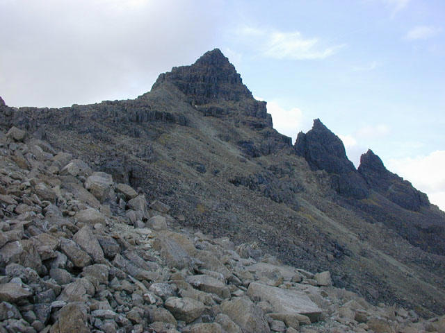 Photo could not load
NG4725 : Sgurr nan Gillean from the east ridge
Nigel Brown
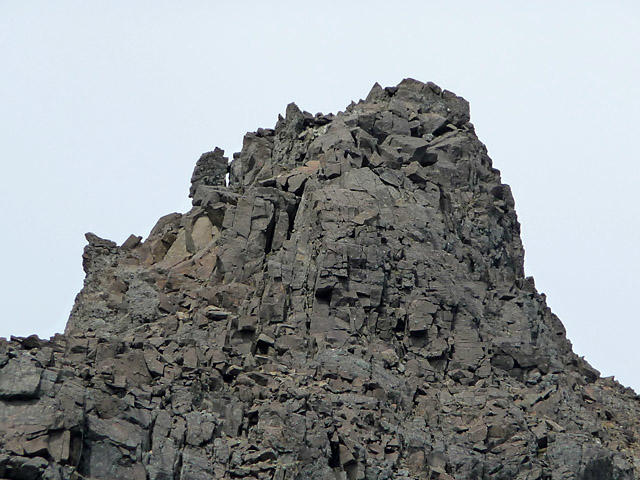 Photo could not load
NG4725 : Summit of Sgurr nan Gillean
John Allan
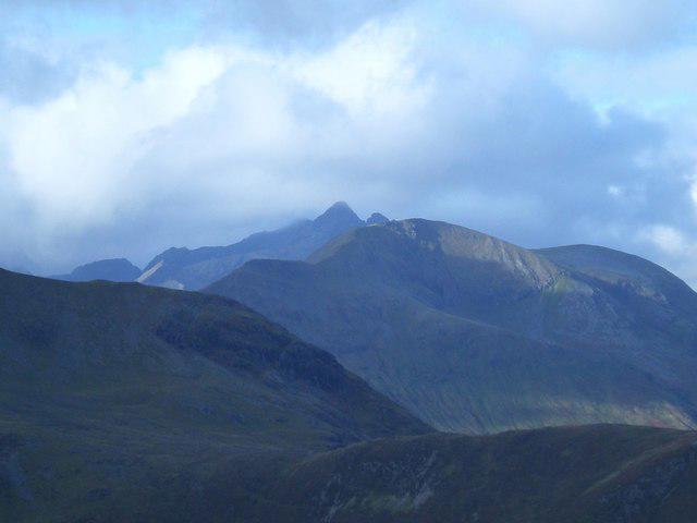 Photo could not load
NG4725 : Sgurr nan Gillean
Martyn Ayre
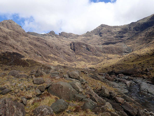 Photo could not load
NG4725 : Section of the Cuillin from Harta Corrie
Didier Silberstein
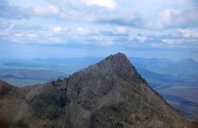 Photo could not load
NG4725 : Sgùrr nan Gillean
James Allan
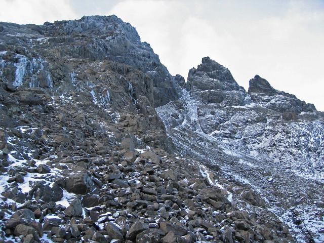 Photo could not load
NG4725 : Sgurr nan Gillean
John Allan
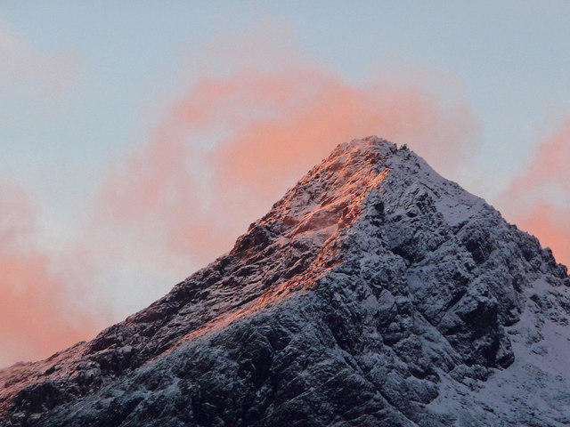
NG4725 : Sunrise on Sgurr nan Gillean
John Allan
Hill facts and local notes
Classifications
Elevation
884m
2,902 ft
Prominence
26m
Coordinates
57.2499, -6.1925
NG472254
OS Map
32
Explorer: 411
At the Summit
The summit features a prominent rocky pinnacle with a small stone cairn, which provides a fitting backdrop for triumphant selfies.
Terrain & Geology
The mountain is primarily composed of gabbro, which is known for its durability and grip—perfect for climbing, though you might want to avoid it if you're wearing ballet shoes!
Views & Scenery
Fantastic views of the Isle of Skye, the Black Cuillin range, and beyond to the Hebrides on clear days.
History & Heritage
Name Origin
The name 'Sgurr nan Gillean' translates to 'Peak of the Boys', as a nod to the local mythology about young warriors.
Historical Significance
It has been a popular hiking destination since the 19th century and is steeped in local lore.
Getting There & Facilities
Parking
A suitable parking area is located at the end of the public road near the foot of Sgurr nan Gillean.
Public Transport
Regular bus services connect from Portree to the starting point, but check the latest timetables.
Nearby Facilities
Amenities can be found in Portree, including cafes, restaurants, toilets, and shops. Perfect for a pre-hike coffee or a post-hike slice of cake!
Safety Information
Known Hazards
- Beware of steep drops, loose stones, and rapidly changing weather conditions which can catch the unwary hiker by surprise.
General Safety Tips
- Check weather conditions before setting out
- Carry appropriate clothing and equipment
- Let someone know your planned route
- Take a map, compass, and GPS device
- Carry emergency supplies: food, water, first aid kit, torch
Hills
Some common questions about the hills answered
Are there group walks up Sgurr nan Gillean Third Pinnacle?
Many walkers use Walkmates to join or organise walks with others. You can check for group walks around Sgurr nan Gillean Third Pinnacle through the maps
Are there other walkers around Sgurr nan Gillean Third Pinnacle?
Activity varies by location and time, but Walkmates lets you see whether others have shared walks or shown interest in this area. Find other people through the walking friends search walking friends for Sgurr nan Gillean Third Pinnacle search or of course create your own walk for Sgurr nan Gillean Third Pinnacle
Can I organise a walk to Sgurr nan Gillean Third Pinnacle?
Yes. If there aren’t any walks listed already, you can create a walk and make it available for others to join.
If you're signed up to Walkmates, you can create a walk to Sgurr nan Gillean Third Pinnacle.
How do I find a walk up this hill?
There are often multiple ways to walk this hill, depending on experience and route preference. Walkmates helps you explore walks and routes that others have shared.
Can I suggest a new route up Sgurr nan Gillean Third Pinnacle?
Yes. You can suggest or create routes to share with others. Walkmates focuses on the social side of walking, so routes are used to help people organise walks and explore areas together, rather than as detailed navigation tools or route libraries.
Other uses really appreciate knowledgeable walkers sharing their routes. Share your favourite route to Sgurr nan Gillean Third Pinnacle here
The is an error or something incorrect about this hill. How do I let you know?
We always strive to keep the information on Walkmates as accurate as possible. If you find an error, please let us know through the contact form and we'll aim to correct it as quickly as possible
Community Discussion
Comments
Location
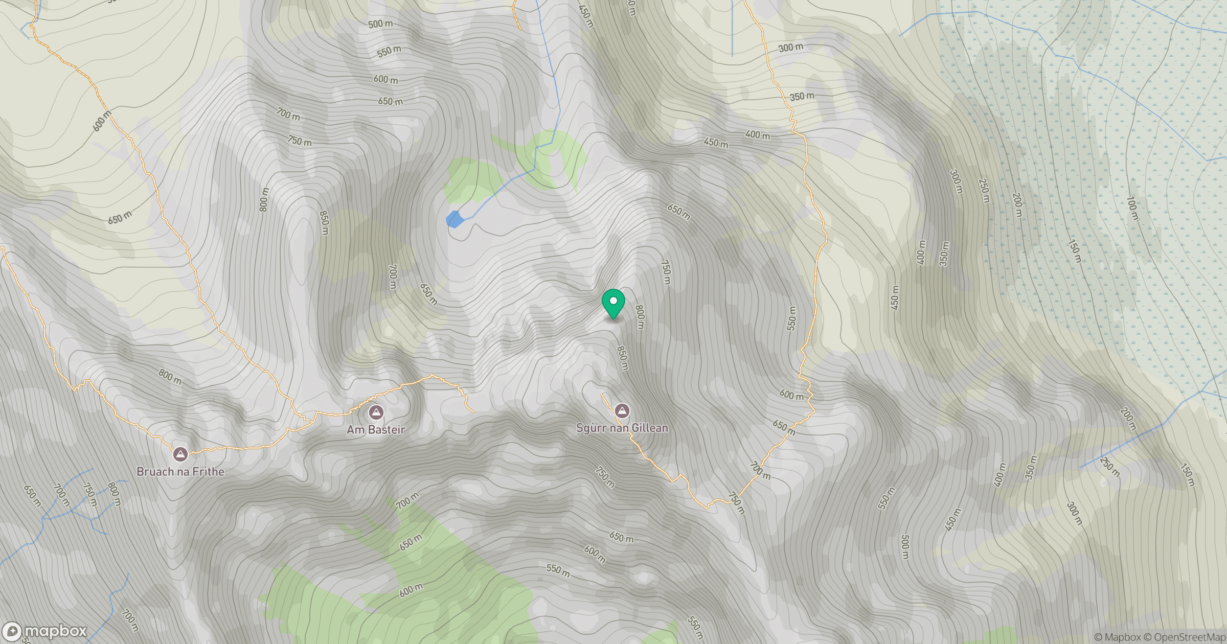
Grid reference: NG472254
View on OpenStreetMapOpens a map in a new tab, centred on the hill.
No comments yet. Be the first.