

Sgurr nan Eag
Good walks are even better shared.
NG4519 : Sgurr nan Eag
Martyn Ayre Photo source
Overview
Sgurr nan Eag: The Peak of the Notches
Nestled in the heart of the Scottish Highlands, Sgurr nan Eag stands proudly at 888 meters. As a Munro, it presents both a sporting challenge and a feast for the eyes. With its prominent location, the mountain offers breathtaking views that extend far beyond the horizon.
Geology
The mountain's geological composition features mainly gneiss and schist, giving it a rugged and ancient appearance. As you climb, you'll marvel at nature's handiwork, revealing the intriguing history of a land shaped by time.
Routes
There are two main routes to tackle Sgurr nan Eag:
- Coire Ghranda Route: This scenic path winds through lush valleys, allowing you to savour the beauty of the surroundings before the ascent really kicks in. It covers about 6.5 km and typically takes around 4 hours.
- An Dorus Route: A more direct climb, this route challenges you with a steeper ascent, rewarding your effort with magnificent vistas. It's shorter, at 5.5 km and takes about 3.5 hours.
Whichever route you choose, make sure to pack a good snack for a well-deserved break at the summit!
Summit Features
Upon reaching the summit, you'll be greeted by a large cairn—ideal for a celebratory moment or a quick picnic while soaking in the awe-inspiring views.
Terrain Type
Expect a mix of rocky terrain with grassy stripes and a few boggy areas near the base. It might not be a stroll in the park, but the sights will keep you motivated!
Views
From Sgurr nan Eag's peak, the panorama is simply stunning. You’ll spot the Isle of Skye, the majestic Cuillin range, and the shimmering expanse of Loch Brittle. If you're there on a clear day, don’t forget to take a picture; these views are not to be missed!
Hazards
As with many mountains, be cautious of steep drops at the summit. Weather conditions can change rapidly, so keep an eye on the sky to avoid any unexpected surprises.
Nearby Summits
Sgurr nan Eag is surrounded by other notable peaks, like Sgurr na Banachdaich (916 m) and Sgurr nan Gobhar (874 m), making them perfect companions for a multi-peak adventure.
Access
To reach Sgurr nan Eag, park at the road end near Glen Brittle campsite, which accommodates several vehicles. Public transportation options are limited, so your best bet is to check local bus schedules if you're coming from Portree.
Facilities
While the Glen Brittle campsite provides basic amenities, the nearby town of Portree is a treasure trove of cafes, shops, and all things lovely to restore energy after your hike.
History
The name Sgurr nan Eag translates to 'Peak of the Notches' in Gaelic, a nod to its distinctive features. This mountain has long been a favoured destination for those seeking adventure, steeped in local history and folklore.
So lace up those hiking boots, pack your sense of adventure, and get ready to make memories that will last a lifetime on Sgurr nan Eag!
Explore routes near Sgurr nan Eag
Walks starting near this hill. Open a route to check its map, distance and full itinerary.
Beinn Eighe Lancaster Wreckage at Coire Mhic Fhearchair
View route
Fairy Lochs Liberator Wreckage Circuit
View route
Dun Mhulan Broch Quick Walk
View route
Banavie to Glen Loy Aqueduct: Neptune’s Staircase Canal Towpath
View route
Route planning notes
These notes describe possible approaches. Check a route's map and access information when planning your walk.
Coire Ghranda Route
A scenic ascent through Coire Ghranda, featuring lush valleys and stunning rock formations.
An Dorus Route
Approaching from An Dorus, this route offers a more direct climb with breathtaking views along the way.
Make a day of it, together
Find someone to share the walk with, or organise a day out along a route you like.
Photo Gallery
View all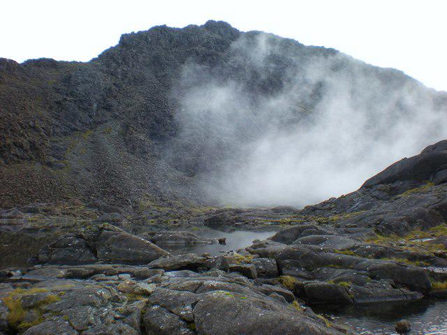 Photo could not load
NG4519 : Sgurr nan Eag
Martyn Ayre
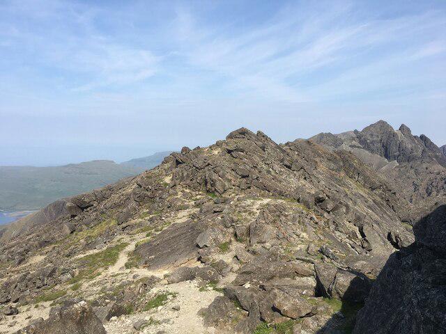 Photo could not load
NG4519 : Summit ridge of Sgurr nan Eag
Steven Brown
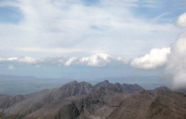 Photo could not load
NG4519 : Sgùrr nan Eag
James Allan
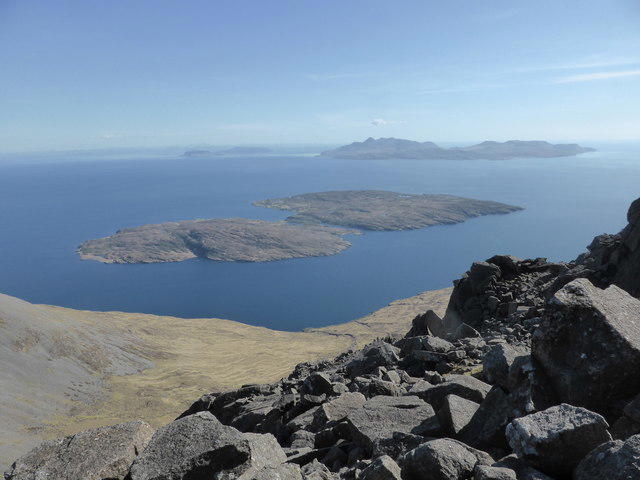 Photo could not load
NG4519 : The east ridge of Sgurr nan Eag
David Medcalf
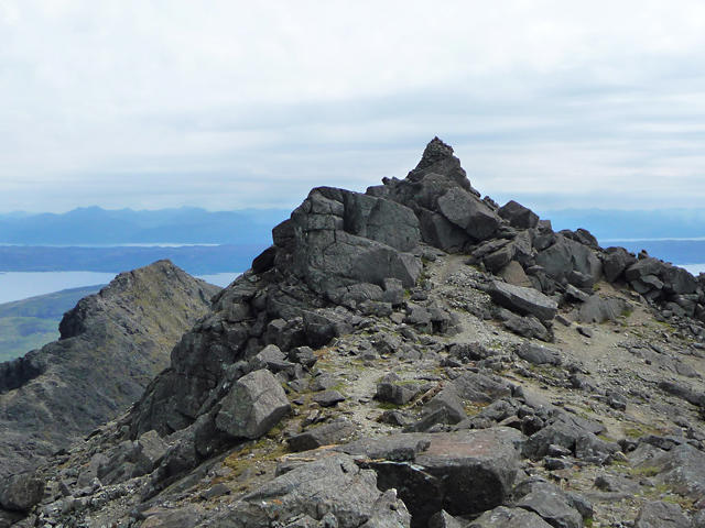 Photo could not load
NG4519 : Summit of Sgùrr nan Eag
John Allan
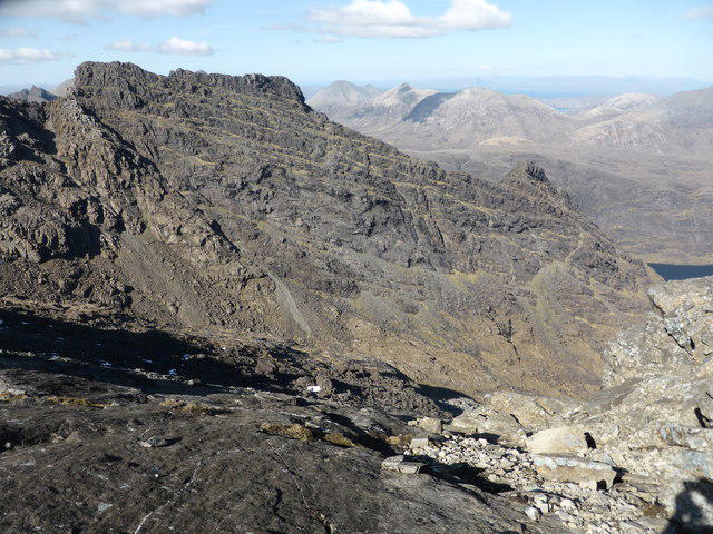 Photo could not load
NG4519 : Looking north towards the Dubh Ridge
David Medcalf
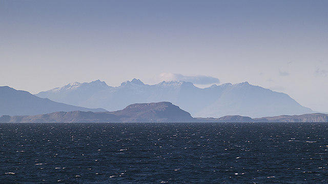 Photo could not load
NG4519 : View towards Skye
William Starkey
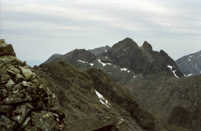 Photo could not load
NG4519 : Summit cairn on Sgùrr nan Eag
Russel Wills
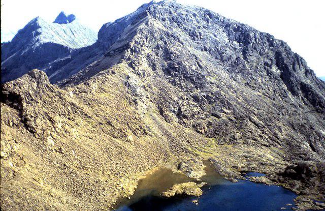 Photo could not load
NG4519 : Southern end of the Black Cuillin ridge
ronnie leask
Hill facts and local notes
Classifications
Elevation
926m
3,039 ft
Prominence
130m
Coordinates
57.1958, -6.2113
NG457195
OS Map
32
Explorer: 411
At the Summit
The summit features a prominent cairn, providing a perfect spot for a celebratory snack and a photo opportunity.
Terrain & Geology
Sgurr nan Eag is primarily composed of gneiss and schist, with stunning views showcasing the intricate geological history of the area.
Views & Scenery
From the summit, you can see the Isle of Skye, the Cuillin range, and Loch Brittle. On a clear day, the views are jaw-dropping!
History & Heritage
Name Origin
Sgurr nan Eag means 'Peak of the Notches' in Scottish Gaelic, referring to the notch-like features on its ridges.
Historical Significance
This mountain is a popular destination for climbers and hikers, steeped in local folklore and history.
Getting There & Facilities
Parking
The nearest parking is at the road end near the Glen Brittle campsite, which can accommodate several vehicles.
Public Transport
There are limited bus services from Portree; check local schedules for the best options.
Nearby Facilities
The nearby Glen Brittle campsite has basic facilities, and Portree offers cafes and shops for refreshments.
Safety Information
Known Hazards
- Be cautious of steep drops near the summit and the potential for rapidly changing weather conditions.
General Safety Tips
- Check weather conditions before setting out
- Carry appropriate clothing and equipment
- Let someone know your planned route
- Take a map, compass, and GPS device
- Carry emergency supplies: food, water, first aid kit, torch
Hills
Some common questions about the hills answered
Are there group walks up Sgurr nan Eag?
Many walkers use Walkmates to join or organise walks with others. You can check for group walks around Sgurr nan Eag through the maps
Are there other walkers around Sgurr nan Eag?
Activity varies by location and time, but Walkmates lets you see whether others have shared walks or shown interest in this area. Find other people through the walking friends search walking friends for Sgurr nan Eag search or of course create your own walk for Sgurr nan Eag
Can I organise a walk to Sgurr nan Eag?
Yes. If there aren’t any walks listed already, you can create a walk and make it available for others to join.
If you're signed up to Walkmates, you can create a walk to Sgurr nan Eag.
How do I find a walk up this hill?
There are often multiple ways to walk this hill, depending on experience and route preference. Walkmates helps you explore walks and routes that others have shared.
Can I suggest a new route up Sgurr nan Eag?
Yes. You can suggest or create routes to share with others. Walkmates focuses on the social side of walking, so routes are used to help people organise walks and explore areas together, rather than as detailed navigation tools or route libraries.
Other uses really appreciate knowledgeable walkers sharing their routes. Share your favourite route to Sgurr nan Eag here
The is an error or something incorrect about this hill. How do I let you know?
We always strive to keep the information on Walkmates as accurate as possible. If you find an error, please let us know through the contact form and we'll aim to correct it as quickly as possible
Community Discussion
Comments
Location
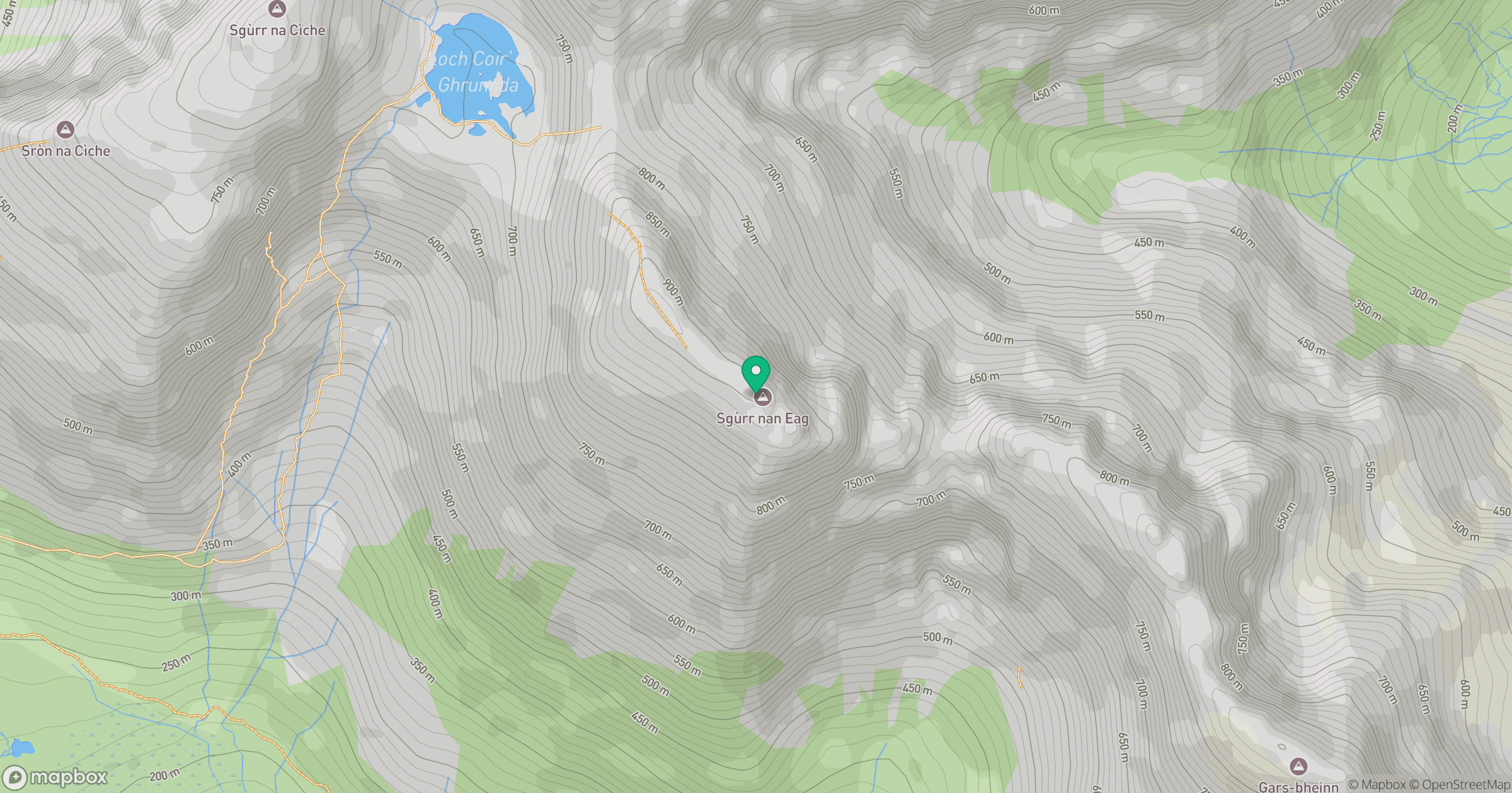
Grid reference: NG457195
View on OpenStreetMapOpens a map in a new tab, centred on the hill.
No comments yet. Be the first.