
Sgurr nan Each West Top
Good walks are even better shared.
Overview
Sgurr nan Each West Top
Introduction
Nestled in the heart of the Scottish Highlands, Sgurr nan Each West Top is a captivating Munro that invites both seasoned hikers and those looking to dip their toes into the mountainous terrain. Standing at an impressive height of 832 meters, it’s a peak that not only offers a physical challenge but also a feast for the eyes.
Geology
The mountain is primarily composed of gneiss, a stunning rock formed under intense heat and pressure. This metamorphic beauty is what gives Sgurr nan Each its captivating, rugged appeal, which has been lovingly sculpted by glacial activity over thousands of years. So, if you find yourself wandering among the rocks, remember, they’ve been here long before you—and they likely know the best views around.
Routes
There are two prime routes to tackle this Munro:
- Glen Shiel Circuit: This moderately challenging 10 km route is a favourite among hikers, offering stunning vistas throughout the journey. Expect a duration of around 4.5 hours.
- North Ridge Approach: For the more adventurous souls, this challenging 8 km trek will take you along a less trodden path, leading to steeper gradients and potentially more rewarding solitude, taking about 3.5 hours.
Summit Features
Upon reaching the summit, hikers are greeted by a modest cairn—a testament to the many who have stood where you stand now. Take a moment to appreciate the sweeping views—a wide canvas of the Highlands spread out below you, idyllic for a photo or just to revel in nature.
Terrain Type
The terrain is a lively mix of rocky outcrops and grassy slopes. Sure, you might encounter a few boggy patches (thank you, Scottish weather!), but those just add character to your hike, right?
Views
The summit rewards you with breathtaking panoramic views, not just of Sgurr nan Each, but also the majestic Five Sisters of Kintail and stunning Loch Duich. Early summer and autumn provide the best visibility and a burst of colours that will make you want to pitch a tent and never leave.
Hazards
As is common in the Highlands, expect the unexpected. Weather can shift faster than you can say ‘Is that a rain cloud?’. Be prepared for steep and uneven ground, particularly on the more remote routes. And remember, no one wants to take a tumble!
Access
Nearest Parking
You can park at Shiel Bridge's end of the road on the A87, but don’t be surprised if spots fill up quickly—early birds catch the worm (or, in this case, the trailhead).
Public Transport
While public transport options are limited, buses from Inverness to Shiel Bridge do exist, though you'll want to check ahead to avoid being left in the lurch.
Nearest Town
The charming Kyle of Lochalsh is the closest town, about 17 km away, providing facilities and maybe even a quick cup of coffee to fuel your hike.
Facilities
While the mountain itself offers no facilities, Kyle of Lochalsh has plenty to offer in terms of cafes, shops, and public toilets. Make sure to refuel before you set off!
History
The name 'Sgurr nan Each', meaning 'Peak of the Horses', resonates with the mythical past of the region, involving horses that galloped across the rugged landscape. This peak is part of the rich tapestry of Scottish folklore, connecting hikers not just to nature but to the stories woven through the hills.
In conclusion, whether you're summiting for the views, the challenge, or just to say you've done it, Sgurr nan Each West Top is a rewarding beacon in the magnificent Scottish Highlands!
Explore routes near Sgurr nan Each West Top
Walks starting near this hill. Open a route to check its map, distance and full itinerary.
Beinn Eighe Lancaster Wreckage at Coire Mhic Fhearchair
View route
Fairy Lochs Liberator Wreckage Circuit
View route
Loch Affric full circuit from River Affric
View route
Banavie to Glen Loy Aqueduct: Neptune’s Staircase Canal Towpath
View route
Route planning notes
These notes describe possible approaches. Check a route's map and access information when planning your walk.
Glen Shiel Circuit
A popular route that offers stunning views across Glen Shiel and the Five Sisters of Kintail, winding its way up the mountain through varied terrain.
North Ridge Approach
A less frequented approach that meanders along the north ridge with occasional steep sections, perfect for those seeking a quieter trek.
Make a day of it, together
Find someone to share the walk with, or organise a day out along a route you like.
Hill facts and local notes
Classifications
Elevation
711m
2,332 ft
Prominence
25m
Coordinates
57.2291, -6.0854
NG535227
OS Map
32
Explorer: 411
At the Summit
The summit boasts a small cairn, providing a perfect photo opportunity, along with stunning panoramic views that make the modest effort worthwhile.
Terrain & Geology
The mountain is primarily composed of gneiss, a type of metamorphic rock that has been heavily shaped by glacial activity, giving it a rugged and dramatic appearance.
Views & Scenery
Panoramic views of the surrounding peaks including the Five Sisters of Kintail and Loch Duich.
History & Heritage
Name Origin
The name 'Sgurr nan Each' translates to 'Peak of the Horses', steeped in local lore relating to the rugged terrain's connection to wild horses.
Historical Significance
This mountain, like many in the Highlands, holds cultural significance and is often featured in local folklore.
Getting There & Facilities
Parking
There is parking available at the end of the road on the A87 at Shiel Bridge. It is a small car park, so arriving early can help secure a spot.
Public Transport
Buses run from Inverness to Shiel Bridge, although schedules are limited. Check local transport services for the latest timetables.
Nearby Facilities
While there are no facilities directly on the mountain, Kyle of Lochalsh has cafes, shops, and public toilets to cater to hikers.
Safety Information
Known Hazards
- Beware of changing weather conditions, particularly in the Highlands where a sunny morning can quickly turn into a blustery afternoon. Some sections can be steep and uneven.
General Safety Tips
- Check weather conditions before setting out
- Carry appropriate clothing and equipment
- Let someone know your planned route
- Take a map, compass, and GPS device
- Carry emergency supplies: food, water, first aid kit, torch
Hills
Some common questions about the hills answered
Are there group walks up Sgurr nan Each West Top?
Many walkers use Walkmates to join or organise walks with others. You can check for group walks around Sgurr nan Each West Top through the maps
Are there other walkers around Sgurr nan Each West Top?
Activity varies by location and time, but Walkmates lets you see whether others have shared walks or shown interest in this area. Find other people through the walking friends search walking friends for Sgurr nan Each West Top search or of course create your own walk for Sgurr nan Each West Top
Can I organise a walk to Sgurr nan Each West Top?
Yes. If there aren’t any walks listed already, you can create a walk and make it available for others to join.
If you're signed up to Walkmates, you can create a walk to Sgurr nan Each West Top.
How do I find a walk up this hill?
There are often multiple ways to walk this hill, depending on experience and route preference. Walkmates helps you explore walks and routes that others have shared.
Can I suggest a new route up Sgurr nan Each West Top?
Yes. You can suggest or create routes to share with others. Walkmates focuses on the social side of walking, so routes are used to help people organise walks and explore areas together, rather than as detailed navigation tools or route libraries.
Other uses really appreciate knowledgeable walkers sharing their routes. Share your favourite route to Sgurr nan Each West Top here
The is an error or something incorrect about this hill. How do I let you know?
We always strive to keep the information on Walkmates as accurate as possible. If you find an error, please let us know through the contact form and we'll aim to correct it as quickly as possible
Community Discussion
Comments
Location
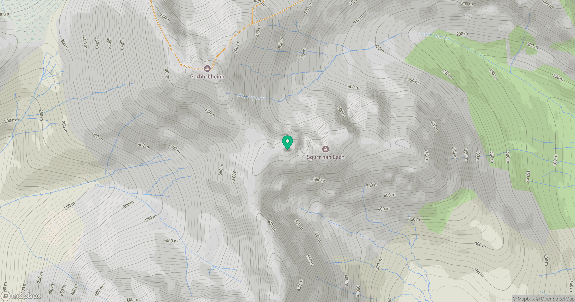
Grid reference: NG535227
View on OpenStreetMapOpens a map in a new tab, centred on the hill.
No comments yet. Be the first.