

Sgurr Mor
Good walks are even better shared.
NH2071 : Sgùrr Mòr
Richard Webb Photo source
Overview
Exploring Sgurr Mor
Sgurr Mor, standing proudly at 1111 meters, offers a rewarding challenge for eager hikers and seasoned adventurers alike. This Munro, situated in the stunning Scottish Highlands, is a testament to nature's grandeur.
Geology
The mountain's geology, rich in schist and granite, forms the rugged foundations of this iconic peak. If it could talk, it would likely boast about centuries of weathering that sculpted its peaks!
Routes
Two prime routes lead adventurers to its summit. The Carn Liath Circuit is favoured for its beautiful scenery and moderate difficulty, circling around the picturesque terrain. Alternatively, the Direct Ascent from Glen Affric provides a more vigorous trek.
Summit Features
Upon reaching the summit, one is greeted by a grand stone cairn, created from the very rocks that make up this mountain. The 360-degree views from the top are simply breathtaking.
Terrain
Expect a mix of rocky paths and grassy patches leading up to the summit, with the terrain becoming more rugged towards the peak itself.
Views
You won't want to forget your camera! The vistas include the Torridon mountains and the majestic Loch Affric, especially glorious during sunrise or sunset.
Hazards
As lovely as the Highlands are, they boast unpredictable weather. Always be cautious, keep your footing, and make sure you're dressed for the occasion.
Nearby Summits
Don't miss the chance to visit nearby summits, including Carn Liath and Sgurr na Lapaich, each offering their own unique appeal.
Access
The Glen Affric car park is your gateway to adventure, boasting ample parking and seasonal amenities. For public transport enthusiasts, the limited bus services to Cannich can help get you started.
Facilities
After your hike, the nearby village of Cannich offers a delightful shop and café to refuel.
History
The meaning of Sgurr Mor speaks to its impressiveness - "great peak" captures its essence perfectly. As a popular Munro, it holds a place in the hearts of many outdoor enthusiasts.
Sgurr Mor truly embodies the spirit of the Highlands! Ready your boots and embrace the adventure ahead.
Explore routes near Sgurr Mor
Walks starting near this hill. Open a route to check its map, distance and full itinerary.
Beinn Eighe Lancaster Wreckage at Coire Mhic Fhearchair
View route
Fairy Lochs Liberator Wreckage Circuit
View route
Glen Affric: Coire Loch Woodland Trail
View route
Loch Migdale from Torroy: Spinningdale pinewood and loch shore walk
View route
Route planning notes
These notes describe possible approaches. Check a route's map and access information when planning your walk.
Carn Liath Circuit
A popular circular route starting from the Glen Affric car park, this trail takes you around Carn Liath before climbing to the summit of Sgurr Mor.
Direct Ascent from Glen Affric
A straightforward ascent from Glen Affric, offering a direct route to the summit. This path can be steeper but is rewarding for those eager to bag this Munro.
Make a day of it, together
Find someone to share the walk with, or organise a day out along a route you like.
Photo Gallery
View all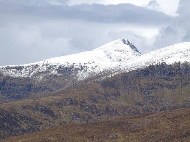 Photo could not load
NH2071 : Sgùrr Mòr
Richard Webb
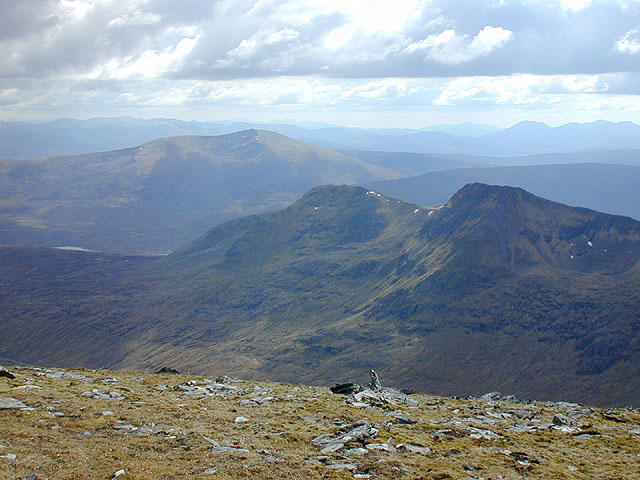 Photo could not load
NH2071 : View southwest from Sgùrr Mòr
Nigel Brown
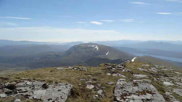 Photo could not load
NH2071 : On the summit of Sgurr Mor, Fannichs - view towards Meall Gorm
Colin Park
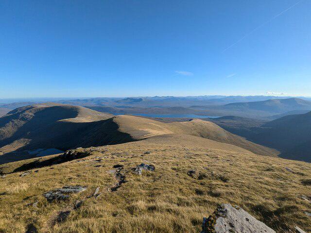 Photo could not load
NH2071 : Eastern Fannichs
Callum Black
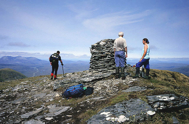 Photo could not load
NH2071 : At the summit cairn of Sgurr Mor
Walter Baxter
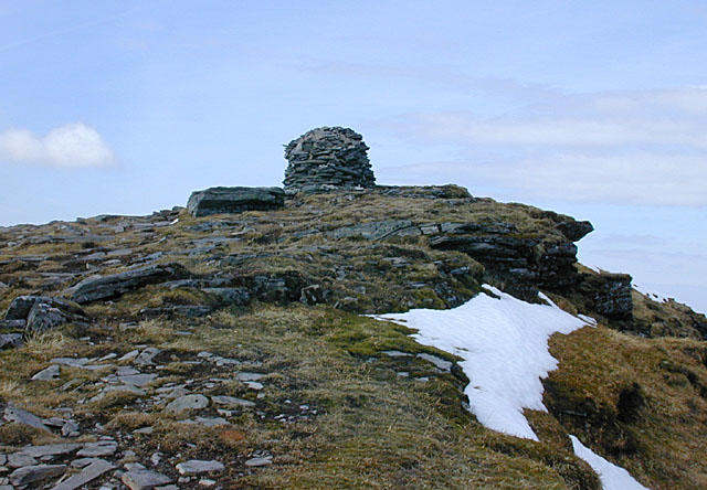 Photo could not load
NH2071 : The summit of Sgùrr Mòr
Nigel Brown
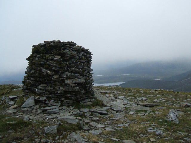 Photo could not load
NH2071 : Summit of Sgurr Mor
David Brown
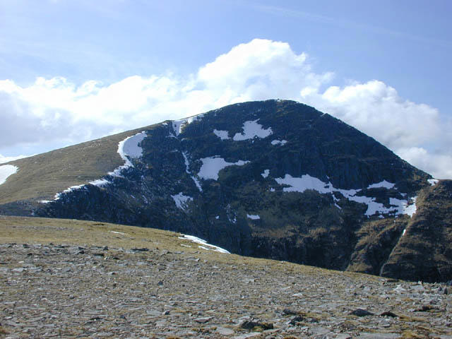 Photo could not load
NH2071 : Approaching Sgurr Mor from the east
Nigel Brown
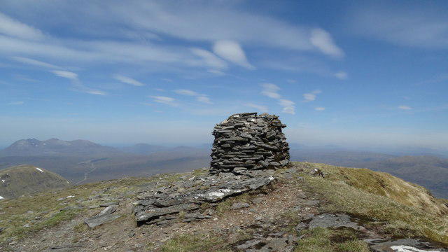 Photo could not load
NH2071 : Summit cairn, Sgurr Mor, Fannichs
Colin Park
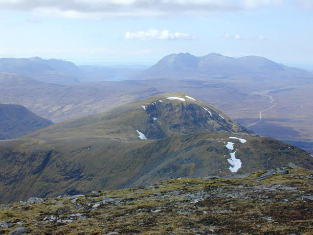 Photo could not load
NH2071 : View north west from Sgurr Mor
Nigel Brown
Hill facts and local notes
Classifications
Elevation
1,109m
3,638 ft
Prominence
914m
Coordinates
57.7001, -5.0168
NH203718
OS Map
20
Explorer: 436S
At the Summit
The summit boasts a substantial stone cairn, a typical feature of Scottish Munros, as well as stunning 360-degree views of the surrounding landscapes.
Terrain & Geology
Sgurr Mor is primarily composed of Schist and granite, lending itself to the rugged beauty typical of the Highlands. The weathered rock formations add to the dramatic landscape, while also supporting a variety of alpine flora.
Views & Scenery
From the summit, enjoy panoramic views of the Torridon mountains, Loch Affric, and the distant peaks of the Cairngorms.
History & Heritage
Name Origin
The name Sgurr Mor translates to 'great peak' in Gaelic, fitting for such a commanding presence in the landscape.
Historical Significance
Sgurr Mor is a notable destination for hikers aiming to complete the Munros, encapsulating the wild spirit of Scotland’s Highlands.
Getting There & Facilities
Parking
Glen Affric car park, which provides a spacious area for parking at the trailhead. Toilets are available seasonally.
Public Transport
Limited bus services run to Cannich, from where a taxi can be arranged to the Glen Affric car park.
Nearby Facilities
While facilities near the car park are minimal, the nearest town Cannich has a small shop and café, perfect for grabbing supplies or a warming meal post-hike.
Safety Information
Known Hazards
- Be cautious of sudden weather changes in the Highlands. The terrain can be slippery, particularly after rain. Ensure appropriate gear is worn.
General Safety Tips
- Check weather conditions before setting out
- Carry appropriate clothing and equipment
- Let someone know your planned route
- Take a map, compass, and GPS device
- Carry emergency supplies: food, water, first aid kit, torch
Hills
Some common questions about the hills answered
Are there group walks up Sgurr Mor?
Many walkers use Walkmates to join or organise walks with others. You can check for group walks around Sgurr Mor through the maps
Are there other walkers around Sgurr Mor?
Activity varies by location and time, but Walkmates lets you see whether others have shared walks or shown interest in this area. Find other people through the walking friends search walking friends for Sgurr Mor search or of course create your own walk for Sgurr Mor
Can I organise a walk to Sgurr Mor?
Yes. If there aren’t any walks listed already, you can create a walk and make it available for others to join.
If you're signed up to Walkmates, you can create a walk to Sgurr Mor.
How do I find a walk up this hill?
There are often multiple ways to walk this hill, depending on experience and route preference. Walkmates helps you explore walks and routes that others have shared.
Can I suggest a new route up Sgurr Mor?
Yes. You can suggest or create routes to share with others. Walkmates focuses on the social side of walking, so routes are used to help people organise walks and explore areas together, rather than as detailed navigation tools or route libraries.
Other uses really appreciate knowledgeable walkers sharing their routes. Share your favourite route to Sgurr Mor here
The is an error or something incorrect about this hill. How do I let you know?
We always strive to keep the information on Walkmates as accurate as possible. If you find an error, please let us know through the contact form and we'll aim to correct it as quickly as possible
Community Discussion
Comments
Location
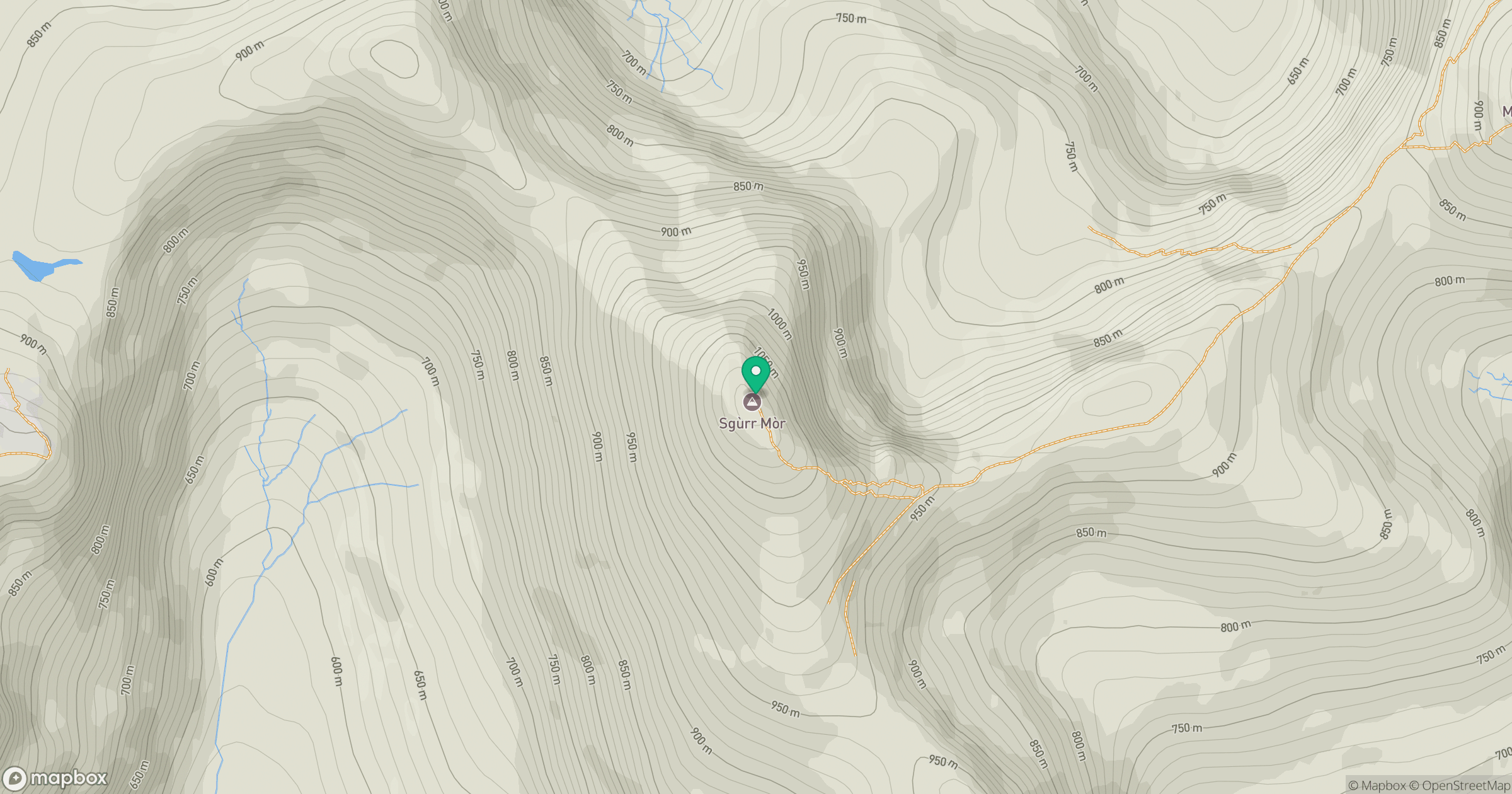
Grid reference: NH203718
View on OpenStreetMapOpens a map in a new tab, centred on the hill.
No comments yet. Be the first.