

Sgurr Dubh Mor
Good walks are even better shared.
NG4520 : On the ascent to Sgurr Dubh Mor with view to Gars-bheinn
Colin Park Photo source
Overview
Sgurr Dubh Mor: A Highland Odyssey
Introduction
Sgurr Dubh Mor stands proudly at 1001 meters in the Scottish Highlands, challenging hikers with its rugged terrain and rewarding them with breathtaking views.
Geology
This majestic Munro is primarily made up of gneiss, a rather fancy word for a type of metamorphic rock that has seen a lot of pressure in its lifetime. It’s tough stuff, much like the hikers who trek its slopes.
Routes
The most popular route is the Bealach na Glaic Mhoir ascent. This route is not for the faint-hearted but will reward eager trekkers with sweeping vistas. At approximately 8 km long, expect it to take around 4.5 hours, depending on how often you stop to take in the scenery… which is often!
Summit Features
Reaching the summit, you’re greeted by a large stone cairn standing as a tribute to those who’ve made it to the top. It’s your chance to pose for that obligatory ‘I conquered the summit!’ photo, and if you’re lucky, a few cheeky choughs might join you for the celebration.
Terrain
The terrain is rocky and rugged, with some grassy patches that provide a brief reprieve as you make your way up. Watch your footing—those rocks can be trickier than they look!
Views
Once summited, the views are nothing short of spectacular. Splash that camera roll with images of the Cuillin Hills and the striking Loch Scavaig below. For the best views, aim for late spring to early autumn when the weather is more forgiving.
Hazards
Be sure to keep an eye on your step; loose rocks and steep sections can trip up the most experienced of hikers. And, let’s face it, no one wants to tumble down a mountain!
Nearby Summits
While Sgurr Dubh Mor is an impressive peak on its own, it’s surrounded by other noteworthy hills, including Sgurr Dubh Beag and Bidein Druim nan Ros, which are perfect for those looking to extend their adventure.
Access
Accessing this glorious realm requires a bit of planning. The nearest parking is available at Coruisk, so make sure to beat the crowds! Public transport options include buses to the nearest village, Broadford, followed by a charming boat ride into the Cuillin, which is part of the adventure.
Facilities
Remember, facilities are sparse at the foot of the mountain; stock up in Broadford beforehand for a successful outing. You wouldn’t want to set out without a well-timed sandwich!
History
The name Sgurr Dubh Mor translates to 'Big Black Peak,' perfectly capturing its imposing nature. Historically, it has been a landmark for ancient clans, adding to its allure and sense of adventure.
Conclusion
Sgurr Dubh Mor is not just a hike; it’s an immersion into the wonders of the Scottish Highlands. Pack your bags, don your walking boots, and let the adventure begin!
Explore routes near Sgurr Dubh Mor
Walks starting near this hill. Open a route to check its map, distance and full itinerary.
Beinn Eighe Lancaster Wreckage at Coire Mhic Fhearchair
View route
Fairy Lochs Liberator Wreckage Circuit
View route
Dun Mhulan Broch Quick Walk
View route
Banavie to Glen Loy Aqueduct: Neptune’s Staircase Canal Towpath
View route
Route planning notes
These notes describe possible approaches. Check a route's map and access information when planning your walk.
Bealach na Glaic Mhoir ascent
A scenic route that starts at the Bealach na Glaic Mhoir and offers a picturesque ascent with stunning views.
Make a day of it, together
Find someone to share the walk with, or organise a day out along a route you like.
Photo Gallery
View all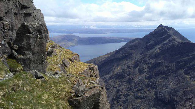 Photo could not load
NG4520 : On the ascent to Sgurr Dubh Mor with view to Gars-bheinn
Colin Park
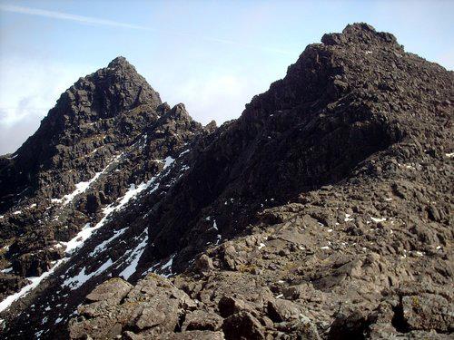 Photo could not load
NG4520 : Sgurr Dubh Mhor & Sgurr Dubh an Da Bheinn
trevor willis
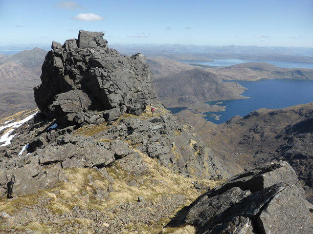 Photo could not load
NG4520 : The summit block on Sgurr Dubh Mor
David Medcalf
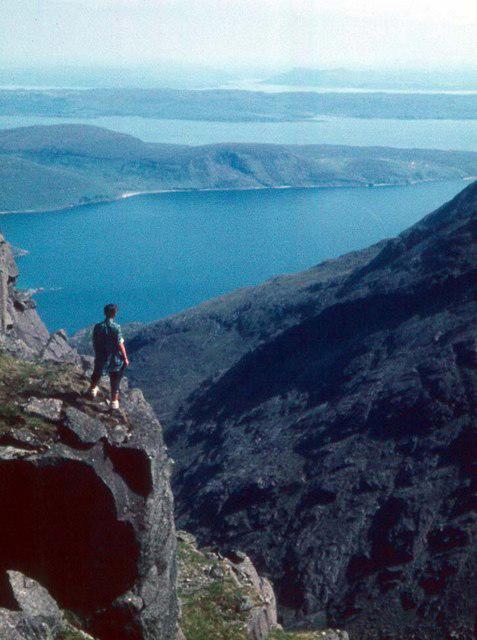 Photo could not load
NG4520 : On the way to Sgurr Dubh Mor
Alan Reid
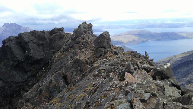 Photo could not load
NG4520 : Summit of Sgurr Dubh Mor - view across Loch Scavaig
Colin Park
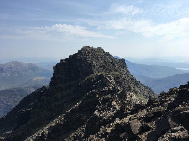 Photo could not load
NG4520 : Sgurr Dubh Mor
Steven Brown
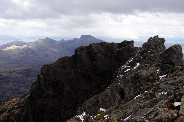 Photo could not load
NG4520 : Sgurr Dubh Mor - East from Summit
Ian Taylor
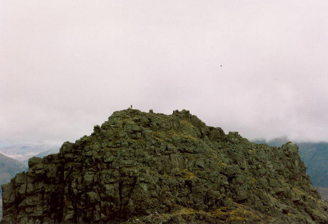 Photo could not load
NG4520 : Sgùrr Dubh Mór from the top of Sgùrr Dubh an Da Bheinn
Richard Law
Hill facts and local notes
Classifications
Elevation
944m
3,097 ft
Prominence
89m
Coordinates
57.2049, -6.2114
NG457205
OS Map
32
Explorer: 411
At the Summit
The summit is marked by a large stone cairn, a fitting tribute to hikers who have conquered this impressive peak.
Terrain & Geology
Sgurr Dubh Mor is primarily composed of gneiss, a metamorphic rock formed under high pressure and temperature—perfectly formed for dramatic ranges and picturesque vistas!
Views & Scenery
On a clear day, catch breathtaking vistas of the surrounding peaks, including the majestic Cuillin Hills and the churning waters of Loch Scavaig.
History & Heritage
Name Origin
Sgurr Dubh Mor loosely translates to 'Big Black Peak'—aptly named for its imposing stature and dark rock faces.
Historical Significance
The mountain holds cultural significance in Scottish Gaelic folklore and was a significant landmark for ancient clans.
Getting There & Facilities
Parking
Parking is available at the Coruisk area, which gives access to multiple trails. Please note that it's a popular spot, so arrive early!
Public Transport
Public transport options include buses to Elgol, followed by a boat trip to the Cuillin area, which is a scenic delight.
Nearby Facilities
There are limited facilities at the start of the trails. The nearest decent facilities can be found in Broadford, including cafes and toilets.
Safety Information
Known Hazards
- Loose rocks and steep ascents in parts; always watch your step—the rocks don’t like to play nice!
General Safety Tips
- Check weather conditions before setting out
- Carry appropriate clothing and equipment
- Let someone know your planned route
- Take a map, compass, and GPS device
- Carry emergency supplies: food, water, first aid kit, torch
Hills
Some common questions about the hills answered
Are there group walks up Sgurr Dubh Mor?
Many walkers use Walkmates to join or organise walks with others. You can check for group walks around Sgurr Dubh Mor through the maps
Are there other walkers around Sgurr Dubh Mor?
Activity varies by location and time, but Walkmates lets you see whether others have shared walks or shown interest in this area. Find other people through the walking friends search walking friends for Sgurr Dubh Mor search or of course create your own walk for Sgurr Dubh Mor
Can I organise a walk to Sgurr Dubh Mor?
Yes. If there aren’t any walks listed already, you can create a walk and make it available for others to join.
If you're signed up to Walkmates, you can create a walk to Sgurr Dubh Mor.
How do I find a walk up this hill?
There are often multiple ways to walk this hill, depending on experience and route preference. Walkmates helps you explore walks and routes that others have shared.
Can I suggest a new route up Sgurr Dubh Mor?
Yes. You can suggest or create routes to share with others. Walkmates focuses on the social side of walking, so routes are used to help people organise walks and explore areas together, rather than as detailed navigation tools or route libraries.
Other uses really appreciate knowledgeable walkers sharing their routes. Share your favourite route to Sgurr Dubh Mor here
The is an error or something incorrect about this hill. How do I let you know?
We always strive to keep the information on Walkmates as accurate as possible. If you find an error, please let us know through the contact form and we'll aim to correct it as quickly as possible
Community Discussion
Comments
Location
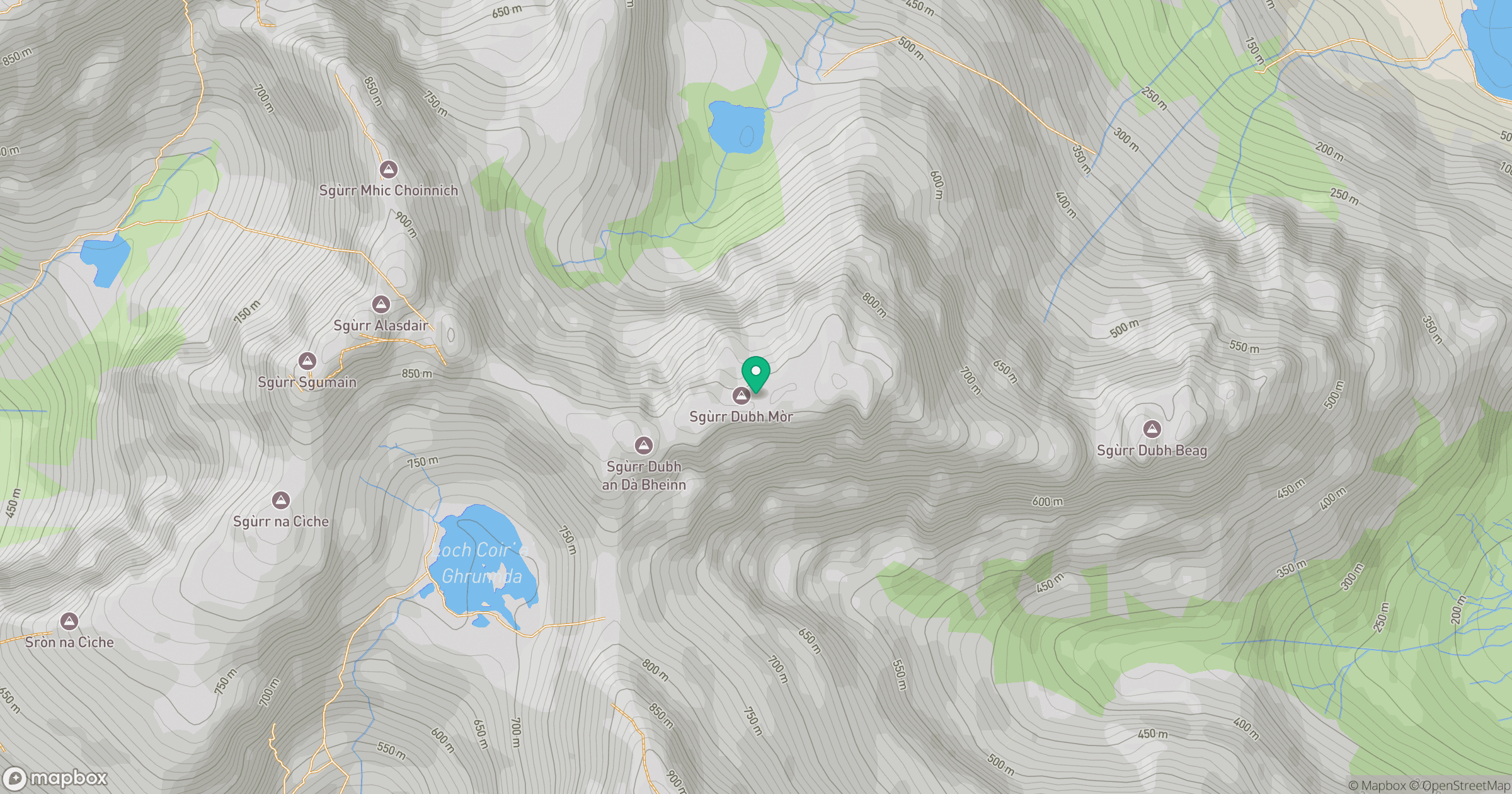
Grid reference: NG457205
View on OpenStreetMapOpens a map in a new tab, centred on the hill.
No comments yet. Be the first.