

Sgurr Dubh an Da Bheinn
Good walks are even better shared.
NG4520 : Summit of Sgurr Dubh Mor - view across Loch Scavaig
Colin Park Photo source
Overview
Sgurr Dubh an Da Bheinn
Overview
Sgurr Dubh an Da Bheinn stands proudly at 849 metres (2785 feet) amidst the rugged beauty of the Scottish Highlands. As a classified Munro, it draws the ambition of hillwalkers eager to conquer its rocky peaks. The mountain presents a unique blend of challenge and reward, with stunning panoramic views that make every bit of effort worthwhile.
Geology
The geological composition of Sgurr Dubh an Da Bheinn consists predominantly of ancient volcanic rock, shaped by the forces of nature over millennia. Glacial erosion has carved out dramatic cliffs and deep gorges, offering intriguing insights into the Earth's past. Gabbro forms much of the terrain, providing a firm footing while being aesthetically captivating.
Routes
There are a couple of fantastic routes to tackle this impressive Munro:
Bealach an Fhirich Route
This is the most popular route, stretching about 13.5 km with an ascent time of approximately 6.5 hours. Starting from the Fairy Pools car park, hikers will navigate through glens before ascending the mountain. Expect a workout, as this route is quite challenging, but the views will have you forgetting your tired legs in no time!
North Ridge Route
For those looking for a bit of extra excitement, why not give the North Ridge Route a go? At 10.0 km in distance and 5.5 hours of walking, this requires some scrambling, but the thrill is certainly worth the additional effort.
Summit Features
At the summit, you'll be greeted by a sizeable cairn, perfect for a celebratory selfie or two. Keep your eyes peeled for the local wildlife that may make an appearance in this breathtaking setting.
Terrain Type
Prepare yourself for a rocky adventure! The terrain is a mix of steep ascents and grassy patches that can be slippery when wet. It's best to wear sturdy boots to tackle this uneven ground.
Views
From the summit, the vistas are absolutely breathtaking. You'll be able to catch glimpses of the Cuillin range and the picturesque Loch na Mhoine. Aim to visit in late spring or summer for the clearest views and relatively mild weather conditions.
Hazards
A word to the wise: the steep drops and loose rocks can be tricky, particularly on the more challenging routes. Always be prepared and check the weather forecast before your climb.
Nearby Summits
The majestic Blaven (928m) and Sgurr nan Gillean (964m) are nearby summits, both presenting further opportunities for exploration.
Access
Nearest parking can be found at the Fairy Pools car park (NG 466 213), which is subject to popularity. Public transport from Portree can lead you toward Glen Brittle, but services can be a bit sparse.
Facilities
Reward yourself in Portree afterwards with delightful local cafés and shops. A hot drink could be just the remedy after your hike!
History
The name 'Sgurr Dubh an Da Bheinn', meaning 'the peak of the black one of the two mountains', reflects the mountain's shadowy granite peak when viewed from afar. As a significant feature of the landscape, it holds a special place in the hearts of both locals and visitors alike.
In conclusion, Sgurr Dubh an Da Bheinn is a must-visit for any serious hiker. Lace up your boots, bring your sense of adventure, and embark on a journey that promises to be as scenic as it is challenging. Happy hiking!
Explore routes near Sgurr Dubh an Da Bheinn
Walks starting near this hill. Open a route to check its map, distance and full itinerary.
Beinn Eighe Lancaster Wreckage at Coire Mhic Fhearchair
View route
Fairy Lochs Liberator Wreckage Circuit
View route
Dun Mhulan Broch Quick Walk
View route
Banavie to Glen Loy Aqueduct: Neptune’s Staircase Canal Towpath
View route
Route planning notes
These notes describe possible approaches. Check a route's map and access information when planning your walk.
Bealach an Fhirich Route
This challenging yet rewarding route begins at the car park near the Fairy Pools and follows a well-defined path up through glens and ridges onto the mountain.
North Ridge Route
A direct approach taking in breathtaking views and requiring some scrambling in sections.
Make a day of it, together
Find someone to share the walk with, or organise a day out along a route you like.
Photo Gallery
View all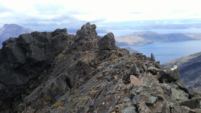 Photo could not load
NG4520 : Summit of Sgurr Dubh Mor - view across Loch Scavaig
Colin Park
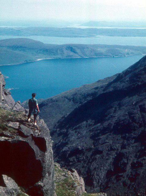 Photo could not load
NG4520 : On the way to Sgurr Dubh Mor
Alan Reid
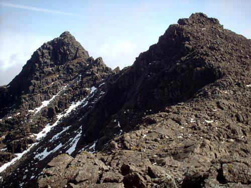 Photo could not load
NG4520 : Sgurr Dubh Mhor & Sgurr Dubh an Da Bheinn
trevor willis
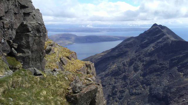 Photo could not load
NG4520 : On the ascent to Sgurr Dubh Mor with view to Gars-bheinn
Colin Park
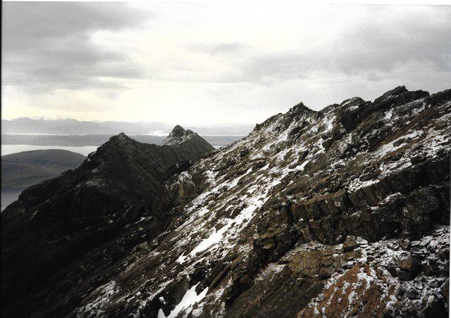 Photo could not load
NG4520 : Sgurr a/ Choire Bhig, Garsbheinn, Sgurr nan Eag from Caisteal a' Gharbh-Choire
Mick Garratt
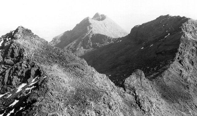 Photo could not load
NG4520 : The Cuillin Ridge to Gars-bheinn
Jim Barton
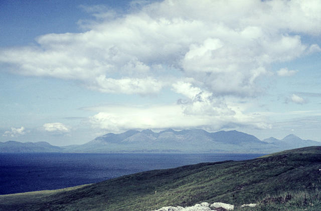 Photo could not load
NG4520 : Skye Cuillin from Rum
John Rostron
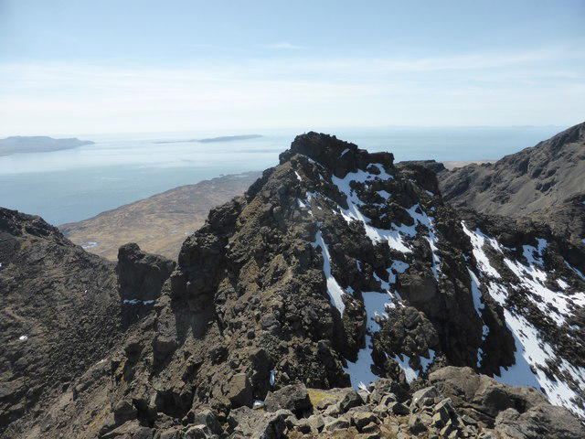 Photo could not load
NG4520 : Sgurr Dubh an Da Bheinn
David Medcalf
Hill facts and local notes
Classifications
Elevation
939m
3,079 ft
Prominence
55m
Coordinates
57.2040, -6.2153
NG455204
OS Map
32
Explorer: 411
At the Summit
The summit is marked by a prominent cairn, offering a great spot for photo opportunities and a well-earned rest. On a clear day, it's also a good place to spot various wildlife.
Terrain & Geology
Sgurr Dubh an Da Bheinn is primarily composed of ancient volcanic rock, characterized by rugged cliffs and gorges caused by glacial activity. The rock formations include gabbro, which is known for its durability and often gives rise to spectacular scenery.
Views & Scenery
Stunning views of the Cuillin range, Blaven mountain, and sparkling Loch na Mhoine.
History & Heritage
Name Origin
The name 'Sgurr Dubh an Da Bheinn' translates to 'the peak of the black one of the two mountains', which speaks to the mountain's striking appearance.
Historical Significance
This peak is an iconic feature in the landscape and is often climbed by both avid hikers and those looking to challenge themselves.
Getting There & Facilities
Parking
Parking is available at the Fairy Pools car park (NG 466 213), which can become quite busy during peak times.
Public Transport
Local buses from Portree operate towards Glen Brittle; however, connections might be limited.
Nearby Facilities
Facilities in Portree include cafés, restaurants, and shops where you can stock up on essentials or enjoy a meal post-hike.
Safety Information
Known Hazards
- Steep drops, loose rocks, and unpredictable weather conditions can pose risks, especially in winter. Always check forecasts before heading out.
General Safety Tips
- Check weather conditions before setting out
- Carry appropriate clothing and equipment
- Let someone know your planned route
- Take a map, compass, and GPS device
- Carry emergency supplies: food, water, first aid kit, torch
Hills
Some common questions about the hills answered
Are there group walks up Sgurr Dubh an Da Bheinn?
Many walkers use Walkmates to join or organise walks with others. You can check for group walks around Sgurr Dubh an Da Bheinn through the maps
Are there other walkers around Sgurr Dubh an Da Bheinn?
Activity varies by location and time, but Walkmates lets you see whether others have shared walks or shown interest in this area. Find other people through the walking friends search walking friends for Sgurr Dubh an Da Bheinn search or of course create your own walk for Sgurr Dubh an Da Bheinn
Can I organise a walk to Sgurr Dubh an Da Bheinn?
Yes. If there aren’t any walks listed already, you can create a walk and make it available for others to join.
If you're signed up to Walkmates, you can create a walk to Sgurr Dubh an Da Bheinn.
How do I find a walk up this hill?
There are often multiple ways to walk this hill, depending on experience and route preference. Walkmates helps you explore walks and routes that others have shared.
Can I suggest a new route up Sgurr Dubh an Da Bheinn?
Yes. You can suggest or create routes to share with others. Walkmates focuses on the social side of walking, so routes are used to help people organise walks and explore areas together, rather than as detailed navigation tools or route libraries.
Other uses really appreciate knowledgeable walkers sharing their routes. Share your favourite route to Sgurr Dubh an Da Bheinn here
The is an error or something incorrect about this hill. How do I let you know?
We always strive to keep the information on Walkmates as accurate as possible. If you find an error, please let us know through the contact form and we'll aim to correct it as quickly as possible
Community Discussion
Comments
Location
View the hill's mapped position and surrounding paths.
Grid reference: NG455204
View on OpenStreetMapOpens a map in a new tab, centred on the hill.
No comments yet. Be the first.