

Sgurr a' Phollain South Top
Good walks are even better shared.
NH3644 : South summit Sgurr a' Phollain
Roddy Urquhart Photo source
Overview
Sgurr a' Phollain South Top
Nestled in the enchanting Scottish Highlands, Sgurr a' Phollain South Top stands at a respectable elevation of 885 meters. A Marilyn by classification, this peak beckons to outdoor enthusiasts with its alluring vistas and challenging terrain.
Geology
The terrain here is a mix of schists and gneisses, showcasing the region's rich geological history. These ancient formations are like nature's history book, each layer a story of its own from millennia past. The rocks may not tell jokes, but they certainly create stunning backdrops for your hiking pics!
Routes
Two main routes cater to hikers eager to conquer this mountain. The Glen Affric Start is a popular choice, winding through luscious flora and providing a firm footing. Alternatively, the Cameron Hill Approach is less trodden, allowing those seeking solace in nature a peaceful trek. Either way, pack your boots and a sense of adventure!
Summit Features
On reaching the summit, you’ll be greeted by a rocky outcrop adorned with a humble cairn. This place demands a moment of reflection—preferably while munching on a snack and catching your breath.
Terrain Type
Expect a combination of rocky paths interspersed with grassy clearings, alongside the occasional bog to test your footwear's water resistance. Mind your step, or you may find your boot doing the Highland Fling!
Views
From the summit, the views are nothing short of breathtaking. You can feast your eyes on the sweeping landscapes of Glen Affric, with mountains dancing in the distance. To make the most of these picturesque sights, aim to hike during spring or early autumn when the skies are clearest.
Hazards
As with many adventures, there are areas requiring caution. Steep sections near the top can become slippery, particularly if the weather takes a turn for the worse. Keep your wits about you, and be mindful of those cheeky loose rocks!
Access
Getting to Sgurr a' Phollain South Top is half the fun. The nearest parking can be found at the Glen Affric car park, which fills up quickly during sunny seasons—so arrive early. Public transport options are limited, but buses from Inverness to Cannich will drop you close enough for a scenic walk to the trailhead.
Facilities
Cannich is your go-to for post-hike recovery fuel, boasting a shop and café. Don't forget, toilets are conveniently located at the Glen Affric car park.
History
The name 'Sgurr a' Phollain' translates to 'peak of the hollow,' a fitting title for such a majestic formation. Its place in the Glen Affric Nature Reserve highlights its ecological importance, making it a cherished destination for conservationists and hikers alike.
So, lace up those boots, pack your snacks, and prepare for an unforgettable adventure on Sgurr a' Phollain South Top. Remember, the mountains are calling—and you must go!
Explore routes near Sgurr a' Phollain South Top
Walks starting near this hill. Open a route to check its map, distance and full itinerary.
Glen Affric: Coire Loch Woodland Trail
View route
Fort Augustus to Kytra Lock: Caledonian Canal Towpath
View route
Beinn Eighe Lancaster Wreckage at Coire Mhic Fhearchair
View route
Loch Migdale from Torroy: Spinningdale pinewood and loch shore walk
View route
Route planning notes
These notes describe possible approaches. Check a route's map and access information when planning your walk.
Glen Affric Start
A scenic route commencing from Glen Affric, providing well-marked paths through stunning foliage.
Cameron Hill Approach
An alternative and less-travelled path starting near the village of Cannich, offering respite from foot traffic.
Make a day of it, together
Find someone to share the walk with, or organise a day out along a route you like.
Photo Gallery
View all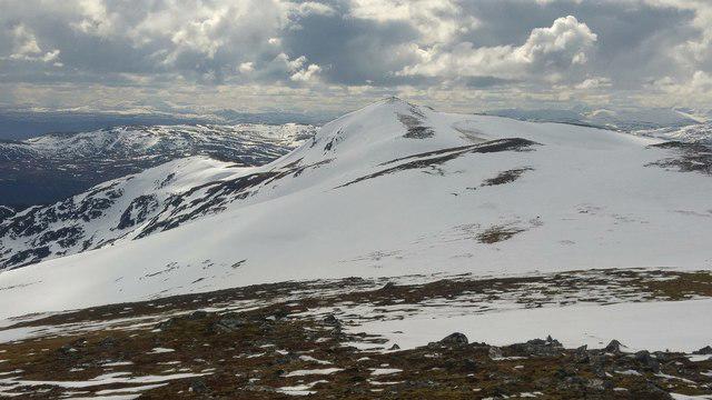 Photo could not load
NH3644 : South summit Sgurr a' Phollain
Roddy Urquhart
Hill facts and local notes
Classifications
Elevation
835m
2,740 ft
Prominence
29m
Coordinates
57.4578, -4.7319
NH362441
OS Map
26
Explorer: 431
At the Summit
The summit features a rocky outcrop marked by a small cairn, perfect for that triumphant summit selfie or two.
Terrain & Geology
The mountain is primarily composed of schists and gneisses, typical of the region's metamorphic rocks. These formations tell a tale of intense geological pressure over millions of years.
Views & Scenery
Panoramic views of the surrounding mountains, including the mighty Glen Affric and the distant peaks of the Great Glen.
History & Heritage
Name Origin
The name 'Sgurr a' Phollain' is derived from Gaelic, translating to 'peak of the hollow.'
Historical Significance
This mountain is significant not only for walkers but also for its biodiversity and as part of the revered Glen Affric Nature Reserve.
Getting There & Facilities
Parking
Parking available at the Glen Affric car park, NH241226. Arrive early, as spots fill up quickly during peak season.
Public Transport
Buses from Inverness to Cannich are available, though it might entail some walking to reach the trailhead.
Nearby Facilities
There are facilities in Cannich including a small shop and a café. Toilets are available at the Glen Affric car park.
Safety Information
Known Hazards
- Steep sections near the summit can be tricky, particularly in wet conditions. Watch out for loose rocks that could send you on an unexpected journey.
General Safety Tips
- Check weather conditions before setting out
- Carry appropriate clothing and equipment
- Let someone know your planned route
- Take a map, compass, and GPS device
- Carry emergency supplies: food, water, first aid kit, torch
Hills
Some common questions about the hills answered
Are there group walks up Sgurr a' Phollain South Top?
Many walkers use Walkmates to join or organise walks with others. You can check for group walks around Sgurr a' Phollain South Top through the maps
Are there other walkers around Sgurr a' Phollain South Top?
Activity varies by location and time, but Walkmates lets you see whether others have shared walks or shown interest in this area. Find other people through the walking friends search walking friends for Sgurr a' Phollain South Top search or of course create your own walk for Sgurr a' Phollain South Top
Can I organise a walk to Sgurr a' Phollain South Top?
Yes. If there aren’t any walks listed already, you can create a walk and make it available for others to join.
If you're signed up to Walkmates, you can create a walk to Sgurr a' Phollain South Top.
How do I find a walk up this hill?
There are often multiple ways to walk this hill, depending on experience and route preference. Walkmates helps you explore walks and routes that others have shared.
Can I suggest a new route up Sgurr a' Phollain South Top?
Yes. You can suggest or create routes to share with others. Walkmates focuses on the social side of walking, so routes are used to help people organise walks and explore areas together, rather than as detailed navigation tools or route libraries.
Other uses really appreciate knowledgeable walkers sharing their routes. Share your favourite route to Sgurr a' Phollain South Top here
The is an error or something incorrect about this hill. How do I let you know?
We always strive to keep the information on Walkmates as accurate as possible. If you find an error, please let us know through the contact form and we'll aim to correct it as quickly as possible
Community Discussion
Comments
Location
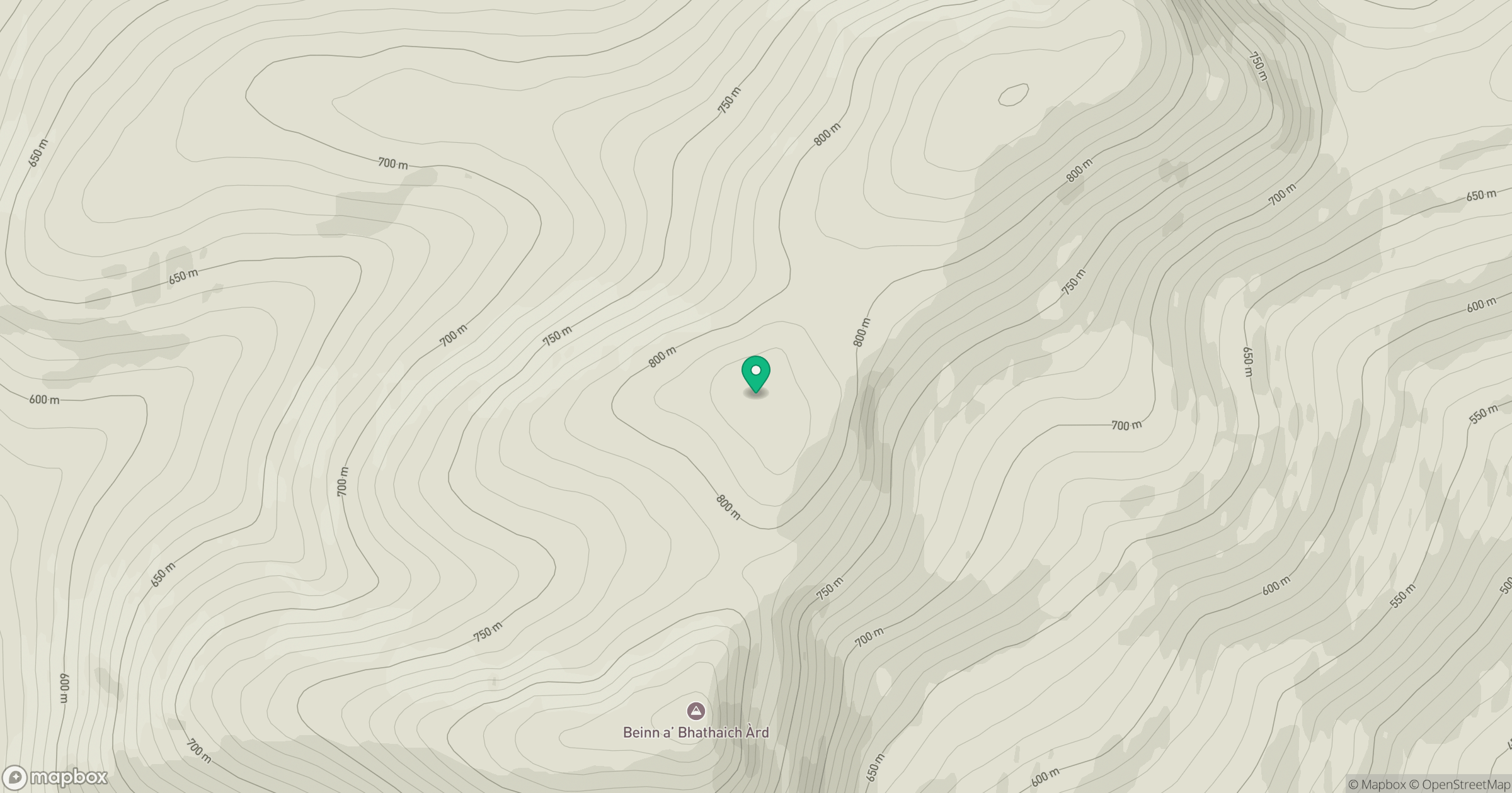
Grid reference: NH362441
View on OpenStreetMapOpens a map in a new tab, centred on the hill.
No comments yet. Be the first.