
Carn Ban
Good walks are even better shared.
Overview
Overview
Carn Ban is a marvellous Marilyn located in the scenic Scottish Highlands, boasting an elevation of 790 meters. This mountain is an excellent choice for those looking to explore the rugged beauty of the Highlands without tackling a major Munro.
Geology
The area is characterised by its granite composition. The fascinating geological features offer glimpses into the ancient processes that shaped this stunning landscape. Glacial activity has also carved out some of the ridges, providing a varied and intriguing terrain.
Routes
Culloden House Route
This moderate-difficulty route stretches about 8 km and takes around 3.5 hours to complete. It starts from Culloden House, leading hikers through lush woodlands. Expect some lovely bursts of wildlife along the way. As you ascend, the anticipation builds, and soon enough, you'll reach the summit with a glorious cairn marking the top.
Dell of Sluggan Route
The alternative Dell of Sluggan Route is equally thrilling. Spanning 6.5 km, it takes about 2.5 hours to hike and offers a variety of terrain challenges, ensuring your legs get a solid workout. The views en route will keep your spirits high, especially when you reach the summit!
Summit Features
Once at the top, revel in the satisfaction of reaching the idyllic summit, which features a well-constructed cairn. Go ahead, stretch your legs and join the many birds of prey soaring above while you admire the breathtaking scenery. Don't forget to take a moment to gather your thoughts and your camera!
Terrain
The mountain presents a delightful mix of grassy slopes and rocky outcrops, coupled with patches of heather. Watch your step in the boggy areas though, as they can be quite slippery!
Views
On a clear day, the views from the summit of Carn Ban are nothing short of spectacular. You can spot the Monadhliath Mountains and the expansive Moray Firth. The sights will make you think twice about ever going back home!
Hazards
As is typical in the Highlands, always keep an eye on the weather, as it can change unexpectedly. Muddy paths can also be a challenge, especially after a rain, making sturdy footwear a must!
Access and Facilities
The nearest parking is at Culloden House, with easy access to public transport from Inverness, which is the closest sizeable town that offers all necessary amenities, including cafes and toilets. Preparing for your journey ensures a more enjoyable advent.
History
As a nod to its heritage, the name 'Carn Ban' derives from the Gaelic for 'White Cairn'. This mountain also has cultural significance due to its proximity to historically rich sites, including the Culloden Battlefield.
In summary, Carn Ban provides an engaging hiking experience suitable for enthusiasts of all abilities. Whether you're an avid hiker or just someone looking for a leisurely stroll with legendary views, Carn Ban is a fantastic choice. Get your walking boots on and hit the trail!
Explore routes near Carn Ban
Public walks starting within 80 km of this hill. Nearby does not mean a route reaches the summit; check its map and access before setting out.
Glen Affric: Coire Loch Woodland Trail
View route
Loch Affric full circuit from River Affric
View route
Great Glen Way low route: Fort Augustus to Invermoriston Old Bridge
View route
Fort Augustus to Kytra Lock: Caledonian Canal Towpath
View route
Route planning notes
These notes describe possible approaches, not verified navigable routes or permission to cross land. Check current paths, local access rules and conditions before setting out.
Culloden House Route
A scenic route starting from Culloden House that leads through woodlands and offers splendid views as you approach the summit.
Dell of Sluggan Route
This route branches off from a nearby forest trail, providing various terrain challenges and rewarding sights.
Make a day of it, together
Find someone to share the walk with, or organise a day out along a route you like.
Hill facts and local notes
Classifications
Elevation
737m
2,418 ft
Prominence
129m
Coordinates
57.4363, -4.7734
NH336418
OS Map
26
Explorer: 431
At the Summit
The summit features a prominent cairn, providing a perfect spot for taking selfies that will surely make friends jealous. There is also a stunning panoramic view that stretches across the Highlands.
Terrain & Geology
Carn Ban is primarily composed of granite, which provides its rugged landscape and sturdy footing. The presence of glacial features is notable, showcasing the area's ancient geological past.
Views & Scenery
From the summit, one can see the rugged peaks of the Monadhliath Mountains as well as the vast expanse of the Moray Firth on a clear day, with local wildlife often gracing the views.
History & Heritage
Name Origin
The name 'Carn Ban' translates to 'White Cairn' in Gaelic, possibly due to the light-coloured rocks found near the summit.
Historical Significance
The mountain is located near historical sites, including the battlefield of Culloden, making it a region of considerable cultural importance.
Getting There & Facilities
Check current local access restrictions, parking rules and transport timetables before travelling. These notes do not confirm public access to the summit.
Parking
There's ample parking available at Culloden House (NH 377 417), just a short drive from Inverness.
Public Transport
The nearest bus services can be caught from Inverness, which is a short journey, followed by a 20-minute walk to reach the starting trailhead.
Nearby Facilities
Inverness offers various facilities, including cafes, restaurants, and toilets. However, no facilities are immediately on the mountain itself, so plan accordingly.
Safety Information
Known Hazards
- Muddy paths can be slippery during wet weather, requiring caution. Also, be wary of sudden changes in weather, typical in the Highlands.
General Safety Tips
- Check weather conditions before setting out
- Carry appropriate clothing and equipment
- Let someone know your planned route
- Take a map, compass, and GPS device
- Carry emergency supplies: food, water, first aid kit, torch
Hills
Some common questions about the hills answered
Are there group walks up Carn Ban?
Many walkers use Walkmates to join or organise walks with others. You can check for group walks around Carn Ban through the maps
Are there other walkers around Carn Ban?
Activity varies by location and time, but Walkmates lets you see whether others have shared walks or shown interest in this area. Find other people through the walking friends search walking friends for Carn Ban search or of course create your own walk for Carn Ban
Can I organise a walk to Carn Ban?
Yes. If there aren’t any walks listed already, you can create a walk and make it available for others to join.
If you're signed up to Walkmates, you can create a walk to Carn Ban.
How do I find a walk up this hill?
There are often multiple ways to walk this hill, depending on experience and route preference. Walkmates helps you explore walks and routes that others have shared.
Can I suggest a new route up Carn Ban?
Yes. You can suggest or create routes to share with others. Walkmates focuses on the social side of walking, so routes are used to help people organise walks and explore areas together, rather than as detailed navigation tools or route libraries.
Other uses really appreciate knowledgeable walkers sharing their routes. Share your favourite route to Carn Ban here
The is an error or something incorrect about this hill. How do I let you know?
We always strive to keep the information on Walkmates as accurate as possible. If you find an error, please let us know through the contact form and we'll aim to correct it as quickly as possible
Community Discussion
Comments
Location
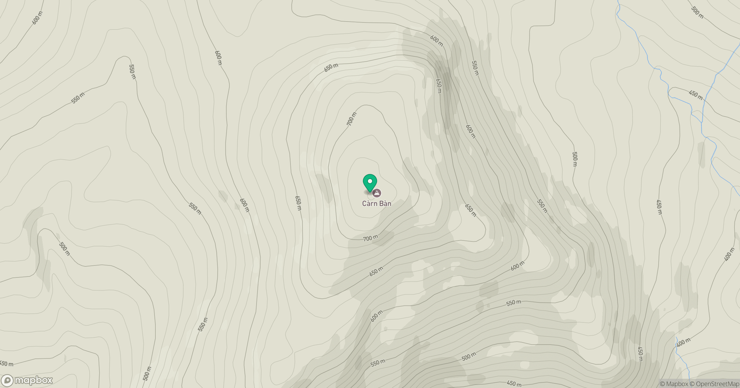
Grid reference: NH336418
View on OpenStreetMapOpens a map in a new tab, centred on the hill.
Hills within 30 km
Straight-line distance, not a walking route or confirmation of access.
Sgurr a' Choire Ghlais
1,084m
Cul Mor
393m
Carn Eighe
1,183m
Mam Sodhail
1,179m
Beinn a' Bhathaich Ard [Beinn a' Bha' ach Ard]
862m
No comments yet. Be the first.