

Garbh-charn
Good walks are even better shared.
Overview
Garbh-charn
Garbh-charn stands tall at 853 meters, a worthy Munro nestled in the scenic folds of the Scottish Highlands. This mountain is not just a climb but an adventure that reveals the dramatic beauty of Scotland's rugged landscapes.
Geology
The fascinating geology of Garbh-charn is largely shaped by ancient sedimentary rocks, crafted by the relentless forces of time and nature. Glacial activity has sculpted the terrain into its current rugged state, creating steep ravines and striking rock formations that are a delight for geology enthusiasts.
Routes
There are two popular routes to tackle Garbh-charn:
- North-East Ridge Route: An exhilarating trek that provides a moderate challenge for those keen on some elevation gain. The route stretches 8.0 km and is estimated to take around 4.5 hours, revealing spectacular views along the way.
- South-West Ascent: For a more leisurely ascent, this path measures 7.5 km and takes approximately 3.5 hours, making it perfect for families or novice hikers.
Summit Features
Upon reaching the summit, you'll find a quaint stone cairn that greets all who dare to conquer this grand mountain! Weather permitting, the panoramic views will leave you speechless, with Loch Awe and the monumental Ben Nevis gracing the horizon.
Views
From the summit, nature puts on a display worth every step taken. Look out for the sprawling Loch Awe and the monumental shapes of surrounding peaks like Ben Lui. The best time to see these sights? Late spring through early autumn is ideal—when the heather blooms and the sun decides to shine! Just remember to keep that trusty umbrella handy, as the Scottish weather is known for throwing a curveball.
Hazards
As with any mountain journey, caution is crucial. The pathways can pose risks with loose rocks and rugged terrains, particularly in wetter conditions. Proper hiking boots and gear are your best mates on this trek.
Access
To reach Garbh-charn, park your car in Dalavich and prepare for your adventure. Parking is limited, so it’s a good idea to rise with the larks for the best chance of a spot. Public transport options include buses running infrequently from Oban, with taxis available for those in need of a lift.
Facilities
While the mountain itself is devoid of facilities, the nearby village of Dalavich offers a quaint café and public toilets, perfect for a pre-hike coffee boost or a post-hike snack.
History
Garbh-charn gets its name from the Gaelic word for 'rough cairn', an apt description given its rugged stature. Historically, the area has seen its share of intrigue during the Jacobite risings, making it rich in folklore and history.
So, whether you’re for the views, geology, or a dash of Scottish history, Garbh-charn has something for everyone, promising an unforgettable experience that will leave you wanting to return!
Happy hiking!
Explore routes near Garbh-charn
Public walks starting within 80 km of this hill. Nearby does not mean a route reaches the summit; check its map and access before setting out.
Glen Affric: Coire Loch Woodland Trail
View route
Loch Affric full circuit from River Affric
View route
Great Glen Way low route: Fort Augustus to Invermoriston Old Bridge
View route
Fort Augustus to Kytra Lock: Caledonian Canal Towpath
View route
Route planning notes
These notes describe possible approaches, not verified navigable routes or permission to cross land. Check current paths, local access rules and conditions before setting out.
North-East Ridge Route
A scenic approach that offers a blend of both challenge and beauty, leading you up via the northeast ridge.
South-West Ascent
This route is a bit more straightforward and ideal for those who prefer an easier climb with magnificent views.
Make a day of it, together
Find someone to share the walk with, or organise a day out along a route you like.
Photo Gallery
View all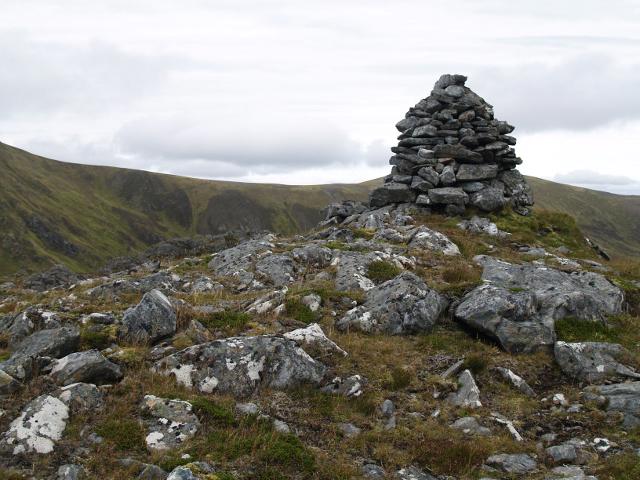 Photo could not load
NH2941 : Summit cairn, Garbh-charn
Chris Eilbeck
Hill facts and local notes
Classifications
Elevation
854m
2,802 ft
Prominence
105m
Coordinates
57.4279, -4.8449
NH292410
OS Map
25
Explorer: 430
At the Summit
At the summit, hikers are greeted by a small stone cairn, a traditional marker celebrating their achievement. On clear days, one can often spot the silhouette of Ben Nevis in the distance.
Terrain & Geology
Composed primarily of ancient sedimentary rock, Garbh-charn features remarkable ruggedness typical of the Highlands, with steep ravines and rocky outcrops. The area is shaped by glacial activity, making it a fascinating geological showcase.
Views & Scenery
The views from Garbh-charn are simply breath-taking, showcasing the expansive Loch Awe and the distant peaks of the Argyll mountains. On a good day, you might even spot the Isle of Mull!
History & Heritage
Name Origin
Garbh-charn translates to 'rough cairn' in Gaelic, fitting for its rugged terrain.
Historical Significance
This area has historically been significant for its strategic location during the Jacobite risings, with tales of Highland clans echoing through the valleys.
Getting There & Facilities
Check current local access restrictions, parking rules and transport timetables before travelling. These notes do not confirm public access to the summit.
Parking
Parking is available at the village of Dalavich, just a short drive from the trailhead. Limited spaces, so arrive early to snag a spot.
Public Transport
Buses run from Oban to Dalavich, but check the timetable as they can be infrequent. Local taxis are also an option for those wishing for a more direct route.
Nearby Facilities
While there are no facilities directly on the mountain, Dalavich offers a small café and public toilets, ideal for refreshing before or after your trek.
Safety Information
Known Hazards
- Loose rocks, steep slopes, and weather changes can be challenging. It’s wise to be extra cautious and equip yourself with proper footwear.
General Safety Tips
- Check weather conditions before setting out
- Carry appropriate clothing and equipment
- Let someone know your planned route
- Take a map, compass, and GPS device
- Carry emergency supplies: food, water, first aid kit, torch
Hills
Some common questions about the hills answered
Are there group walks up Garbh-charn?
Many walkers use Walkmates to join or organise walks with others. You can check for group walks around Garbh-charn through the maps
Are there other walkers around Garbh-charn?
Activity varies by location and time, but Walkmates lets you see whether others have shared walks or shown interest in this area. Find other people through the walking friends search walking friends for Garbh-charn search or of course create your own walk for Garbh-charn
Can I organise a walk to Garbh-charn?
Yes. If there aren’t any walks listed already, you can create a walk and make it available for others to join.
If you're signed up to Walkmates, you can create a walk to Garbh-charn.
How do I find a walk up this hill?
There are often multiple ways to walk this hill, depending on experience and route preference. Walkmates helps you explore walks and routes that others have shared.
Can I suggest a new route up Garbh-charn?
Yes. You can suggest or create routes to share with others. Walkmates focuses on the social side of walking, so routes are used to help people organise walks and explore areas together, rather than as detailed navigation tools or route libraries.
Other uses really appreciate knowledgeable walkers sharing their routes. Share your favourite route to Garbh-charn here
The is an error or something incorrect about this hill. How do I let you know?
We always strive to keep the information on Walkmates as accurate as possible. If you find an error, please let us know through the contact form and we'll aim to correct it as quickly as possible
Community Discussion
Comments
Location
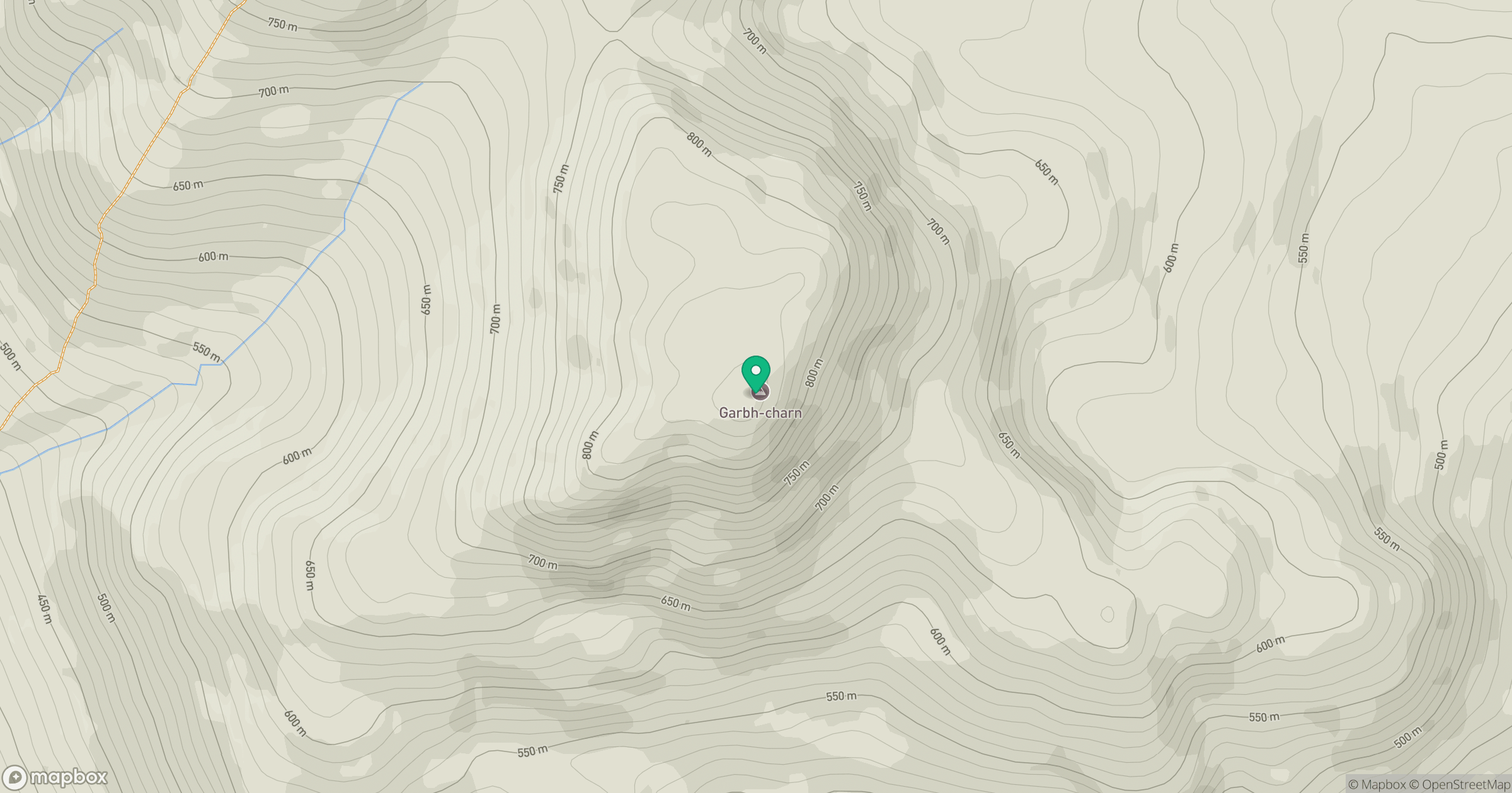
Grid reference: NH292410
View on OpenStreetMapOpens a map in a new tab, centred on the hill.
Hills within 30 km
Straight-line distance, not a walking route or confirmation of access.
Sgurr a' Choire Ghlais
1,084m
Cul Mor
393m
Carn Eighe
1,183m
Mam Sodhail
1,179m
Sgurr na Ruaidhe
993m
No comments yet. Be the first.