

Sgurr a' Choire-rainich
Good walks are even better shared.
Overview
Sgurr a' Choire-rainich
Located in the Scottish Highlands, Sgurr a' Choire-rainich is a stunning Munro that offers both a challenge and breathtaking scenery. Reaching an elevation of 1,067 meters, this peak is an absolute gem for those looking to escape the hustle and bustle of daily life.
Geology
The geology is fascinating here, primarily consisting of schist and granite. The ancient glacial activity has left its mark, carving the rugged landscape that we see today. Be sure to examine the stones; they tell stories of a time long before humans wandered these hills.
Routes
There are a couple of well-trodden routes to reach the summit. The North East Ridge Route provides a moderate challenge with 8.5 km to cover in roughly 4 hours. This path embraces you with stunning vistas as you ascend, making your climb much more enjoyable.
If you prefer a gentler start, the South West Approach offers an easier trek of approximately 10 km, taking around 5 hours to complete. Just don’t forget to look up occasionally to soak in the view!
Summit Features
At the summit, expect to find a sizeable stone cairn and an old trig point—ideal for that coveted summit photo. You’ll want to capture the moment you reach the top, even if the only thing smiling back is your exhausted reflection!
Terrain
The terrain ranges from rocky paths to grassy slopes, with some boggy patches thrown in for good measure. It's wise to wear sturdy footwear to ward off wet socks.
Views
The views from Sgurr a' Choire-rainich are nothing short of spectacular. On a clear day, you're treated to a panorama of surrounding peaks like Ben Nevis and the Nevis Range, while the Lochaber valley unfolds beneath you. The best seasons for unclouded scenery are late spring and early autumn, as long as the weather plays ball!
Hazards
It’s essential to be cautious of steep sections and the risk of sudden weather changes. Scottish weather is notorious for keeping folks on their toes, so be prepared with a good jacket and a sense of adventure. The bogs also wait to catch the unwary!
Nearby Summits
If you’re eager for more peaks, consider visiting nearby summits like Sgurr a' Mhaoraich and Sgurr nan Saighead—all within eager reach after conquering this Munro.
Access
Nearest parking can be found at the A86 road near the North East Ridge route start. Public transport links from Fort William get you close, and a taxi can help bridge the final gap. The closest town, Spean Bridge, offers facilities if you need to refuel.
Facilities
Once you descend, amenities can be found in Spean Bridge, offering cafes and shops where you can grab a bite or even a wee cuppa. Remember, advanced hiking equipment can only prepare you so much for a feast afterward!
History
The name 'Sgurr a' Choire-rainich' literally means 'peak of the rainy corrie', reminding all adventurers that rain is just a misty hug from the Scottish Highlands. It carries historical significance as a beloved destination for climbers since the 19th century.
Happy hiking, and may your boots be forever dry!
Explore routes near Sgurr a' Choire-rainich
Public walks starting within 80 km of this hill. Nearby does not mean a route reaches the summit; check its map and access before setting out.
Glen Affric: Coire Loch Woodland Trail
View route
Beinn Eighe Lancaster Wreckage at Coire Mhic Fhearchair
View route
Loch Affric full circuit from River Affric
View route
Inverness: River Ness and Caledonian Canal circuit
View route
Route planning notes
These notes describe possible approaches, not verified navigable routes or permission to cross land. Check current paths, local access rules and conditions before setting out.
North East Ridge Route
A popular approach that meanders up a well-defined ridge with stunning views along the way. Perfect for those who enjoy a bit of a workout without climbing like a goat.
South West Approach
This route offers a gentler gradient, ideal for less experienced walkers. It still promises some splendid panoramas, but don't forget to lift your eyes from the path now and then!
Make a day of it, together
Find someone to share the walk with, or organise a day out along a route you like.
Photo Gallery
View all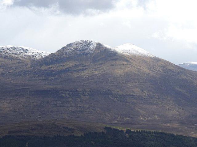 Photo could not load
NH2457 : Sgùrr a' Choire-rainich
Richard Webb
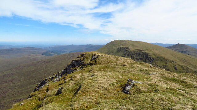 Photo could not load
NH2456 : On summit of Sgurr a' Choire-rainich - view towards Sgurr a' Mhuilinn
Colin Park
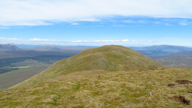 Photo could not load
NH2456 : On the summit of Sgurr a' Ghlas Leathaid - view to Sgurr a' Choire-rainich
Colin Park
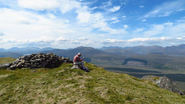 Photo could not load
NH2456 : On summit of Sgurr a' Choire-rainich
Colin Park
Hill facts and local notes
Classifications
Elevation
847m
2,779 ft
Prominence
140m
Coordinates
57.5682, -4.9310
NH247569
OS Map
25
Explorer: 430
At the Summit
At the summit, hikers can find a large stone cairn and a weathered trig point, perfect for that quintessential summit selfie—if you can catch your breath, that is!
Terrain & Geology
The mountain is primarily composed of schist and granite, which provides a rugged yet beautifully scenic backdrop. The erosion patterns visible in the rocks tell a tale of ancient glacial activity that sculpted this landscape.
Views & Scenery
From the summit, remarkable views of the surrounding peaks, including the iconic Ben Nevis, the Nevis Range, and Lochaber valley can be seen. On a clear day, you might even spot the shimmering waters of Loch Linnhe in the distance.
History & Heritage
Name Origin
The name 'Sgurr a' Choire-rainich' derives from Gaelic, meaning 'peak of the rainy corrie', a fitting tribute to the often damp conditions in the area.
Historical Significance
The summit has been a popular destination for climbers and hikers since the late 19th century, playing a role in the Scottish mountaineering history.
Getting There & Facilities
Check current local access restrictions, parking rules and transport timetables before travelling. These notes do not confirm public access to the summit.
Parking
The nearest parking is available at the A86 road near the start of the North East Ridge route, with space for several cars.
Public Transport
Buses run from Fort William to nearby villages, with the closest bus stop about 5 km from the trailhead. Taxis or ride-sharing might be necessary for the final stretch.
Nearby Facilities
Facilities are limited to Spean Bridge, where you can find cafes, local shops, and public toilets. Don't expect a five-star dining experience in the hills!
Safety Information
Known Hazards
- Be wary of craggy steep sections and changing weather. The mountain can quickly turn from idyllic to ominous if clouds roll in. Also, the terrain can be quite boggy after rain.
General Safety Tips
- Check weather conditions before setting out
- Carry appropriate clothing and equipment
- Let someone know your planned route
- Take a map, compass, and GPS device
- Carry emergency supplies: food, water, first aid kit, torch
Hills
Some common questions about the hills answered
Are there group walks up Sgurr a' Choire-rainich?
Many walkers use Walkmates to join or organise walks with others. You can check for group walks around Sgurr a' Choire-rainich through the maps
Are there other walkers around Sgurr a' Choire-rainich?
Activity varies by location and time, but Walkmates lets you see whether others have shared walks or shown interest in this area. Find other people through the walking friends search walking friends for Sgurr a' Choire-rainich search or of course create your own walk for Sgurr a' Choire-rainich
Can I organise a walk to Sgurr a' Choire-rainich?
Yes. If there aren’t any walks listed already, you can create a walk and make it available for others to join.
If you're signed up to Walkmates, you can create a walk to Sgurr a' Choire-rainich.
How do I find a walk up this hill?
There are often multiple ways to walk this hill, depending on experience and route preference. Walkmates helps you explore walks and routes that others have shared.
Can I suggest a new route up Sgurr a' Choire-rainich?
Yes. You can suggest or create routes to share with others. Walkmates focuses on the social side of walking, so routes are used to help people organise walks and explore areas together, rather than as detailed navigation tools or route libraries.
Other uses really appreciate knowledgeable walkers sharing their routes. Share your favourite route to Sgurr a' Choire-rainich here
The is an error or something incorrect about this hill. How do I let you know?
We always strive to keep the information on Walkmates as accurate as possible. If you find an error, please let us know through the contact form and we'll aim to correct it as quickly as possible
Community Discussion
Comments
Location
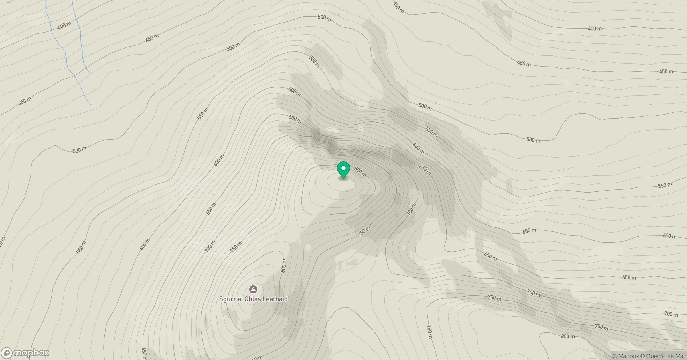
Grid reference: NH247569
View on OpenStreetMapOpens a map in a new tab, centred on the hill.
Hills within 30 km
Straight-line distance, not a walking route or confirmation of access.
No comments yet. Be the first.