

Sgurr a' Bhac Chaolais
Good walks are even better shared.
Overview
Sgurr a' Bhac Chaolais
Overview
Sgurr a' Bhac Chaolais is a striking Munro located in the picturesque Scottish Highlands, known for its dramatic scenery and the challenging routes leading to its summit. At an elevation of 770 meters, it beckons both seasoned mountaineers and casual hikers eager for adventure.
Geology
This mountain offers a stunning display of ancient geology, primarily consisting of schist and gneiss. These rocks have been shaped over time by glaciation, providing a fascinating insight into the Earth's history. If rocks could talk, these would have quite the story to tell!
Routes
Glen Elg Route
Starting from the charming Glen Elg, this route is about 11.5 km long and takes approximately 5 hours to complete. It features a beautiful meander through lush valleys that lead up to a more strenuous ascent towards the summit. Don't forget your camera – the views are spectacular!
Inverinate Path
For those up for a challenge, the Inverinate Path spans about 14 km and takes around 6 hours. Although it’s a longer trek, the diverse landscapes make it well worth the extra steps.
Terrain
Expect a mixture of rocky and grassy terrains, with sections of scree and the occasional heather-covered slope. Trekking poles can be handy here to maintain balance on rocky stretches, unless you want to audition for a one-man show about falling!
Views
Upon reaching the summit, you will be treated to breathtaking views of the Skye Cuillin to the south and Loch Duich to the north. Clear days can reveal even more distant landscapes, making photographers (and selfie-lovers) quite happy!
Best Seasons
Late spring through early autumn, especially from June to September, is ideal for hiking. These months typically offer the most stable weather.
Hazards
Be cautious of loose stones along the path and be prepared for sudden weather changes. Good footwear and a solid walking stick will be your best friends here.
Nearby Summits
If you're up for additional challenges, consider summiting Sgurr na Coinnich or Beinn Bhuidhe, both of which provide enjoyable hikes in the area.
Access
Nearest Parking
Parking is located at the end of the road in Glen Elg. Limited spaces mean arriving early on weekends is a must!
Public Transport
The nearest bus service runs from Kyle of Lochalsh, from where you may need a taxi to reach Glen Elg.
Nearest Town
Kyle of Lochalsh is the nearest town, approximately 20 km away.
Facilities
Unfortunately, there are no immediate facilities in Glen Elg. The nearest cafe and toilets are found in Kyle of Lochalsh, so plan accordingly if you're in need.
History
Name Meaning
Sgurr a' Bhac Chaolais translates to 'peak of the hollow of the caolas', a fitting name given its landscape.
Significance
This mountain carries historical weight - cherished by local hikers for generations, Sgurr a' Bhac Chaolais remains a beloved landmark amidst the Highlands.
Now that you’re equipped with all the necessary information, grab your gear, lace up your boots, and head out for a memorable adventure at Sgurr a' Bhac Chaolais. Just remember, the mountain isn’t going anywhere, so there’s no need to rush!
Explore routes near Sgurr a' Bhac Chaolais
Public walks starting within 80 km of this hill. Nearby does not mean a route reaches the summit; check its map and access before setting out.
Loch Affric full circuit from River Affric
View route
Glen Affric: Coire Loch Woodland Trail
View route
Banavie to Glen Loy Aqueduct: Neptune’s Staircase Canal Towpath
View route
Ben Nevis via Mountain Path
View route
Route planning notes
These notes describe possible approaches, not verified navigable routes or permission to cross land. Check current paths, local access rules and conditions before setting out.
Glen Elg Route
A scenic trail beginning in Glen Elg that meanders past lush valleys before tackling the steeper final ascent to the summit.
Inverinate Path
Starting from the village of Inverinate, this route offers a longer trek but rewards hikers with fabulous views and varied landscapes along the way.
Make a day of it, together
Find someone to share the walk with, or organise a day out along a route you like.
Photo Gallery
View all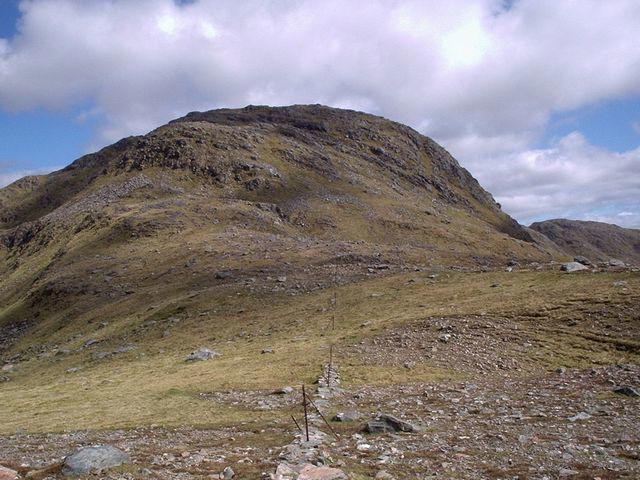 Photo could not load
NG9511 : Sgurr a' Bhac Chaolais from the west
Eric Gunstensen
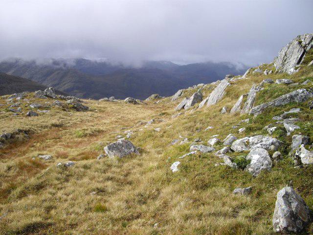 Photo could not load
NG9510 : Sgùrr a' Bhac Chaolais
Callum Black
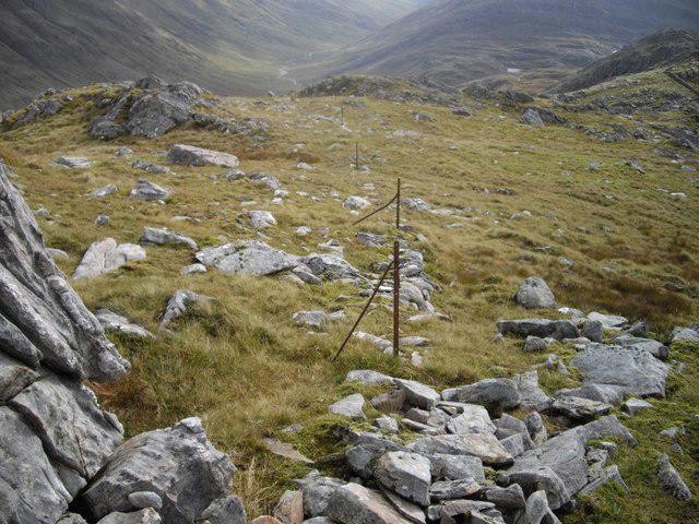 Photo could not load
NG9510 : Remains of a fence
Callum Black
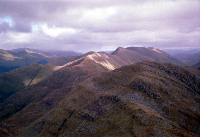 Photo could not load
NG9511 : Sgùrr a' Bhac Chaolais from Sgùrr na Sgine
Russel Wills
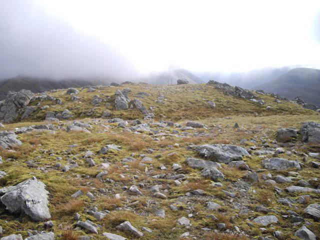 Photo could not load
NG9511 : Sgùrr a' Bhac Chaolais
Callum Black
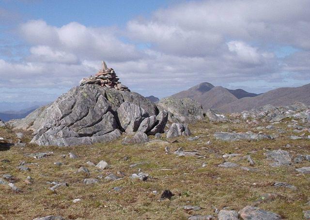 Photo could not load
NG9511 : Summit cairn of Sgurr a' Bhac Chaolais
Eric Gunstensen
Hill facts and local notes
Classifications
Elevation
885m
2,904 ft
Prominence
121m
Coordinates
57.1447, -5.3763
NG958110
OS Map
33
Explorer: 414S
At the Summit
The summit is marked by a sizeable stone cairn and offers incredible panoramic views. It's a popular spot for photos, so remember to smile!
Terrain & Geology
Sgurr a' Bhac Chaolais is primarily composed of schist and gneiss, typical of the rugged terrain in this part of the Highlands. These ancient rocks date back millions of years, providing a glimpse into the geological history of the area.
Views & Scenery
From the summit, you can see the rugged peaks of the Skye Cuillin to the south and Loch Duich to the north. On a clear day, you might even catch a glimpse of the Isle of Skye.
History & Heritage
Name Origin
The name 'Sgurr a' Bhac Chaolais' can be translated to 'peak of the hollow of the caolas', reflecting the landscape's features.
Historical Significance
The mountain is cherished by local hikers and has been a popular destination for generations, standing as a proud sentinel over the surrounding lands.
Getting There & Facilities
Check current local access restrictions, parking rules and transport timetables before travelling. These notes do not confirm public access to the summit.
Parking
Parking is available at the end of the road in Glen Elg, with limited spaces. Arrive early on weekends to secure a spot.
Public Transport
The nearest bus service operates from Kyle of Lochalsh. From there, you may need to arrange a taxi to Glen Elg.
Nearby Facilities
There are no facilities directly in Glen Elg. The nearest cafe and toilets can be found in Kyle of Lochalsh.
Safety Information
Known Hazards
- Loose stones on the path, sudden weather changes, and tricky footing on the ascent.
General Safety Tips
- Check weather conditions before setting out
- Carry appropriate clothing and equipment
- Let someone know your planned route
- Take a map, compass, and GPS device
- Carry emergency supplies: food, water, first aid kit, torch
Hills
Some common questions about the hills answered
Are there group walks up Sgurr a' Bhac Chaolais?
Many walkers use Walkmates to join or organise walks with others. You can check for group walks around Sgurr a' Bhac Chaolais through the maps
Are there other walkers around Sgurr a' Bhac Chaolais?
Activity varies by location and time, but Walkmates lets you see whether others have shared walks or shown interest in this area. Find other people through the walking friends search walking friends for Sgurr a' Bhac Chaolais search or of course create your own walk for Sgurr a' Bhac Chaolais
Can I organise a walk to Sgurr a' Bhac Chaolais?
Yes. If there aren’t any walks listed already, you can create a walk and make it available for others to join.
If you're signed up to Walkmates, you can create a walk to Sgurr a' Bhac Chaolais.
How do I find a walk up this hill?
There are often multiple ways to walk this hill, depending on experience and route preference. Walkmates helps you explore walks and routes that others have shared.
Can I suggest a new route up Sgurr a' Bhac Chaolais?
Yes. You can suggest or create routes to share with others. Walkmates focuses on the social side of walking, so routes are used to help people organise walks and explore areas together, rather than as detailed navigation tools or route libraries.
Other uses really appreciate knowledgeable walkers sharing their routes. Share your favourite route to Sgurr a' Bhac Chaolais here
The is an error or something incorrect about this hill. How do I let you know?
We always strive to keep the information on Walkmates as accurate as possible. If you find an error, please let us know through the contact form and we'll aim to correct it as quickly as possible
Community Discussion
Comments
Location
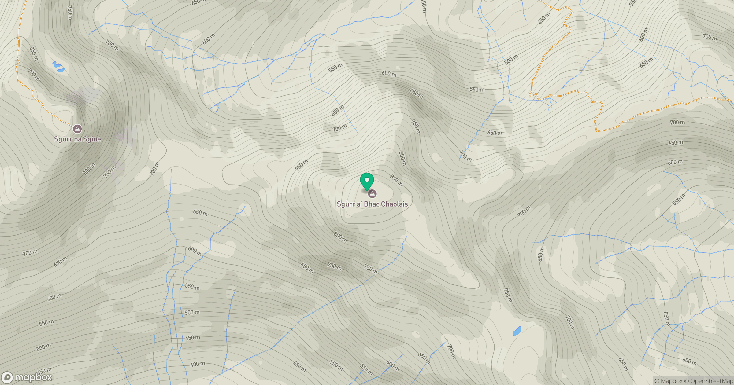
Grid reference: NG958110
View on OpenStreetMapOpens a map in a new tab, centred on the hill.
Hills within 30 km
Straight-line distance, not a walking route or confirmation of access.
Sgurr Fhuaran
1,069m
Sgurr a' Mhaoraich
1,027m
An Caisteal
622m
Gleouraich
1,035m
Beinn Sgritheall
974m
No comments yet. Be the first.