

Sanda Island
Good walks are even better shared.
NR7304 : Sanda Island
Michael Earnshaw Photo source
Overview
Exploring Sanda Island
Nestled in the stunning waters off the Kintyre Peninsula, Sanda Island is a hidden gem for those looking to escape the hustle and bustle of everyday life.
Geology
Sanda Island features captivating Old Red Sandstone cliffs that tell the story of the Earth’s history, dating back over 400 million years. Walk along the coastal paths and feel the ancient tales beneath your feet.
Access
Getting to Sanda Island is a breeze. Park at the slipway in Tayinloan, where frequent ferries whisk adventure-seekers across the scenic stretch of sea. Buses from nearby Campbeltown offer easy access, making your journey all the more pleasant. Just ensure you check the ferry times before you head out – we’d hate for you to miss the last boat!
Routes
The Sanda Island Coastal Trail takes you on a delightful 2.5 km loop around the island. Suitable for all ages and fitness levels, this easy route allows you to soak in the natural beauty at a leisurely pace. Don’t forget your camera – every turn reveals yet another breathtaking view!
Terrain
Expect a mix of grassy expanses and rocky coastal pathways. Perfect for the little ones who fancy an adventure (and perhaps a tumble or two).
Views
From various lookout points on the island, you can enjoy sweeping vistas across the waters towards the Kintyre Peninsula and the Paps of Jura. The sunsets here are particularly entrancing – pack a flask of tea to enjoy as the sun dips below the horizon!
Hazards
As with any coastal area, keep a keen eye on the tides, and do tread carefully along the rocky paths. Slips can happen – especially if one is distracted by the views!
History
The island's name carries a nod to its nautical past, derived from Old Norse ‘sand’ – a fitting tribute given its charming beaches. Sanda Island has hosted mariners for centuries, and whispers of history linger in the air.
Conclusion
Sanda Island might not have towering peaks, but it combines stunning vistas, fascinating geology, and a relaxed atmosphere, making it a must-visit for anyone looking to escape to nature. Just remember to take all your rubbish with you – we wouldn’t want to ruin this idyllic paradise!
Enjoy your adventure!
Explore routes near Sanda Island
Walks starting near this hill. Open a route to check its map, distance and full itinerary.
Goatfell from Cladach
View route
Portballintrae to Giant's Causeway: railway path and Blue Trail return
View route
Carrick Forest Drive: Stinchar Bridge to Loch Doon
View route
Glentrool Water of Trool and Spout Head Trail
View route
Route planning notes
These notes describe possible approaches. Check a route's map and access information when planning your walk.
Sanda Island Coastal Trail
A scenic loop around the perimeter of Sanda Island showcasing its breathtaking coastal landscapes and diverse wildlife.
Make a day of it, together
Find someone to share the walk with, or organise a day out along a route you like.
Photo Gallery
View all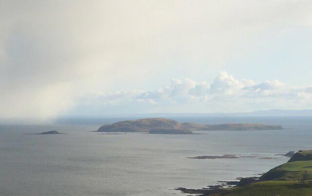 Photo could not load
NR7304 : Sanda Island
Michael Earnshaw
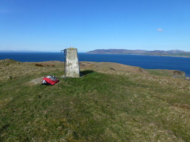 Photo could not load
NR7304 : Trig Point Sanda Island
Rude Health
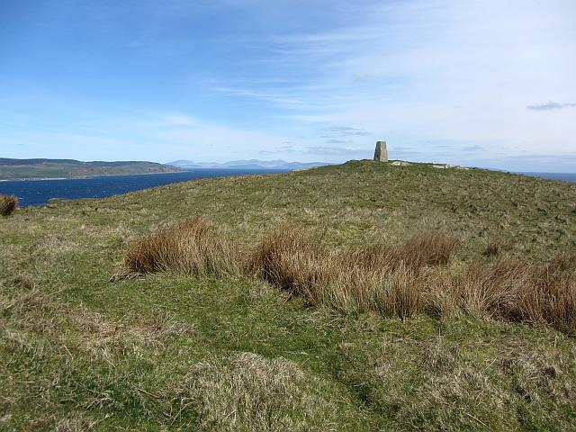 Photo could not load
NR7304 : Sanda, the triangulation pillar
Richard Webb
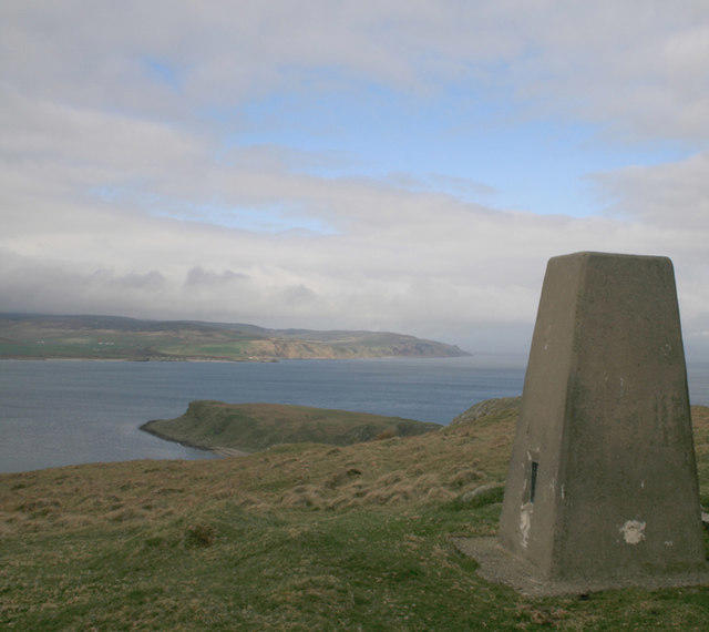 Photo could not load
NR7304 : Trigpoint, Sanda Island
Becky Williamson
Hill facts and local notes
Classifications
Elevation
123m
404 ft
Prominence
123m
Coordinates
55.2809, -5.5756
NR730043
OS Map
68
Explorer: 356S
At the Summit
The island boasts rolling hills with no official summit, but there are plenty of vantage points where one can survey the serene, sweeping views of the surrounding seas and islands.
Terrain & Geology
Sanda Island is primarily composed of Old Red Sandstone, which reveals a fascinating geological history dating back over 400 million years. The soft, sedimentary rocks create stunning cliffs and coastal features.
Views & Scenery
From various points on the island, gaze upon the stunning views of the neighbouring Kintyre Peninsula and the distant Paps of Jura.
History & Heritage
Name Origin
The name 'Sanda' is derived from the Norse word 'sand', which reflects the island's sandy beaches.
Historical Significance
Historically, Sanda Island has been a significant point for navigation, and remnants of its past can still be seen today.
Getting There & Facilities
Parking
Parking is available at the slipway in Tayinloan, where ferry services to Sanda Island depart.
Public Transport
Buses run frequently from Campbeltown to Tayinloan, with the ferry service operational mainly during the summer months.
Nearby Facilities
There are no facilities on the island itself. It's recommended to bring food, water, and a picnic blanket to enjoy the scenic spots.
Safety Information
Known Hazards
- Beware of changing tides and rocky shorelines. It’s also wise to watch out for slippery paths especially after rain.
General Safety Tips
- Check weather conditions before setting out
- Carry appropriate clothing and equipment
- Let someone know your planned route
- Take a map, compass, and GPS device
- Carry emergency supplies: food, water, first aid kit, torch
Hills
Some common questions about the hills answered
Are there group walks up Sanda Island?
Many walkers use Walkmates to join or organise walks with others. You can check for group walks around Sanda Island through the maps
Are there other walkers around Sanda Island?
Activity varies by location and time, but Walkmates lets you see whether others have shared walks or shown interest in this area. Find other people through the walking friends search walking friends for Sanda Island search or of course create your own walk for Sanda Island
Can I organise a walk to Sanda Island?
Yes. If there aren’t any walks listed already, you can create a walk and make it available for others to join.
If you're signed up to Walkmates, you can create a walk to Sanda Island.
How do I find a walk up this hill?
There are often multiple ways to walk this hill, depending on experience and route preference. Walkmates helps you explore walks and routes that others have shared.
Can I suggest a new route up Sanda Island?
Yes. You can suggest or create routes to share with others. Walkmates focuses on the social side of walking, so routes are used to help people organise walks and explore areas together, rather than as detailed navigation tools or route libraries.
Other uses really appreciate knowledgeable walkers sharing their routes. Share your favourite route to Sanda Island here
The is an error or something incorrect about this hill. How do I let you know?
We always strive to keep the information on Walkmates as accurate as possible. If you find an error, please let us know through the contact form and we'll aim to correct it as quickly as possible
Community Discussion
Comments
Location
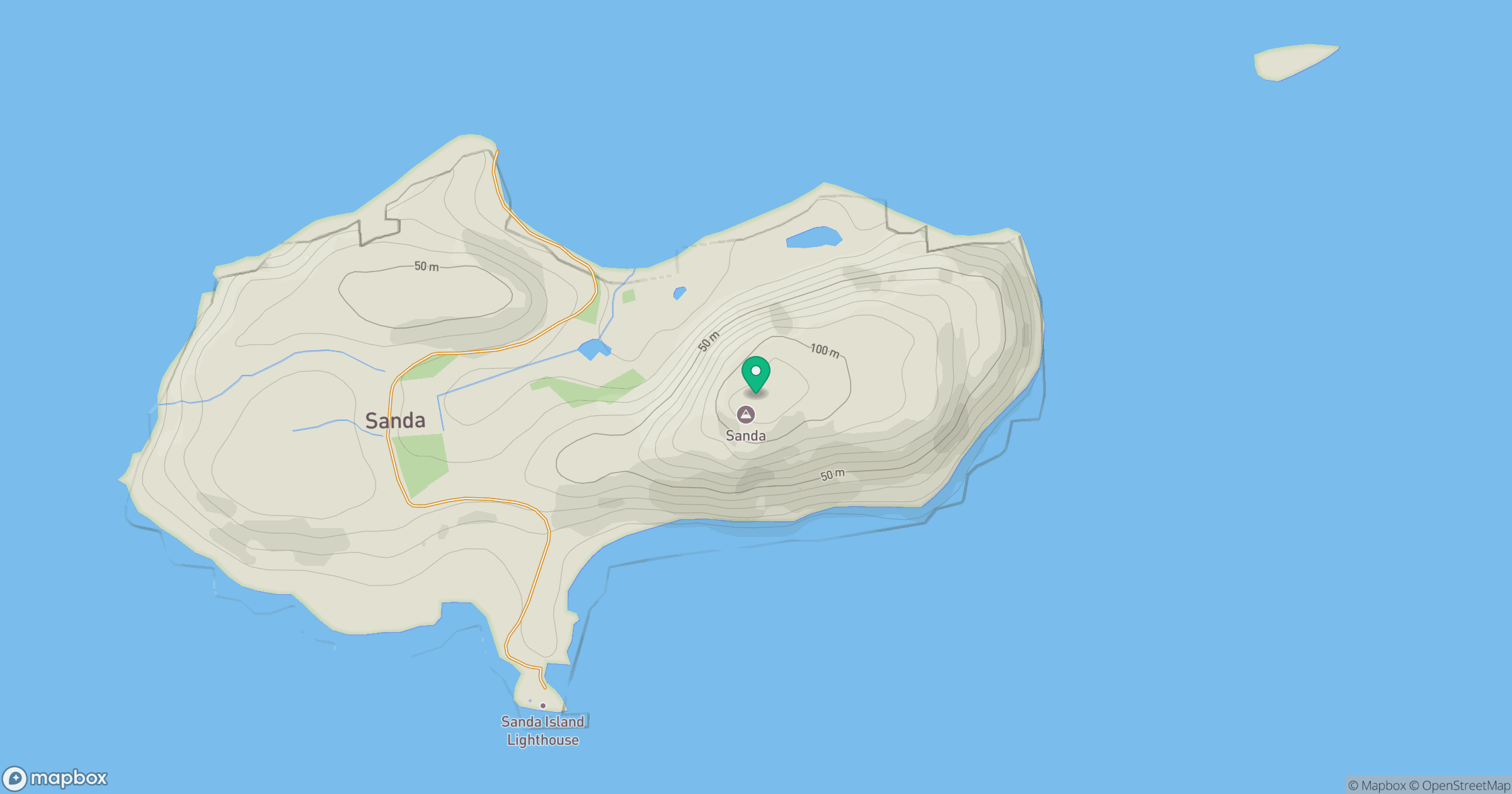
Grid reference: NR730043
View on OpenStreetMapOpens a map in a new tab, centred on the hill.
No comments yet. Be the first.