
Cnoc Odhar
Good walks are even better shared.
Overview
Cnoc Odhar: A Hiker's Delight
Cnoc Odhar, often referred to as the 'Grey Hill', stands proud at 649 meters above sea level in the picturesque region of Argyll and Bute. Despite its modest height, it is classified as a Marilyn due to its significant prominence of 213 meters, attracting hikers eager to bask in its stunning views.
Geology
The geological makeup of Cnoc Odhar is fascinating. Formed predominantly from ancient volcanic rock, you can see spectacular outcrops of basalt that have survived the test of time. As you wander its slopes, feel free to imagine geological events as old as the dinosaurs that shaped this very landscape.
Routes
One of the most popular routes to conquer Cnoc Odhar starts from the friendly village of Lochdon. The Cnoc Odhar Loop spans approximately 8.5 km and typically takes about 3.5 hours. The trail alternates between cozy wooded paths and beautiful open hillsides, making it a treat for nature lovers and photographers alike. Overall, it's a moderate trek, perfect for a weekend adventure.
Summit Features
Reaching the summit rewards you with a modest yet charming stone cairn, along with ample space to lay out a picnic blanket. If you've made the climb, don’t forget to take a few moments to enjoy those panoramic views—your legs will thank you!
Terrain
Expect a delightful mix of grassy slopes, rocky outcrops, and, yes, the odd muddy patch—lovely for getting a little adventurous with your boots! Exploring this terrain is a joy for those who love a bit of variety in their hikes.
Views
From the top, you can indulge in breathtaking sights, with nearby islands like Mull and Iona taking center stage. The expansive views of the Firth of Lorn will make you want to shout, 'I love Scotland!' There's no better time to soak it all in than during spring and early summer when the visibility is at its best, and the landscape blooms into life.
Hazards
While Cnoc Odhar is a relatively safe hike, there are still some hazards to be aware of. Be prepared for muddy trails after rain, and keep an eye on sudden weather changes. Also, watch out for the occasional sheep—it seems they enjoy photobombing hikers!
Nearby Summits
The exhilaration doesn’t have to stop at Cnoc Odhar! You can also explore nearby summits like Ben More, the tallest peak in the area, and Dun da Ghaoithe, each offering their own unique challenges and views.
Access
Getting there is a breeze! The nearest parking is in Lochdon at a convenient lay-by. For those relying on public transport, you can catch a bus from Oban or a ferry from Mull. Oban itself is only about half an hour away, with plenty of facilities to fuel your adventure.
Facilities
While the facilities in Lochdon are limited to a small shop, Oban is just a short drive away and has all the amenities you could need, including cafes and toilets—perfect for a warm cup of tea after your hike.
History
Cnoc Odhar's name, meaning 'Grey Hill', perfectly captures its natural essence. Rich in history, the region has been home to various clans, and you’ll find archaeological remnants strewn across the landscape, telling the stories of those who walked these hills long before us.
In conclusion, Cnoc Odhar is a hidden gem that promises its visitors stunning views, a touch of adventure, and just the right amount of challenge. Don’t miss out on this delightful hike!
Explore routes near Cnoc Odhar
Public walks starting within 80 km of this hill. Nearby does not mean a route reaches the summit; check its map and access before setting out.
Goatfell from Cladach
View route
Portballintrae to Giant's Causeway: railway path and Blue Trail return
View route
Carrick Forest Drive: Stinchar Bridge to Loch Doon
View route
Glentrool Water of Trool and Spout Head Trail
View route
Route planning notes
These notes describe possible approaches, not verified navigable routes or permission to cross land. Check current paths, local access rules and conditions before setting out.
Cnoc Odhar Loop
A scenic loop starting from the nearby village of Lochdon, offering a mixture of wooded paths and open hillside.
Make a day of it, together
Find someone to share the walk with, or organise a day out along a route you like.
Hill facts and local notes
Classifications
Elevation
277m
909 ft
Prominence
104m
Coordinates
55.3546, -5.6804
NR667128
OS Map
68
Explorer: 356S
At the Summit
The summit is adorned with a modest stone cairn and offers a substantial flat area that's perfect for a picnic—or a not-so-little nap once you've conquered the ascent.
Terrain & Geology
The region is predominantly composed of volcanic rock, with notable outcrops of basalt and a wealth of ancient geological features that tell tales of the earth’s fiery past.
Views & Scenery
Views of the nearby islands of Mull and Iona, as well as sweeping vistas of the Firth of Lorn and the rugged Scottish coastline.
History & Heritage
Name Origin
Cnoc Odhar translates to 'Grey Hill' in Gaelic, which perfectly describes its muted palette of heathers and grasses.
Historical Significance
This area has a rich history, being part of ancient clan territories and featuring several archaeological sites scattered around.
Getting There & Facilities
Check current local access restrictions, parking rules and transport timetables before travelling. These notes do not confirm public access to the summit.
Parking
Parking is available in the village of Lochdon at a small lay-by next to the road, with enough space for a few cars.
Public Transport
Buses run from Oban to Lochdon, and there’s also a ferry service from Mull, making it accessible for non-drivers.
Nearby Facilities
The closest facilities are in Lochdon, which has a small shop, and Oban offers more options including cafes and toilets.
Safety Information
Known Hazards
- Muddy trails, sudden weather changes, and the occasional cheeky sheep appearing out of nowhere.
General Safety Tips
- Check weather conditions before setting out
- Carry appropriate clothing and equipment
- Let someone know your planned route
- Take a map, compass, and GPS device
- Carry emergency supplies: food, water, first aid kit, torch
Hills
Some common questions about the hills answered
Are there group walks up Cnoc Odhar?
Many walkers use Walkmates to join or organise walks with others. You can check for group walks around Cnoc Odhar through the maps
Are there other walkers around Cnoc Odhar?
Activity varies by location and time, but Walkmates lets you see whether others have shared walks or shown interest in this area. Find other people through the walking friends search walking friends for Cnoc Odhar search or of course create your own walk for Cnoc Odhar
Can I organise a walk to Cnoc Odhar?
Yes. If there aren’t any walks listed already, you can create a walk and make it available for others to join.
If you're signed up to Walkmates, you can create a walk to Cnoc Odhar.
How do I find a walk up this hill?
There are often multiple ways to walk this hill, depending on experience and route preference. Walkmates helps you explore walks and routes that others have shared.
Can I suggest a new route up Cnoc Odhar?
Yes. You can suggest or create routes to share with others. Walkmates focuses on the social side of walking, so routes are used to help people organise walks and explore areas together, rather than as detailed navigation tools or route libraries.
Other uses really appreciate knowledgeable walkers sharing their routes. Share your favourite route to Cnoc Odhar here
The is an error or something incorrect about this hill. How do I let you know?
We always strive to keep the information on Walkmates as accurate as possible. If you find an error, please let us know through the contact form and we'll aim to correct it as quickly as possible
Community Discussion
Comments
Location
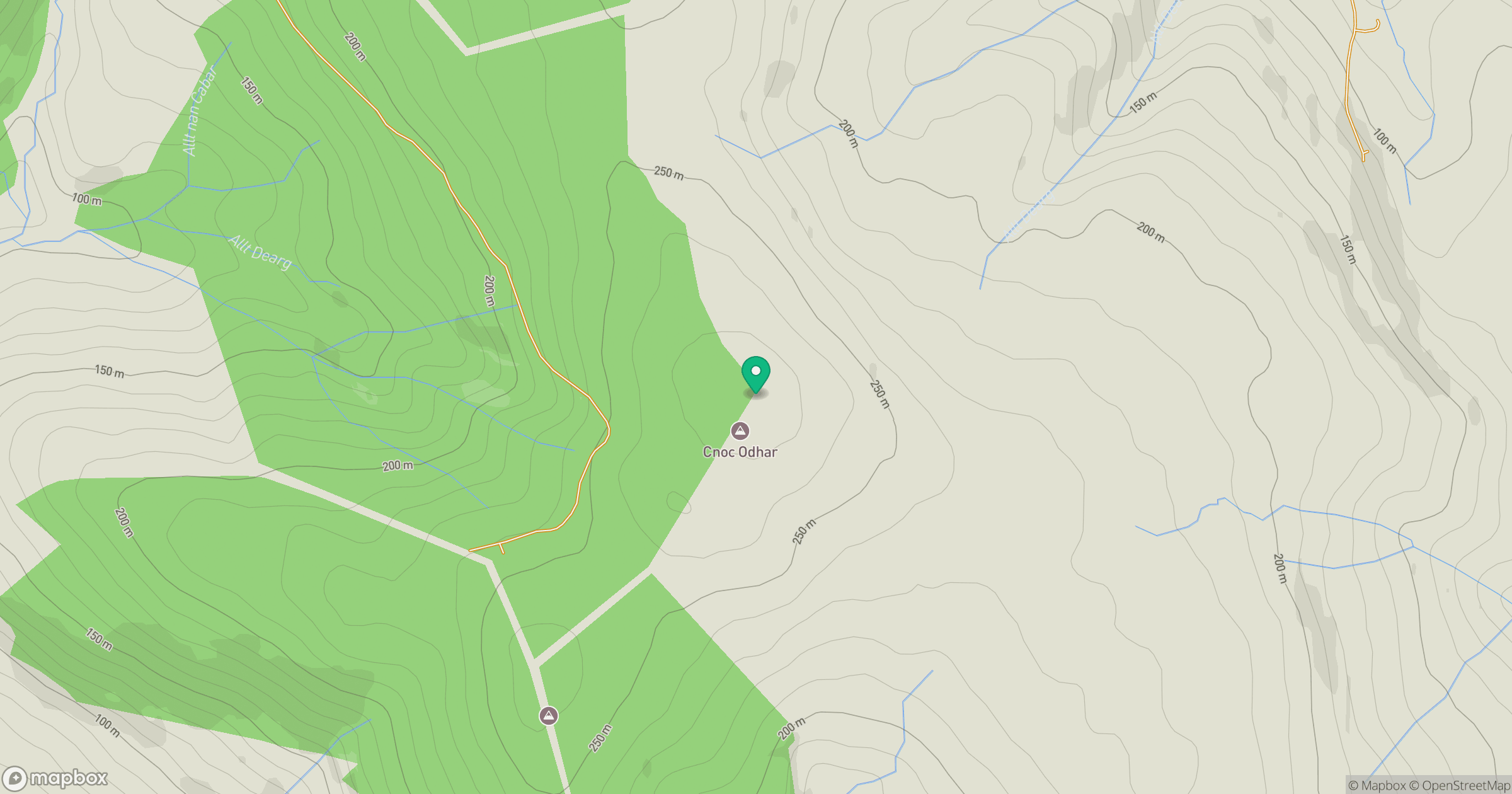
Grid reference: NR667128
View on OpenStreetMapOpens a map in a new tab, centred on the hill.
Hills within 30 km
Straight-line distance, not a walking route or confirmation of access.
No comments yet. Be the first.