

Island Davaar
Good walks are even better shared.
NR7519 : Entrance to the cave on Davaar, summer 1971
David Douglas Photo source
Overview
Island Davaar
Elevation: 42 meters
Island Davaar, often lovingly referred to as the 'deer island', is a small but mighty island perched off the southern coast of the Kintyre peninsula. This Marilyn-classified islet offers a delightful escapade for walkers eager to explore its intimate trails. Although not among the giants, the island's charm and splendour lie in its unique character.
Geology
The geology of Davaar is primarily composed of sedimentary rocks that hold within them ancient maritime tales. The layers of shale and sandstone will make geologists salivate—or at least raise an inquisitive brow. It's a splendid location to learn about the geological history of the region.
Routes
The main route known as the Davaar Island Circular Walk takes you on a journey through the island's enchanting surroundings. It covers a distance of approximately 2.5 km and can comfortably be completed in about 1.5 hours. Expect moderate difficulty, where visitors may encounter the odd rambunctious sheep.
Summit Features
Upon reaching the summit, hikers will find a modest rocky outcrop adorned with a small cairn, a perfect spot for a picturesque selfie or a contemplative moment. The views from the top undeniably reward the effort taken to reach them.
Terrain Type
The variety of terrain includes grassy patches, rocky scrambles, and a few tricky spots that might make you wonder if your shoes were the best choice for the day. Just a heads up!
Views
Summit views encompass stunning sights of Campbeltown Loch, dotted with sailing boats and the majestic peaks of Kintyre, revealing themselves when the weather permits. Spring and early summer are undoubtedly the best seasons to witness wildflowers, while autumn treats you to the glow of golden hues.
Hazards
Despite its charm, it’s essential to tread carefully; wet rocks can be slippery, and sudden tide changes might make the circular route a bit more interesting than planned. Be mindful of wildlife—you never know when a wayward sheep might decide to challenge your right of way!
Nearby Summits
For those willing to venture farther, the nearby Beinn an Tuirc offers more heights with a respectable elevation of 1183 meters. A great way to stay on your toes!
Access
Reaching Island Davaar involves a delightful ferry ride from Campbeltown. It's the nearest town providing ample parking at the ferry terminal, convenient transport links, and all facilities you might need before or after your adventure.
Facilities
While Davaar Island may lack amenities, Campbeltown is close at hand and offers cafes, shops, and public restrooms—a perfect place to refuel after climbing your mini mountain!
History
The name 'Davaar' evokes images of a pastoral past; it is derived from 'Dabhair', meaning 'the island of the deer'. Its historical significance is marked by the ruins of a 19th-century chapel and an enigmatic cave painting. Exploring these remnants can feel like stepping into a time machine.
Last updated: 2023-10-03
Whether you're there for a hearty hike, history, or just to enjoy the views, Island Davaar promises to be a delightful dash into the Irish Sea's charm.
Explore routes near Island Davaar
Walks starting near this hill. Open a route to check its map, distance and full itinerary.
Goatfell from Cladach
View route
Portballintrae to Giant's Causeway: railway path and Blue Trail return
View route
Carrick Forest Drive: Stinchar Bridge to Loch Doon
View route
Bishop’s Glen group walk
View route
Route planning notes
These notes describe possible approaches. Check a route's map and access information when planning your walk.
Davaar Island Circular Walk
A scenic route offering views of the coastline and the main ascent to the summit, rich with wildlife sightings along the way.
Make a day of it, together
Find someone to share the walk with, or organise a day out along a route you like.
Photo Gallery
View all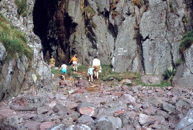 Photo could not load
NR7519 : Entrance to the cave on Davaar, summer 1971
David Douglas
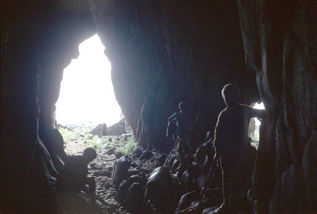 Photo could not load
NR7519 : looking out from the cave
David Douglas
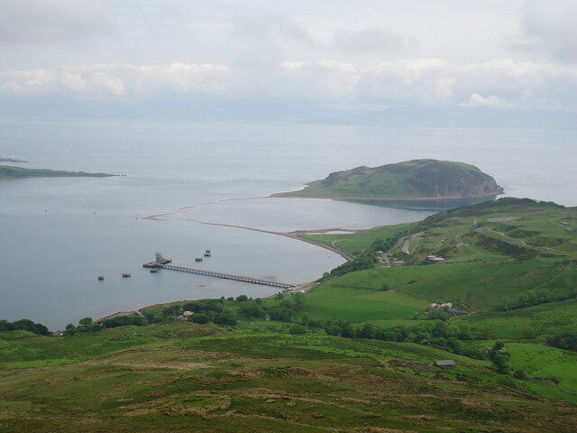 Photo could not load
NR7520 : Island Davaar and Campbeltown Loch
Michael Earnshaw
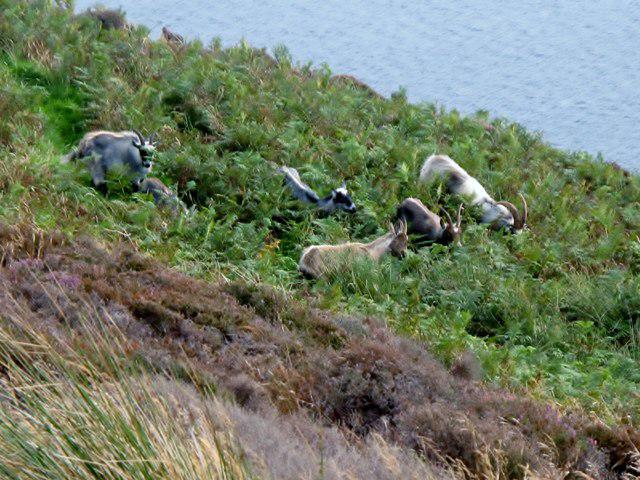 Photo could not load
NR7519 : Island Davaar Feral Goats
Rude Health
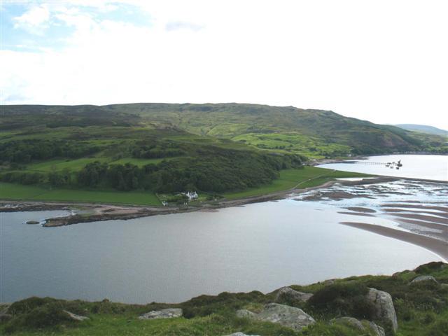 Photo could not load
NR7519 : Kildalloig Bay from trig point on Davaar Island.
Johnny Durnan
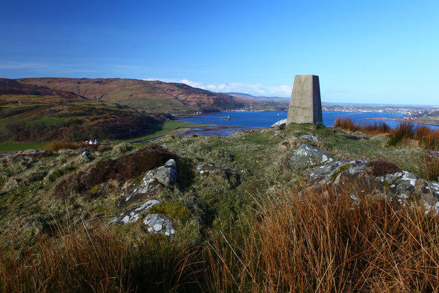 Photo could not load
NR7519 : The High Point of Island Davaar
Calum McRoberts
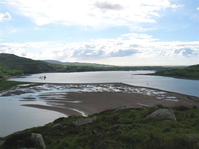 Photo could not load
NR7519 : Davaar Island view of Campbeltown Loch and the Dhorlin.
Johnny Durnan
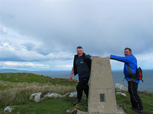 Photo could not load
NR7519 : Davaar Island trig point.
Johnny Durnan
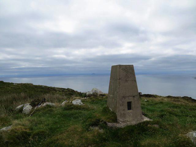 Photo could not load
NR7519 : Davaar trig pillar
John Ferguson
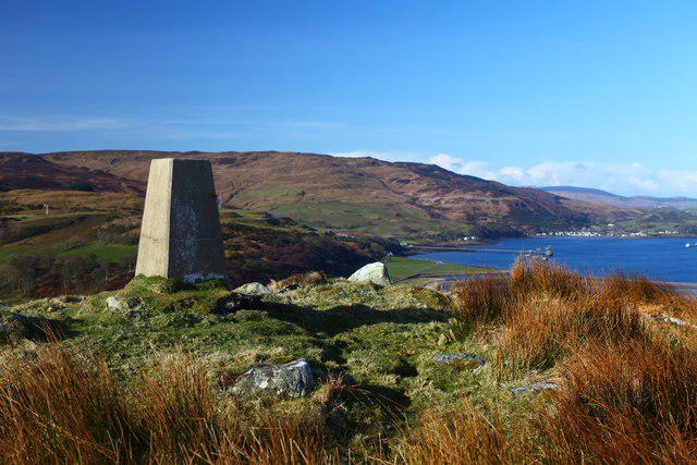
NR7519 : Triangulation Point on Island Davaar
Calum McRoberts
Hill facts and local notes
Classifications
Elevation
115m
377 ft
Prominence
114m
Coordinates
55.4226, -5.5442
NR758200
OS Map
68 69
Explorer: 356S
At the Summit
The summit is marked by a modest rocky outcrop and features a small cairn that provides an excellent vantage point for photography and contemplation.
Terrain & Geology
Island Davaar is primarily composed of sedimentary rocks featuring an assemblage of shale and sandstone. Its formation is linked to the geological history of the region, with its sedimentary layers telling tales of ancient environments.
Views & Scenery
The panoramic views include Campbeltown Loch, the surrounding islands, and on a clear day, the peaks of the Kintyre peninsula can be discerned in the distance.
History & Heritage
Name Origin
The name Davaar comes from the Gaelic 'Dabhair', meaning 'the island of the deer'.
Historical Significance
The island has historical significance with ruins of a 19th-century chapel and a well-preserved artsy cave painting of what many believe to be a form of early Christian iconography.
Getting There & Facilities
Parking
Parking is available at the ferry terminal in Campbeltown, with a short ferry ride to the island required.
Public Transport
Buses operate from various locations in Scotland to Campbeltown. Regular ferry services connect the mainland to Davaar Island.
Nearby Facilities
There are no facilities on the island, but Campbeltown offers cafes, shops, and public restrooms.
Safety Information
Known Hazards
- Slippery rocks during wet weather, sudden changes in tide affecting access, and wildlife encounters.
General Safety Tips
- Check weather conditions before setting out
- Carry appropriate clothing and equipment
- Let someone know your planned route
- Take a map, compass, and GPS device
- Carry emergency supplies: food, water, first aid kit, torch
Hills
Some common questions about the hills answered
Are there group walks up Island Davaar?
Many walkers use Walkmates to join or organise walks with others. You can check for group walks around Island Davaar through the maps
Are there other walkers around Island Davaar?
Activity varies by location and time, but Walkmates lets you see whether others have shared walks or shown interest in this area. Find other people through the walking friends search walking friends for Island Davaar search or of course create your own walk for Island Davaar
Can I organise a walk to Island Davaar?
Yes. If there aren’t any walks listed already, you can create a walk and make it available for others to join.
If you're signed up to Walkmates, you can create a walk to Island Davaar.
How do I find a walk up this hill?
There are often multiple ways to walk this hill, depending on experience and route preference. Walkmates helps you explore walks and routes that others have shared.
Can I suggest a new route up Island Davaar?
Yes. You can suggest or create routes to share with others. Walkmates focuses on the social side of walking, so routes are used to help people organise walks and explore areas together, rather than as detailed navigation tools or route libraries.
Other uses really appreciate knowledgeable walkers sharing their routes. Share your favourite route to Island Davaar here
The is an error or something incorrect about this hill. How do I let you know?
We always strive to keep the information on Walkmates as accurate as possible. If you find an error, please let us know through the contact form and we'll aim to correct it as quickly as possible
Community Discussion
Comments
Location
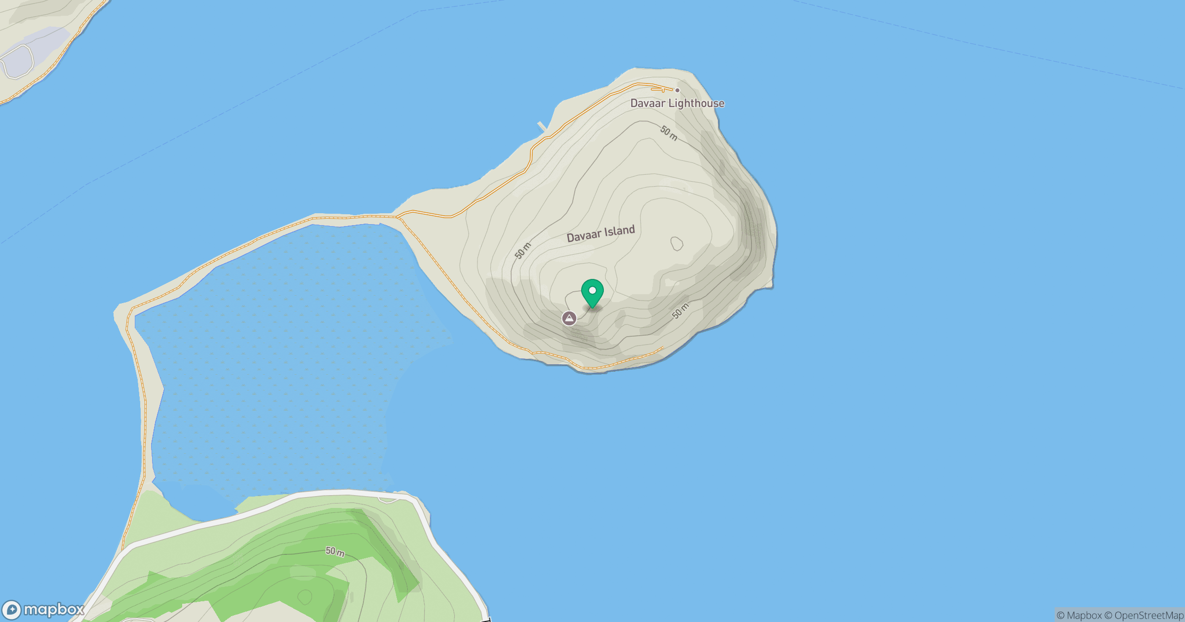
Grid reference: NR758200
View on OpenStreetMapOpens a map in a new tab, centred on the hill.
No comments yet. Be the first.