

Beinn Ghuilean
Good walks are even better shared.
NR7216 : Tough moorland, Beinn Ghuilean
Richard Webb Photo source
Overview
Beinn Ghuilean
Overview
Beinn Ghuilean, standing at an elevation of 306 meters, is a charming Marilyn located in the picturesque Scottish Highlands. Its scenic routes and stunning vistas make it a favourite among hikers and outdoor enthusiasts looking for a delightful day out.
Geology
This hill is primarily comprised of ancient volcanic rock, a reminder of the dramatic geological forces that shaped the Highlands millions of years ago. Beinn Ghuilean reflects the Tertiary geological period, alluring geologists and nature lovers alike.
Routes
The most popular route starts from Ardaneaskan. This moderate hike covers approximately 6 kilometres and can typically be tackled in about three hours. The path meanders through lush landscapes, culminating at a summit that rewards your efforts with breathtaking views. Be sure to bring a snack; trust me, you'll need it!
Summit Features
Upon reaching the summit, adventurers are greeted by a prominent cairn that serves as a perfect rest stop to recharge your batteries while soaking in the stunning 360-degree views of the surrounding hills and lochs.
Terrain Type
The terrain is predominantly grassy with rocky outcrops, which makes for a pleasant and varied hiking experience. Do keep an eye out for the occasional boggy patch; no one enjoys muddy boots!
Views
The summit of Beinn Ghuilean offers remarkable vistas. On clear days, you can see the expansive sea and coastline of Argyll, as well as the hills and distant peaks of Mull. The best seasons to experience these views are spring and summer when you can also enjoy the heather in bloom.
Hazards
As with any Highland hike, caution is advised. Be wary of slippery rocks, particularly after rainfall, and be prepared for sudden weather shifts that make the Highlands both beautiful and unpredictable.
Nearby Summits
Don’t forget to check out nearby peaks such as Beinn a' Chreachain and Beinn Bheula, perfect for extending your outdoor adventure!
Access
Parking can be found at Ardaneaskan, where a small area accommodates a handful of vehicles. Public transport options are sparse, with the nearest train station located in Oban. Lochgilphead, about 12 miles away, offers cafés and shops for after-hike refreshment.
Facilities
Facilities in the immediate vicinity are limited, so consider stocking up on necessities in Lochgilphead before you set off.
History
The name 'Beinn Ghuilean' translates to 'Hill of the Fir', a nod to the ancient forests that once blanketed this region. Historically, the area has been significant for its wildlife and as a route for smugglers in days gone by.
In conclusion, Beinn Ghuilean is a delightful destination for those looking to experience the beauty of the Scottish Highlands. With its moderate routes, fair summit features, and stunning views, it’s well worth a visit. Just remember to check the weather and take your mucky boots in stride!
Explore routes near Beinn Ghuilean
Walks starting near this hill. Open a route to check its map, distance and full itinerary.
Goatfell from Cladach
View route
Portballintrae to Giant's Causeway: railway path and Blue Trail return
View route
Carrick Forest Drive: Stinchar Bridge to Loch Doon
View route
Bishop’s Glen group walk
View route
Route planning notes
These notes describe possible approaches. Check a route's map and access information when planning your walk.
From Ardaneaskan
A scenic route starting from the village of Ardaneaskan, leading through lush landscapes and offering breathtaking views as you ascend.
Make a day of it, together
Find someone to share the walk with, or organise a day out along a route you like.
Photo Gallery
View all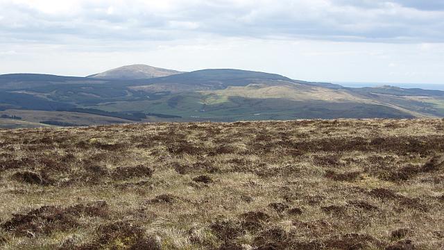 Photo could not load
NR7216 : Tough moorland, Beinn Ghuilean
Richard Webb
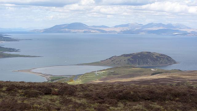 Photo could not load
NR7317 : View off Beinn Ghuilean
Richard Webb
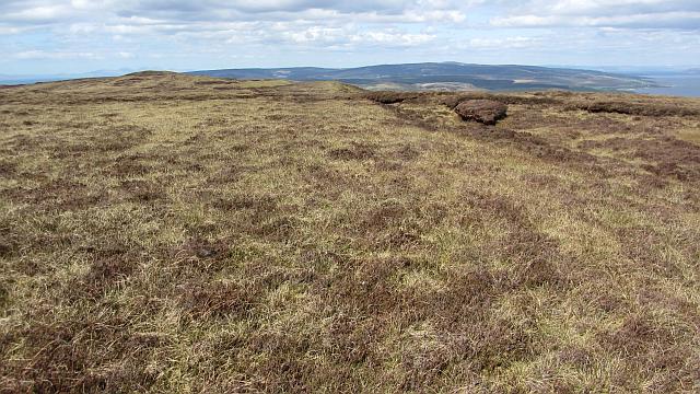 Photo could not load
NR7217 : The summit, Beinn Ghuilean
Richard Webb
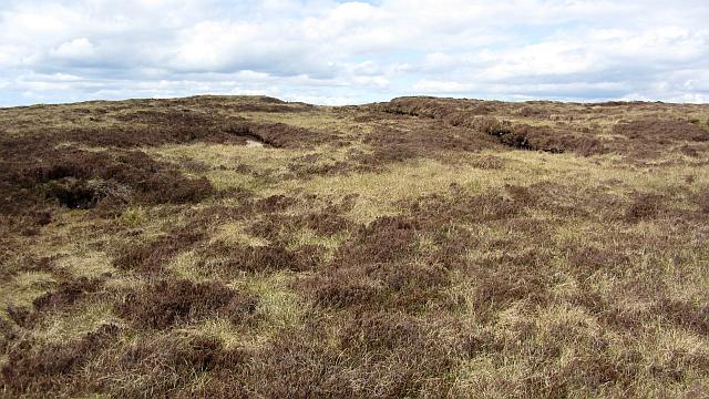 Photo could not load
NR7217 : Peat workings on Beinn Ghuilean
Richard Webb
Hill facts and local notes
Classifications
Elevation
354m
1,161 ft
Prominence
276m
Coordinates
55.3950, -5.5872
NR729170
OS Map
68
Explorer: 356S
At the Summit
The summit features a notable cairn, which offers a perfect spot for a well-deserved snack while enjoying the stunning 360-degree views.
Terrain & Geology
Beinn Ghuilean is primarily composed of volcanic rock, which adds to its rugged and dramatic appearance. The mountain's formation dates back to the Tertiary period, giving it a rich geological history.
Views & Scenery
From the summit, you can enjoy splendid views of the surrounding hills, lochs, and the dramatic coastline of Argyll. On a clear day, you might even spot the distant peaks of Mull.
History & Heritage
Name Origin
The name 'Beinn Ghuilean' translates to 'Hill of the Fir', reflecting the coniferous trees that once blanketed the area.
Historical Significance
Historically, this region was significant for its rich wildlife and as a route for smugglers along the Ardfern coast.
Getting There & Facilities
Parking
There is a small parking area in Ardaneaskan, which can accommodate a few vehicles. Arrive early to secure a spot.
Public Transport
Public transport options are limited; however, local bus services connect to nearby areas. The nearest train station is in Oban.
Nearby Facilities
Facilities are limited in the immediate area, but Lochgilphead offers cafes, shops, and essential amenities.
Safety Information
Known Hazards
- Be cautious of slippery rocks, especially after rainfall, and be mindful of sudden weather changes common in the Highlands.
General Safety Tips
- Check weather conditions before setting out
- Carry appropriate clothing and equipment
- Let someone know your planned route
- Take a map, compass, and GPS device
- Carry emergency supplies: food, water, first aid kit, torch
Hills
Some common questions about the hills answered
Are there group walks up Beinn Ghuilean?
Many walkers use Walkmates to join or organise walks with others. You can check for group walks around Beinn Ghuilean through the maps
Are there other walkers around Beinn Ghuilean?
Activity varies by location and time, but Walkmates lets you see whether others have shared walks or shown interest in this area. Find other people through the walking friends search walking friends for Beinn Ghuilean search or of course create your own walk for Beinn Ghuilean
Can I organise a walk to Beinn Ghuilean?
Yes. If there aren’t any walks listed already, you can create a walk and make it available for others to join.
If you're signed up to Walkmates, you can create a walk to Beinn Ghuilean.
How do I find a walk up this hill?
There are often multiple ways to walk this hill, depending on experience and route preference. Walkmates helps you explore walks and routes that others have shared.
Can I suggest a new route up Beinn Ghuilean?
Yes. You can suggest or create routes to share with others. Walkmates focuses on the social side of walking, so routes are used to help people organise walks and explore areas together, rather than as detailed navigation tools or route libraries.
Other uses really appreciate knowledgeable walkers sharing their routes. Share your favourite route to Beinn Ghuilean here
The is an error or something incorrect about this hill. How do I let you know?
We always strive to keep the information on Walkmates as accurate as possible. If you find an error, please let us know through the contact form and we'll aim to correct it as quickly as possible
Community Discussion
Comments
Location
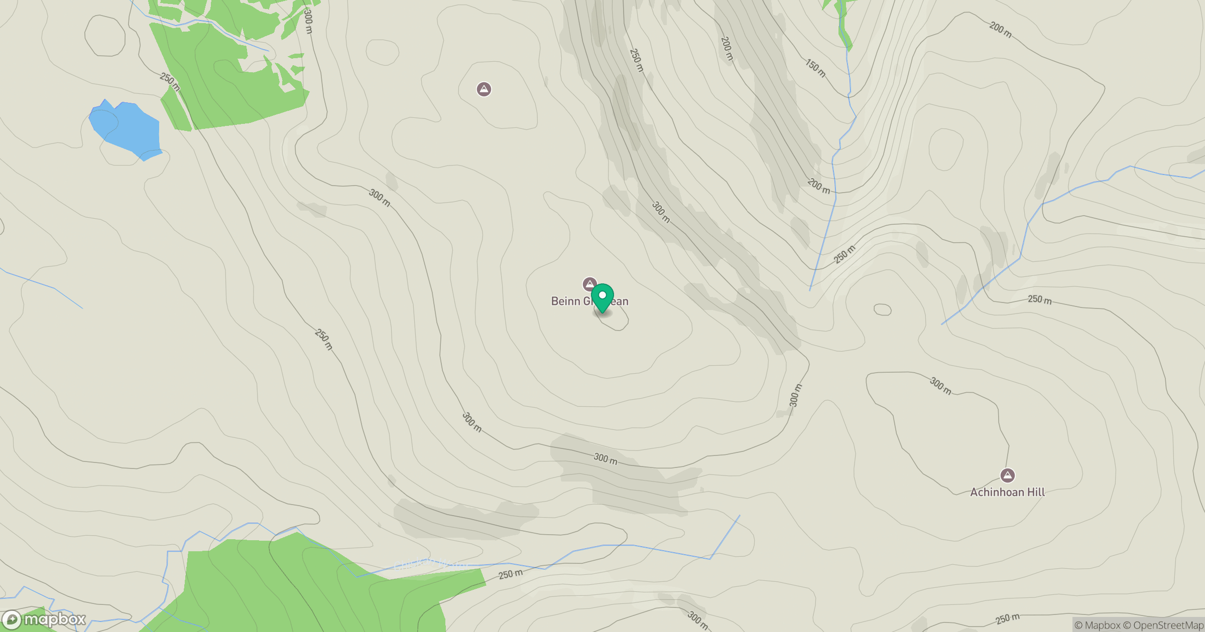
Grid reference: NR729170
View on OpenStreetMapOpens a map in a new tab, centred on the hill.
No comments yet. Be the first.