

Beinn na Lice
Good walks are even better shared.
Overview
Beinn na Lice
Overview
Beinn na Lice, at a proud elevation of 514 meters, is a Marilyn mountain nestled in the stunning landscape of the Scottish Highlands. This peak, whose very name evokes images of weathered slabs and scenic adventures, provides an excellent opportunity for hikers eager to explore the natural beauty of this region without the sweat-inducing effort required by some of its taller neighbours.
Geology
Composed mainly of schist and granite, Beinn na Lice has been well shaped by ancient glaciers that carved their way through the Highlands. The rocky outcrops and stunning formations create an awe-inspiring environment that is a geologist's playground. Just remember not to take any large samples home with you—one can ask in earnest but no one will likely help you get it into the car!
Routes
The most popular starting point for summiting Beinn na Lice is the Achintraid area. The route stretches approximately 5.3 kilometers and is best tackled in a moderate two-and-a-half hours. Expect pleasantly undulating paths with some steep sections sprinkled in to keep things interesting. This is not designed for those who prefer the road more travelled or indeed flat!
Summit Features
Once you reach the summit, take a moment to rest at the cairn and enjoy your well-earned views. It’s not every day you can say you climbed a Marilyn, after all!
Terrain
The terrain consists of a delightful mix of rocky and grassy patches, with a few boggy surprises for those who like to test their boots. So, be prepared to encounter a bit of mud—think of it as nature's own spa treatment!
Views
From the top, the views are nothing short of spectacular. You’ll be able to gaze upon the distant Raasay Island and the awe-inducing peaks of the Cuillin on Skye. If the weather behaves, you will also be rewarded with expansive views of the sea—perfect for daydreaming about your next seaside escape!
Hazards
As with all Scottish peaks, Beinn na Lice comes with its share of hazards. Watch out for rocky terrain, sudden weather changes (seriously, it can go from sunny to 'wet sponge' in mere moments), and the ever-mischievous bogs ready to gulp your boots whole!
Access
The nearest parking area is a small layby along the A87, not far from Achintraid. While there's limited space so early birds might catch the worm (or rather, the parking spot), public transport to the area is limited. Lochcarron is the closest town offering cafes and shops to equip you for your adventure.
Facilities
Facilities are scarce directly on the mountain, but Lochcarron has a range of cafes and shops. Stop by, grab a scone, and fuel up before your ascent!
History
The etymology of Beinn na Lice reveals its identity as the 'Mountain of the Slab', inspired by the fragmented rock formations found throughout. While perhaps not a mountain steeped in rich tales, it has become an essential destination for those wanting to experience the magnificence of the Scottish Highlands.
So, don your best hiking boots, make sure you have enough snacks to fuel even the hungriest of adventures, and head off to Beinn na Lice for a memorable day in the great outdoors!
Keep your spirits high and your footwear waterproof—happy hiking!
Explore routes near Beinn na Lice
Public walks starting within 80 km of this hill. Nearby does not mean a route reaches the summit; check its map and access before setting out.
Portballintrae to Giant's Causeway: railway path and Blue Trail return
View route
Goatfell from Cladach
View route
Comber Greenway: Dee Street to Belfast Road
View route
Belfast street-art walk
View route
Route planning notes
These notes describe possible approaches, not verified navigable routes or permission to cross land. Check current paths, local access rules and conditions before setting out.
Achintraid Start Point
A pleasant walk through scenic glens with occasional steep sections.
Make a day of it, together
Find someone to share the walk with, or organise a day out along a route you like.
Photo Gallery
View all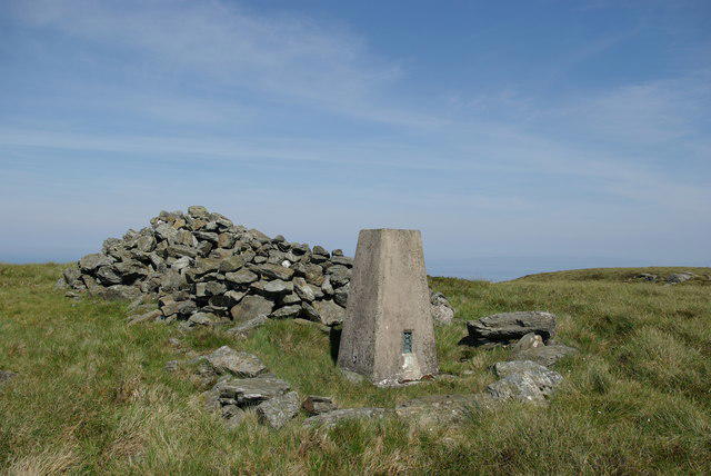 Photo could not load
NR6008 : Trig point & cairn on Beinn na Lice
Leslie Barrie
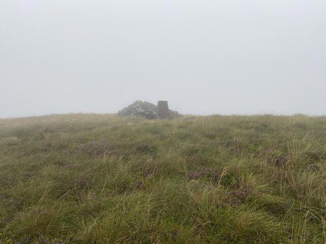 Photo could not load
NR6008 : Beinn na Lice Trig Point and Cairn
thejackrustles
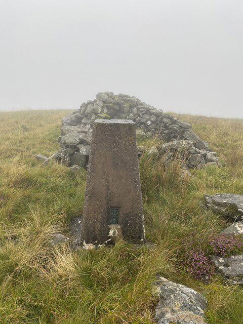 Photo could not load
NR6008 : Beinn na Lice Trig Point Flush Bracket S8560
thejackrustles
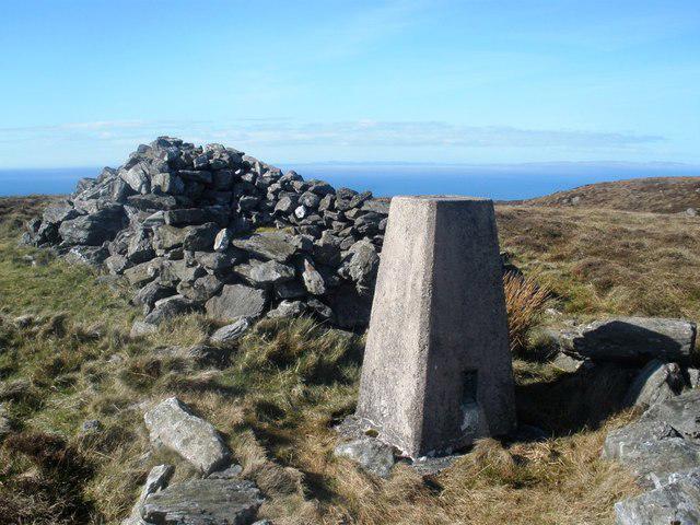 Photo could not load
NR6008 : Beinn na Lice - Trig & Cairn
Derek Tootill
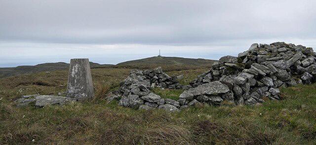 Photo could not load
NR6008 : Triangulation pillar and shelter, Beinn na Lice, Argyll
Claire Pegrum
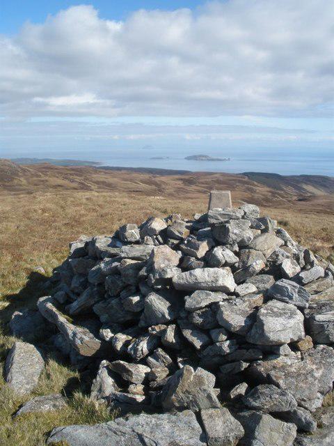 Photo could not load
NR6008 : Beinn na Lice - Cairn & Trig
Derek Tootill
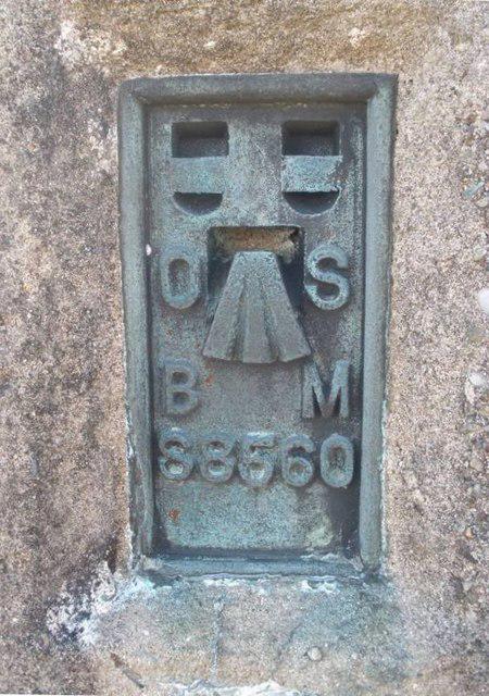 Photo could not load
NR6008 : Flush Bracket, Beinn na Lice Trig Pillar - Mull of Kintyre
Derek Tootill
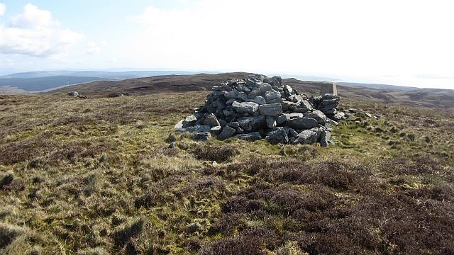 Photo could not load
NR6008 : Beinn na Lice summit
Richard Webb
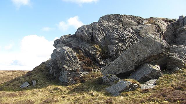 Photo could not load
NR6008 : Crag, Beinn na Lice
Richard Webb
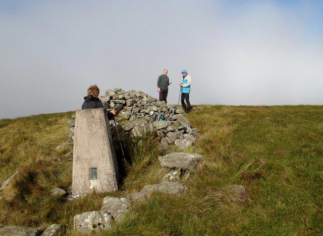 Photo could not load
NR6008 : Beinn na Lice
Rude Health
Hill facts and local notes
Classifications
Elevation
428m
1,404 ft
Prominence
221m
Coordinates
55.3124, -5.7794
NR602085
OS Map
68
Explorer: 356S
At the Summit
The summit features a small cairn, which offers a perfect spot for a quick photo-op (or to stage a dramatic 'I conquered the mountain' pose).
Terrain & Geology
Beinn na Lice is primarily composed of schist and granite, typical of the Scottish Highlands. These rocks have been shaped by glacial activity, resulting in stunning rugged terrain.
Views & Scenery
From the summit, you can catch sight of the stunning Raasay Island and the majestic peaks of the Cuillin on Skye, not to mention the expansive sea views.
History & Heritage
Name Origin
The name Beinn na Lice translates to 'Mountain of the Slab', perhaps referring to the large slabs of rock found on its slopes.
Historical Significance
While not steeped in extensive historical tales, the mountain is a beloved hiking destination for locals and visitors alike, offering a slice of the rugged Highlands experience.
Getting There & Facilities
Check current local access restrictions, parking rules and transport timetables before travelling. These notes do not confirm public access to the summit.
Parking
Parking available at the small layby on the A87 near Achintraid. Spaces are limited, so arrive early or risk a long walk from the nearest roadside.
Public Transport
Limited bus services run from Lochcarron to nearby villages, but a car is highly recommended for ease of access.
Nearby Facilities
There are no facilities directly on Beinn na Lice; however, Lochcarron offers cafes, shops, and basic amenities for hikers to refuel.
Safety Information
Known Hazards
- Rocky terrain, potential for sudden weather changes, and some boggy areas that may resemble a monster truck track.
General Safety Tips
- Check weather conditions before setting out
- Carry appropriate clothing and equipment
- Let someone know your planned route
- Take a map, compass, and GPS device
- Carry emergency supplies: food, water, first aid kit, torch
Hills
Some common questions about the hills answered
Are there group walks up Beinn na Lice?
Many walkers use Walkmates to join or organise walks with others. You can check for group walks around Beinn na Lice through the maps
Are there other walkers around Beinn na Lice?
Activity varies by location and time, but Walkmates lets you see whether others have shared walks or shown interest in this area. Find other people through the walking friends search walking friends for Beinn na Lice search or of course create your own walk for Beinn na Lice
Can I organise a walk to Beinn na Lice?
Yes. If there aren’t any walks listed already, you can create a walk and make it available for others to join.
If you're signed up to Walkmates, you can create a walk to Beinn na Lice.
How do I find a walk up this hill?
There are often multiple ways to walk this hill, depending on experience and route preference. Walkmates helps you explore walks and routes that others have shared.
Can I suggest a new route up Beinn na Lice?
Yes. You can suggest or create routes to share with others. Walkmates focuses on the social side of walking, so routes are used to help people organise walks and explore areas together, rather than as detailed navigation tools or route libraries.
Other uses really appreciate knowledgeable walkers sharing their routes. Share your favourite route to Beinn na Lice here
The is an error or something incorrect about this hill. How do I let you know?
We always strive to keep the information on Walkmates as accurate as possible. If you find an error, please let us know through the contact form and we'll aim to correct it as quickly as possible
Community Discussion
Comments
Location
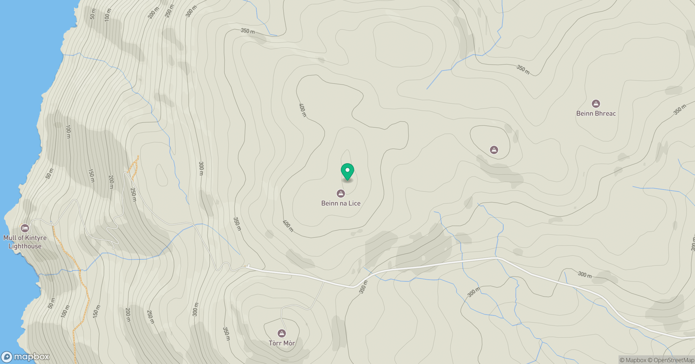
Grid reference: NR602085
View on OpenStreetMapOpens a map in a new tab, centred on the hill.
Hills within 30 km
Straight-line distance, not a walking route or confirmation of access.
No comments yet. Be the first.