
Round Hill
Good walks are even better shared.
Overview
Round Hill is a 409-metre summit in the Yorkshire Dales, North Yorkshire, England (grid SE122535).
Round Hill in North Yorkshire
Round Hill is a 409-metre summit in the Yorkshire Dales, North Yorkshire, England (grid SE122535).
The recorded highest point is a small grassy rise with a cairn.
Route and access information for this hill has not been verified. The summit facts and map marker do not provide verified walking directions.
Source: Database of British and Irish Hills, version 18.3.
Explore routes near Round Hill
Public walks starting within 80 km of this hill. Nearby does not mean a route reaches the summit; check its map and access before setting out.
Bolton Abbey: Strid Wood and Barden Bridge Circuit
View route
Fewston and Swinsty: both reservoir circuits
View route
Silsden to Kildwick Canal Walk
View route
Skipton to Gargrave Canal Walk
View route
Route planning notes
These notes describe possible approaches, not verified navigable routes or permission to cross land. Check current paths, local access rules and conditions before setting out.
North Face Route (unverified)
Route details have not been verified for this hill. Check the location, access and distance before planning a walk. More direct and steeper climb that rewards with panoramic views. Perfect for those looking to stretch their legs and lungs!
Make a day of it, together
Find someone to share the walk with, or organise a day out along a route you like.
Hill facts and local notes
Classifications
Elevation
409m
1,342 ft
Prominence
110m
Coordinates
53.9778, -1.8151
SE122535
OS Map
104
Explorer: 297
At the Summit
The recorded highest point is a small grassy rise with a cairn.
Terrain & Geology
Composed primarily of chalk, providing a rich biodiversity, including rare plants and animals. The underlying geology dates back to the Late Cretaceous period.
History & Heritage
Name Origin
The name 'Round Hill' derives from its rounded, smooth profile, a literal nod to its appearance.
Historical Significance
Historically, Round Hill and the surrounding area have been places for agricultural grazing and are woven into local folklore, often connected to ancient farming practices.
Safety Information
Known Hazards
- Watch out for sudden weather changes. Stay away from cliff edges if you're near the coast!
General Safety Tips
- Check weather conditions before setting out
- Carry appropriate clothing and equipment
- Let someone know your planned route
- Take a map, compass, and GPS device
- Carry emergency supplies: food, water, first aid kit, torch
Hills
Some common questions about the hills answered
Are there group walks up Round Hill?
Many walkers use Walkmates to join or organise walks with others. You can check for group walks around Round Hill through the maps
Are there other walkers around Round Hill?
Activity varies by location and time, but Walkmates lets you see whether others have shared walks or shown interest in this area. Find other people through the walking friends search walking friends for Round Hill search or of course create your own walk for Round Hill
Can I organise a walk to Round Hill?
Yes. If there aren’t any walks listed already, you can create a walk and make it available for others to join.
If you're signed up to Walkmates, you can create a walk to Round Hill.
How do I find a walk up this hill?
There are often multiple ways to walk this hill, depending on experience and route preference. Walkmates helps you explore walks and routes that others have shared.
Can I suggest a new route up Round Hill?
Yes. You can suggest or create routes to share with others. Walkmates focuses on the social side of walking, so routes are used to help people organise walks and explore areas together, rather than as detailed navigation tools or route libraries.
Other uses really appreciate knowledgeable walkers sharing their routes. Share your favourite route to Round Hill here
The is an error or something incorrect about this hill. How do I let you know?
We always strive to keep the information on Walkmates as accurate as possible. If you find an error, please let us know through the contact form and we'll aim to correct it as quickly as possible
Community Discussion
Comments
Location
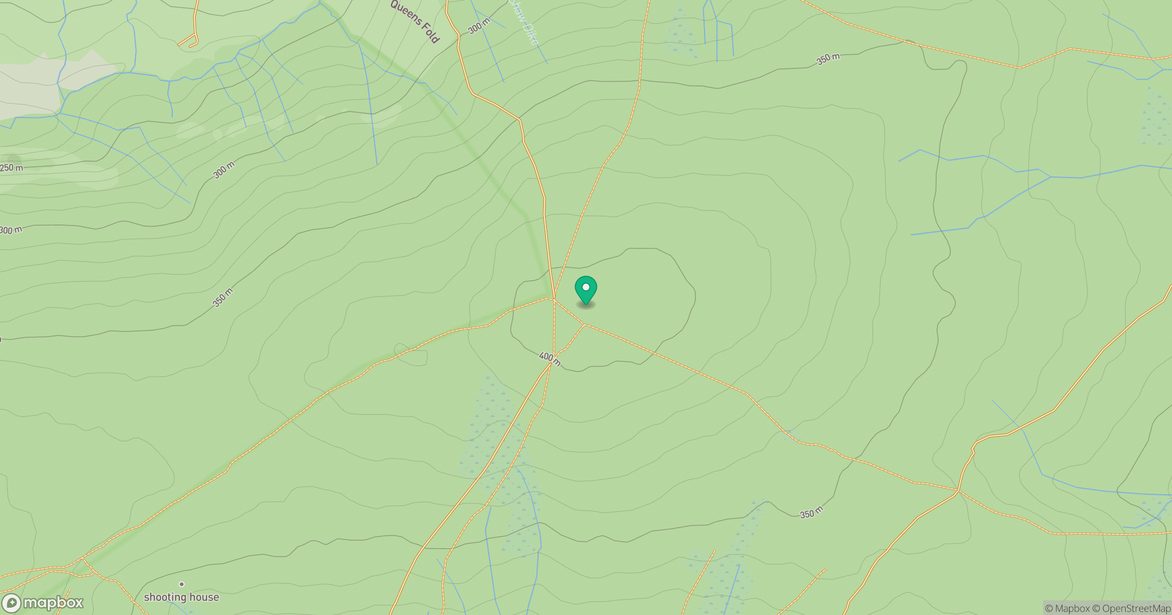
Grid reference: SE122535
View on OpenStreetMapOpens a map in a new tab, centred on the hill.
Hills within 30 km
Straight-line distance, not a walking route or confirmation of access.
Rombalds Moor [Ilkley Moor]
402m
Buckden Pike
702m
Simon's Seat
485m
Lindley Moor
292m
The Chevin
282m
No comments yet. Be the first.