

Rhiw Gwraidd
Good walks are even better shared.
SO0163 : Rhiw Gwraidd
Rude Health Photo source
Overview
Rhiw Gwraidd
Introduction
Rhiw Gwraidd stands proud at 434 meters, providing a delightful hike for those seeking both adventure and stunning vistas in the heart of the Brecon Beacons. With a range of terrain and a summit that rewards your efforts with jaw-dropping views, it’s a fantastic day out for walkers of all levels.
Geology
The rocks that make up Rhiw Gwraidd are largely sedimentary, specifically mudstone and sandstone. This geological feature not only helps shape the landscape but also provides a home for diverse flora and fauna, ensuring that every step brings something new to see. Don’t worry; these rocks don’t bite!
Routes
The most popular route is a lovely trek from Trecastle. At 8.5 km with a walking time of about 3.5 hours, it’s moderate in difficulty and perfect for a leisurely Sunday stroll or a post-work adventure.
Summit Features
Upon reaching the summit, you'll be greeted by a large stone cairn, a popular spot for photographs—or for sitting down with your lunch if you're feeling peckish. The views from the top are simply splendid!
Terrain Type
The terrain is predominantly grassy, sprinkled with rocky outcrops that add to the character of the path. It's mostly easy-going, but do watch out for those hidden boggy spots that seem to come out of nowhere!
Views
From Rhiw Gwraidd, you can feast your eyes on stunning landscapes that stretch as far as the eye can see. Look out for Pen y Fan and the distant rolling hills, perfect for those Instagram photos if that’s your thing! The best time to visit for maximum eye candy is during late spring and early autumn.
Hazards
While the hike is enjoyable, keep an eye on the weather as dense fog can roll in unexpectedly, and the uneven terrain might trip up the unwary. A navigation tool of some sort is highly recommended.
Nearby Summits
Rhiw Gwraidd is neighbours with some of the Beacons' giants like Pen y Fan and Corn Du, so why not consider adding them to your hiking itinerary for the full experience?
Access
Parking is available in Trecastle, a quaint little village that welcomes hikers with open arms. Public transport options are sparse, but a bus does run from Brecon, though it might not coincide well with your hiking schedule. Ensure you check ahead!
Facilities
After your escapade, treat yourself to a well-earned cuppa at the local café or stock up on essentials at the shop in Trecastle.
History
The name Rhiw Gwraidd reflects the hill's strong cultural roots, meaning ‘brow of the hill’ in Welsh. Local legends abound about ancient battles fought on these lands, adding a sprinkle of mystique to your adventure.
In summary, Rhiw Gwraidd is a delightful outing waiting to challenge your legs while offering spectacular sights. Just make sure to pack your sense of adventure and perhaps a sandwich or two!
Happy hiking!
Explore routes near Rhiw Gwraidd
Walks starting near this hill. Open a route to check its map, distance and full itinerary.
Elan Valley: Reservoir Trail to Pen y Garreg Dam
View route
Hafren Forest: full Source of the Severn Trail
View route
Brecon Basin to Brynich Aqueduct: Canal Towpath Walk
View route
Ystwyth Trail: Black Covert to Llanilar and back
View route
Route planning notes
These notes describe possible approaches. Check a route's map and access information when planning your walk.
Trecastle to Rhiw Gwraidd
A scenic route starting from Trecastle, taking you through lush valleys and over gentle hills before reaching the summit of Rhiw Gwraidd.
Make a day of it, together
Find someone to share the walk with, or organise a day out along a route you like.
Photo Gallery
View all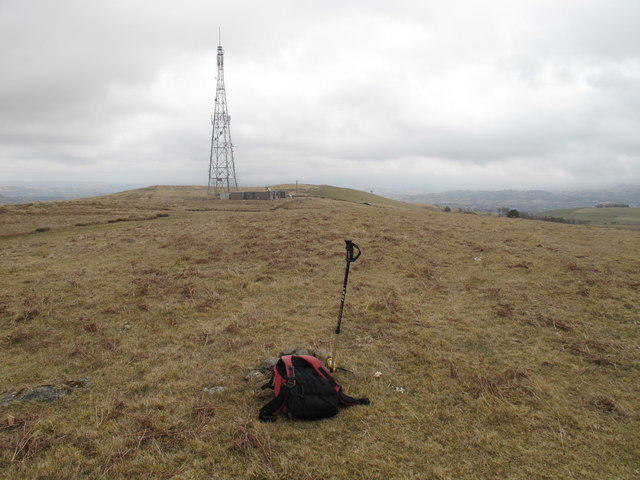 Photo could not load
SO0163 : Rhiw Gwraidd
Rude Health
Hill facts and local notes
Classifications
Elevation
442m
1,450 ft
Prominence
213m
Coordinates
52.2602, -3.4430
SO016634
OS Map
147
Explorer: 200E
At the Summit
The summit features a large stone cairn, which is a testament to the many walkers who have reached this point. The views from the top are absolutely gobsmacking!
Terrain & Geology
The mountain is predominantly composed of sedimentary rocks, specifically mudstone and sandstone, which gives it a rugged and varied terrain. The presence of these rocks contributes to the unique flora found on the slopes.
Views & Scenery
From the summit, you can see Pen y Fan in the distance, along with the rolling hills of the Brecon Beacons and the valleys below, not to mention the occasional sheep.
History & Heritage
Name Origin
Rhiw Gwraidd is thought to mean 'brow of the hill' in Welsh, reflecting its location as a prominent hill in the area.
Historical Significance
The mountain has historical significance in local folklore, often associated with tales of ancient battles and the whimsical spirits of the Brecon Beacons.
Getting There & Facilities
Parking
The nearest parking is at Trecastle, where there is a small car park at the edge of the village, ideal for starting your hike.
Public Transport
Public transport is limited; however, buses run from Brecon to Trecastle, providing access to the area.
Nearby Facilities
There are limited facilities in Trecastle, including a small shop and a cafe where you can grab a bite before or after your hike.
Safety Information
Known Hazards
- Dense fog can occur suddenly, so it's wise to carry navigation tools. The terrain may be uneven, especially near the summit.
General Safety Tips
- Check weather conditions before setting out
- Carry appropriate clothing and equipment
- Let someone know your planned route
- Take a map, compass, and GPS device
- Carry emergency supplies: food, water, first aid kit, torch
Hills
Some common questions about the hills answered
Are there group walks up Rhiw Gwraidd?
Many walkers use Walkmates to join or organise walks with others. You can check for group walks around Rhiw Gwraidd through the maps
Are there other walkers around Rhiw Gwraidd?
Activity varies by location and time, but Walkmates lets you see whether others have shared walks or shown interest in this area. Find other people through the walking friends search walking friends for Rhiw Gwraidd search or of course create your own walk for Rhiw Gwraidd
Can I organise a walk to Rhiw Gwraidd?
Yes. If there aren’t any walks listed already, you can create a walk and make it available for others to join.
If you're signed up to Walkmates, you can create a walk to Rhiw Gwraidd.
How do I find a walk up this hill?
There are often multiple ways to walk this hill, depending on experience and route preference. Walkmates helps you explore walks and routes that others have shared.
Can I suggest a new route up Rhiw Gwraidd?
Yes. You can suggest or create routes to share with others. Walkmates focuses on the social side of walking, so routes are used to help people organise walks and explore areas together, rather than as detailed navigation tools or route libraries.
Other uses really appreciate knowledgeable walkers sharing their routes. Share your favourite route to Rhiw Gwraidd here
The is an error or something incorrect about this hill. How do I let you know?
We always strive to keep the information on Walkmates as accurate as possible. If you find an error, please let us know through the contact form and we'll aim to correct it as quickly as possible
Community Discussion
Comments
Location
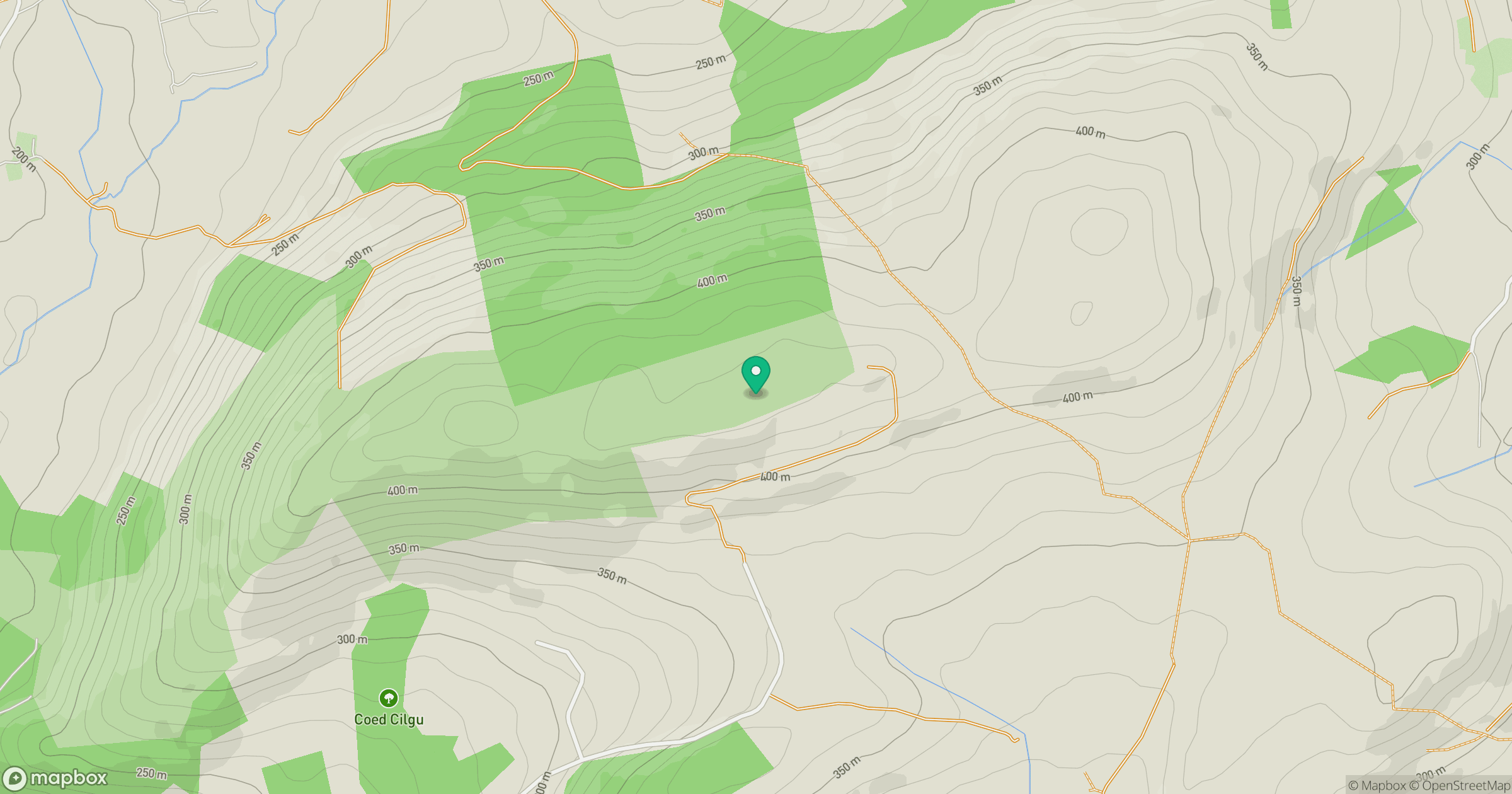
Grid reference: SO016634
View on OpenStreetMapOpens a map in a new tab, centred on the hill.

No comments yet. Be the first.