
Drum Ddu
Good walks are even better shared.
Overview
Drum Ddu
Drum Ddu, nestled in the heart of the Black Mountains, stands as a stalwart sentinel over the stunning landscape. With an elevation of 610 meters (2001 feet), it may not be the tallest peak in the region, but don't let its stature fool you; this Marilyn packs a punch in terms of scenic beauty and varied terrain.
Geology
This mountain is primarily composed of Old Red Sandstone, a characteristic feature of the Black Mountains. These ancient, weathered rocks hold stories of geological transformations and offer an intriguing backdrop for outdoor enthusiasts keen on nature’s history.
Access and Parking
Accessing Drum Ddu is a piece of cake. The nearest parking is conveniently located at Crickhowell, right by the River Usk. From here, a well-marked path leads you straight to the foot of the mountain. For those relying on public transport, buses frequently run to Crickhowell from surrounding towns, making it a doddle to reach your destination.
Routes
Several routes can be taken to the summit. The most popular is the route from Crickhowell, which meanders through picturesque landscapes—think meadows, enchanting woodlands, and not a whiff of urban bustle. For those looking for a challenge, you can take a direct route from the A467; it’s steep but oh so rewarding!
Summit Features
Upon reaching the summit, you'll be greeted by a modest but charming stone cairn. It’s a fantastic spot for an impromptu picnic—and let’s be honest, who doesn’t love a good sandwich with a view?
Views
The vistas from Drum Ddu are nothing short of breathtaking. On clear days, the views stretch across the Black Mountains to the Brecon Beacons and, if you squint hard enough, the Severn Estuary. The best times to capture these views are in spring or early summer when the skies are crisp and the landscape is awash with colours of blooming flora.
Hazards
While the mountain welcomes adventurers, it’s essential to be cautious. After rain, rocks can become slippery, and certain paths may be boggy. It’s advisable to bring sturdy footwear and keep an eye on the weather; fog can close in as quickly as a cup of tea can brew!
Nearby Summits
Drum Ddu is surrounded by formidable neighbours, including Pen Cerrig-Calch and Waun Fach, both offering their unique adventures and stunning scenery.
Facilities
After conquering Drum Ddu, why not treat yourself? Head back to Crickhowell, where a variety of cafes and pubs await your weary feet. You’ll find the perfect brew to toast your achievement—perhaps a cheeky slice of cake, too.
History
In Welsh, 'Drum Ddu' literally means 'Black Hill', a name derived from the mountain's often gloomy appearance. Historically, this mountain has been significant in local folklore, providing a habitat for diverse wildlife and rare plants.
So pack your bags, lace up your boots, and prepare for an unforgettable trek up Drum Ddu—where the views are majestic, and the memories are priceless!
Explore routes near Drum Ddu
Public walks starting within 80 km of this hill. Nearby does not mean a route reaches the summit; check its map and access before setting out.
Elan Valley: Reservoir Trail to Pen y Garreg Dam
View route
Hafren Forest: full Source of the Severn Trail
View route
Ystwyth Trail: Black Covert to Llanilar and back
View route
Brecon Basin to Brynich Aqueduct: Canal Towpath Walk
View route
Route planning notes
These notes describe possible approaches, not verified navigable routes or permission to cross land. Check current paths, local access rules and conditions before setting out.
Crickhowell to Drum Ddu
A popular and scenic route starting from Crickhowell, winding through meadows and woodland before ascending the hillside towards the summit.
From the A467
A shorter, steeper ascent directly from the A467, offering a more challenging approach but rewarding views.
Make a day of it, together
Find someone to share the walk with, or organise a day out along a route you like.
Hill facts and local notes
Classifications
Elevation
538m
1,765 ft
Prominence
128m
Coordinates
52.2325, -3.5079
SN971604
OS Map
147
Explorer: 200W
At the Summit
The summit is marked by a stone cairn, providing a great photo opportunity and a fitting spot to catch your breath after the climb.
Terrain & Geology
Composed primarily of Old Red Sandstone, Drum Ddu features ancient sedimentary layers that offer fascinating insights into the geological history of the region. The weathered rock formations contribute to the stunning views and dramatic terrain.
Views & Scenery
From the summit, you can enjoy sweeping views of the Black Mountains, the Brecon Beacons, and on a clear day, the Severn Estuary in the distance.
History & Heritage
Name Origin
The name 'Drum Ddu' translates to 'Black Hill' in Welsh, aptly reflecting its often misty, shadowy appearance.
Historical Significance
This mountain is part of the natural heritage of the region, steeped in local folklore and offering a habitat for rare species of flora and fauna.
Getting There & Facilities
Check current local access restrictions, parking rules and transport timetables before travelling. These notes do not confirm public access to the summit.
Parking
Parking is available at the base of the route from Crickhowell, near the bridge over the River Usk. The area is well signposted.
Public Transport
The nearest bus stop is in Crickhowell, serviced by local routes from Abergavenny and other surrounding towns.
Nearby Facilities
There are several cafes and pubs in Crickhowell to refuel after your adventure, as well as public toilets available near the town centre.
Safety Information
Known Hazards
- Beware of slippery rocks and uneven terrain, especially in wet conditions. Fog can roll in quickly, potentially reducing visibility.
General Safety Tips
- Check weather conditions before setting out
- Carry appropriate clothing and equipment
- Let someone know your planned route
- Take a map, compass, and GPS device
- Carry emergency supplies: food, water, first aid kit, torch
Hills
Some common questions about the hills answered
Are there group walks up Drum Ddu?
Many walkers use Walkmates to join or organise walks with others. You can check for group walks around Drum Ddu through the maps
Are there other walkers around Drum Ddu?
Activity varies by location and time, but Walkmates lets you see whether others have shared walks or shown interest in this area. Find other people through the walking friends search walking friends for Drum Ddu search or of course create your own walk for Drum Ddu
Can I organise a walk to Drum Ddu?
Yes. If there aren’t any walks listed already, you can create a walk and make it available for others to join.
If you're signed up to Walkmates, you can create a walk to Drum Ddu.
How do I find a walk up this hill?
There are often multiple ways to walk this hill, depending on experience and route preference. Walkmates helps you explore walks and routes that others have shared.
Can I suggest a new route up Drum Ddu?
Yes. You can suggest or create routes to share with others. Walkmates focuses on the social side of walking, so routes are used to help people organise walks and explore areas together, rather than as detailed navigation tools or route libraries.
Other uses really appreciate knowledgeable walkers sharing their routes. Share your favourite route to Drum Ddu here
The is an error or something incorrect about this hill. How do I let you know?
We always strive to keep the information on Walkmates as accurate as possible. If you find an error, please let us know through the contact form and we'll aim to correct it as quickly as possible
Community Discussion
Comments
Location
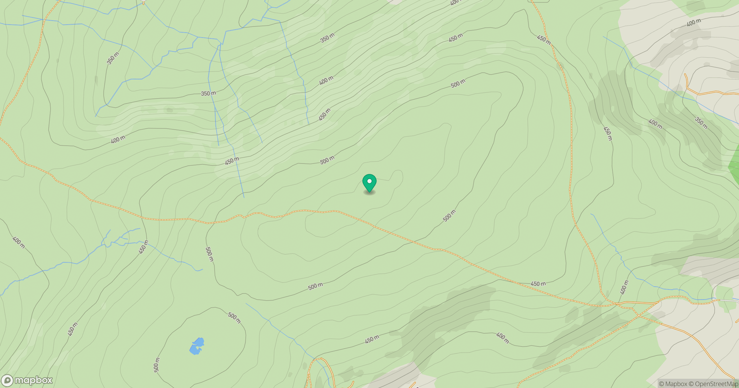
Grid reference: SN971604
View on OpenStreetMapOpens a map in a new tab, centred on the hill.
Hills within 30 km
Straight-line distance, not a walking route or confirmation of access.
No comments yet. Be the first.