
Creag na h-Iolaire
Good walks are even better shared.
Overview
Creag na h-Iolaire: A Highland Gem
Nestled in the picturesque Scottish Highlands, Creag na h-Iolaire stands proudly at 550 meters above sea level, classified as a Marilyn due to its prominence. This mountain, with its enticing name meaning 'Crag of the Eagle', offers a blend of geological wonder and scenic beauty, making it a beloved choice for hikers.
Geology
Creag na h-Iolaire is primarily composed of schist and gneiss, materials that boast a rich history shaped by the relentless forces of nature. Glacial features, such as striations and moraines, map the tale of the ice ages, giving this crag a fascinating geological texture that will leave any rock-lover in awe.
Routes and Accessibility
For those keen on making their way to the summit, the most popular route begins at the Mains of Ardgay. This moderate path, approximately 6 km round trip, meanders through lush landscapes, giving hikers plenty of opportunities to soak in the stunning vistas. On the way up, make sure to stop at the rocky outcrops — the view only gets better as you ascend!
Access
Parking is available at Mains of Ardgay, where a small car park welcomes adventurers. Public transport lovers can rejoice; Ardgay has a train station serviced by buses from Tain, making it a breeze to reach the starting point. The closest town, Ardgay, also offers a quaint café perfect for refuelling post-hike.
Summit Features and Views
Reaching the summit unveils a modest stone cairn, a pleasant resting spot for tired legs and camera-wielding trekkers alike. With the remarkable Loch Shin sprawled out beneath you, and the distant Ben Klibreck gracing the horizon, the scenery is nothing short of breathtaking. Early risers are rewarded with the most magical sunrises, where the light paints the landscape in hues of orange and gold.
Hazards to Be Aware Of
However, a word of caution: the weather in the Highlands can be as fickle as a cat on a hot tin roof. Watch for sudden changes in conditions, as they can transform a sunny walk into a wet and wild adventure, and be prepared for slippery or boggy passages.
Nearby Summits
For those looking to extend their adventure, consider tagging Ben Klibreck onto your list! Standing majestically at 744 meters, it’s a worthy companion to Creag na h-Iolaire.
Conclusion
In conclusion, Creag na h-Iolaire is a splendid destination for hikers seeking the charm of the Scottish Highlands. Whether you're a local or just visiting, this hill guarantees memories that will stick like mud to your boots. So pack your bags, grab your hiking poles, and get ready for an adventure on the Crag of the Eagle!
Explore routes near Creag na h-Iolaire
Public walks starting within 80 km of this hill. Nearby does not mean a route reaches the summit; check its map and access before setting out.
Ben Klibreck
View route
Loch Migdale from Torroy: Spinningdale pinewood and loch shore walk
View route
Fairy Lochs Liberator Wreckage Circuit
View route
Beinn Eighe Lancaster Wreckage at Coire Mhic Fhearchair
View route
Route planning notes
These notes describe possible approaches, not verified navigable routes or permission to cross land. Check current paths, local access rules and conditions before setting out.
Mains of Ardgay to Summit
A straightforward ascent along well-defined paths, offering stunning views of the surrounding terrain as you gain height.
Make a day of it, together
Find someone to share the walk with, or organise a day out along a route you like.
Hill facts and local notes
Classifications
Elevation
357m
1,171 ft
Prominence
100m
Coordinates
58.2036, -5.0826
NC189280
OS Map
15
Explorer: 442W
At the Summit
The summit features a small, stone-built cairn which is perfect for the obligatory summit selfie. Don't forget to check for any shy seals peeking from the nearby coastline!
Terrain & Geology
Creag na h-Iolaire is primarily composed of schist and gneiss, featuring interesting glacial features such as striations and moraines, which tell a tale of the ice ages.
Views & Scenery
From the summit, you can gaze upon the stunning Loch Shin, the rugged peaks of the surrounding ranges, and on a clear day, you might even spot the iconic Ben Klibreck to the west.
History & Heritage
Name Origin
The name 'Creag na h-Iolaire' translates to 'Crag of the Eagle', hinting at the majestic birds that once soared over these heights.
Historical Significance
The mountain is known not only for its scenic beauty but also for the historical tales of local clans and their adventures in the Highlands.
Getting There & Facilities
Check current local access restrictions, parking rules and transport timetables before travelling. These notes do not confirm public access to the summit.
Parking
Parking is available at the Mains of Ardgay, where there is a small car park suitable for several vehicles.
Public Transport
The nearest train station is in Ardgay, with bus services available from larger towns like Tain.
Nearby Facilities
Facilities are limited; however, a charming local café in Ardgay serves excellent refreshments, and public toilets are available.
Safety Information
Known Hazards
- Be wary of sudden changes in weather, which is common in the Highlands. The terrain can also be slippery when wet, and some areas may be boggy.
General Safety Tips
- Check weather conditions before setting out
- Carry appropriate clothing and equipment
- Let someone know your planned route
- Take a map, compass, and GPS device
- Carry emergency supplies: food, water, first aid kit, torch
Hills
Some common questions about the hills answered
Are there group walks up Creag na h-Iolaire?
Many walkers use Walkmates to join or organise walks with others. You can check for group walks around Creag na h-Iolaire through the maps
Are there other walkers around Creag na h-Iolaire?
Activity varies by location and time, but Walkmates lets you see whether others have shared walks or shown interest in this area. Find other people through the walking friends search walking friends for Creag na h-Iolaire search or of course create your own walk for Creag na h-Iolaire
Can I organise a walk to Creag na h-Iolaire?
Yes. If there aren’t any walks listed already, you can create a walk and make it available for others to join.
If you're signed up to Walkmates, you can create a walk to Creag na h-Iolaire.
How do I find a walk up this hill?
There are often multiple ways to walk this hill, depending on experience and route preference. Walkmates helps you explore walks and routes that others have shared.
Can I suggest a new route up Creag na h-Iolaire?
Yes. You can suggest or create routes to share with others. Walkmates focuses on the social side of walking, so routes are used to help people organise walks and explore areas together, rather than as detailed navigation tools or route libraries.
Other uses really appreciate knowledgeable walkers sharing their routes. Share your favourite route to Creag na h-Iolaire here
The is an error or something incorrect about this hill. How do I let you know?
We always strive to keep the information on Walkmates as accurate as possible. If you find an error, please let us know through the contact form and we'll aim to correct it as quickly as possible
Community Discussion
Comments
Location
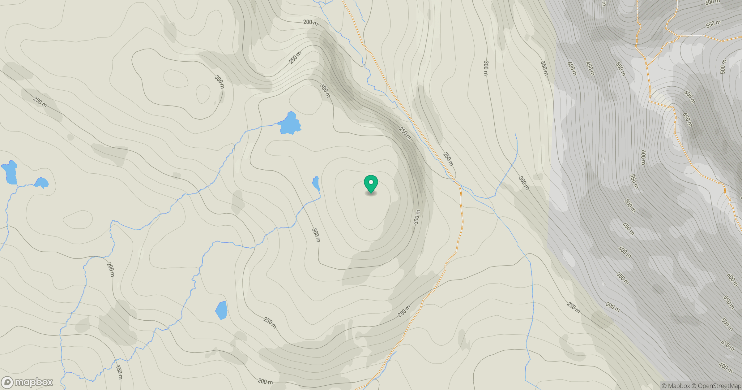
Grid reference: NC189280
View on OpenStreetMapOpens a map in a new tab, centred on the hill.
Hills within 30 km
Straight-line distance, not a walking route or confirmation of access.
Quinag - Sail Ghorm [Sail Gorm]
776m
Quinag - Spidean Coinich
764m
Quinag - Sail Gharbh
809m
Canisp
847m
Suilven
731m
No comments yet. Be the first.