

Parkhouse Hill North Top
Good walks are even better shared.
SK0867 : View over Glutton Grange
Bill Boaden Photo source
Overview
Parkhouse Hill North Top
Overview
Nestled in the heart of the Peak District National Park, Parkhouse Hill North Top stands at an impressive 454 meters. Don't let its height fool you, it's no giant, but what it lacks in elevation it more than makes up for in beauty and charm. Known affectionately as a 'Marilyn', it is a hill that deserves a spot on the itinerary of any outdoor enthusiast.
Geology
This region is defined by its intriguing limestone landscapes. The impressive dry stone walls and open pastures are remnants of the area’s glacial past. So, while you’re trudging up the hill, take a moment to ponder the ice that shaped these very rocks thousands of years ago—it’s a great conversation starter!
Routes
The Trail from Hollinsclough
A delightful 4.5 km journey. This moderate hike starts from the picturesque village of Hollinsclough. The paths weave through grassy meadows and offer an almost pastoral scene, with sheep baa-ing their approval as you pass.
From the Dove Valley
For those seeking a bit more of a challenge, this 6 km route takes you through the scenic Dove Valley. Expect to climb steadily, but the breathtaking views and the rewarding summit will be well worth the effort.
Summit Features
Reaching the top, you'll find a modest cairn that acts as the perfect backdrop for those obligatory summit selfies. The panoramic views are absolutely stunning!
Terrain Type
The terrain combines grassy fields with rocky outcrops, creating a varied landscape. It can be uneven so be sure to watch your step; you might trip over your own enthusiasm!
Views
Highlights
From the summit, you can marvel at the majestic Chrome Hill as well as the sprawling beauty of the Peak District. It’s a sight that will make even the most seasoned hiker stop and gawk.
Best Seasons
Spring and autumn are prime times for visiting; the weather is more stable and the views clearer.
Hazards
As beautiful as it is, watch out for loose stones underfoot, and be cautious in wet weather; it can get a tad slippery.
Nearby Summits
Nearby, you'll find the charming Chrome Hill and the equally inviting Parkhouse Hill. Perfect for a little mountain-hopping!
Access
Parking is available in Hollinsclough, but don’t dawdle—those spots fill up faster than you can say, "where’s my map?" Public transport is a little sparse, so check the local bus schedule from Buxton.
Facilities
On the mountain itself, you won’t find any facilities—unless you count the sheep! However, Buxton is not far away, offering plenty of cafes and amenities.
History
Name Meaning
The etymology of ‘Parkhouse’ speaks to its historical use in wildlife preservation, an important aspect of rural life.
Significance
This hill is steeped in culture and history, intertwined with local traditions that add to the charm.
So, whether you're here for a gentle stroll or a hearty trek, Parkhouse Hill North Top is certainly worth the visit. But remember, safe hikes are happy hikes!
Explore routes near Parkhouse Hill North Top
Walks starting near this hill. Open a route to check its map, distance and full itinerary.
Tissington Trail: Parsley Hay, Hartington Station and Heathcote
View route
Three Villages and Five Wells
View route
Three Villages and Five Wells
View route
Three Villages and Five Wells
View route
Route planning notes
These notes describe possible approaches. Check a route's map and access information when planning your walk.
The Trail from Hollinsclough
A scenic route starting from the quaint village of Hollinsclough, ascending via grassy paths that meander through picturesque landscapes.
From the Dove Valley
Starting along the River Dove, this route climbs steadily up through lush fields and rocky outcrops, offering varied terrain and stunning views.
Make a day of it, together
Find someone to share the walk with, or organise a day out along a route you like.
Photo Gallery
View all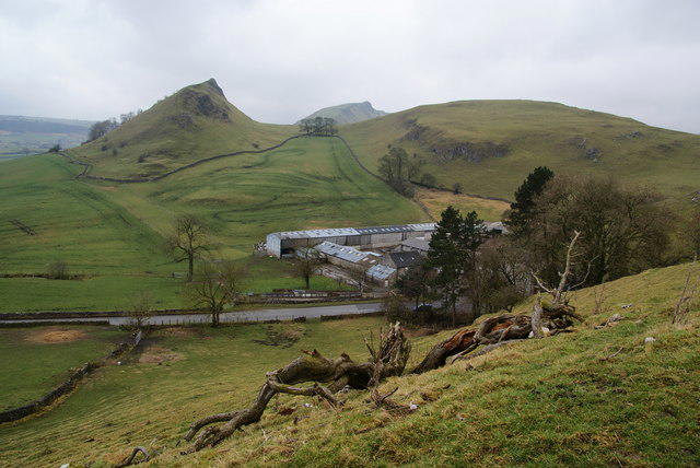 Photo could not load
SK0867 : View over Glutton Grange
Bill Boaden
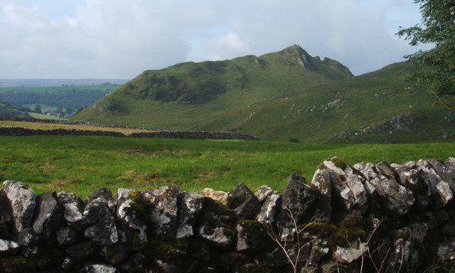 Photo could not load
SK0867 : Drystone wall, fields and Parkhouse Hill, near Earl Sterndale
Peter Barr
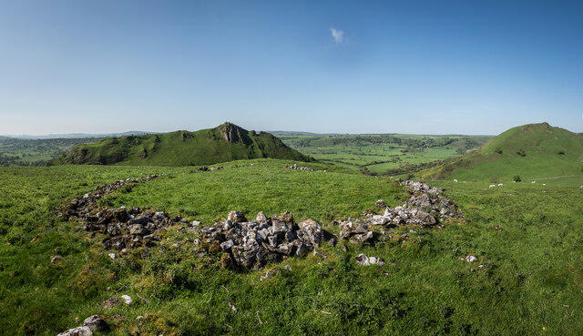 Photo could not load
SK0867 : Tumulus on Parkhouse hill North Top
Brian Deegan
Hill facts and local notes
Classifications
Elevation
362m
1,188 ft
Prominence
35m
Coordinates
53.2023, -1.8802
SK081672
OS Map
119
Explorer: OL24W
At the Summit
The summit is marked by a modest cairn and provides a wide panoramic view of the surrounding Peak District landscape.
Terrain & Geology
The area is predominantly limestone, characterised by dry stone walls and open pastures, which are remnants of glacial activity during the last Ice Age.
Views & Scenery
From the summit, you can catch breathtaking views of the surrounding hills, including Chrome Hill and the grassy uplands of the Peak District.
History & Heritage
Name Origin
The name ‘Parkhouse’ likely derives from the historical use of the area, as 'park' refers to an enclosed area for preserving wildlife or livestock.
Historical Significance
The hill is part of the rich geological and cultural tapestry of the Peak District, closely associated with agriculture and local folklore.
Getting There & Facilities
Parking
There is a small car park at Hollinsclough. Be sure to arrive early to nab a space, especially on weekends!
Public Transport
Buses run occasionally from Buxton; check local schedules for current times.
Nearby Facilities
There are no facilities immediately on the hill; however, the town of Buxton offers cafes, restaurants, and public toilets.
Safety Information
Known Hazards
- Watch for loose stones on paths and potential slippery spots in wet weather.
General Safety Tips
- Check weather conditions before setting out
- Carry appropriate clothing and equipment
- Let someone know your planned route
- Take a map, compass, and GPS device
- Carry emergency supplies: food, water, first aid kit, torch
Hills
Some common questions about the hills answered
Are there group walks up Parkhouse Hill North Top?
Many walkers use Walkmates to join or organise walks with others. You can check for group walks around Parkhouse Hill North Top through the maps
Are there other walkers around Parkhouse Hill North Top?
Activity varies by location and time, but Walkmates lets you see whether others have shared walks or shown interest in this area. Find other people through the walking friends search walking friends for Parkhouse Hill North Top search or of course create your own walk for Parkhouse Hill North Top
Can I organise a walk to Parkhouse Hill North Top?
Yes. If there aren’t any walks listed already, you can create a walk and make it available for others to join.
If you're signed up to Walkmates, you can create a walk to Parkhouse Hill North Top.
How do I find a walk up this hill?
There are often multiple ways to walk this hill, depending on experience and route preference. Walkmates helps you explore walks and routes that others have shared.
Can I suggest a new route up Parkhouse Hill North Top?
Yes. You can suggest or create routes to share with others. Walkmates focuses on the social side of walking, so routes are used to help people organise walks and explore areas together, rather than as detailed navigation tools or route libraries.
Other uses really appreciate knowledgeable walkers sharing their routes. Share your favourite route to Parkhouse Hill North Top here
The is an error or something incorrect about this hill. How do I let you know?
We always strive to keep the information on Walkmates as accurate as possible. If you find an error, please let us know through the contact form and we'll aim to correct it as quickly as possible
Community Discussion
Comments
Location
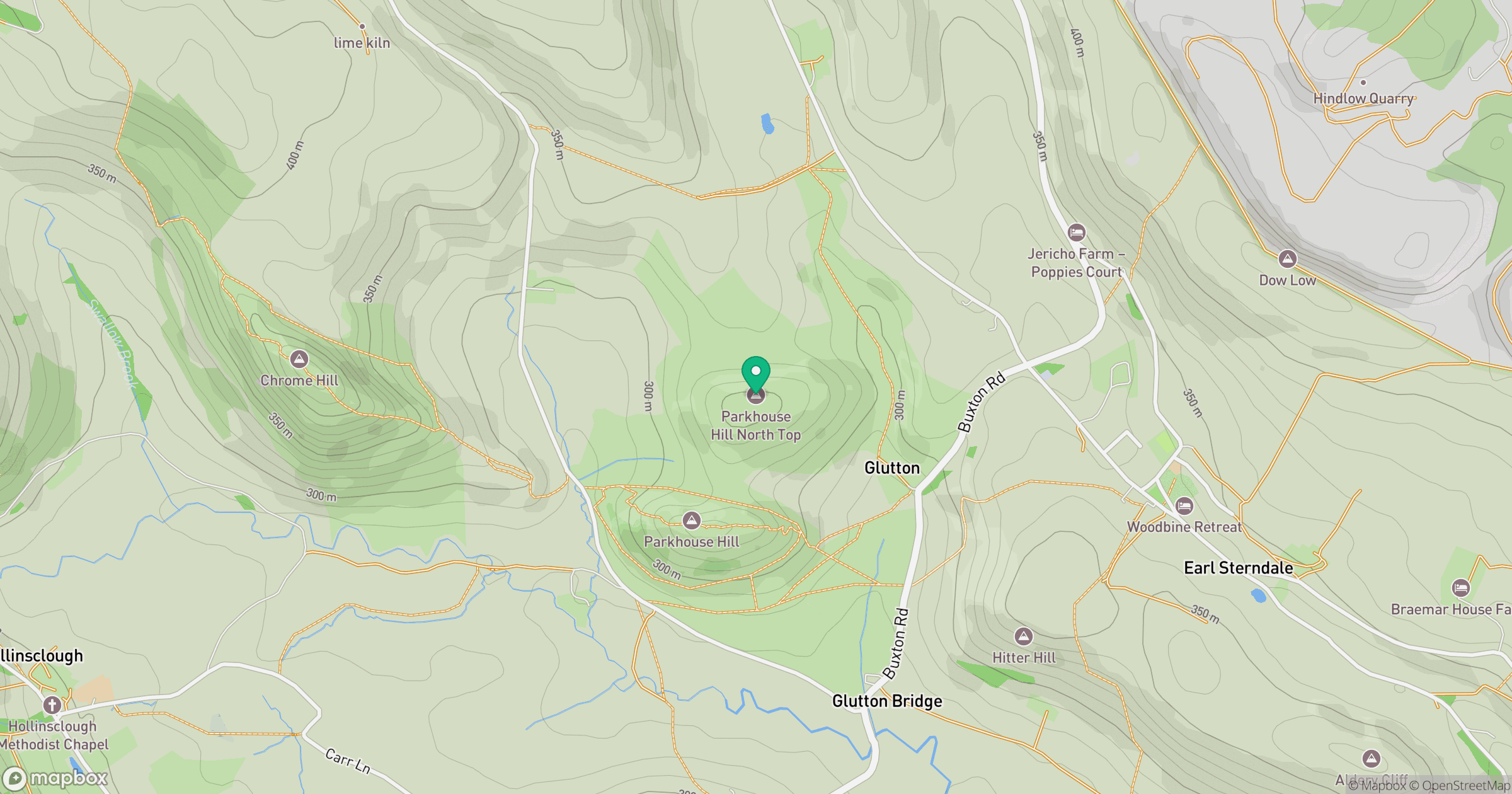
Grid reference: SK081672
View on OpenStreetMapOpens a map in a new tab, centred on the hill.
Nearby Hills
The Roaches
505m

Kinder Scout
636m
Rombalds Moor [Ilkley Moor]
402m
Winter Hill
456m

Pendle Hill
557m
No comments yet. Be the first.