
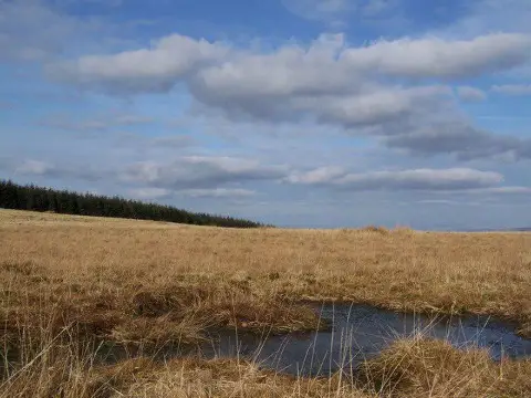
Mynydd Pencarreg
Good walks are even better shared.
Overview
Mynydd Pencarreg: A Hidden Gem in the Brecon Beacons
Nestled within the breathtaking Brecon Beacons National Park, Mynydd Pencarreg stands proud at an elevation of 530 meters. As a Marilyn, it offers a challenging yet rewarding experience for hikers seeking quieter trails away from the crowds.
Geology
The mountain is a testament to millions of years of geological activity. Predominantly made up of sedimentary rocks, you'll tread on ancient sandstones and mudstones as you make your way to the summit. A fascinating site for geology enthusiasts, the layers tell a story that dates back to the Mesozoic era.
Routes
The Mynydd Pencarreg Circular Route is the most popular among walkers. Spanning 8.5 km, this moderate trek typically takes around 3.5 hours. Starting from the charming village of Pencarreg, the path meanders through lush farmlands and offers spectacular vistas at every turn.
Summit Features
Upon reaching the summit, you'll be greeted by a trig point that serves as a sight for sore eyes after your ascent. The area is rich with heather and blueberries, with sheep often claiming their territory on the nearby slopes, adding to the charming countryside ambience.
Terrain
Make sure you're equipped for a variety of terrain! You'll encounter grassy fields, rocky outcrops, and the occasional bog—perfect for testing your balance and bravery.
Views
From the summit, you'll enjoy stunning panoramic views of the surrounding landscape. On a clear day, the beauty of the Cambrian Mountains and even the distant peaks of Snowdonia will leave you breathless—though not as breathless as that final ascent!
Best Seasons for Views
For the best visibility, spring and early autumn are ideal times to visit. The vibrant colours and clearer skies will enhance your photographic opportunities, so be sure to pack that camera!
Hazards
As with all adventures in the outdoors, caution is key. Keep an eye on the ever-changing weather, as it can turn from sunny to ‘as gloomy as a Monday morning’ in the blink of an eye. Also, watch your footing on slippery rocks and keep your boots above the bogs—your feet will thank you!
Nearby Summits
If you're feeling adventurous, consider exploring nearby summits like Mynydd Mallaen (521 meters) and Mynydd Trefeglwys (496 meters). Each offers their own unique views and experiences.
Access
The journey begins at Pencarreg, where you can find free parking about 2 km from the trailhead. If you're relying on public transport, the local bus from Llandovery is a solid option.
Facilities
There aren’t any facilities atop Mynydd Pencarreg, but don't fret! Llandovery is just around the corner, offering numerous cafes, pubs, and necessary amenities, ensuring you can refuel after your adventure.
History
The name Mynydd Pencarreg translates beautifully to 'the mountain of the headland.' This was likely derived from its elevated and prominent landscape position.
Rich in history, this area has been settled since prehistoric times, with remnants of ancient burial mounds still visible.
So there you have it—everything you need to conquer Mynydd Pencarreg while enjoying some of the best Wales has to offer. Happy hiking, and remember: every mountain climbed is a story waiting to be told!
Explore routes near Mynydd Pencarreg
Public walks starting within 80 km of this hill. Nearby does not mean a route reaches the summit; check its map and access before setting out.
Dolaucothi Estate: Cothi Valley and Red Waymarked Circuit
View route
Llanerchaeron: Lanlas, Aberaeron and Aeron Valley circular
View route
Abergwili to Nantgaredig: Tywi Valley Path out and back
View route
Usk Reservoir: Glasfynydd Forest and Dam Circuit
View route
Route planning notes
These notes describe possible approaches, not verified navigable routes or permission to cross land. Check current paths, local access rules and conditions before setting out.
Mynydd Pencarreg Circular Route
A scenic circular walk starting from the village of Pencarreg, following footpaths and farmland.
Make a day of it, together
Find someone to share the walk with, or organise a day out along a route you like.
Photo Gallery
View all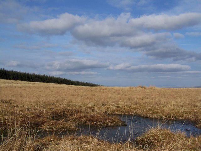 Photo could not load
SN5743 : Boggy ground on Mynydd Pencarreg
Dan Gregory
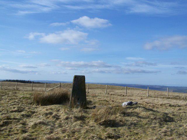 Photo could not load
SN5743 : Mynydd Pencarreg triangulation pillar
Dan Gregory
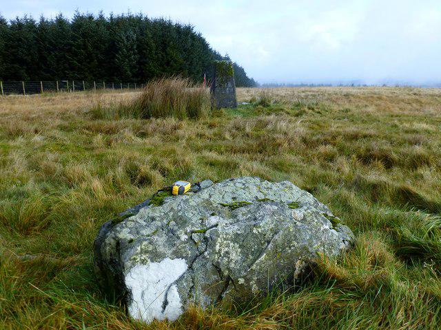 Photo could not load
SN5743 : Mynydd Pencarreg
Rude Health
Hill facts and local notes
Classifications
Elevation
415m
1,362 ft
Prominence
139m
Coordinates
52.0690, -4.0795
SN575432
OS Map
146
Explorer: 186 199
At the Summit
The summit features a prominent trig point, surrounded by a rugged walking area with heather and bilberry bushes. On a clear day, you might even see some sheep eyeing you suspiciously.
Terrain & Geology
Mynydd Pencarreg is primarily composed of sedimentary rocks, notably sandstones and mudstones. These layers date from the Mesozoic era, offering a rich geological history underfoot.
Views & Scenery
Panoramic views of the surrounding hills, the Cambrian Mountains to the north, and if you squint just right, maybe even a glimpse of Mount Snowdon.
History & Heritage
Name Origin
The name Mynydd Pencarreg translates to 'the mountain of the headland' in Welsh, hinting at its prominent position in the landscape.
Historical Significance
Historically, the area has seen settlements since prehistoric times and is rich in archaeological sites, including ancient burial mounds.
Getting There & Facilities
Check current local access restrictions, parking rules and transport timetables before travelling. These notes do not confirm public access to the summit.
Parking
Free parking is available at the village of Pencarreg, located about 2 km from the trailhead.
Public Transport
The nearest bus service comes to Pencarreg on the Towy Valley route. Check local bus schedules for updates.
Nearby Facilities
While there are no facilities directly on Mynydd Pencarreg, Llandovery offers pubs, cafes, and public toilets for pre- and post-hike essential comfort.
Safety Information
Known Hazards
- Beware of sudden weather changes typical of the region, the odd slippery rock, and don’t forget to watch your step around the bogs!
General Safety Tips
- Check weather conditions before setting out
- Carry appropriate clothing and equipment
- Let someone know your planned route
- Take a map, compass, and GPS device
- Carry emergency supplies: food, water, first aid kit, torch
Hills
Some common questions about the hills answered
Are there group walks up Mynydd Pencarreg?
Many walkers use Walkmates to join or organise walks with others. You can check for group walks around Mynydd Pencarreg through the maps
Are there other walkers around Mynydd Pencarreg?
Activity varies by location and time, but Walkmates lets you see whether others have shared walks or shown interest in this area. Find other people through the walking friends search walking friends for Mynydd Pencarreg search or of course create your own walk for Mynydd Pencarreg
Can I organise a walk to Mynydd Pencarreg?
Yes. If there aren’t any walks listed already, you can create a walk and make it available for others to join.
If you're signed up to Walkmates, you can create a walk to Mynydd Pencarreg.
How do I find a walk up this hill?
There are often multiple ways to walk this hill, depending on experience and route preference. Walkmates helps you explore walks and routes that others have shared.
Can I suggest a new route up Mynydd Pencarreg?
Yes. You can suggest or create routes to share with others. Walkmates focuses on the social side of walking, so routes are used to help people organise walks and explore areas together, rather than as detailed navigation tools or route libraries.
Other uses really appreciate knowledgeable walkers sharing their routes. Share your favourite route to Mynydd Pencarreg here
The is an error or something incorrect about this hill. How do I let you know?
We always strive to keep the information on Walkmates as accurate as possible. If you find an error, please let us know through the contact form and we'll aim to correct it as quickly as possible
Community Discussion
Comments
Location
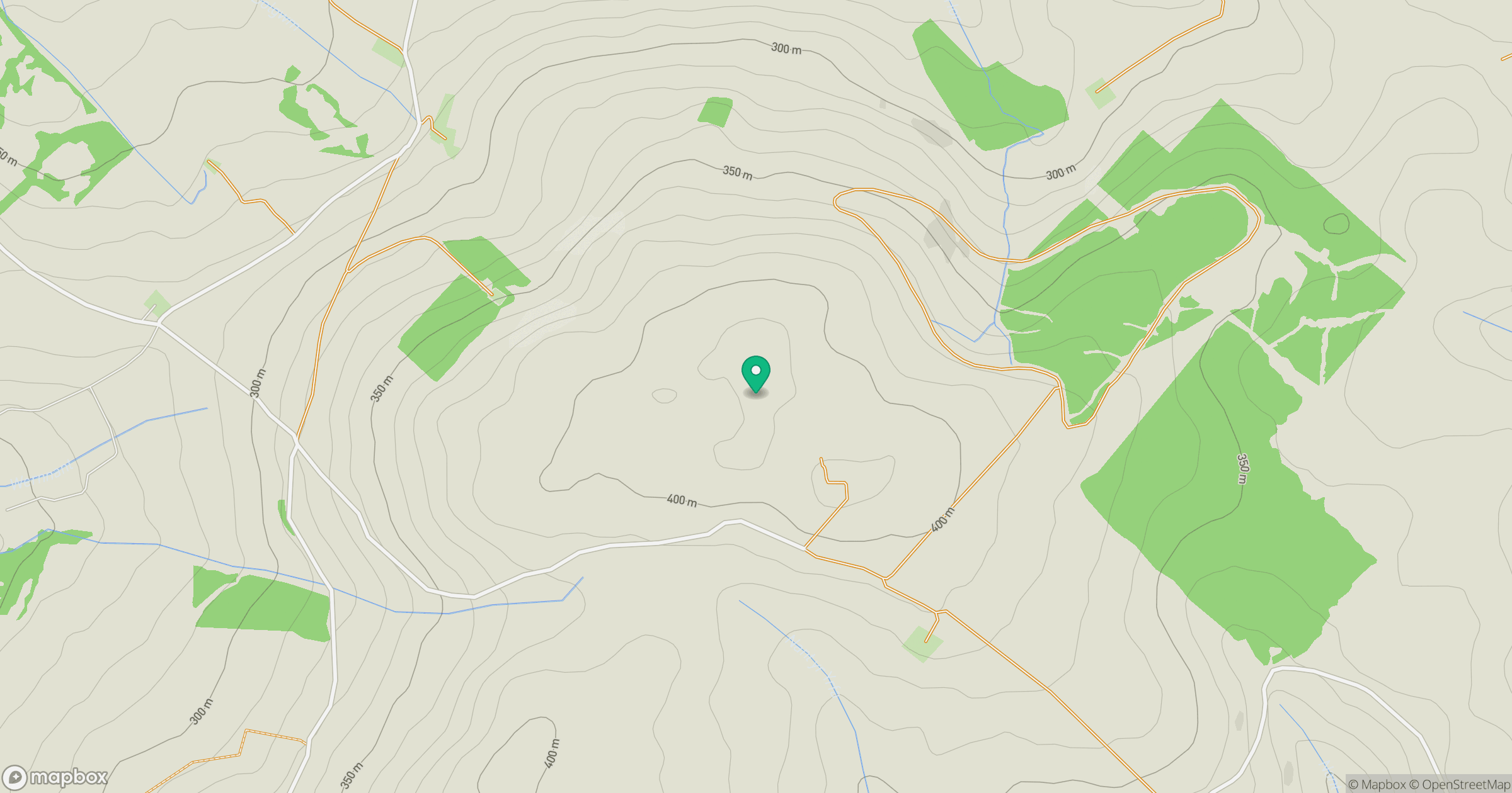
Grid reference: SN575432
View on OpenStreetMapOpens a map in a new tab, centred on the hill.
Hills within 30 km
Straight-line distance, not a walking route or confirmation of access.
Banc Cwm-coed-ifor
308m
Mynydd Llanybyther
409m
Allt Maestir
278m
Banc Beili-Tew
278m
Mynydd Figyn
328m
No comments yet. Be the first.