
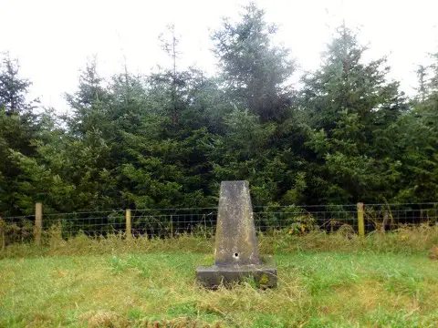
Allt Maestir
Good walks are even better shared.
Overview
Allt Maestir: A Hidden Gem in Snowdonia
Nestled in the stunning Snowdonia National Park, Allt Maestir stands tall among its peers, clocking in at an elevation of 568 meters. Despite its relatively modest height, it offers an unmissable adventure for any hiker eager to soak in the Scottish splendour.
Geology
What makes Allt Maestir unique is its Old Red Sandstone geology. This ancient rock gives rise to fascinating formations and is a treat for geology buffs eager to explore the planet's history, one stone at a time. Just be careful, or the rocks might just tell you their secrets!
Routes
There are a couple of popular routes to choose from. The Start of the A5 is a delightful and gradual ascent, taking about 2.5 hours to cover 4.5 km. For those seeking a bit more challenge, try the Minffordd Track, where you’ll tackle some steep sections and traverse through marvelous woodlands.
Summit Features
Reaching the summit rewards you with a robust cairn ready for your triumphant photograph—you might even be tempted to throw your hands in the air as if you just don’t care! 🤳
Terrain Type
The terrain is rocky, with surprises like grassy patches and bogs that might make you reconsider which shoes you wore today. Good hiking boots are a must, or you might find your feet getting a little too acquainted with the local marshes.
Views
From the top, the views are nothing short of spectacular. On a clear day, the Ogwen Valley unfolds before you, with the majestic Snowdon looming in the distance. The best times for optimal visibility? Late spring and early autumn—because who doesn’t enjoy a clear horizon and crisp air?
Hazards
As with anywhere in nature, Allt Maestir has its hazards. It can be slippery when wet, so keep your wits about you! Plus, sudden weather changes could send you scuttling for cover (or the nearest pub). And don’t forget about our furry four-legged friends—local sheep might take a keen interest in your sandwiches!
Access
Parking is available at the side of the A5, just before Capel Curig. Time your visit wisely, as these spots can fill up faster than you can say 'hiker's paradise'. If you're relying on public transport, buses from Betws-y-Coed are at your service but keep an eye on the quirky schedules.
Facilities
Capel Curig has charming cafes and handy public toilets, so be sure to refuel before or after your trek. No one wants to hike on an empty stomach!
History
The name Allt Maestir, meaning 'The slope of the master', adds a dash of mystique to your hike. The area is steeped in local folklore, making it not just a physical journey but also a cultural one.
In conclusion, Allt Maestir may not be the tallest peak, but it surely offers a hearty dose of adventure, stunning views, and a stronger connection to the natural world, leaving you with memories to cherish.
Happy hiking and don't forget to wear your Sunday best boots!
Explore routes near Allt Maestir
Public walks starting within 80 km of this hill. Nearby does not mean a route reaches the summit; check its map and access before setting out.
Llanerchaeron: Lanlas, Aberaeron and Aeron Valley circular
View route
Dolaucothi Estate: Cothi Valley and Red Waymarked Circuit
View route
Ystwyth Trail: Black Covert to Llanilar and back
View route
Abergwili to Nantgaredig: Tywi Valley Path out and back
View route
Route planning notes
These notes describe possible approaches, not verified navigable routes or permission to cross land. Check current paths, local access rules and conditions before setting out.
Start of the A5
A gradual ascent through lush greenery leading to the rocky summit.
Minffordd Track
A well-marked path that winds through delightful woodland before heading upwards.
Make a day of it, together
Find someone to share the walk with, or organise a day out along a route you like.
Photo Gallery
View all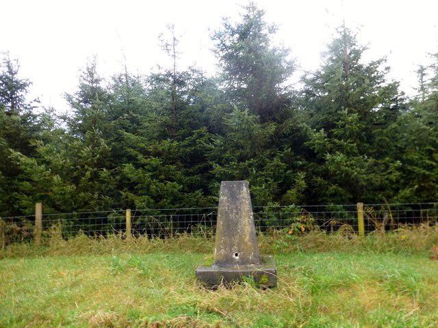 Photo could not load
SN5450 : Allt Maestir Summit Trig
Rude Health
Hill facts and local notes
Classifications
Elevation
278m
911 ft
Prominence
102m
Coordinates
52.1336, -4.1239
SN547504
OS Map
146
Explorer: 199
At the Summit
At the summit, you'll find a sturdy cairn, which is perfect for that iconic photo-op. If the wind is right, you may even hear your own echoes of triumph.
Terrain & Geology
The hills are primarily composed of Old Red Sandstone, which has weathered into a whimsical array of shapes and sizes. You might find yourself gazing at some rather unusual rock formations if you keep your eyes peeled.
Views & Scenery
Breathtaking views of the Ogwen Valley, Snowdon in the distance, and, if you're lucky, the soft sound of local sheep bleating in approval.
History & Heritage
Name Origin
The name 'Allt Maestir' roughly translates to 'The slope of the master', possibly hinting at its regal stature in the landscape.
Historical Significance
This area has been significant for local folklore, and legends abound regarding its natural beauty and hidden treasures.
Getting There & Facilities
Check current local access restrictions, parking rules and transport timetables before travelling. These notes do not confirm public access to the summit.
Parking
Parking available at the side of the A5 road before reaching Capel Curig. Limited spots, so arrive early to snag one.
Public Transport
Buses run regularly from Betws-y-Coed to Capel Curig, but be mindful of the timetable – they have a few quirks of their own.
Nearby Facilities
There are local cafes and public toilets in Capel Curig, ideal for a pre-hike caffeine fix or a post-hike treat.
Safety Information
Known Hazards
- Slippery rocks when wet, sudden weather changes, and the occasional enthusiastic sheep may create unexpected obstacles.
General Safety Tips
- Check weather conditions before setting out
- Carry appropriate clothing and equipment
- Let someone know your planned route
- Take a map, compass, and GPS device
- Carry emergency supplies: food, water, first aid kit, torch
Hills
Some common questions about the hills answered
Are there group walks up Allt Maestir?
Many walkers use Walkmates to join or organise walks with others. You can check for group walks around Allt Maestir through the maps
Are there other walkers around Allt Maestir?
Activity varies by location and time, but Walkmates lets you see whether others have shared walks or shown interest in this area. Find other people through the walking friends search walking friends for Allt Maestir search or of course create your own walk for Allt Maestir
Can I organise a walk to Allt Maestir?
Yes. If there aren’t any walks listed already, you can create a walk and make it available for others to join.
If you're signed up to Walkmates, you can create a walk to Allt Maestir.
How do I find a walk up this hill?
There are often multiple ways to walk this hill, depending on experience and route preference. Walkmates helps you explore walks and routes that others have shared.
Can I suggest a new route up Allt Maestir?
Yes. You can suggest or create routes to share with others. Walkmates focuses on the social side of walking, so routes are used to help people organise walks and explore areas together, rather than as detailed navigation tools or route libraries.
Other uses really appreciate knowledgeable walkers sharing their routes. Share your favourite route to Allt Maestir here
The is an error or something incorrect about this hill. How do I let you know?
We always strive to keep the information on Walkmates as accurate as possible. If you find an error, please let us know through the contact form and we'll aim to correct it as quickly as possible
Community Discussion
Comments
Location
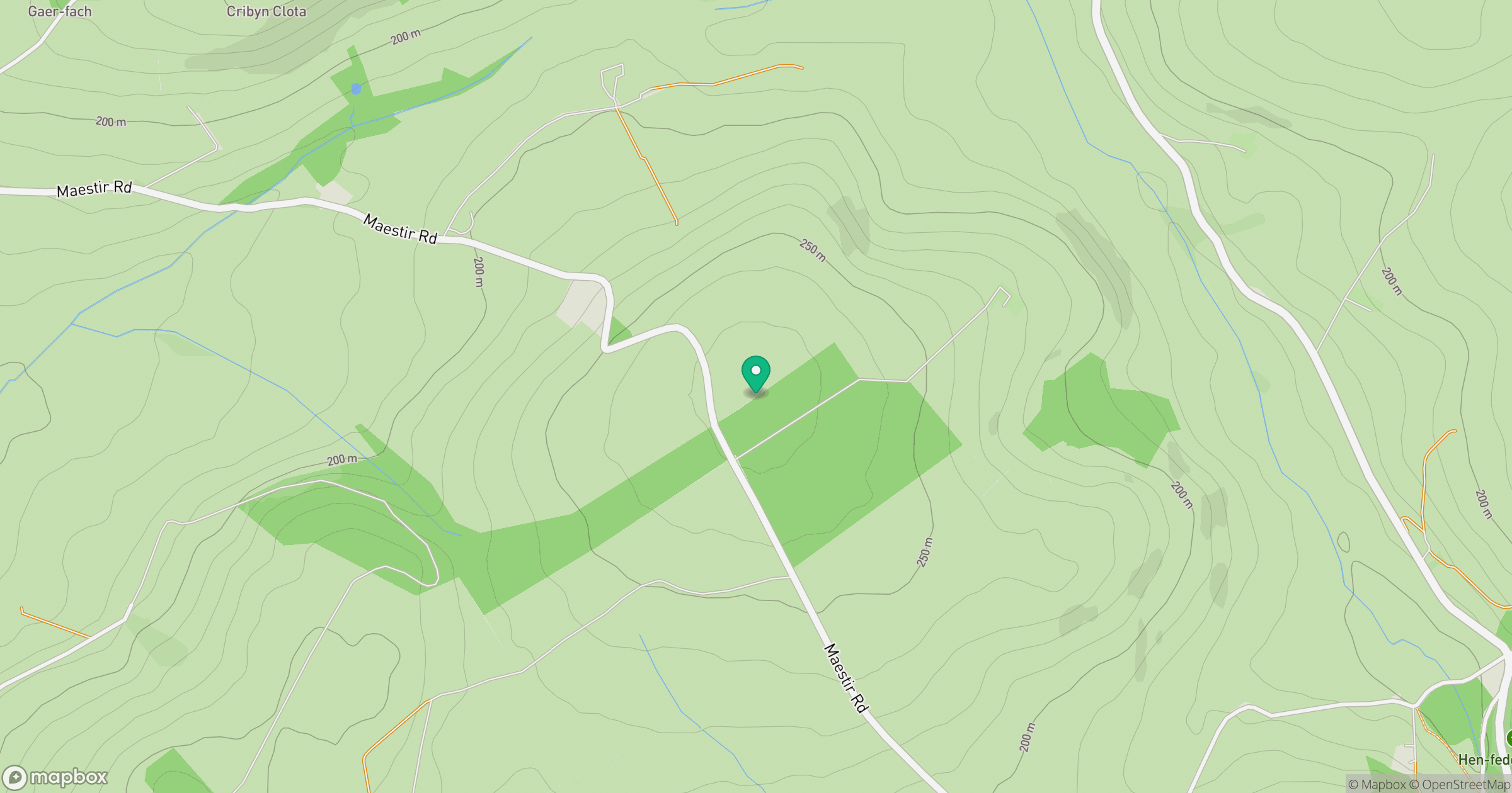
Grid reference: SN547504
View on OpenStreetMapOpens a map in a new tab, centred on the hill.
Hills within 30 km
Straight-line distance, not a walking route or confirmation of access.
Mynydd Pencarreg
415m
Mynydd Llanybyther
409m
Rhos Ymryson
323m
Banc Cwm-coed-ifor
308m
Banc Beili-Tew
278m
No comments yet. Be the first.