

Mynydd Gellionnen
Good walks are even better shared.
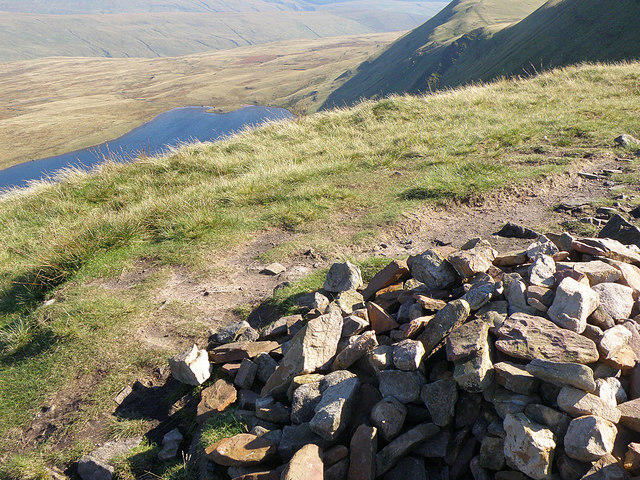
SN7004 : On top of Gellionnen - an Uncommon Common
Nigel Davies Photo source
Overview
Mynydd Gellionnen: A Hiker's Delight
Nestled within the breathtaking Brecon Beacons, Mynydd Gellionnen stands tall at 776 meters. This striking mountain showcases the rugged beauty of South Wales and offers a variety of hiking opportunities that will leave you buzzing with joy. After all, there’s no better cure for a busy mind than a good hike!
Geology
Stepping onto Mynydd Gellionnen is like walking back in time. The mountain is formed from sedimentary rocks such as mudstones and sandstones. These rocky layers tell a tale of ancient oceans that once covered this land.
Routes
One of the most popular routes starts at Clydach Vale. Spanning approximately 6.5 km, this moderate trail winds its way up to the summit, taking about 2.5 hours to complete. If you’re looking for a workout while soaking in jaw-dropping views, this path is perfect for you!
Summit Features
Upon reaching the summit, hikers are greeted with a green and pleasant view that has a cheeky trig point waiting for a snapshot. Grab a photo, and you might just capture the essence of Welsh hiking—invigorating, uplifting, and a little muddy!
Terrain Type
The terrain is predominantly grassy but has its fair share of rocky outcrops and boggy patches. It’s a splendid reminder of Wales’ diverse landscapes, so good hiking boots are essential. Just think of hiking Mynydd Gellionnen as a great way to keep your ankles on their toes!
Views
The views from the summit are the stuff of Instagram dreams! You can catch sights of the Brecon Beacons stretching endlessly and the Black Mountains holding court in the distance. Spring and autumn provide the best opportunities to witness the scenery in its full glory—just make sure your camera is charged!
Hazards
While the hike is incredibly rewarding, do stay vigilant. Weather can change in the blink of an eye in this region, and the terrain can be slippery, particularly after the rain. Avoid trying to be a mountain goat!
Access
For those looking to drive, Clydach Vale car park is your best bet. If you prefer public transport, a bus from nearby Merthyr Tydfil will drop you close to the entry point, where the adventure begins.
Facilities
While you won't find service stations atop Mynydd Gellionnen, Clydach does have a few friendly cafes and pubs to replenish lost calories after your hike and swap war stories with fellow adventurers.
History
The name 'Mynydd Gellionnen' is a nod to its Welsh roots and carries historical weight, with evidence of ancient settlements in the area. This mountain isn’t just a physical challenge; it’s also a gateway to the rich tapestry of history that Wales has to offer.
Conclusion
Whether you’re new to hiking or a seasoned pro, Mynydd Gellionnen is a grand adventure waiting for you to tackle its slopes. Grab your walking boots, a packed lunch, and perhaps a quirky hat for good measure, and don’t forget to enjoy the journey as much as the destination!
Happy hiking!
Explore routes near Mynydd Gellionnen
Walks starting near this hill. Open a route to check its map, distance and full itinerary.
Swansea Canal: Coed Gwilym Park to Pontardawe Aqueduct
View route
Ammanford Walk with Men Walking & Talking
View route
Swansea Clyne Valley Railway Walk: Blackpill to Dunvant
View route
Llanelli warden-led wildlife walk
View route
Route planning notes
These notes describe possible approaches. Check a route's map and access information when planning your walk.
Clydach Vale Via Gellionnen
A popular route starting from Clydach Vale providing an excellent ascent to the summit with scenic views along the way.
Make a day of it, together
Find someone to share the walk with, or organise a day out along a route you like.
Photo Gallery
View all Photo could not load
SN7004 : On top of Gellionnen - an Uncommon Common
Nigel Davies
Hill facts and local notes
Classifications
Elevation
268m
879 ft
Prominence
59m
Coordinates
51.7276, -3.8771
SN704048
OS Map
170
Explorer: 165
At the Summit
The summit features a prominent trig point, which serves as a great photo opportunity, particularly against the backdrop of the expansive views.
Terrain & Geology
Mynydd Gellionnen comprises sedimentary rocks, predominantly mudstones and sandstones, which are characteristic of the South Wales region. The rugged terrain and rock formations tell the geological history of the area, providing a window into ancient sea floors.
Views & Scenery
From the summit, one can enjoy panoramic views of the Brecon Beacons, the distant Black Mountains, and on a clear day, the Severn Estuary can be seen.
History & Heritage
Name Origin
The name 'Mynydd Gellionnen' translates to 'Hill of Gellionnen', where 'Mynydd' is Welsh for 'mountain'.
Historical Significance
Historically, the region has been utilised for grazing and has traces of ancient settlement, with the landscape narrating stories of the past.
Getting There & Facilities
Parking
Park at Clydach Vale car park, with adequate spaces and access to trails. Please ensure not to block entrances.
Public Transport
Local buses operate from nearby towns such as Merthyr Tydfil, providing access to Clydach.
Nearby Facilities
There are no facilities directly on the mountain, but in Clydach, you’ll find pubs and cafes to rest and refuel after your hike.
Safety Information
Known Hazards
- Be cautious of sudden weather changes, steep drops, and slippery terrain, particularly after rainfall.
General Safety Tips
- Check weather conditions before setting out
- Carry appropriate clothing and equipment
- Let someone know your planned route
- Take a map, compass, and GPS device
- Carry emergency supplies: food, water, first aid kit, torch
Hills
Some common questions about the hills answered
Are there group walks up Mynydd Gellionnen?
Many walkers use Walkmates to join or organise walks with others. You can check for group walks around Mynydd Gellionnen through the maps
Are there other walkers around Mynydd Gellionnen?
Activity varies by location and time, but Walkmates lets you see whether others have shared walks or shown interest in this area. Find other people through the walking friends search walking friends for Mynydd Gellionnen search or of course create your own walk for Mynydd Gellionnen
Can I organise a walk to Mynydd Gellionnen?
Yes. If there aren’t any walks listed already, you can create a walk and make it available for others to join.
If you're signed up to Walkmates, you can create a walk to Mynydd Gellionnen.
How do I find a walk up this hill?
There are often multiple ways to walk this hill, depending on experience and route preference. Walkmates helps you explore walks and routes that others have shared.
Can I suggest a new route up Mynydd Gellionnen?
Yes. You can suggest or create routes to share with others. Walkmates focuses on the social side of walking, so routes are used to help people organise walks and explore areas together, rather than as detailed navigation tools or route libraries.
Other uses really appreciate knowledgeable walkers sharing their routes. Share your favourite route to Mynydd Gellionnen here
The is an error or something incorrect about this hill. How do I let you know?
We always strive to keep the information on Walkmates as accurate as possible. If you find an error, please let us know through the contact form and we'll aim to correct it as quickly as possible
Community Discussion
Comments
Location
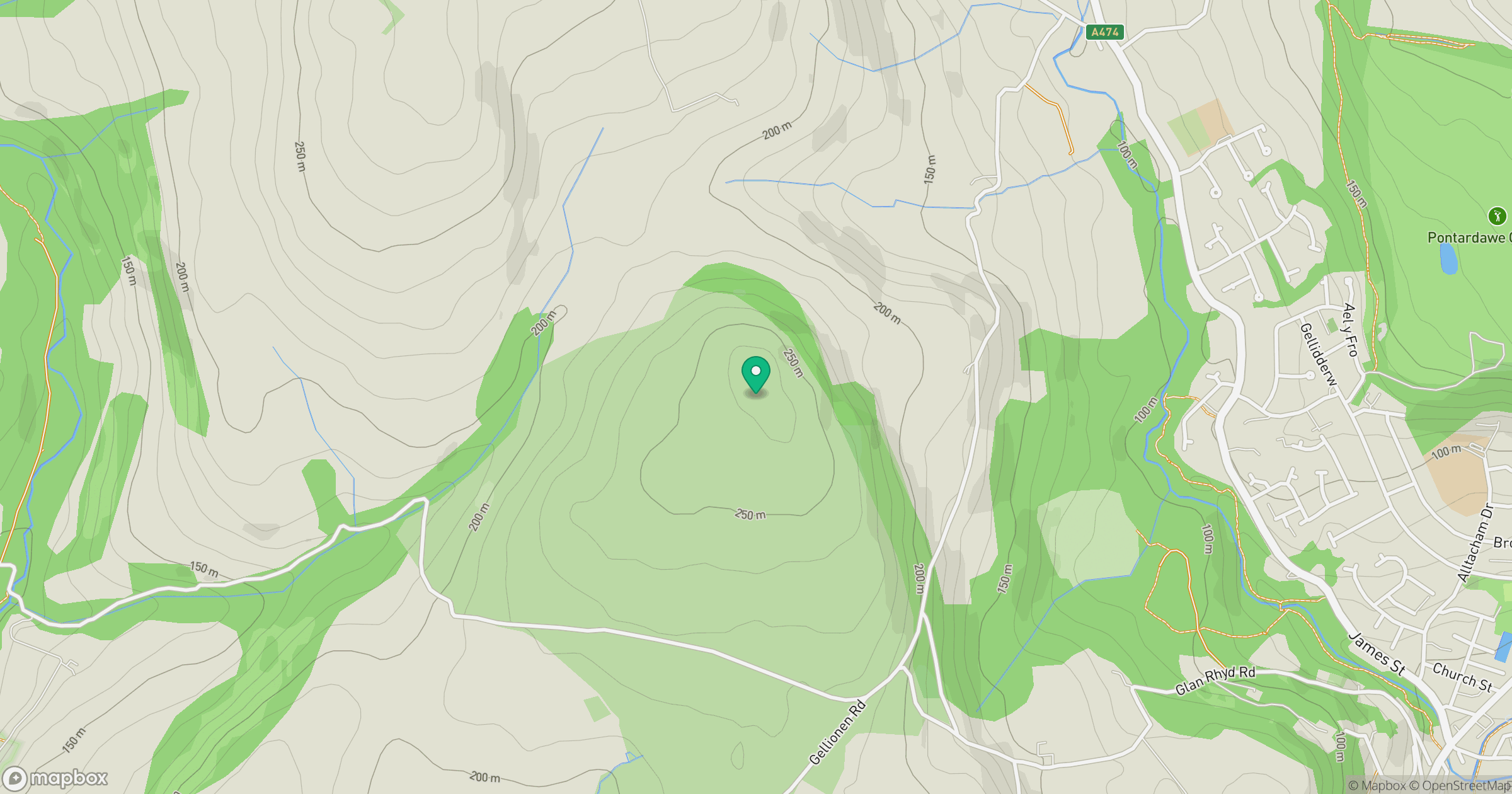
Grid reference: SN704048
View on OpenStreetMapOpens a map in a new tab, centred on the hill.
No comments yet. Be the first.