

Mullach Fraoch-choire
Good walks are even better shared.
NH0917 : Summit cairn and windbreak on Mullach Fraoch-choire
Eric Gunstensen Photo source
Overview
Mullach Fraoch-choire: A Hiker's Delight
Introduction
Nestled in the majestic Scottish Highlands, Mullach Fraoch-choire is a classic Munro that beckons adventurous souls. With its elevation of 946 meters, it offers challenges and breathtaking scenery for hikers of all stripes.
Geology
Mullach Fraoch-choire boasts ancient Lewisian Gneiss, which is essentially the rock equivalent of a vintage wine—20 generations old and still kicking! These rugged slopes offer both challenges and stunning landscapes, making each step feel like a proud stride through history.
Routes
Two popular routes lead to the summit:
- East Ridge Route: This moderate trek takes you along the breathtaking East Ridge, revealing stunning panoramic views, especially as you near the top. Expect a little bit of everything: ascents, rocky paths, and some fantastic photo ops!
- Cirque of Munro Route: For those who fancy a tougher challenge, the Cirque route is ideal. It's perfect for seasoned hikers looking to tackle something more adventurous (and hide from the masses).
Summit Features
As you approach the summit, you’ll be greeted by a large cairn that’s practically begging for a selfie or two. Take a moment to catch your breath—after all, it’s not every day you conquer a Munro!
Terrain and Views
The terrain here is a mix of rocky outcrops, soft grassy slopes, and the odd bog to keep you on your toes. On a clear day, the glorious sights stretch to Loch Ness and far beyond. Don’t forget to bring your binoculars; who knows what creatures lurk in the depths?
Hazards
Always keep your wits about you! Be aware of sudden weather changes and those loose rocks waiting to trip you up. It pays to be cautious—nobody likes a soggy bottom!
Nearby Summits
While Mullach Fraoch-choire is a gem on its own, nearby Sgurr na Lapaich and Mullach Coire Mhic Fhearchair offer further adventures worthy of exploration.
Access
The nearest parking lot gives you convenient access to your chosen trailhead. Just a short drive from Drumnadrochit, you’ll find a couple of cafes there to fuel your adventure. Remember, public transport is an option, but not the most convenient one—so, if possible, bring your own wheels!
Conclusion
In summary, Mullach Fraoch-choire is not just a walk in the park; it’s a rewarding trek perfect for those seeking a blend of adventure, stunning views, and a good workout (that certainly counts for something in the grand scheme of things!). Don't forget to wear sensible footwear and pack enough snacks — an empty stomach can turn even the best views sour!
Happy hiking!
Explore routes near Mullach Fraoch-choire
Walks starting near this hill. Open a route to check its map, distance and full itinerary.
Glen Affric: Coire Loch Woodland Trail
View route
Fort Augustus to Kytra Lock: Caledonian Canal Towpath
View route
Banavie to Glen Loy Aqueduct: Neptune’s Staircase Canal Towpath
View route
Beinn Eighe Lancaster Wreckage at Coire Mhic Fhearchair
View route
Route planning notes
These notes describe possible approaches. Check a route's map and access information when planning your walk.
East Ridge Route
This route begins from the north side near the car park and ascends the picturesque East Ridge, offering stunning views as you climb.
Cirque of Munro Route
An alternative route that traverses around the cirque, providing a mix of scenic trails and bouldery sections.
Make a day of it, together
Find someone to share the walk with, or organise a day out along a route you like.
Photo Gallery
View all Photo could not load
NH0917 : Summit cairn and windbreak on Mullach Fraoch-choire
Eric Gunstensen
 Photo could not load
NH0917 : Rocks at summit area of Mullach Fraoch-choire
Trevor Littlewood
 Photo could not load
NH0917 : Summit Cairn on Mullach Fraoch-choire
Alan Hodgson
 Photo could not load
NH0917 : Mullach Fraoch-choire summit
John Allan
 Photo could not load
NH0917 : Summit cairn and shelter, Mullach Fraoch-choire
Craig Wallace
 Photo could not load
NH0917 : Cairn on Mullach Fraoch-choire
Steven Brown
 Photo could not load
NH0917 : Mullach Fraoch-choire summit
Tim Denvir
 Photo could not load
NH0917 : Mullach midge attack!
Karl and Ali
Hill facts and local notes
Classifications
Elevation
1,101m
3,612 ft
Prominence
151m
Coordinates
57.2054, -5.1556
NH094171
OS Map
33
Explorer: 414N
At the Summit
The summit is marked by a large cairn, which makes for an excellent photo opportunity and a perfect spot to catch your breath (or your lunch, if you’ve packed it!).
Terrain & Geology
Mullach Fraoch-choire is primarily composed of Lewisian Gneiss, one of the oldest rocks in the world, dating back over 3 billion years. This ancient rock is often schistose, yielding some spectacularly rugged terrain suitable for adventurous spirits.
Views & Scenery
From the summit, gaze upon Loch Ness and the surrounding glens, or try spotting Ben Nevis in the distance; if you squint hard enough, you might just convince yourself it’s waving back!
History & Heritage
Name Origin
The name 'Mullach Fraoch-choire' translates to 'Hill of Heather Hollow', reflecting its lush, heather-covered slopes which bloom vibrantly in late summer.
Historical Significance
This mountain holds cultural significance as part of the legend-laden landscape of the Highlands, connected with various folklore and historical tales.
Getting There & Facilities
Parking
There is a small car park located at NH086149, just off the main road, which provides necessary access to the start of the hiking routes.
Public Transport
The nearest bus stop is located in Drumnadrochit, approximately 10 miles away, with limited services. A car is highly recommended for easier access.
Nearby Facilities
You will find a couple of cafes and public toilets in Drumnadrochit, perfect for that pre-hike caffeine boost or a post-hike piece of cake.
Safety Information
Known Hazards
- Sudden weather changes can occur, resulting in poor visibility. Loose rocks on steep sections can also pose a risk, so watch your step!
General Safety Tips
- Check weather conditions before setting out
- Carry appropriate clothing and equipment
- Let someone know your planned route
- Take a map, compass, and GPS device
- Carry emergency supplies: food, water, first aid kit, torch
Hills
Some common questions about the hills answered
Are there group walks up Mullach Fraoch-choire?
Many walkers use Walkmates to join or organise walks with others. You can check for group walks around Mullach Fraoch-choire through the maps
Are there other walkers around Mullach Fraoch-choire?
Activity varies by location and time, but Walkmates lets you see whether others have shared walks or shown interest in this area. Find other people through the walking friends search walking friends for Mullach Fraoch-choire search or of course create your own walk for Mullach Fraoch-choire
Can I organise a walk to Mullach Fraoch-choire?
Yes. If there aren’t any walks listed already, you can create a walk and make it available for others to join.
If you're signed up to Walkmates, you can create a walk to Mullach Fraoch-choire.
How do I find a walk up this hill?
There are often multiple ways to walk this hill, depending on experience and route preference. Walkmates helps you explore walks and routes that others have shared.
Can I suggest a new route up Mullach Fraoch-choire?
Yes. You can suggest or create routes to share with others. Walkmates focuses on the social side of walking, so routes are used to help people organise walks and explore areas together, rather than as detailed navigation tools or route libraries.
Other uses really appreciate knowledgeable walkers sharing their routes. Share your favourite route to Mullach Fraoch-choire here
The is an error or something incorrect about this hill. How do I let you know?
We always strive to keep the information on Walkmates as accurate as possible. If you find an error, please let us know through the contact form and we'll aim to correct it as quickly as possible
Community Discussion
Comments
Location
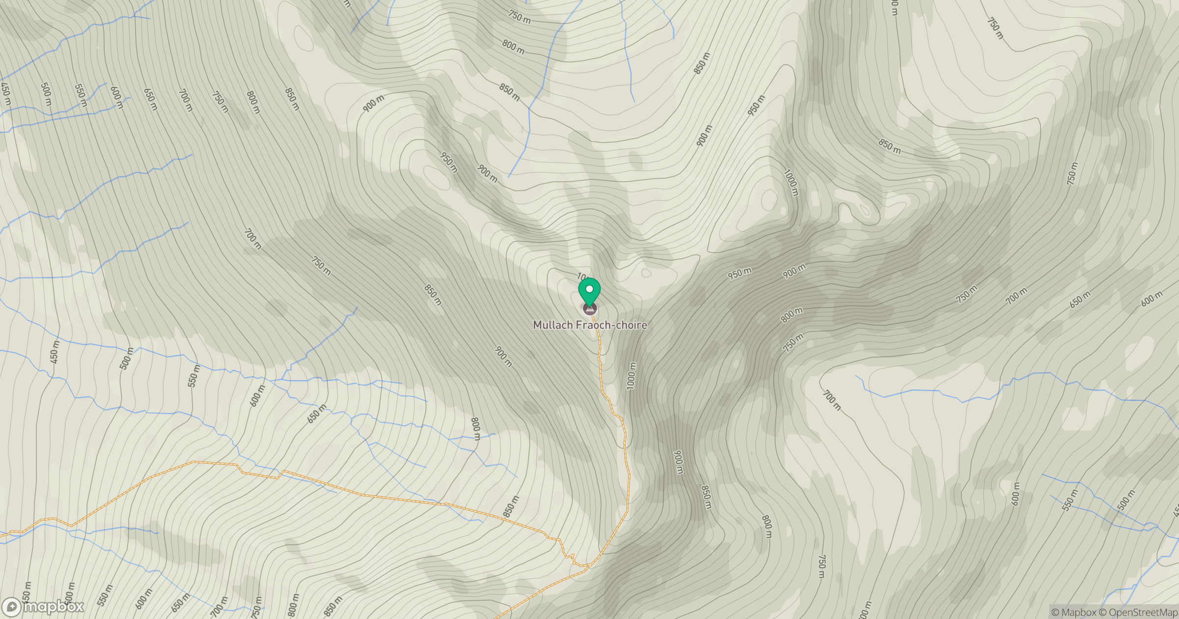
Grid reference: NH094171
View on OpenStreetMapOpens a map in a new tab, centred on the hill.
No comments yet. Be the first.