

Mullach a' Ghlinne
Good walks are even better shared.
Overview
Mullach a' Ghlinne
Mullach a' Ghlinne stands proudly at 972 meters, offering those brave enough to climb it some spectacular views. Located in the Scottish Highlands, today it gleams like a diamond when it catches the sunlight, though climb it on a cloudy day, and you might just find it playing hide and seek.
Geology
This Munro is proudly made up of granitic gneiss, a rock born out of fire and pressure, making it tough as nails. These ancient rocks can tell a tale of millions of years of Earth's history, and who wouldn’t want to walk on a page from such an epic tome?
Routes
The most popular route is the North West Ridge Route, stretching about 10.5 kilometers. It’s moderate, which means you won’t need to train for a marathon to start, but good hiking boots and a decent breakfast are advised.
Facilities
For those who like a bit of comfort before (or after) their hike, the Ben Lawers Visitor Centre has a delightful café and toilets. Fortify yourself with a slice of cake or a hot drink before you hit the trail.
Access
The adventure begins at the Ben Lawers Visitor Centre parking area. Just a heads up—spots can fill up quickly on a sunny day, so arrive early! If you’re relying on public transport, keep an eye on local bus schedules from nearby towns like Killin.
Summit Features
At the summit, you’ll find a rather chubby cairn perfect for photoshoots. Don’t forget to strike your best pose before the wind steals your hat!
Views
Prepare your camera because the views from the top are nothing short of stunning. On a clear day, the Ben Lawers range, Loch Tay, and even the distant Ben Nevis will unfurl before your eyes. The golden hour—the time just before sunset—is particularly magical, casting a warm glow over the hills.
Nearby Summits
Mullach a' Ghlinne plays nice with its neighbors, including Beinn Ghlas and the towering Ben Lawers. If you’re feeling particularly sprightly, consider tackling them all!
Safety Precautions
As enjoyable as it may be to ascend, do heed the warnings of changing weather. The Highlands can turn from sunny to stormy in a matter of moments, so bring layers and a raincoat, just in case those clouds decide to join the party.
Happy hiking! And remember, if you run into any sheep on the way, they’re probably more experienced hikers than we are.
Explore routes near Mullach a' Ghlinne
Public walks starting within 80 km of this hill. Nearby does not mean a route reaches the summit; check its map and access before setting out.
Fort Augustus to Kytra Lock: Caledonian Canal Towpath
View route
Great Glen Way low route: Fort Augustus to Invermoriston Old Bridge
View route
Coire Ardair lochan from Aberarder and back
View route
Loch Affric full circuit from River Affric
View route
Route planning notes
These notes describe possible approaches, not verified navigable routes or permission to cross land. Check current paths, local access rules and conditions before setting out.
North West Ridge Route
This route approaches the summit via the North West ridge, providing spectacular views of the surrounding landscape as you ascend.
Make a day of it, together
Find someone to share the walk with, or organise a day out along a route you like.
Photo Gallery
View all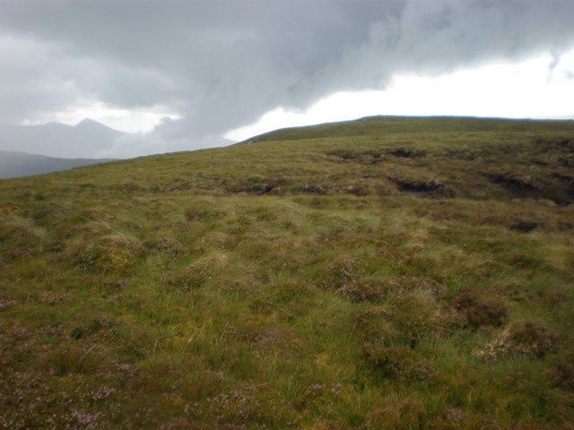 Photo could not load
NH3601 : Looking west to Mullach a' Ghlinne 528m top
Sarah McGuire
Hill facts and local notes
Classifications
Elevation
529m
1,736 ft
Prominence
103m
Coordinates
57.0718, -4.7069
NH359011
OS Map
34
Explorer: 400
At the Summit
The summit features a large stone cairn that serves as a marker and a great spot for a celebratory selfie. The views from the cairn can be breathtaking—so remember to put your phone on airplane mode for that perfect shot.
Terrain & Geology
Mullach a' Ghlinne is primarily composed of granitic gneiss, a hard and metamorphic rock, formed under intense heat and pressure during the Caledonian Orogeny, providing it with stunning vertical cliffs and a rugged profile.
Views & Scenery
From the summit, you can see the majestic peaks of the Ben Lawers range, Loch Tay, and even the distant outline of the mighty Ben Nevis on a clear day.
History & Heritage
Name Origin
The name Mullach a' Ghlinne translates to 'Hill of the Glen', reflecting its geographical position and local dialect.
Historical Significance
The mountain is a part of the Lawers range and holds significant importance for local folklore and Scottish history, often featured in tales of battles fought in the surrounding valleys.
Getting There & Facilities
Check current local access restrictions, parking rules and transport timetables before travelling. These notes do not confirm public access to the summit.
Parking
There is a small parking area at the Ben Lawers Visitor Centre, located at NH 438 354, which serves as the primary access point for hikers.
Public Transport
Buses operate from nearby towns such as Killin and Aberfeldy; however, check the local schedules as services may vary.
Nearby Facilities
At the Ben Lawers Visitor Centre, you can enjoy a small café, toilets, and interpretive displays about the local wildlife and geology.
Safety Information
Known Hazards
- Be cautious of sudden weather changes. The Highlands are notorious for their unpredictable climate; what starts as a sunny day can quickly turn into a storm. Loose rocks and steep drops demand attention on the ascent and descent.
General Safety Tips
- Check weather conditions before setting out
- Carry appropriate clothing and equipment
- Let someone know your planned route
- Take a map, compass, and GPS device
- Carry emergency supplies: food, water, first aid kit, torch
Hills
Some common questions about the hills answered
Are there group walks up Mullach a' Ghlinne?
Many walkers use Walkmates to join or organise walks with others. You can check for group walks around Mullach a' Ghlinne through the maps
Are there other walkers around Mullach a' Ghlinne?
Activity varies by location and time, but Walkmates lets you see whether others have shared walks or shown interest in this area. Find other people through the walking friends search walking friends for Mullach a' Ghlinne search or of course create your own walk for Mullach a' Ghlinne
Can I organise a walk to Mullach a' Ghlinne?
Yes. If there aren’t any walks listed already, you can create a walk and make it available for others to join.
If you're signed up to Walkmates, you can create a walk to Mullach a' Ghlinne.
How do I find a walk up this hill?
There are often multiple ways to walk this hill, depending on experience and route preference. Walkmates helps you explore walks and routes that others have shared.
Can I suggest a new route up Mullach a' Ghlinne?
Yes. You can suggest or create routes to share with others. Walkmates focuses on the social side of walking, so routes are used to help people organise walks and explore areas together, rather than as detailed navigation tools or route libraries.
Other uses really appreciate knowledgeable walkers sharing their routes. Share your favourite route to Mullach a' Ghlinne here
The is an error or something incorrect about this hill. How do I let you know?
We always strive to keep the information on Walkmates as accurate as possible. If you find an error, please let us know through the contact form and we'll aim to correct it as quickly as possible
Community Discussion
Comments
Location
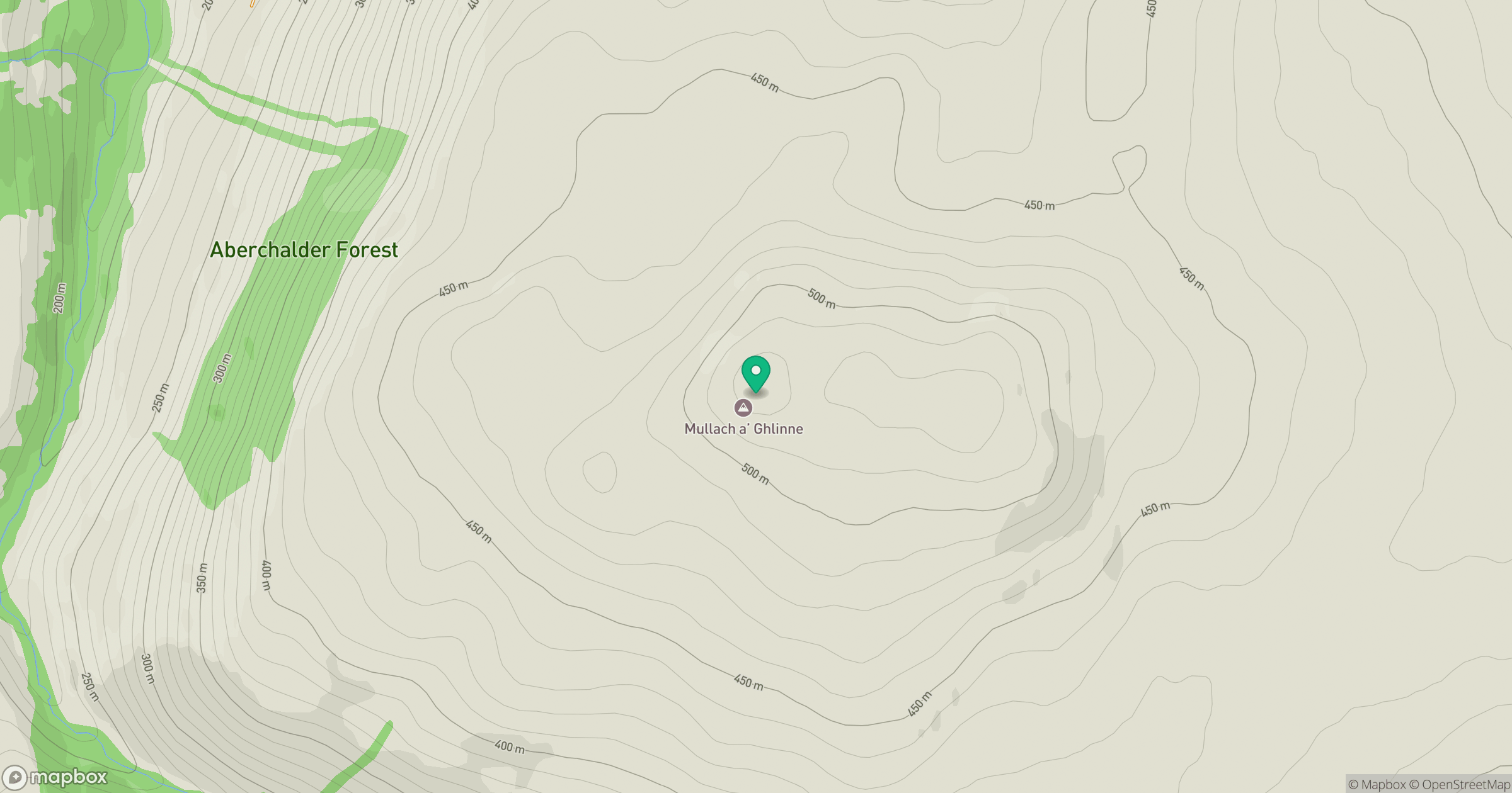
Grid reference: NH359011
View on OpenStreetMapOpens a map in a new tab, centred on the hill.
Hills within 30 km
Straight-line distance, not a walking route or confirmation of access.
Creag Meagaidh
1,128m
Beinn Mheadhoin
541m
Stob Choire Claurigh
1,177m
Binnein Mor
550m
Meall a' Cholumain
317m
No comments yet. Be the first.