

Meall a' Cholumain
Good walks are even better shared.
Overview
Meall a' Cholumain
Overview
Nestled in the breathtaking Scottish Highlands, Meall a' Cholumain raises its head majestically at 823 meters, beckoning hikers to explore its scenic paths. Known for its relatively gentle slopes and stunning summit views, this Munro is a must-visit for outdoor enthusiasts.
Geology
The mountain boasts fascinating geological formations, primarily composed of ancient metamorphic rocks such as schists and gneisses. The textures tell a long, storied past, hinting at the incredible forces of nature that shaped this stunning landscape. It’s a geologist’s playground!
Routes
The most popular route is the Druim na Falaich Route.
- Distance: 7.5 km
- Time: Approximately 3.5 hours
- Difficulty: Moderate
This route takes you through lovely heather-covered hills, allowing you to soak in the beautiful Highland scenery along the way. It’s an uphill battle but worth every step for the views awaiting at the summit.
Summit Features
Upon reaching the summit, you’ll be greeted by a substantial cairn—a perfect excuse for a celebratory snack and a photo op! On clear days, the panoramic views are simply out of this world!
Terrain Type
Expect a mix of grassy slopes and rocky outcrops, providing an adventurous yet manageable hiking experience. The varied terrain keeps you engaged as you make your way to the top.
Views
- Highlights: You can feast your eyes on the majestic peaks of Creag Meagaidh and the tranquil waters of Loch Laggan.
- Best Seasons: Late spring to early autumn is best for clear views. Don't forget your camera, especially during the heather bloom in August!
Hazards
Like any proud mountain, Meall a' Cholumain has its quirks! Watch out for loose rocks, sudden weather changes, and steep drops—the hikers’ trifecta of hazards. Additionally, expect the occasional sheep blocking the path, asserting its right of way!
Nearby Summits
If you're feeling adventurous, consider tackling nearby peaks such as Creag Meagaidh (1095 meters) and Stob Poite Coire Ardair (1011 meters) to extend your adventure.
Access
- Nearest Parking: A small layby on the A86 road near Laggan is your best bet; just follow local parking signs to avoid fines!
- Public Transport: A local bus service connects Fort William and Inverness, with stops in Laggan.
- Nearest Town: The charming village of Laggan is close by, offering a slice of Highland life.
Facilities
You'll find a lovely café in Laggan for refreshments after your hike, as well as public toilets to freshen up.
History
- Name Meaning: The name translates to 'hill of Colum', likely a nod to St. Columba, reflecting a historical significance.
- Significance: Serving as a guiding star for local shepherds and wanderers for centuries, Meall a' Cholumain holds a special place in the hearts of the Highland locals.
So, lace up your boots and get ready for an unforgettable adventure on Meall a' Cholumain!
Explore routes near Meall a' Cholumain
Public walks starting within 80 km of this hill. Nearby does not mean a route reaches the summit; check its map and access before setting out.
Fort Augustus to Kytra Lock: Caledonian Canal Towpath
View route
Great Glen Way low route: Fort Augustus to Invermoriston Old Bridge
View route
Coire Ardair lochan from Aberarder and back
View route
Loch Affric full circuit from River Affric
View route
Route planning notes
These notes describe possible approaches, not verified navigable routes or permission to cross land. Check current paths, local access rules and conditions before setting out.
Druim na Falaich Route
A scenic and relatively straightforward ascent starting from the village of Laggan. The path winds through heather and grassland, offering stunning views as you gain altitude.
Make a day of it, together
Find someone to share the walk with, or organise a day out along a route you like.
Photo Gallery
View all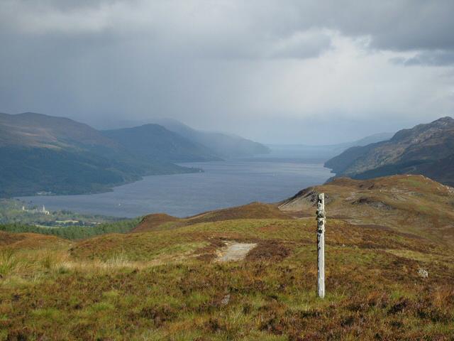 Photo could not load
NH3604 : NE from Meall a Cholumain
Lis Burke
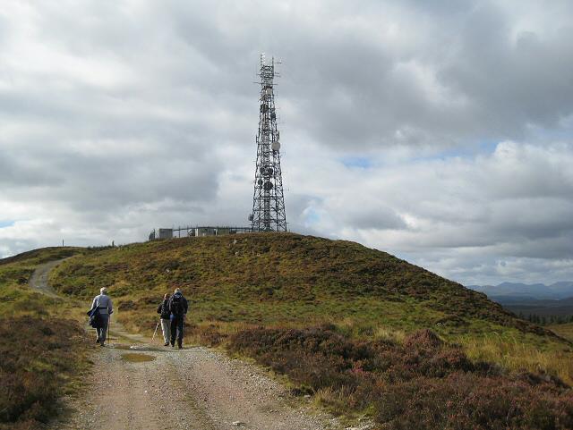 Photo could not load
NH3604 : Meall a Cholumain
Lis Burke
Hill facts and local notes
Classifications
Elevation
317m
1,040 ft
Prominence
100m
Coordinates
57.1055, -4.7083
NH360048
OS Map
34
Explorer: 400
At the Summit
The summit features a sizeable cairn, perfect for those obligatory summit selfies. On clear days, the views are simply breathtaking, stretching across the vast Scottish landscape.
Terrain & Geology
Meall a' Cholumain is predominantly composed of metamorphic rocks, including schists and gneisses, shaped by ancient tectonic activity that has left fascinating textures and formations. These rocks tell a tale millions of years in the making, making it a geological wonder.
Views & Scenery
From the summit, enjoy sweeping views of the surrounding mountains, including the majestic Creag Meagaidh and the serene Loch Laggan. The sight of mountains dancing with clouds is a true photographer’s dream.
History & Heritage
Name Origin
The name 'Meall a' Cholumain' translates roughly to 'hill of Colum', possibly referring to St. Columba, highlighting a rich historical connection.
Historical Significance
This hill has served as a landmark for local shepherds and climbers alike, contributing to the cultural tapestry of the Highlands.
Getting There & Facilities
Check current local access restrictions, parking rules and transport timetables before travelling. These notes do not confirm public access to the summit.
Parking
Park at the small layby just off the A86 road near Laggan. Be mindful of local signs and road regulations to avoid any unintentional fines.
Public Transport
The nearest public transport is a bus service that runs between Fort William and Inverness, with stops in Laggan. Check current schedules for up-to-date service times.
Nearby Facilities
The nearest facilities are found in Laggan, including a charming café and public toilets. Perfect for post-hike recovery with a slice of cake!
Safety Information
Known Hazards
- Loose rocks, unpredictable weather, and steep drops at certain points require caution. Also, keep an eye out for the odd sheep that thinks it owns the path!
General Safety Tips
- Check weather conditions before setting out
- Carry appropriate clothing and equipment
- Let someone know your planned route
- Take a map, compass, and GPS device
- Carry emergency supplies: food, water, first aid kit, torch
Hills
Some common questions about the hills answered
Are there group walks up Meall a' Cholumain?
Many walkers use Walkmates to join or organise walks with others. You can check for group walks around Meall a' Cholumain through the maps
Are there other walkers around Meall a' Cholumain?
Activity varies by location and time, but Walkmates lets you see whether others have shared walks or shown interest in this area. Find other people through the walking friends search walking friends for Meall a' Cholumain search or of course create your own walk for Meall a' Cholumain
Can I organise a walk to Meall a' Cholumain?
Yes. If there aren’t any walks listed already, you can create a walk and make it available for others to join.
If you're signed up to Walkmates, you can create a walk to Meall a' Cholumain.
How do I find a walk up this hill?
There are often multiple ways to walk this hill, depending on experience and route preference. Walkmates helps you explore walks and routes that others have shared.
Can I suggest a new route up Meall a' Cholumain?
Yes. You can suggest or create routes to share with others. Walkmates focuses on the social side of walking, so routes are used to help people organise walks and explore areas together, rather than as detailed navigation tools or route libraries.
Other uses really appreciate knowledgeable walkers sharing their routes. Share your favourite route to Meall a' Cholumain here
The is an error or something incorrect about this hill. How do I let you know?
We always strive to keep the information on Walkmates as accurate as possible. If you find an error, please let us know through the contact form and we'll aim to correct it as quickly as possible
Community Discussion
Comments
Location
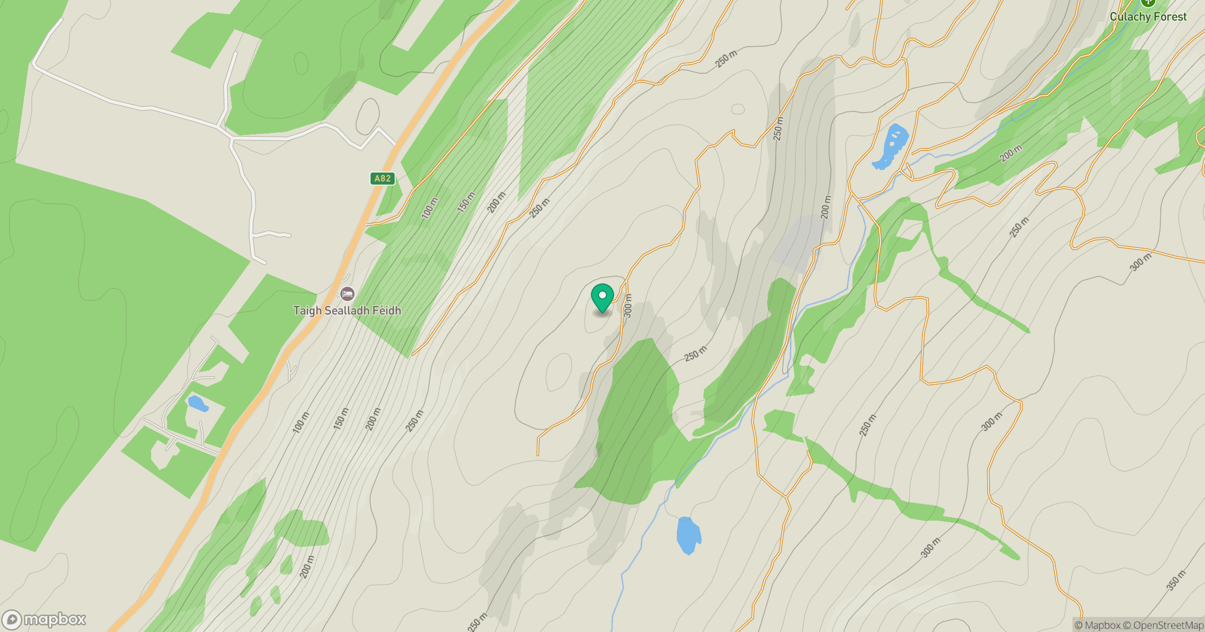
Grid reference: NH360048
View on OpenStreetMapOpens a map in a new tab, centred on the hill.
Hills within 30 km
Straight-line distance, not a walking route or confirmation of access.
No comments yet. Be the first.