
Carn Dearg
Good walks are even better shared.
Overview
Exploring Carn Dearg
Nestled in the stunning Scottish Highlands, Carn Dearg stands proud at 943 meters, inviting adventurers from near and far to tackle its rugged slopes. Known as a Munro, this mountain offers not just a challenge but a breathtaking experience that is sure to leave you in awe and perhaps slightly out of breath.
Geology
Carn Dearg's foundation is made of ancient Lewisian gneiss, boasting some of the oldest rocks in the UK. Its dramatic cliffs and fascinating corries tell tales of glacial carving, making every step a walk through history. Don't forget to bring your geology hat – or just a sense of curiosity!
Routes
North East Ridge Route
This popular route is a hiker's delight, leading you through lush glens before your feet find solid ground on the ridge. Dare I say, it's the quintessential Scottish hiking experience!
- Distance: 9.5 km
- Time: Approximately 4.5 hours
- Difficulty: Moderate
South West Approach
For those seeking a bit more adventure, the south west route offers a rugged trek across rolling moors. Mind the bogs – they’re known for snatching up the unwary!
- Distance: 10.0 km
- Time: Around 5 hours
- Difficulty: Challenging
Summit Features
Upon reaching the summit, you’ll be greeted by a classic Scottish stone cairn, a perfect backdrop for a victory photo. Take a moment to enjoy your well-deserved snacks while soaking in the glorious vistas.
Terrain Type
Expect a mix of rocky outcrops and grassy slopes with occasional boggy patches down low. A true test of skill and perseverance – and maybe a bit of mud dancing!
Views
From the top, witness spectacular sights of Loch Ness and the legendary Ben Nevis, all under the open Scottish sky. For the best views, aim for spring or early summer when wildflowers dot the landscape, or visit in late autumn for those crisp, clear skies.
Hazards
As with all mountains, be aware of potential hazards. Look out for rockfall in steep sections and prepare for typical Scottish weather changes. Muddy paths can add to the adventure, so sturdy footgear is a must!
Access
Nearest Parking
Park at Glen Roy’s car park, roughly 5 km from the North East Ridge trailhead.
Public Transport
Regular buses from Fort William to Roy Bridge make accessing the starting point manageable.
Nearest Town
Fort William is your gateway, offering all the necessities a hiker could need.
Facilities
After your epic walk, reward yourself in Fort William, where cafes and restaurants await. Plus, restrooms are available for the weary and refreshment-seekers.
History
The name 'Carn Dearg' means 'Red Mountain', a fitting title for a peak that displays a reddish glow at certain times of day. Historically, it has been a sought-after summit for Munro-baggers, embodying the spirit and allure of the Highlands.
So, lace up your boots, prepare your senses for adventure, and enjoy the remarkable journey that is Carn Dearg. It might just be the mountain you hold closest to your heart!
Explore routes near Carn Dearg
Walks starting near this hill. Open a route to check its map, distance and full itinerary.
Fort Augustus to Kytra Lock: Caledonian Canal Towpath
View route
Banavie to Glen Loy Aqueduct: Neptune’s Staircase Canal Towpath
View route
Glen Affric: Coire Loch Woodland Trail
View route
Ben Nevis via Mountain Path
View route
Route planning notes
These notes describe possible approaches. Check a route's map and access information when planning your walk.
North East Ridge Route
A popular ascent, starting from the north east side, leading hikers through a picturesque glen before tackling the ridge.
South West Approach
An off the beaten path adventure that makes for an interesting trek over rolling moors leading up to the summit.
Make a day of it, together
Find someone to share the walk with, or organise a day out along a route you like.
Hill facts and local notes
Classifications
Elevation
816m
2,679 ft
Prominence
201m
Coordinates
57.0311, -4.7204
NN349966
OS Map
34
Explorer: 400
At the Summit
The summit is marked by a prominent cairn, a classic feature on many Scottish peaks, providing a lovely photo opportunity and a chance for some celebratory snacks!
Terrain & Geology
Carn Dearg is primarily composed of Lewisian gneiss, one of the oldest rock types in the UK. The mountain's rugged terrain has been shaped over millennia by glacial activity, leading to striking cliffs and stunning corries.
Views & Scenery
Breathtaking views of Loch Ness and the surrounding mountains including the impressive Ben Nevis on a clear day.
History & Heritage
Name Origin
The name 'Carn Dearg' translates to 'Red Mountain', likely referencing the reddish hue of the rocks on certain days.
Historical Significance
The mountain has been a popular target for Munro-baggers and is cherished for its natural beauty and challenging landscapes.
Getting There & Facilities
Parking
Parking available at the Glen Roy car park, about 5 km from the start of the North East Ridge Route.
Public Transport
Buses run from Fort William to Roy Bridge, with a short walk to reach the trailhead.
Nearby Facilities
Fort William has a range of facilities including cafes, restaurants, and public toilets. The local tourist information centre can also provide useful tips.
Safety Information
Known Hazards
- Rockfall in steep areas, unpredictable weather, and muddy paths, especially after rainfall. Always be prepared!
General Safety Tips
- Check weather conditions before setting out
- Carry appropriate clothing and equipment
- Let someone know your planned route
- Take a map, compass, and GPS device
- Carry emergency supplies: food, water, first aid kit, torch
Hills
Some common questions about the hills answered
Are there group walks up Carn Dearg?
Many walkers use Walkmates to join or organise walks with others. You can check for group walks around Carn Dearg through the maps
Are there other walkers around Carn Dearg?
Activity varies by location and time, but Walkmates lets you see whether others have shared walks or shown interest in this area. Find other people through the walking friends search walking friends for Carn Dearg search or of course create your own walk for Carn Dearg
Can I organise a walk to Carn Dearg?
Yes. If there aren’t any walks listed already, you can create a walk and make it available for others to join.
If you're signed up to Walkmates, you can create a walk to Carn Dearg.
How do I find a walk up this hill?
There are often multiple ways to walk this hill, depending on experience and route preference. Walkmates helps you explore walks and routes that others have shared.
Can I suggest a new route up Carn Dearg?
Yes. You can suggest or create routes to share with others. Walkmates focuses on the social side of walking, so routes are used to help people organise walks and explore areas together, rather than as detailed navigation tools or route libraries.
Other uses really appreciate knowledgeable walkers sharing their routes. Share your favourite route to Carn Dearg here
The is an error or something incorrect about this hill. How do I let you know?
We always strive to keep the information on Walkmates as accurate as possible. If you find an error, please let us know through the contact form and we'll aim to correct it as quickly as possible
Community Discussion
Comments
Location
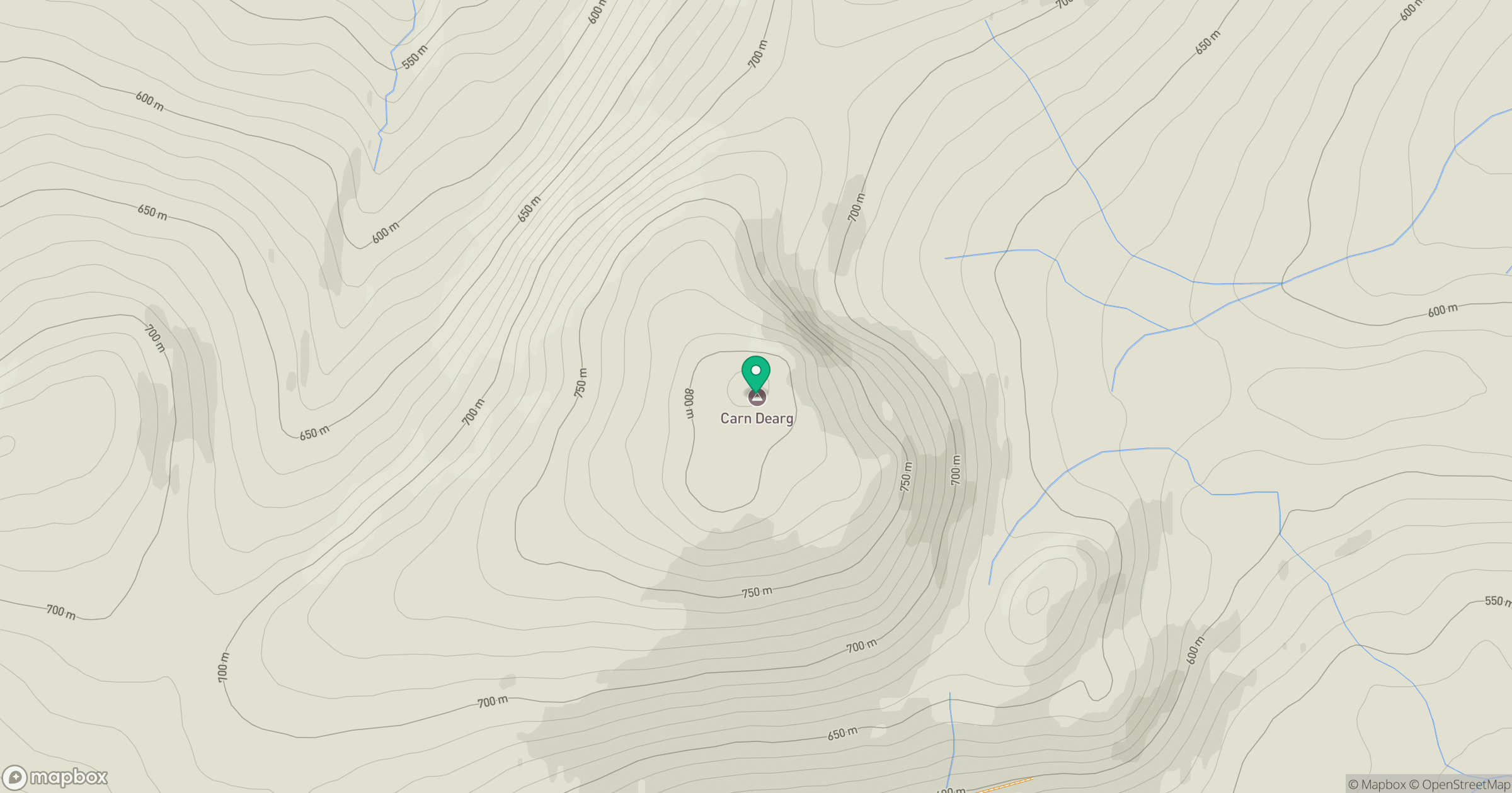
Grid reference: NN349966
View on OpenStreetMapOpens a map in a new tab, centred on the hill.
Nearby Hills
Creag Meagaidh
1,128m
Stob Choire Claurigh
1,177m
Stob Ban
977m
Beinn Mheadhoin
541m
Aonach Mor
1,220m
No comments yet. Be the first.