

Mow Cop - Trig Point
Good walks are even better shared.
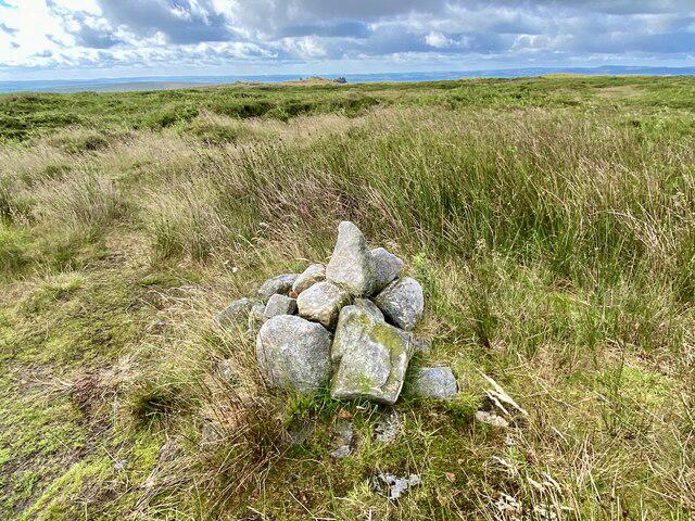
SJ8557 : The Gritstone Trail
Kate Jewell Photo source
Overview
Mow Cop - Trig Point
Mow Cop stands proudly at an elevation of 244 meters, providing not only splendid exercise but also a rich tapestry of history and geology. The summit's trig point and castle remain iconic landmarks among locals and visitors alike.
Geology
The sandstone that forms Mow Cop is a remnant from the Carboniferous period, which astonishingly means rocks here have been around longer than your grumpy uncle at a family gathering! The distinctive cliffs and rocky outcrops are a favourite for climbers and geologists, ensuring that even beneath their hiking boots, a story is unfolding.
Routes and Access
One of the most popular routes begins in Mow Cop Village, an easy 2 km walk that can be tackled within an hour. Bring your walking boots because the stony paths lead you up to the castle and trig point without the need for a superhero cape!
Nearest parking is conveniently located at Mow Cop Village, offering free access to eager hikers. Alternatively, for those preferring public transport, local buses can whisk you in from Congleton. Just try not to mix up your directions with your GPS, or you might just end up exploring the community centre instead!
Summit Features
Reaching the top, visitors are rewarded with not just the satisfaction of having conquered Mow Cop but also with picturesque views that capture both the Shropshire Hills and the rolling Cheshire Plain. Don’t forget to snap a selfie with the trig point—#IClimbedMowCop is definitely a hashtag waiting to trend!
Hazards
As beautiful as it is, the trek does come with its fair share of hazards. The paths can be uneven, with muddy sections that are particularly keen to ambush unsuspecting footwear. If you have little ones in tow, keep a close eye on them, especially near the steeper drops!
Nearby Summits
Mow Cop is not alone in its majesty; nearby summits such as The Cloud and Croker Hill offer even more hiking opportunities. Why not extend your adventure and chase more summits?
Facilities
Once you’ve descended and possibly worked up a thirst, a quick trip back to Mow Cop Village will lead you to charming cafes and perhaps that well-deserved slice of cake.
Conclusion
Whether you’re a seasoned hiker or just fancy a light walk coupled with spectacular views, Mow Cop - Trig Point offers something for everyone. Strap on those walking boots and head out for an adventure that promises to be both enjoyable and invigorating!
Explore routes near Mow Cop - Trig Point
Walks starting near this hill. Open a route to check its map, distance and full itinerary.
Rudyard Lake Circuit near Leek
View route
Apedale Circular Route
View route
Sandbach Walk with Men Walking & Talking
View route
Deep Hayes Country Park: Cumberledge Pool and woodland circuit
View route
Route planning notes
These notes describe possible approaches. Check a route's map and access information when planning your walk.
Mow Cop Castle Route
A pleasant walk starting from Mow Cop Village, culminating at the iconic trig point with its impressive views.
Make a day of it, together
Find someone to share the walk with, or organise a day out along a route you like.
Photo Gallery
View all Photo could not load
SJ8557 : The Gritstone Trail
Kate Jewell
 Photo could not load
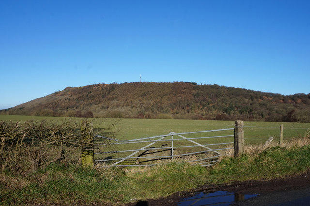
SJ8557 : Telecoms mast at Mow Cop
Bill Boaden
 Photo could not load
SJ8557 : Mow Cop transmitter
Stephen Craven
 Photo could not load
SJ8557 : House near Mow Cop castle
Stephen Craven
 Photo could not load
SJ8557 : Mow Cop transmitter
Stephen Craven
 Photo could not load
SJ8557 : Mow Cop, Staffordshire
Paul Kleiman
 Photo could not load
SJ8557 : Path at Mow Cop leads to Castle Road
Raymond Knapman
 Photo could not load
SJ8557 : Sheep near Mow Cop
Stephen Craven
 Photo could not load
SJ8557 : Mow Cop Folly
Richard Styles

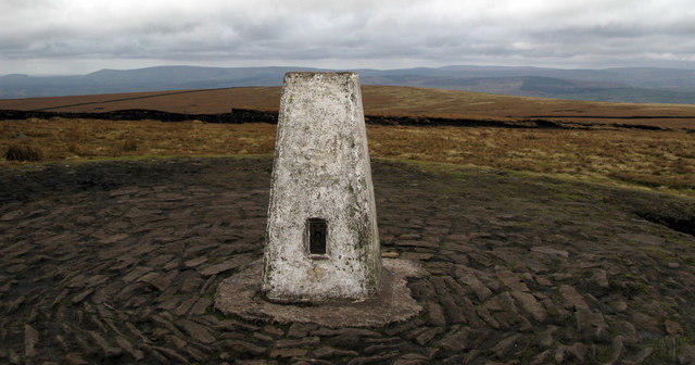
SJ8557 : Trigpoint and The Old Man Of Mow, Mow Cop
Brian Deegan
Hill facts and local notes
Classifications
Elevation
335m
1,100 ft
Prominence
11m
Coordinates
53.1149, -2.2130
SJ858575
OS Map
118
Explorer: 258 268S
At the Summit
The summit is adorned with a trig point and the ruins of Mow Cop Castle, offering a taste of history along with a panoramic vista.
Terrain & Geology
Mow Cop is primarily composed of sandstone, which dates back to the Carboniferous period. The rocky outcrops provide fascinating geological features and a perfect playground for budding geologists.
Views & Scenery
On a clear day, you can see the sprawling Cheshire Plain, the Shropshire Hills, and even the Welsh mountains peeking through the horizon.
History & Heritage
Name Origin
The name 'Mow Cop' is believed to derive from the Old English 'mow', meaning 'to cut or mow', and 'cop', a term for hill.
Historical Significance
The site has historical importance, particularly due to Mow Cop Castle, built in the 18th century as a folly.
Getting There & Facilities
Parking
Parking is available at Mow Cop Village, where there are no charges—so no excuses for not shelling out for a scone later!
Public Transport
Accessible via local bus services, including the 3A route from Congleton.
Nearby Facilities
There are no facilities directly on the summit, but refreshments can be found in Mow Cop Village—perfect for a celebratory cuppa after your hike.
Safety Information
Known Hazards
- Uneven terrain and steep drops in certain areas. It's wise to keep an eye on the little ones!
- Muddy paths can be encountered after rainy periods.
General Safety Tips
- Check weather conditions before setting out
- Carry appropriate clothing and equipment
- Let someone know your planned route
- Take a map, compass, and GPS device
- Carry emergency supplies: food, water, first aid kit, torch
Hills
Some common questions about the hills answered
Are there group walks up Mow Cop - Trig Point?
Many walkers use Walkmates to join or organise walks with others. You can check for group walks around Mow Cop - Trig Point through the maps
Are there other walkers around Mow Cop - Trig Point?
Activity varies by location and time, but Walkmates lets you see whether others have shared walks or shown interest in this area. Find other people through the walking friends search walking friends for Mow Cop - Trig Point search or of course create your own walk for Mow Cop - Trig Point
Can I organise a walk to Mow Cop - Trig Point?
Yes. If there aren’t any walks listed already, you can create a walk and make it available for others to join.
If you're signed up to Walkmates, you can create a walk to Mow Cop - Trig Point.
How do I find a walk up this hill?
There are often multiple ways to walk this hill, depending on experience and route preference. Walkmates helps you explore walks and routes that others have shared.
Can I suggest a new route up Mow Cop - Trig Point?
Yes. You can suggest or create routes to share with others. Walkmates focuses on the social side of walking, so routes are used to help people organise walks and explore areas together, rather than as detailed navigation tools or route libraries.
Other uses really appreciate knowledgeable walkers sharing their routes. Share your favourite route to Mow Cop - Trig Point here
The is an error or something incorrect about this hill. How do I let you know?
We always strive to keep the information on Walkmates as accurate as possible. If you find an error, please let us know through the contact form and we'll aim to correct it as quickly as possible
Community Discussion
Comments
Location
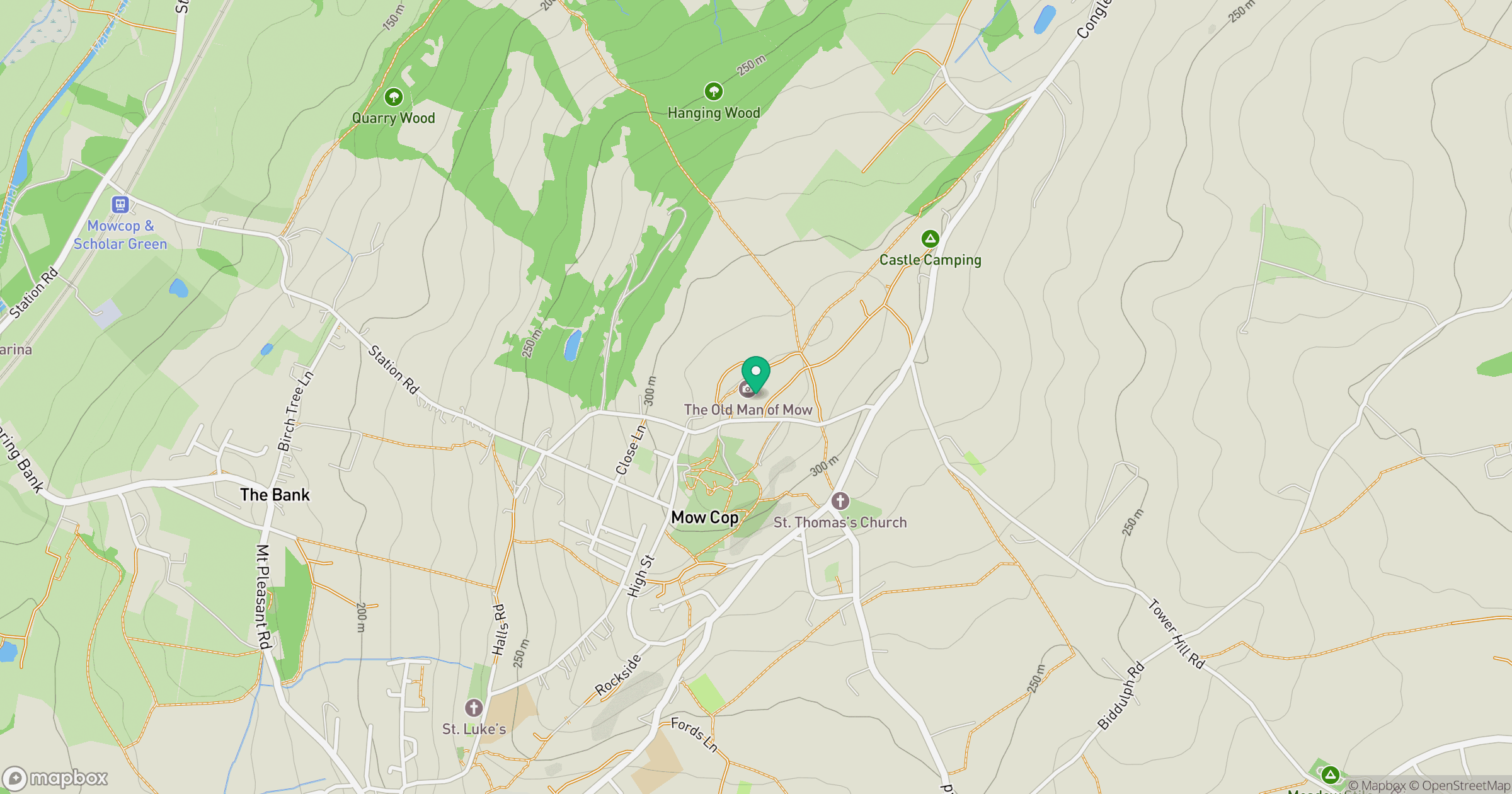
Grid reference: SJ858575
View on OpenStreetMapOpens a map in a new tab, centred on the hill.
No comments yet. Be the first.