

Moelfre Uchaf
Good walks are even better shared.
Overview
Moelfre Uchaf
Nestled in the heart of Snowdonia National Park, Moelfre Uchaf stands proudly at an elevation of 750 meters, gazing down upon the lush valleys and jagged peaks that surround it. With its captivating landscapes and rich geological features, it’s no surprise this mountain attracts hikers seeking both challenge and beauty.
Geology
The geology of Moelfre Uchaf is predominantly slate and mudstone, remnants of ancient ocean flooring that have been upturned and sculpted over millions of years. The exposure of these rocks creates stunning formations, providing hikers with a glimpse into the earth's distant past.
Routes
The Moelfre Uchaf Circular Route is perhaps the most popular way to the summit. Starting from Rhyd-Ddu, this moderate trail offers a manageable distance of 8 km, taking approximately 3.5 hours to complete. The route is designed to engage both seasoned hikers and those who may be newer to hillwalking, winding through breathtaking scenery while giving a friendly nudge uphill.
Summit Features
Upon reaching the summit, hikers will be greeted by a simple stone cairn, an ancient signal of human presence amidst nature's grandeur. The astonishment of the surrounding views is enough to make anyone forget their worries—or at least their cellular signal.
Terrain Type
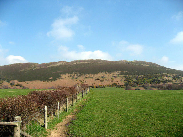
Expect a delightful mix of rocky paths and grassy meadows, with the occasional boggy section that adds a dash of adventure. Sturdy footwear is key to comfortable hiking here, as you might face slippery spots after a rain shower.
Views
From the summit, the vistas are nothing short of spectacular. Towering peaks of Snowdon seem within arm’s reach, and valleys stretch out like a patchwork quilt below. Keep your eyes peeled for sighting Anglesey on a clear day—it’s as if the mountains are showing off!
Best Seasons for Views
The best times to witness the majesty of Moelfre Uchaf are during spring and early autumn. Springtime brings vibrant wildflowers, while autumn often showcases stunning, luminous foliage.
Hazards
However, it isn’t all sunshine and roses—hikers should be wary of quickly changing weather conditions that can catch the unprepared off guard. Slippery rocks may challenge your footing, especially after rain, so pay attention to your step.
Nearby Summits
Just a hop, skip, and a jump away lies Moel Eilio, which stands at 724 meters. A great option to combine with your Moelfre Uchaf hike!
Access
You can park at a small lot in Rhyd-Ddu, accommodating around 10 vehicles. Arriving early is a wise move, as this popular starting point fills up quickly. For public transport, check the bus schedules from Caernarfon or Porthmadog ahead of time to ensure a smooth arrival.
The nearest town, Caernarfon, is about 12 km away and boasts various amenities, perfect for stocking up before your adventure.
Facilities
Although facilities are sparse on the mountain, Rhyd-Ddu itself offers a quaint café to fuel up post-hike, along with some public toilets.
History
The name Moelfre Uchaf hints at its ancient maritime connections, translating to 'Upper Hill of the Hill of the Sea.' This area has been a stage for human activity for thousands of years, with evidence of ancient stone circles that add layers to the rich tapestry of its history.
In summary, Moelfre Uchaf offers not just a hike, but an exploration of geological history, stunning vistas, and a glimpse into the remote past of its surroundings. So lace up those boots, pack that picnic, and head out—adventure awaits!
Explore routes near Moelfre Uchaf
Public walks starting within 80 km of this hill. Nearby does not mean a route reaches the summit; check its map and access before setting out.
Conwy Quay to Llanfairfechan: the upland coast-path alternative
View route
Llyn Crafnant: Lakeside Circuit from the NRW Car Park
View route
Dyserth to Prestatyn: old railway walkway return
View route
Snowdon Pyg Track returning by Miner's Track
View route
Route planning notes
These notes describe possible approaches, not verified navigable routes or permission to cross land. Check current paths, local access rules and conditions before setting out.
Moelfre Uchaf Circular Route
A scenic circular walk starting from the village of Rhyd-Ddu, providing a blend of gentle ascents and thrilling descents.
Make a day of it, together
Find someone to share the walk with, or organise a day out along a route you like.
Photo Gallery
View all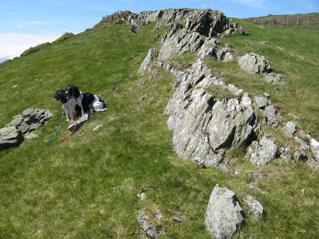 Photo could not load
SH8971 : Sandstone outcrop
Jonathan Wilkins
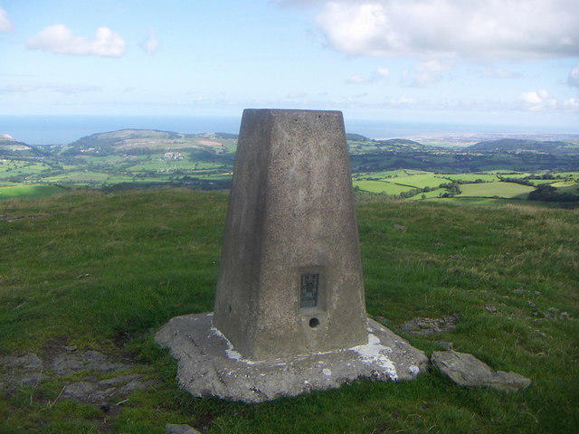 Photo could not load
SH8971 : Trig Pillar Moelfre Uchaf
Dewi
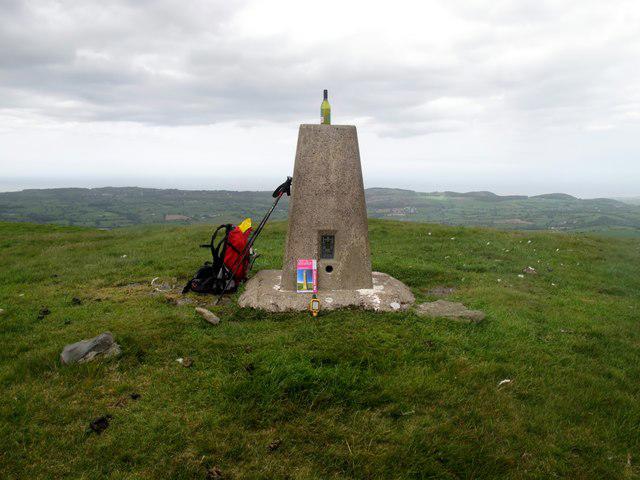 Photo could not load
SH8971 : Moelfre Uchaf
Rude Health
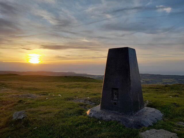 Photo could not load
SH8971 : Evening at Moelfre Uchaf
David Bremner
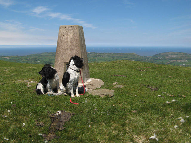 Photo could not load
SH8971 : Moelfre Uchaf trig
Jonathan Wilkins
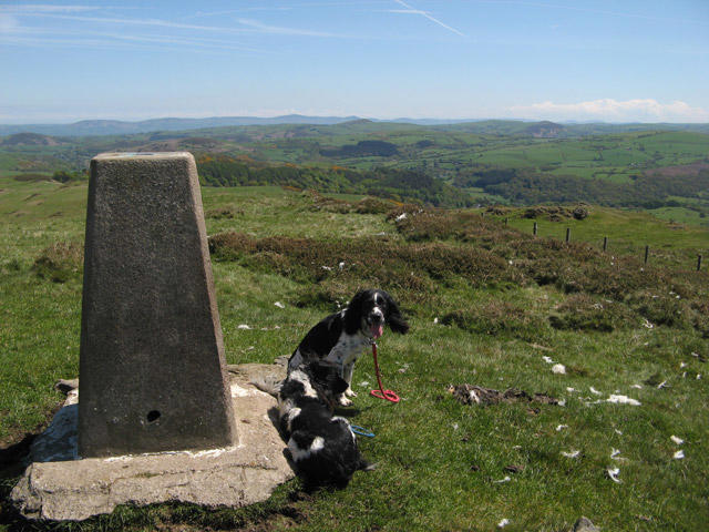 Photo could not load
SH8971 : Moelfre Uchaf view to the east
Jonathan Wilkins
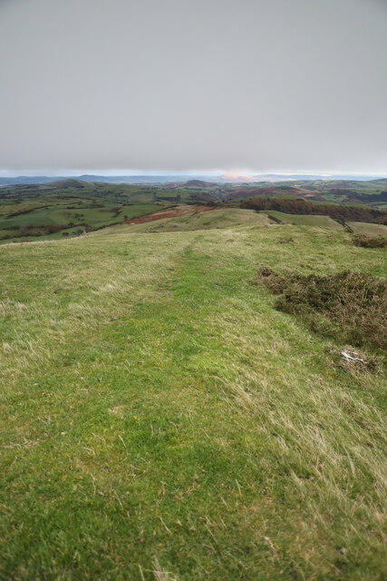 Photo could not load
SH8971 : East ridge of Moelfre Uchaf
Andy Waddington
Hill facts and local notes
Classifications
Elevation
396m
1,299 ft
Prominence
144m
Coordinates
53.2300, -3.6523
SH898716
OS Map
116
Explorer: OL17E
At the Summit
Features a simple stone cairn and a panoramic view that can make you forget to check your Instagram feed—this mountain's beauty deserves your full attention.
Terrain & Geology
Predominantly composed of slate and mudstone, Moelfre Uchaf features the geological legacy of ancient ocean floors, uplifted and sculpted by glaciation. The surrounding area showcases a mix of rocky outcrops and lush greenery.
Views & Scenery
Breathtaking views of Snowdon, the surrounding peaks, and the lush valleys below; on a clear day, even Anglesey is visible!
History & Heritage
Name Origin
Moelfre Uchaf translates to 'Upper Hill of the Hill of the Sea' in Welsh, a nod to the mountain's coastal prehistoric connections.
Historical Significance
This area has been inhabited for thousands of years, with historical evidence of ancient communities and stone circles nearby.
Getting There & Facilities
Check current local access restrictions, parking rules and transport timetables before travelling. These notes do not confirm public access to the summit.
Parking
There is a small car park in Rhyd-Ddu at the foot of the mountain with space for around 10 vehicles; arrive early to avoid disappointment!
Public Transport
Regular bus services run from Caernarfon and Porthmadog to Rhyd-Ddu, but check the timetables beforehand—don't get stranded!
Nearby Facilities
No facilities on the mountain itself; however, Rhyd-Ddu has a small café for post-hike refreshments and a public toilet.
Safety Information
Known Hazards
- Watch out for sudden weather changes; the mountain can be a fickle mistress. Also, beware of slippery rocks, especially after rain.
General Safety Tips
- Check weather conditions before setting out
- Carry appropriate clothing and equipment
- Let someone know your planned route
- Take a map, compass, and GPS device
- Carry emergency supplies: food, water, first aid kit, torch
Hills
Some common questions about the hills answered
Are there group walks up Moelfre Uchaf?
Many walkers use Walkmates to join or organise walks with others. You can check for group walks around Moelfre Uchaf through the maps
Are there other walkers around Moelfre Uchaf?
Activity varies by location and time, but Walkmates lets you see whether others have shared walks or shown interest in this area. Find other people through the walking friends search walking friends for Moelfre Uchaf search or of course create your own walk for Moelfre Uchaf
Can I organise a walk to Moelfre Uchaf?
Yes. If there aren’t any walks listed already, you can create a walk and make it available for others to join.
If you're signed up to Walkmates, you can create a walk to Moelfre Uchaf.
How do I find a walk up this hill?
There are often multiple ways to walk this hill, depending on experience and route preference. Walkmates helps you explore walks and routes that others have shared.
Can I suggest a new route up Moelfre Uchaf?
Yes. You can suggest or create routes to share with others. Walkmates focuses on the social side of walking, so routes are used to help people organise walks and explore areas together, rather than as detailed navigation tools or route libraries.
Other uses really appreciate knowledgeable walkers sharing their routes. Share your favourite route to Moelfre Uchaf here
The is an error or something incorrect about this hill. How do I let you know?
We always strive to keep the information on Walkmates as accurate as possible. If you find an error, please let us know through the contact form and we'll aim to correct it as quickly as possible
Community Discussion
Comments
Location
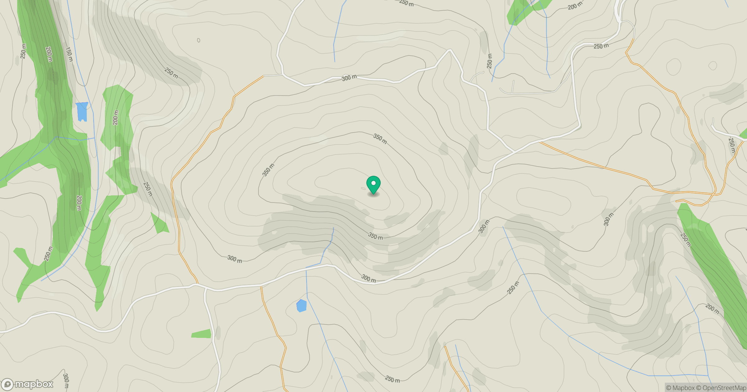
Grid reference: SH898716
View on OpenStreetMapOpens a map in a new tab, centred on the hill.
Hills within 30 km
Straight-line distance, not a walking route or confirmation of access.
Mynydd Tryfan
402m
Great Orme [Y Gogarth]
207m
Moel Siabod
872m
Carnedd Llewelyn
1,062m
Carnedd Dafydd
1,044m
No comments yet. Be the first.