
Y Garn
Good walks are even better shared.
Overview
Y Garn is a 946 m mountain above Cwm Idwal in the Glyderau, Eryri (Snowdonia). Its steep paths, loose rock and nearby crags make it a strenuous mountain outing requiring suitable experience, equipment and navigation.
Y Garn (Glyderau)
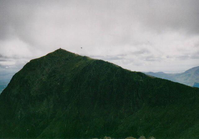
Y Garn stands above Cwm Idwal in the Glyderau, within Eryri (Snowdonia) National Park. This is the summit at SH630595, not the other Welsh hills called Y Garn. The current Database of British and Irish Hills gives 946 m (3,104 ft) and 234 m prominence for record 1972. Older guides commonly give 947 m. It remains one of the Welsh 3,000-foot mountains. DoBIH
Summit and views
The summit feature is a stone cairn/shelter. In clear weather the outlook includes Tryfan, the Glyderau, the Carneddau, the Yr Wyddfa (Snowdon) group and the Ogwen valley. Cwm Clyd and Cwm Cywion lie on the mountain’s eastern side. Cloud can remove both the view and obvious route-finding cues. Walkhighlands
Mountain routes
Choose a detailed mapped route and plan the whole return before setting off.
- Ogwen circular: reach Llyn Idwal, climb the north-east ridge, descend to Llyn y Cwn, then return by the steep constructed path beside Devil’s Kitchen. The circuit can also be walked in reverse. The walking path does not go through the dark gully itself. Walking Britain
- North-east ridge out-and-back: the same steep ridge provides a direct ascent and return from Ogwen. Loose ground and nearby crags require careful footwork, especially descending. Walking Britain
- Glyder Fawr extension: from Y Garn, descend to Llyn y Cwn before the steep scree ascent to Glyder Fawr. Return to the lake and the Devil’s Kitchen walking path if using the Ogwen outline here. This adds substantial climbing and rocky summit navigation. The return crosses steep, loose ground. Glyders topography
- Nant Peris: Esgair Ceunant is a western approach. A circuit can return by Llwybr y Carw through Cwm Padrig. It has faint and eroded sections, a misleading branch above difficult ground and a road return. Cwm Clyd is on the opposite, eastern side. Mud and Routes
The nearby peaks of Tryfan (917.5 m) and Elidir Fawr (924 m) are separate mountain objectives, each requiring its own route plan. Combining summits is not a casual extension. DoBIH
Getting there
The usual Ogwen start is Cwm Idwal Visitor Centre, SH64930 60366, beside the A5 at the western end of Llyn Ogwen. The National Park’s small pay-and-display car park fills quickly; use designated parking and keep roads and emergency access clear. The T10 links Bangor, Bethesda and Betws-y-Coed with Ogwen. Check current services and the last return before travelling. Toilets and a snack bar are available at the centre; check opening arrangements for refreshments. National Trust · Eryri National Park
Terrain and safety
Y Garn is a strenuous mountain walk, with steep rocky paths, loose scree, grassy ground and wet sections. The north-east ridge and the Devil’s Kitchen approach need confidence on steep terrain. Rain makes rock slippery and can make streams awkward to cross. Navigation is important in cloud, and summit-edge crags are a serious hazard.
Check the Met Office mountain forecast, carry a map and compass and know how to use them. Take suitable footwear, waterproofs, warm layers, food, water, a torch and emergency equipment. Plan for the least experienced person in your group and turn back if conditions exceed your skills. Snow or ice can change the walk into a winter mountaineering outing requiring appropriate equipment and experience. In a mountain emergency, call 999, ask for Police, then Mountain Rescue. Eryri safety advice
Geology, name and conservation
“Y Garn” is usually translated as “The Cairn”. The surrounding Cwm Idwal landscape contains Ordovician sedimentary and volcanic rocks, subsequently altered, folded and shaped by glaciation. Name explanation · Cwm Idwal geology
Y Garn’s summit is included in Cwm Idwal National Nature Reserve, designated in 1954. Follow reserve notices: keep dogs on a short lead, take litter home, and do not camp, light fires or fly drones. The National Trust asks visitors to stay out of Llyn Idwal, Llyn Clyd, Llyn Bochlwyd and Llyn y Cwn to protect their sensitive ecosystems. Use an established campsite for an overnight stay. National Trust reserve guidance
Explore routes near Y Garn
Walks starting near this hill. Open a route to check its map, distance and full itinerary.
Snowdon Pyg Track returning by Miner's Track
View route
Beddgelert Forest: Derwen Circuit and Llyn Llywelyn
View route
Beddgelert Forest: Llyn Llywelyn Woodland Circuit
View route
Llyn Crafnant: Lakeside Circuit from the NRW Car Park
View route
Route planning notes
These notes describe possible approaches. Check a route's map and access information when planning your walk.
Ogwen Valley Circular
From Cwm Idwal Visitor Centre, reach Llyn Idwal and climb Y Garn’s north-east ridge. Descend south to Llyn y Cwn, then take the steep, rocky walking path beside Devil’s Kitchen back to Cwm Idwal and Ogwen. Do not enter the gully itself. Loose ground and awkward wet-rock steps require mountain experience; stream crossings may be difficult after rain.
Y Garn via the North-East Ridge
From Ogwen, approach Llyn Idwal and take the steep path beside Cwm Clyd onto Y Garn’s north-east ridge. Return by the same route. The upper path is loose and steep, with crags nearby; it needs sure footing and competent navigation.
Y Garn and Glyder Fawr via Llyn y Cwn
An extended mountain outing from Ogwen: climb Y Garn’s north-east ridge, descend to Llyn y Cwn, then climb the steep scree path to Glyder Fawr. Retrace that section to Llyn y Cwn and descend the rocky path beside Devil’s Kitchen to Cwm Idwal. Allow for substantial extra ascent and navigation on Glyder Fawr’s rocky summit area.
Cwm Idwal and Y Garn Loop
The reverse of the Ogwen circular: follow Llyn Idwal’s shore, climb the steep walking path beside Devil’s Kitchen to Llyn y Cwn, and ascend Y Garn from the south. Descend the north-east ridge to Llyn Idwal and return to Ogwen. This includes steep, loose and exposed mountain ground, not just the lower lakeside circuit. Do not enter the Devil’s Kitchen gully.
Y Garn from Nant Peris via Esgair Ceunant
From Nant Peris, ascend Esgair Ceunant to Y Garn. The circuit descends towards Llyn y Cwn, then takes Llwybr y Carw through Cwm Padrig to the valley road. Indistinct, eroded sections and a misleading branch above a difficult drop demand careful navigation; the return includes road walking.
Make a day of it, together
Find someone to share the walk with, or organise a day out along a route you like.
Hill facts and local notes
Classifications
Elevation
946m
3,104 ft
Prominence
234m
Coordinates
53.1157, -4.0471
SH630595
OS Map
115
Explorer: OL17W
At the Summit
Stone cairn/shelter, as recorded by the Database of British and Irish Hills.
Terrain & Geology
Y Garn rises above the glacially sculpted Cwm Idwal landscape. The area contains Ordovician sedimentary and volcanic rocks, later altered and folded; ice carved its cwms and steep slopes.
Views & Scenery
In clear weather, views include Tryfan, the Glyderau, the Carneddau, the Yr Wyddfa (Snowdon) group and the Ogwen valley. Cwm Clyd and Cwm Cywion lie on Y Garn’s eastern side.
History & Heritage
Name Origin
Y Garn is usually translated from Welsh as “The Cairn”; garn is the mutated form of carn.
Historical Significance
Y Garn’s summit lies within Cwm Idwal National Nature Reserve, designated in 1954 for its geology and rare plants. The reserve landscape is associated with Charles Darwin’s geological investigations.
Getting There & Facilities
Parking
Small National Park car park at Cwm Idwal Visitor Centre beside the A5, at the western end of Llyn Ogwen (SH64930 60366). Spaces are limited. Use designated parking, check current charges and restrictions, and keep roads and emergency access clear. Consider the T10 bus.
Public Transport
The TrawsCymru T10 links Bangor, Bethesda and Betws-y-Coed and stops at Ogwen. Check the current timetable, operating days and last return before travelling; services for Nant Peris are a separate journey.
Nearby Facilities
Cwm Idwal Visitor Centre at Ogwen has public toilets and a snack bar. Check refreshment opening times before relying on it. Carry food, water and mountain equipment for the summit outing.
Safety Information
Known Hazards
- Steep, loose paths and nearby cliffs require sure footing, especially on the north-east ridge.
- The rocky walking path beside Devil’s Kitchen is not a route through the gully itself; wet rock and stream crossings can be hazardous.
- Cloud can make route-finding difficult. Carry a map and compass and know how to use them.
- Llwybr y Carw towards Nant Peris has indistinct, eroded sections and a misleading branch above difficult ground.
- In a mountain emergency call 999, ask for Police, then Mountain Rescue.
Seasonal Hazards
Snow and ice can turn these steep routes into winter mountaineering terrain requiring appropriate equipment and experience. Strong winds, heavy rain and low cloud increase risk in any season; allow for short daylight in winter and turn back when necessary.
General Safety Tips
- Check weather conditions before setting out
- Carry appropriate clothing and equipment
- Let someone know your planned route
- Take a map, compass, and GPS device
- Carry emergency supplies: food, water, first aid kit, torch
Hills
Some common questions about the hills answered
Are there group walks up Y Garn?
Many walkers use Walkmates to join or organise walks with others. You can check for group walks around Y Garn through the maps
Are there other walkers around Y Garn?
Activity varies by location and time, but Walkmates lets you see whether others have shared walks or shown interest in this area. Find other people through the walking friends search walking friends for Y Garn search or of course create your own walk for Y Garn
Can I organise a walk to Y Garn?
Yes. If there aren’t any walks listed already, you can create a walk and make it available for others to join.
If you're signed up to Walkmates, you can create a walk to Y Garn.
How do I find a walk up this hill?
There are often multiple ways to walk this hill, depending on experience and route preference. Walkmates helps you explore walks and routes that others have shared.
Can I suggest a new route up Y Garn?
Yes. You can suggest or create routes to share with others. Walkmates focuses on the social side of walking, so routes are used to help people organise walks and explore areas together, rather than as detailed navigation tools or route libraries.
Other uses really appreciate knowledgeable walkers sharing their routes. Share your favourite route to Y Garn here
The is an error or something incorrect about this hill. How do I let you know?
We always strive to keep the information on Walkmates as accurate as possible. If you find an error, please let us know through the contact form and we'll aim to correct it as quickly as possible
Community Discussion
Comments
Location
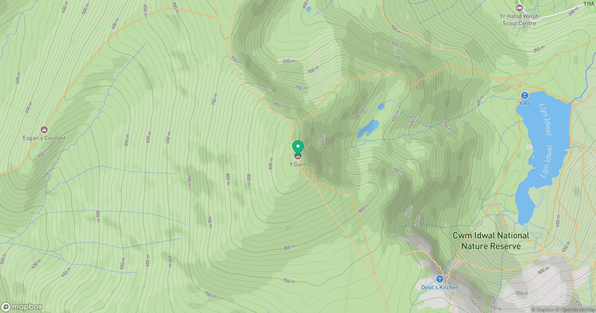
Grid reference: SH630595
View on OpenStreetMapOpens a map in a new tab, centred on the hill.
No comments yet. Be the first.