

Moel y Golfa
Good walks are even better shared.
SJ2812 : The summit of Moel y Golfa and distant Rodney's Pillar
Jeremy Bolwell Photo source
Explore routes near Moel y Golfa
Walks starting near this hill. Open a route to check its map, distance and full itinerary.
Welshpool to Sweeps Bridge: Montgomery Canal and Belan Locks
View route
Lightspout Waterfall via Carding Mill Valley Circular
View route
Carding Mill Valley and The Long Mynd walk
View route
Colemere and Blakemere Canal Walk
View route
Route planning notes
These notes describe possible approaches. Check a route's map and access information when planning your walk.
Moel y Golfa Path
A well-defined path starting from the village of Caersws, taking you through lush hillsides and open fields. This is the most popular route to reach the summit.
Make a day of it, together
Find someone to share the walk with, or organise a day out along a route you like.
Photo Gallery
View all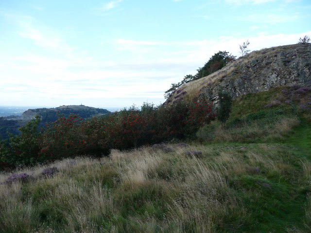 Photo could not load
SJ2812 : The summit of Moel y Golfa and distant Rodney's Pillar
Jeremy Bolwell
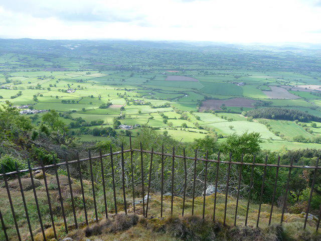 Photo could not load
SJ2812 : View westwards from the Gypsy King monument on Moel y Golfa
Jeremy Bolwell
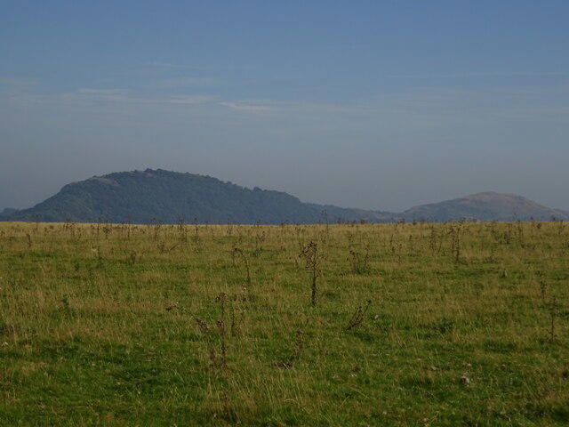 Photo could not load
SJ2912 : Moel y Golfa and Middletown Hill from Heldre Hill
Andrew Shannon
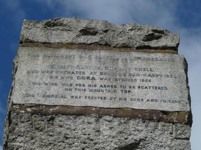 Photo could not load
SJ2812 : Plaque on the Gypsy King monument on Moel y Golfa
Jeremy Bolwell
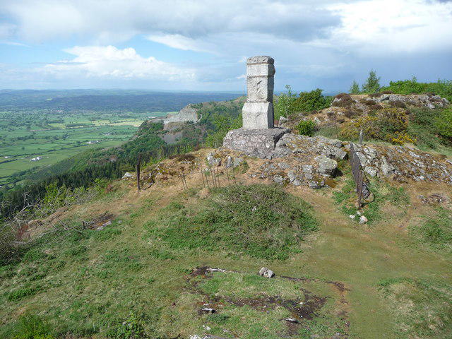 Photo could not load
SJ2812 : The Gypsy King monument on Moel y Golfa
Jeremy Bolwell
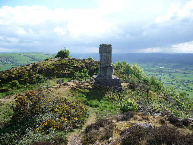 Photo could not load
SJ2812 : The Gypsy King monument on Moel y Golfa looking south west
Jeremy Bolwell
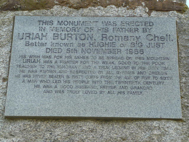 Photo could not load
SJ2812 : Plaque on the Gypsy King monument on Moel y Golfa
Jeremy Bolwell
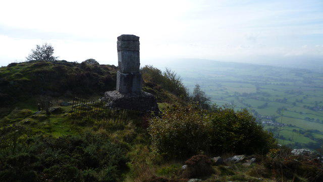 Photo could not load
SJ2912 : On top of Moel y Golfa
Jeremy Bolwell
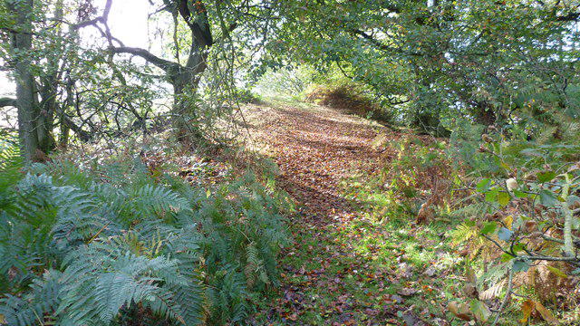 Photo could not load
SJ2912 : Woodland path on Moel y Golfa in autumn
Jeremy Bolwell
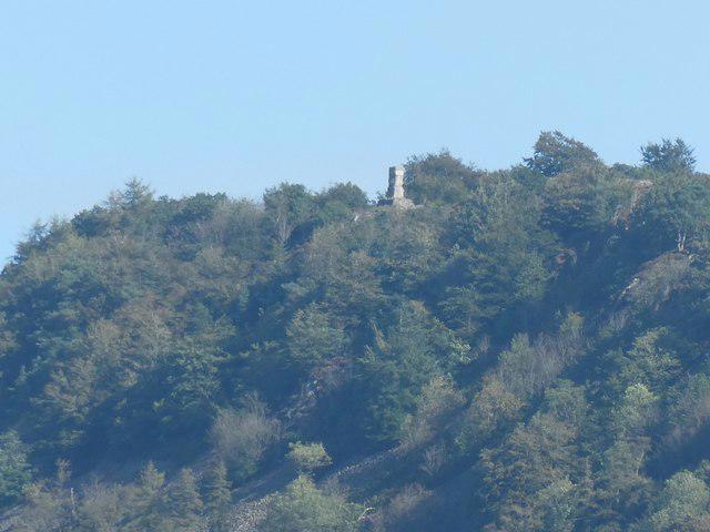
SJ2912 : Distant view to the Gypsy King's monument on Moel-y-Golfa
Jeremy Bolwell
Hill facts and local notes
Classifications
Elevation
403m
1,323 ft
Prominence
261m
Coordinates
52.7058, -3.0512
SJ290125
OS Map
126
Explorer: 240
At the Summit
The summit features a prominent trig point, alongside a small stone cairn. The panoramic views from the top make the climb well worth it, even if you have to fend off sheep that think you’ve come to share their turf.
Terrain & Geology
Mostly composed of sandstone and mudstone, Moel y Golfa showcases the typical geology of the Welsh hills, making it a bountiful area for exploration and discovery. The summit is predominantly rocky, giving way to grassy slopes as you descend.
Views & Scenery
On a clear day, you can see the mountains of Snowdonia to the north, the Brecon Beacons to the south, and the stunning green valleys that typify this region.
History & Heritage
Name Origin
The name 'Moel y Golfa' translates to 'hill of the hollow' in Welsh, possibly referring to the natural depressions found in the area.
Historical Significance
Moel y Golfa is a beloved local landmark and has been a site for hiking and outdoor activities for generations. Its accessibility makes it a popular spot for both serious hikers and families.
Getting There & Facilities
Parking
There is a small car park at the base near Caersws, with enough space for several cars. It gets busy on weekends, so arrive early.
Public Transport
The nearest train station is Caersws, which is on the Cambrian Line. Local bus services also run to and from the area, but check current timetables.
Nearby Facilities
There are no facilities on the mountain itself, but Caersws offers a few cafés and pubs where you can refuel after your adventure. Toilets can also be found in the village.
Safety Information
Known Hazards
- Loose stones on paths, muddy terrain after rain, and occasional sheep encounters that may cause them to steer you off course.
General Safety Tips
- Check weather conditions before setting out
- Carry appropriate clothing and equipment
- Let someone know your planned route
- Take a map, compass, and GPS device
- Carry emergency supplies: food, water, first aid kit, torch
Hills
Some common questions about the hills answered
Are there group walks up Moel y Golfa?
Many walkers use Walkmates to join or organise walks with others. You can check for group walks around Moel y Golfa through the maps
Are there other walkers around Moel y Golfa?
Activity varies by location and time, but Walkmates lets you see whether others have shared walks or shown interest in this area. Find other people through the walking friends search walking friends for Moel y Golfa search or of course create your own walk for Moel y Golfa
Can I organise a walk to Moel y Golfa?
Yes. If there aren’t any walks listed already, you can create a walk and make it available for others to join.
If you're signed up to Walkmates, you can create a walk to Moel y Golfa.
How do I find a walk up this hill?
There are often multiple ways to walk this hill, depending on experience and route preference. Walkmates helps you explore walks and routes that others have shared.
Can I suggest a new route up Moel y Golfa?
Yes. You can suggest or create routes to share with others. Walkmates focuses on the social side of walking, so routes are used to help people organise walks and explore areas together, rather than as detailed navigation tools or route libraries.
Other uses really appreciate knowledgeable walkers sharing their routes. Share your favourite route to Moel y Golfa here
The is an error or something incorrect about this hill. How do I let you know?
We always strive to keep the information on Walkmates as accurate as possible. If you find an error, please let us know through the contact form and we'll aim to correct it as quickly as possible
Community Discussion
Comments
Location
View the hill's mapped position and surrounding paths.
Grid reference: SJ290125
View on OpenStreetMapOpens a map in a new tab, centred on the hill.

No comments yet. Be the first.