
Yr Allt
Good walks are even better shared.
Overview
Yr Allt
Nestled in the stunning Cambrian Mountains, Yr Allt stands tall at 356 meters, acting as a natural lookout over the rolling hills and valleys below. It's classified as a Marilyn, making it a popular choice for those eager to bag summits without the need for a climbing harness!
Geology
Yr Allt's ancient rocks tell tales of a time long before sheep took over the hills! The dominant sedimentary rocks - mudstones and sandstones - were laid down during the Ordovician period, giving us a peek into the Earth's layers. The erosional patterns shape a fascinating landscape for geologists and curious hikers alike.
Routes
One of the more popular routes is the Penderyn Circular. This 8.5 km trek provides moderate difficulty, perfect for families and seasoned hikers. It begins in the village of Penderyn, allowing you to explore the local charm before heading up to the summit. Plan for about 3 hours; this will give you plenty of time to enjoy the scenery without turning into a sweaty mess!
Summit Features
Upon reaching the summit, you'll be greeted by a humble cairn and a delightful stone shelter. It serves as a perfect picnic spot, allowing you to appreciate the stunning views while munching on your well-deserved sandwiches.
Terrain
The terrain of Yr Allt is predominantly grassy with a few rocky patches that can add an element of surprise - or mild frustration - depending on your footwear. It's a delightful hike with just enough challenges to keep things interesting.
Views
The views from the summit are best enjoyed in spring or early autumn when the rolling hills and peaks of the Brecon Beacons are in full splendour. The vistas stretch far and wide, rewarding hikers with sights of neighbouring mountains that will leave your Instagram followers rather envious!
Hazards
While the hike is generally safe, keep an eye out for muddy patches after rain - your boots might decide to participate in the slip-and-slide competitions. A little caution on the rocky areas can go a long way towards avoiding any unexpected tumbles.
Access
Parking is available in Penderyn, but arrive early if you're planning a weekend escapade! The nearest bus services operate from Aberdare and Hirwaun, making it accessible for those relying on public transport. Once in Penderyn, you can fuel up on local delights before the climb.
Facilities
Although there are none directly on Yr Allt, the village of Penderyn offers a couple of charming cafes for a cuppa and public toilets for a much-needed pit stop.
History
The name 'Yr Allt' translates to 'the bank' or 'the slope' in Welsh, perfectly encapsulating the nature of this lovely mountain. Historically, it’s been a favourite haven for shepherds and hikers seeking both challenge and inspiration.
In conclusion, Yr Allt caters to the adventurer and the casual walker alike, promising views and a bit of history to spice up your day. So strap on those boots, take a deep breath, and enjoy the beautiful Welsh landscape!
Explore routes near Yr Allt
Public walks starting within 80 km of this hill. Nearby does not mean a route reaches the summit; check its map and access before setting out.
Welshpool to Sweeps Bridge: Montgomery Canal and Belan Locks
View route
Oswestry Walk with Men Walking & Talking
View route
Shrewsbury Walk with Men Walking & Talking
View route
Lightspout Waterfall via Carding Mill Valley Circular
View route
Route planning notes
These notes describe possible approaches, not verified navigable routes or permission to cross land. Check current paths, local access rules and conditions before setting out.
Penderyn Circular
A lovely circular route starting from Penderyn that takes in scenic landscapes and the charming village itself.
Make a day of it, together
Find someone to share the walk with, or organise a day out along a route you like.
Hill facts and local notes
Classifications
Elevation
232m
761 ft
Prominence
106m
Coordinates
52.6824, -3.1221
SJ242100
OS Map
126
Explorer: 240
At the Summit
The summit is marked by a modest cairn, offering a perfect spot to catch your breath and admire the splendid views. There's also an impressive stone shelter, perfect for a picnic!
Terrain & Geology
Yr Allt is primarily composed of ancient sedimentary rocks, including mudstones and sandstones, formed during the Ordovician period. The geological features offer interesting insights into the region's tectonic history, with signs of erosion and weathering visible along the paths.
Views & Scenery
From the summit, hikers can view the rugged peaks of the Brecon Beacons, as well as the beautiful surrounding valleys. On a clear day, the sight of distant hills can be quite a rewarding bonus.
History & Heritage
Name Origin
The name 'Yr Allt' means 'the bank' or 'the slope' in Welsh, a fitting title for such a beautiful terrain.
Historical Significance
Yr Allt has played a part in local history, often frequented by shepherds and hikers seeking solace and inspiration in the vast landscapes.
Getting There & Facilities
Check current local access restrictions, parking rules and transport timetables before travelling. These notes do not confirm public access to the summit.
Parking
There is a small car park near Penderyn which accommodates approximately 20 vehicles. Arrive early during weekends to secure a spot.
Public Transport
The nearest bus stop is in Penderyn, serviced by local buses from Aberdare and Hirwaun.
Nearby Facilities
While there are no facilities directly on the mountain, Penderyn has a couple of local cafes and public toilets available for visitors.
Safety Information
Known Hazards
- Beware of muddy patches after rainfall; those boots can get slippery. Additionally, some rocky areas require caution, especially on the descent.
General Safety Tips
- Check weather conditions before setting out
- Carry appropriate clothing and equipment
- Let someone know your planned route
- Take a map, compass, and GPS device
- Carry emergency supplies: food, water, first aid kit, torch
Hills
Some common questions about the hills answered
Are there group walks up Yr Allt?
Many walkers use Walkmates to join or organise walks with others. You can check for group walks around Yr Allt through the maps
Are there other walkers around Yr Allt?
Activity varies by location and time, but Walkmates lets you see whether others have shared walks or shown interest in this area. Find other people through the walking friends search walking friends for Yr Allt search or of course create your own walk for Yr Allt
Can I organise a walk to Yr Allt?
Yes. If there aren’t any walks listed already, you can create a walk and make it available for others to join.
If you're signed up to Walkmates, you can create a walk to Yr Allt.
How do I find a walk up this hill?
There are often multiple ways to walk this hill, depending on experience and route preference. Walkmates helps you explore walks and routes that others have shared.
Can I suggest a new route up Yr Allt?
Yes. You can suggest or create routes to share with others. Walkmates focuses on the social side of walking, so routes are used to help people organise walks and explore areas together, rather than as detailed navigation tools or route libraries.
Other uses really appreciate knowledgeable walkers sharing their routes. Share your favourite route to Yr Allt here
The is an error or something incorrect about this hill. How do I let you know?
We always strive to keep the information on Walkmates as accurate as possible. If you find an error, please let us know through the contact form and we'll aim to correct it as quickly as possible
Community Discussion
Comments
Location
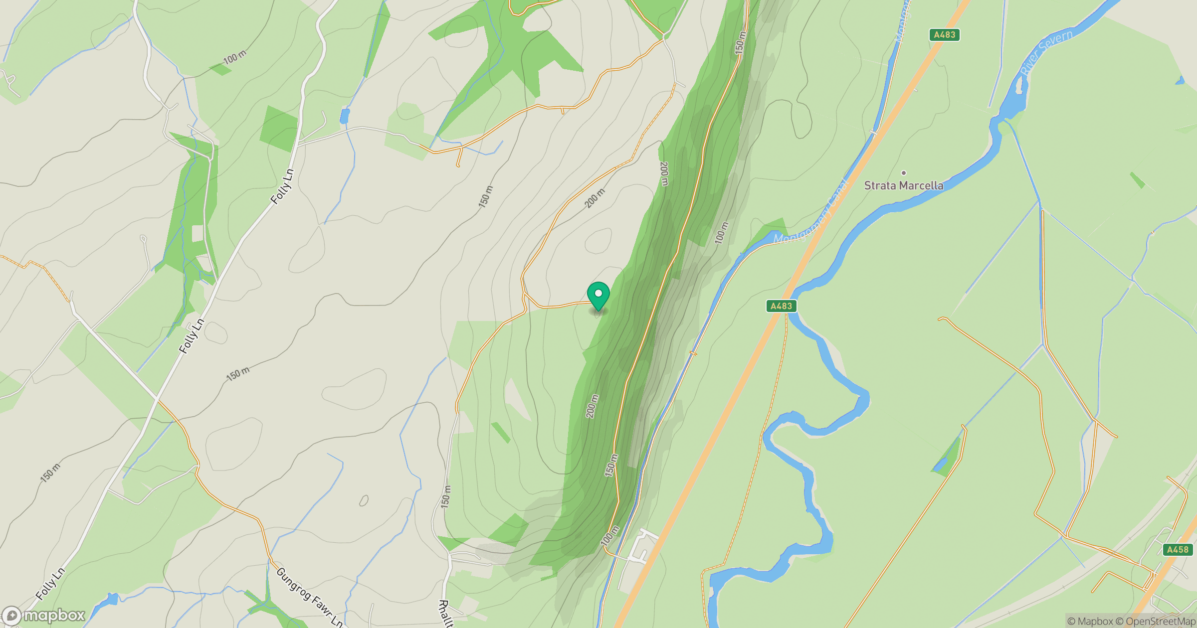
Grid reference: SJ242100
View on OpenStreetMapOpens a map in a new tab, centred on the hill.
Hills within 30 km
Straight-line distance, not a walking route or confirmation of access.
Stiperstones
537m
Long Mynd - Pole Bank
517m
Cadair Berwyn
832m
Long Mountain
408m
Moel y Golfa
403m
No comments yet. Be the first.