

Corndon Hill
Good walks are even better shared.
SO3096 : Trig point and cairn on the summit of Corndon Hill
Jeremy Bolwell Photo source
Overview
Corndon Hill: A Hiker's Delight
Corndon Hill, standing proud at 510 meters, is a splendid example of the natural beauty found in the Shropshire Hills. Its summit not only offers breathtaking views but also a rich tapestry of geological history.
Geology
Made up largely of Old Red Sandstone, Corndon Hill’s formations tell a story of ancient riverbeds and plains. The playful display of colours and textures is a feast for any geology enthusiast. Bring your trusty rock hammer, just kidding—don't bring that!
Routes
There are various routes to choose from, suitable for all levels of experience:
- Corndon Hill Circular Walk: This moderate route of about 8 km takes you through picturesque landscapes and is well-marked, perfect for a family outing.
- Straight Ascent: A more challenging 2 km path directly from the car park—ideal for those who think 'why take the scenic route when you can sweat your way up?'
Summit Features
At the top of Corndon Hill, you'll find a notable trig point surrounded by a few stone markers. Don't forget to take a selfie—it's practically a rite of passage for hikers!
Terrain Type
The delightful terrain is a mix of grassy slopes and rocky patches, but watch out for the occasional bog! A great reminder that even the best-laid plans can get a bit muddy.
Views
Once at the summit, you won't be disappointed! Expect panoramic views of the Long Mynd and, if you're lucky, the Brecon Beacons and Malvern Hills in the distance. The best times to enjoy these vistas are during spring or autumn, where the weather plays nice.
Hazards
Mind the sheep! They themselves aren't hazardous but can be quite a distraction when trying to navigate your path. And watch out for those quick weather changes that can sweep across the hills; remember, it’s England!
Nearby Summits
If you’re feeling adventurous, consider a visit to Bury Ditch or Clee Hill for additional hiking opportunities and challenges.
Access and Facilities
Parking is convenient at SO306974, and the local town of Bishop's Castle is just a short drive away. Enjoy a pint at a local pub or grab some snacks before heading out.
History
The name Corndon is derived from Old English, translating as 'hilltop', which it certainly is, with a significance steeped in local history.
So lace up those hiking boots and get ready for a delightful adventure on Corndon Hill!
Explore routes near Corndon Hill
Walks starting near this hill. Open a route to check its map, distance and full itinerary.
Welshpool to Sweeps Bridge: Montgomery Canal and Belan Locks
View route
Lightspout Waterfall via Carding Mill Valley Circular
View route
Carding Mill Valley and The Long Mynd walk
View route
Shrewsbury Walk with Men Walking & Talking
View route
Route planning notes
These notes describe possible approaches. Check a route's map and access information when planning your walk.
Corndon Hill Circular Walk
This moderate circular route offers stunning views and a well-marked path through varied terrain.
Straight Ascent from the Parking Area
A direct and steep ascent from the nearest parking area, ideal for those who prefer a challenge.
Make a day of it, together
Find someone to share the walk with, or organise a day out along a route you like.
Photo Gallery
View all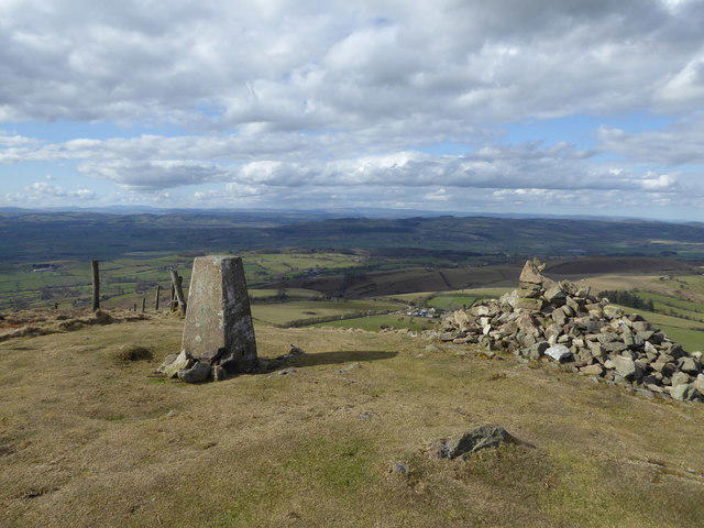 Photo could not load
SO3096 : Trig point and cairn on the summit of Corndon Hill
Jeremy Bolwell
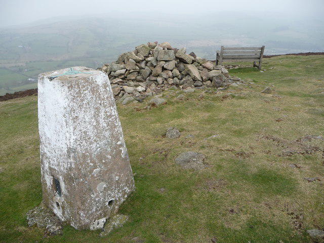 Photo could not load
SO3096 : Corndon Hill summit
Jeremy Bolwell
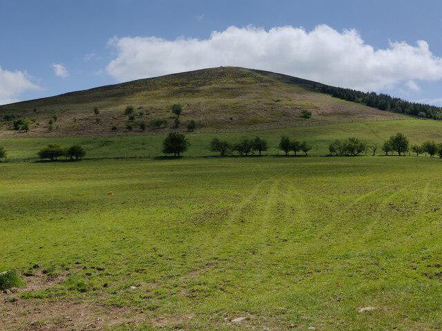 Photo could not load
SO3096 : Corndon Hill
Mat Fascione
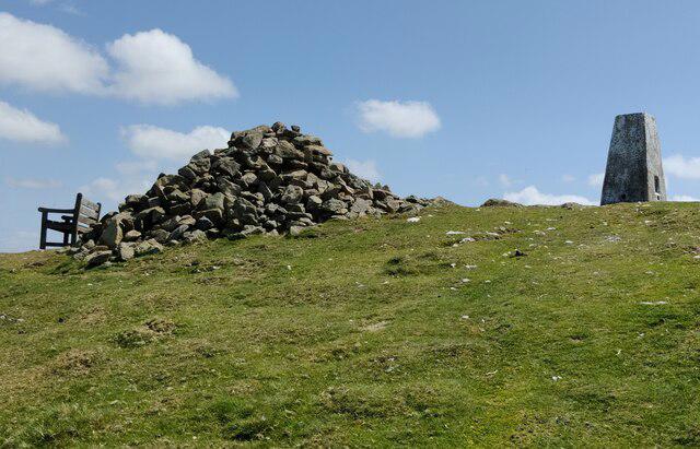 Photo could not load
SO3096 : The summit of Corndon Hill
Mat Fascione
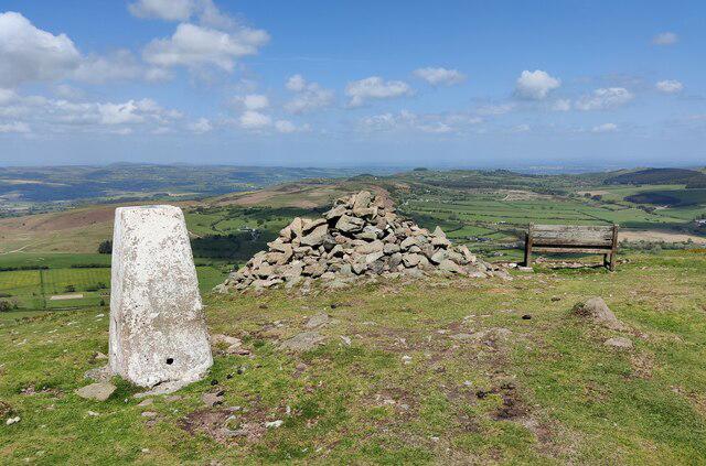 Photo could not load
SO3096 : The summit of Corndon Hill
Mat Fascione
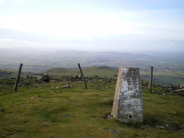 Photo could not load
SO3096 : Westwards from Corndon towards Montgomery
Richard Law
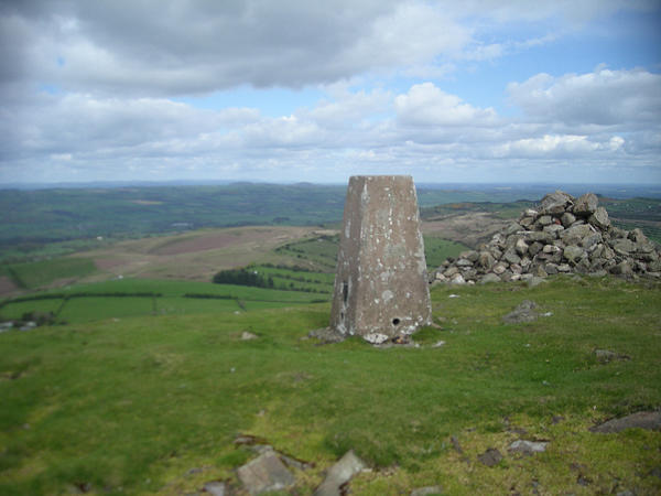 Photo could not load
SO3096 : Corndon Hill trig point
Row17
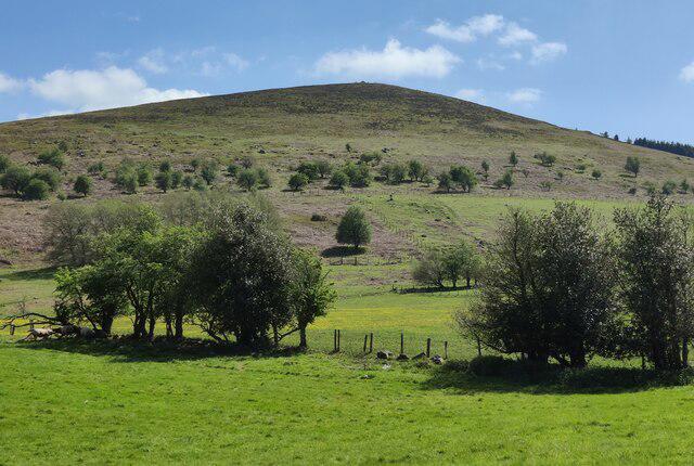 Photo could not load
SO3096 : Corndon Hill
Mat Fascione
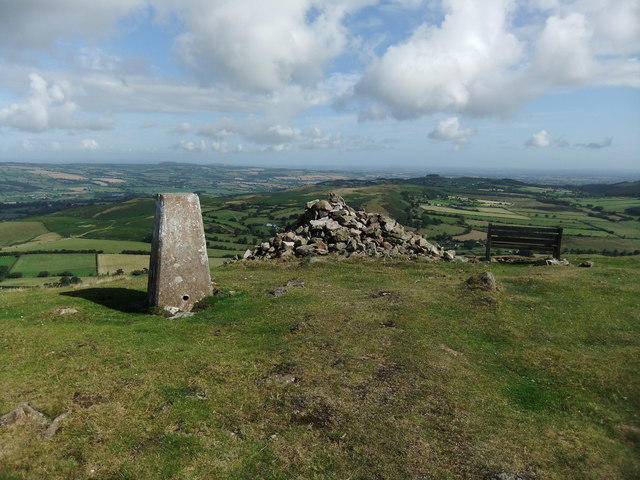 Photo could not load
SO3096 : Perfect day on Corndon Hill
David Brown
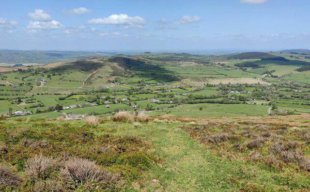
SO3096 : Shropshire countryside north of Corndon Hill
Mat Fascione
Hill facts and local notes
Classifications
Elevation
514m
1,685 ft
Prominence
203m
Coordinates
52.5657, -3.0253
SO306969
OS Map
137
Explorer: 216
At the Summit
The summit features a prominent trig point and several stone markers, providing excellent views of the surrounding hills and valleys.
Terrain & Geology
Corndon Hill is primarily composed of Old Red Sandstone, a sedimentary rock known for its rich colours and layered formations. This geological makeup contributes to the dramatic landscapes of the Shropshire Hills.
Views & Scenery
From the summit, you can see the Long Mynd, the Brecon Beacons, and on a clear day, even the Malvern Hills.
History & Heritage
Name Origin
The name 'Corndon' is believed to derive from the Old English meaning 'hilltop', certainly a fitting name for this prominent feature.
Historical Significance
Corndon Hill has historical importance, as it stood as a lookout point during various local skirmishes and remains a beloved hiking destination.
Getting There & Facilities
Parking
There is a small car park at SO306974, providing easy access to the main walking routes.
Public Transport
Buses from nearby towns like Bishop's Castle stop at the village of Little Stretton, approximately 3 miles away.
Nearby Facilities
Facilities include a couple of local pubs in Bishop's Castle for refreshments, as well as public toilets in the town square.
Safety Information
Known Hazards
- Watch for sheep and livestock on the trails; they have a right to be there. Also, be mindful of sudden weather changes typical of the region.
General Safety Tips
- Check weather conditions before setting out
- Carry appropriate clothing and equipment
- Let someone know your planned route
- Take a map, compass, and GPS device
- Carry emergency supplies: food, water, first aid kit, torch
Hills
Some common questions about the hills answered
Are there group walks up Corndon Hill?
Many walkers use Walkmates to join or organise walks with others. You can check for group walks around Corndon Hill through the maps
Are there other walkers around Corndon Hill?
Activity varies by location and time, but Walkmates lets you see whether others have shared walks or shown interest in this area. Find other people through the walking friends search walking friends for Corndon Hill search or of course create your own walk for Corndon Hill
Can I organise a walk to Corndon Hill?
Yes. If there aren’t any walks listed already, you can create a walk and make it available for others to join.
If you're signed up to Walkmates, you can create a walk to Corndon Hill.
How do I find a walk up this hill?
There are often multiple ways to walk this hill, depending on experience and route preference. Walkmates helps you explore walks and routes that others have shared.
Can I suggest a new route up Corndon Hill?
Yes. You can suggest or create routes to share with others. Walkmates focuses on the social side of walking, so routes are used to help people organise walks and explore areas together, rather than as detailed navigation tools or route libraries.
Other uses really appreciate knowledgeable walkers sharing their routes. Share your favourite route to Corndon Hill here
The is an error or something incorrect about this hill. How do I let you know?
We always strive to keep the information on Walkmates as accurate as possible. If you find an error, please let us know through the contact form and we'll aim to correct it as quickly as possible
Community Discussion
Comments
Location
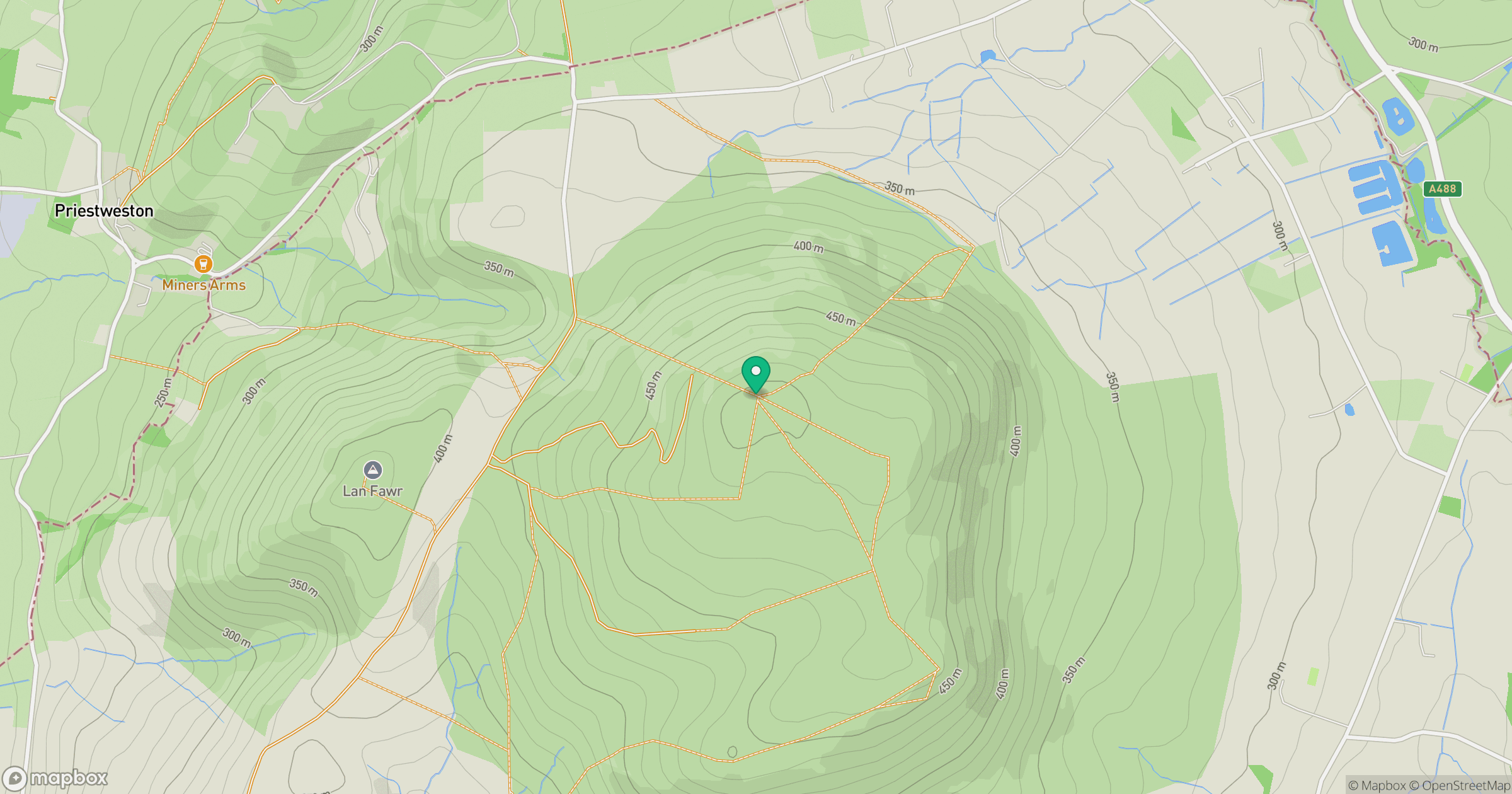
Grid reference: SO306969
View on OpenStreetMapOpens a map in a new tab, centred on the hill.
Nearby Hills
Stiperstones
537m
Long Mynd - Pole Bank
517m
Titterstone Clee Hill
533m
Cadair Berwyn
832m

The Wrekin
407m
No comments yet. Be the first.