

Llanymynech Hill
Good walks are even better shared.
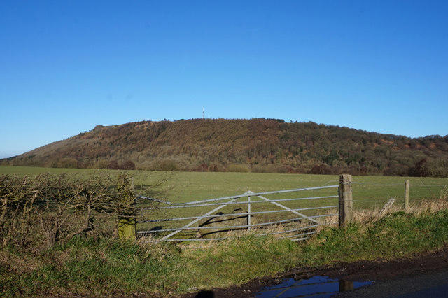
SJ2622 : Cwrs Goff Llanymynech Golf Course
Alan Richards Photo source
Overview
Llanymynech Hill: A Hidden Gem in Shropshire
Overview
Llanymynech Hill, a Marilyn at 320 meters, offers a rewarding hiking experience. Nestled in the picturesque Shropshire Hills, it is easily accessible and presents stunning views from its summit. If you’ve ever wanted to feel on top of the world—this is your chance, albeit a modest top!
Geology
The intriguing geology of Llanymynech Hill is dominated by Carboniferous limestone, with its limestone cliffs and unique karst formations providing both botanical and geological interest. Nature lovers will appreciate the flora thriving in the limestone soil and might even spot a few rare species on their climb.
Routes
Two main routes stand out for hikers. The Llanymynech Hill Circular Route is easy and accessible for families, while the Hillfort Trail offers a tinge of challenge along with rich historical context. Either way, don’t forget to enjoy the views!
Summit Features
Reaching the summit, you'll find a trig point and remnants of an Iron Age hillfort. These markers remind us of the intriguing people who once surveyed the lands from such a height. Picnics are highly encouraged here, as the scenery is quite hungry for your attention—just don’t feed the views!
Terrain
Expect a mixture of grassy paths, rocky ascents, and inviting woodlands. The terrain is generally friendly, though some paths can surprise you with their rocky nature. Remember, a good pair of boots is always a friend on any venture.
Views
On a clear day, the views are nothing short of spectacular. You can gaze toward the Berwyn Mountains of Wales and take in the vastness of the Shropshire plains. Best viewed in spring or autumn when nature's colours are in full swing, making it a picture-perfect panorama.
Hazards
While the paths are mild for the most part, beware of unexpected slips, especially during wet conditions. Ticks can be more of a nuisance than a hazard, so check yourself after stomping through the wild grass!
Access
The nearest parking is a quaint spot at the base of the hill, easily reached from the B4396. If you prefer public transport, local buses connect from Oswestry and Welshpool. The village itself is charming and offers a nice café to unwind after your hike.
Nearby Summits
For those wanting to bag more peaks, nearby summits include Nantyr Llethrid and Mynydd Isa, each offering their own unique experiences.
Conclusion
Llanymynech Hill is more than just a walk; it is a symphony of nature, history, and stunning vistas waiting to charm every trekker. Grab your boots, a sense of adventure, and perhaps a sandwich or two for the summit—because the only thing better than the views will be your picnic!
Explore routes near Llanymynech Hill
Walks starting near this hill. Open a route to check its map, distance and full itinerary.
Oswestry Walk with Men Walking & Talking
View route
Welshpool to Sweeps Bridge: Montgomery Canal and Belan Locks
View route
Ellesmere Walk with Men Walking & Talking
View route
Colemere and Blakemere Canal Walk
View route
Route planning notes
These notes describe possible approaches. Check a route's map and access information when planning your walk.
Llanymynech Hill Circular Route
A delightful loop starting from the village of Llanymynech, weaving through woodland and open pastures before ascending to the summit. A perfect route for families and those who fancy a good stroll with some gentle inclines.
The Hillfort Trail
This trail takes you through the ancient hillfort at the summit, offering a fascinating glimpse into history whilst you catch your breath from the ascent. Expect some steeper sections but well worth the effort.
Make a day of it, together
Find someone to share the walk with, or organise a day out along a route you like.
Photo Gallery
View all Photo could not load
SJ2622 : Cwrs Goff Llanymynech Golf Course
Alan Richards
 Photo could not load
SJ2622 : Llanymynech Golf Course
John H Darch
 Photo could not load
SJ2622 : Llanymynech Golf Course
Tim Heaton
 Photo could not load
SJ2622 : Trees on Llanymynech Golf Course
Dave Croker
 Photo could not load
SJ2622 : Llanymynech Hill
Rude Health
Hill facts and local notes
Classifications
Elevation
226m
741 ft
Prominence
124m
Coordinates
52.7922, -3.0941
SJ263221
OS Map
126
Explorer: 240
At the Summit
The summit features a well-preserved trig point and a former hillfort site, where you can enjoy a picnic and consider the strategic importance of the location—who wouldn't want to watch over their neighbours from such a vantage point?
Terrain & Geology
Llanymynech Hill is primarily composed of Carboniferous limestone, creating striking cliff formations and a unique karst landscape. The rock gives way to beautiful natural features such as swallow holes and limestone pavements, making it a veritable playground for geologists and curious hikers alike.
Views & Scenery
Magnificent views over the Welsh Borders, including the Berwyn Mountains in the distance, and the Shropshire plains stretching out to the east.
History & Heritage
Name Origin
The name Llanymynech derives from the Welsh 'Llan' meaning church and 'mynech' meaning monk. It implies a historical connection to early Christian sites.
Historical Significance
The hill has been inhabited from the Iron Age, with significant archaeological remnants, including the hillfort, providing insight into ancient settlement patterns.
Getting There & Facilities
Parking
There is a small car park at the base of the hill in the village of Llanymynech, easily accessible from the B4396.
Public Transport
Local buses from Oswestry and Welshpool service the village. Check the timetable for the best connections.
Nearby Facilities
Llanymynech offers a small café for refreshments after your trek, while the nearby town of Oswestry has more extensive amenities including shops and toilets.
Safety Information
Known Hazards
- Some paths may be uneven or slippery, particularly after rain, so a decent pair of walking boots is advisable. Wildlife, including ticks, can be present in long grass.
General Safety Tips
- Check weather conditions before setting out
- Carry appropriate clothing and equipment
- Let someone know your planned route
- Take a map, compass, and GPS device
- Carry emergency supplies: food, water, first aid kit, torch
Hills
Some common questions about the hills answered
Are there group walks up Llanymynech Hill?
Many walkers use Walkmates to join or organise walks with others. You can check for group walks around Llanymynech Hill through the maps
Are there other walkers around Llanymynech Hill?
Activity varies by location and time, but Walkmates lets you see whether others have shared walks or shown interest in this area. Find other people through the walking friends search walking friends for Llanymynech Hill search or of course create your own walk for Llanymynech Hill
Can I organise a walk to Llanymynech Hill?
Yes. If there aren’t any walks listed already, you can create a walk and make it available for others to join.
If you're signed up to Walkmates, you can create a walk to Llanymynech Hill.
How do I find a walk up this hill?
There are often multiple ways to walk this hill, depending on experience and route preference. Walkmates helps you explore walks and routes that others have shared.
Can I suggest a new route up Llanymynech Hill?
Yes. You can suggest or create routes to share with others. Walkmates focuses on the social side of walking, so routes are used to help people organise walks and explore areas together, rather than as detailed navigation tools or route libraries.
Other uses really appreciate knowledgeable walkers sharing their routes. Share your favourite route to Llanymynech Hill here
The is an error or something incorrect about this hill. How do I let you know?
We always strive to keep the information on Walkmates as accurate as possible. If you find an error, please let us know through the contact form and we'll aim to correct it as quickly as possible
Community Discussion
Comments
Location
View the hill's mapped position and surrounding paths.
Grid reference: SJ263221
View on OpenStreetMapOpens a map in a new tab, centred on the hill.
No comments yet. Be the first.