

Moel y Fronllwyd
Good walks are even better shared.
Overview
Moel y Fronllwyd: An Exploration
Overview
Moel y Fronllwyd stands at a modest 534 meters in elevation yet provides an extraordinary experience for hikers and views that could charm even the most cynical landscape lover.
Geology
The bedrock of Moel y Fronllwyd is primarily made up of mudstone and sandstone, telling the tale of epochs long gone. Be cautious of loose rocks as they have the knack of tumbling down unexpectedly!
Routes
There are a couple of popular routes to reach the summit of Moel y Fronllwyd. Both routes offer their unique scenery:
- The route from Llangollen is particularly lovely, taking you through ample greenery and rolling hills before reaching the summit.
- Alternatively, the Cwm Lloer route will satisfy those looking for a bit more character in their hike while leading advantageously to the peak.
Terrain and Summit Features
The terrain can be grassy at times, but don’t get too comfortable; rockier patches are waiting around the corner. At the summit, you’ll find a small cairn that has weathered many a storm, just like us hearty hikers.
Views
Upon conquering the summit, you’ll be rewarded with views that stretch for miles. From the summit, gaze upon the unparalleled landscape of the Berwyn Mountains, or, on a particularly clear day, even catch a glimpse of Snowdonia.
Hazards
As with many hills, be aware of loose rocks, especially on the steeper sections and don’t let a sudden change in weather catch you out. Always pack a sense of adventure…and a raincoat!
Nearby Summits
In the vicinity are other hills such as Moel Wnion and Moel y Gamelin, both of which could happily vie for your attention on your outdoor adventures.
Access
The nearest parking area is conveniently located near Llangollen, providing an easy start to your adventure. Public transport services regularly connect Llangollen with nearby towns. Facilities in Llangollen are welcoming, with cafes and shops ready to refuel you.
Conclusion
Moel y Fronllwyd may not be the highest mountain on the block, but it wraps its charm in rocky outcrops, stunning views, and excellent hiking opportunities. So grab your walking shoes and perhaps a sandwich, and make a day of it. After all, every hill is a mountain if you believe hard enough!
Explore routes near Moel y Fronllwyd
Public walks starting within 80 km of this hill. Nearby does not mean a route reaches the summit; check its map and access before setting out.
Welshpool to Sweeps Bridge: Montgomery Canal and Belan Locks
View route
Oswestry Walk with Men Walking & Talking
View route
Llangollen to Horseshoe Falls: Canal Towpath from Market Street
View route
Waun-oer, Maesglase and Cribin Fawr guided mountain walk
View route
Route planning notes
These notes describe possible approaches, not verified navigable routes or permission to cross land. Check current paths, local access rules and conditions before setting out.
From The Small Town of Llangollen
This route starts from a small car park near Llangollen and gradually leads to the open moors. Ideal for a more scenic approach.
Via Cwm Lloer
A delightful walk through Cwm Lloer, full of beautiful flora and fauna, with a direct approach to the summit.
Make a day of it, together
Find someone to share the walk with, or organise a day out along a route you like.
Photo Gallery
View all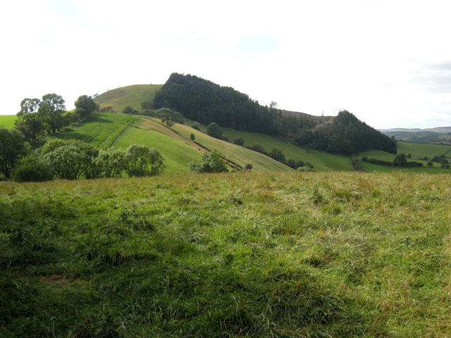 Photo could not load
SJ1217 : Moel-y-Fronllwyd
Oliver Dixon
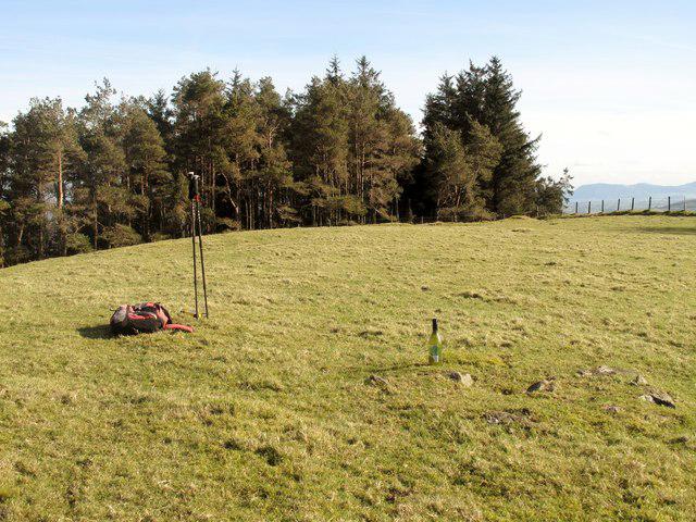 Photo could not load
SJ1217 : Moel y Fronllwyd
Rude Health
Hill facts and local notes
Classifications
Elevation
396m
1,298 ft
Prominence
141m
Coordinates
52.7494, -3.3048
SJ120176
OS Map
125
Explorer: 239
At the Summit
At the summit, you will find a small, but distinguished cairn that stands proudly amid patches of rocky outcrops. No trig point here, just the sense of accomplishment.
Terrain & Geology
The mountain primarily comprises mudstone and sandstone, typical of the Welsh landscape. These rocks were formed during the late Palaeozoic era, giving a rugged but endearing quality to the hill.
Views & Scenery
Breathtaking views of the surrounding Berwyn Mountains and, on clear days, the distant peaks of Snowdonia and the expansive valleys below.
History & Heritage
Name Origin
The name 'Moel y Fronllwyd' translates to 'Hill of the Grey Bank', reflecting its rugged, yet charming appearance.
Historical Significance
The area has historical ties to rural Welsh life and is a picturesque representation of the culture surrounding the Berwyn Mountains.
Getting There & Facilities
Check current local access restrictions, parking rules and transport timetables before travelling. These notes do not confirm public access to the summit.
Parking
There is ample parking at the base near Llangollen, with clear signs to guide you to the trailhead.
Public Transport
Regular bus services operate from Wrexham and Oswestry to Llangollen. Check local schedules for the best times.
Nearby Facilities
Llangollen offers various facilities, including cafes, shops, and public toilets, perfect for a warm-up brew before your ascent.
Safety Information
Known Hazards
- Loose rocks on steeper sections and rapidly changing weather conditions. Always check forecasts before setting out.
General Safety Tips
- Check weather conditions before setting out
- Carry appropriate clothing and equipment
- Let someone know your planned route
- Take a map, compass, and GPS device
- Carry emergency supplies: food, water, first aid kit, torch
Hills
Some common questions about the hills answered
Are there group walks up Moel y Fronllwyd?
Many walkers use Walkmates to join or organise walks with others. You can check for group walks around Moel y Fronllwyd through the maps
Are there other walkers around Moel y Fronllwyd?
Activity varies by location and time, but Walkmates lets you see whether others have shared walks or shown interest in this area. Find other people through the walking friends search walking friends for Moel y Fronllwyd search or of course create your own walk for Moel y Fronllwyd
Can I organise a walk to Moel y Fronllwyd?
Yes. If there aren’t any walks listed already, you can create a walk and make it available for others to join.
If you're signed up to Walkmates, you can create a walk to Moel y Fronllwyd.
How do I find a walk up this hill?
There are often multiple ways to walk this hill, depending on experience and route preference. Walkmates helps you explore walks and routes that others have shared.
Can I suggest a new route up Moel y Fronllwyd?
Yes. You can suggest or create routes to share with others. Walkmates focuses on the social side of walking, so routes are used to help people organise walks and explore areas together, rather than as detailed navigation tools or route libraries.
Other uses really appreciate knowledgeable walkers sharing their routes. Share your favourite route to Moel y Fronllwyd here
The is an error or something incorrect about this hill. How do I let you know?
We always strive to keep the information on Walkmates as accurate as possible. If you find an error, please let us know through the contact form and we'll aim to correct it as quickly as possible
Community Discussion
Comments
Location
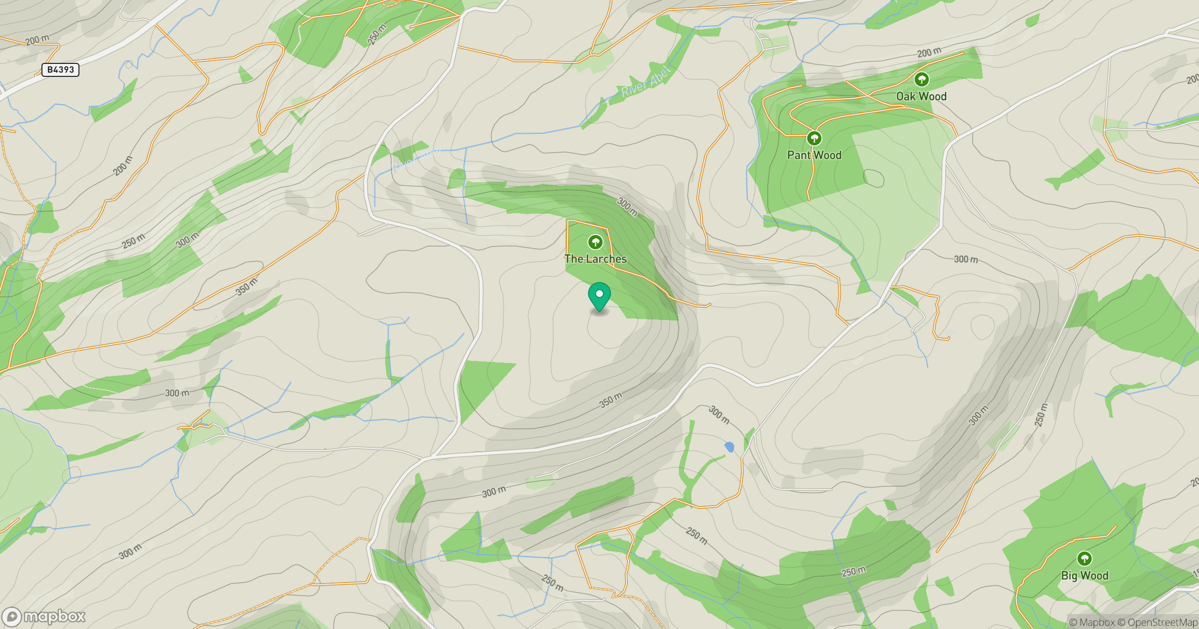
Grid reference: SJ120176
View on OpenStreetMapOpens a map in a new tab, centred on the hill.
Hills within 30 km
Straight-line distance, not a walking route or confirmation of access.
No comments yet. Be the first.