

Allt y Gader
Good walks are even better shared.
Overview
Allt y Gader: A Gem in Snowdonia
Allt y Gader is a hidden treasure nestled in the heart of Snowdonia National Park, Wales. Standing at an elevation of 568 meters, it may not be the tallest mountain, but don't let that fool you. This peak packs a punch with its rugged terrain and breathtaking views, making it a favourite among hikers of varying abilities.
Geology
The mountain's surface dances with volcanic rock formations such as andesite and rhyolite, remnants of ancient volcanic activity. Glacial sculpting has left its mark on the landscape, creating steep ascents and stunning ravines. As you hike, take a moment to appreciate the geological story written into the very stones beneath your feet.
Routes
Cwm Cywarch Route
This moderately challenging path leads you through a tranquil woodland setting before steeply ascending towards the summit. The fragrance of pine fills the air, and the chirping of birds accompanies your journey.
Llyn Cwm Ffynnon Route
For the more adventurous, this challenging route from Llyn Cwm Ffynnon offers steeper climbs and greater rewards. Prepare to earn those bragging rights with some panoramic vistas.
Summit Features
Reaching the summit, you'll find a triangulation point and a small stone marker. On a clear day, the view extends across the stunning Hiraethog hills and beyond, quite the reward for your uphill jaunt.
Terrain Type
The terrain can be rocky and challenging, with some sections turning muddy in the wet seasons, so good boots are a must. It's not a stroll in the park, but rather a robust amble through nature’s splendor.
Views
From the summit, the majestic peaks of Cadair Idris loom in the distance while the rolling hills of the Arans dance on the horizon. Perfectly picturesque, these views shine brightest during Spring and Autumn when nature wears its best attire.
Hazards
Be cautious of slippery rocks, particularly in wet weather. The swiftly changing conditions can surprise even the seasoned hiker, so it pays to be prepared.
Nearby Summits
For those who crave more heights, Cadair Idris and Aran Fawddwy are nearby giants worth exploring.
Access
Parking is somewhat limited at Cwm Cywarch—arrive early or you may find yourself waiting longer than you’d like. Public transport can get you to the starting point if you're not keen on the driver's seat.
Facilities
While there are no facilities at the summit, Machynlleth—your nearest town—has everything a weary adventurer might need, from cozy cafes to public toilets.
History
The name 'Allt y Gader' hails from Welsh roots, meaning 'the heights of the enclosure', hinting at its once-thriving agricultural background. Add a sprinkle of folklore, and you've got an area rich in stories and adventure.
Allt y Gader is truly more than just a mountain; it's an expedition into the soulful heart of Snowdonia.
Don’t forget to pack your camera, and perhaps a snack or two—after all, calories don’t count when you're in the great outdoors!
Explore routes near Allt y Gader
Public walks starting within 80 km of this hill. Nearby does not mean a route reaches the summit; check its map and access before setting out.
Welshpool to Sweeps Bridge: Montgomery Canal and Belan Locks
View route
Oswestry Walk with Men Walking & Talking
View route
Llangollen to Horseshoe Falls: Canal Towpath from Market Street
View route
World’s End and back
View route
Route planning notes
These notes describe possible approaches, not verified navigable routes or permission to cross land. Check current paths, local access rules and conditions before setting out.
Cwm Cywarch Route
A scenic route starting from Cwm Cywarch, this trail meanders through beautiful woodlands before climbing towards the summit, offering picturesque views back down the valley.
Llyn Cwm Ffynnon Route
This approach begins at Llyn Cwm Ffynnon and is a bit steeper but rewards hikers with stunning views of the surrounding peaks and valleys.
Make a day of it, together
Find someone to share the walk with, or organise a day out along a route you like.
Photo Gallery
View all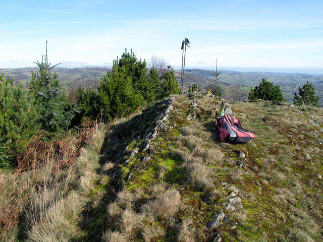 Photo could not load
SJ1417 : Allt y Gader
Rude Health
Hill facts and local notes
Classifications
Elevation
334m
1,096 ft
Prominence
122m
Coordinates
52.7500, -3.2623
SJ148176
OS Map
125
Explorer: 239
At the Summit
The summit features a triangulation point with a small stone marker. On a clear day, the summit provides panoramic views that are nothing short of spectacular.
Terrain & Geology
Allt y Gader is primarily composed of volcanic rock, specifically andesite and rhyolite, which forms the distinctive rugged landscape characteristic of the area. Over millennia, glacial erosion has shaped the local topography, giving rise to its steep inclines and sharp ridges.
Views & Scenery
From the summit, one can see the expansive views of the Hiraethog hills, the Arans, and even the iconic peaks of Snowdon on a good day.
History & Heritage
Name Origin
The name 'Allt y Gader' translates to 'the heights of the enclosure', likely referring to the ancient farming practices in the area.
Historical Significance
The area is rich in folklore, often regarded as a haunt of fairy tales and local legends, adding to its charm.
Getting There & Facilities
Check current local access restrictions, parking rules and transport timetables before travelling. These notes do not confirm public access to the summit.
Parking
Parking available at Cwm Cywarch with space for about 10-15 cars; arrive early to secure a place.
Public Transport
Local bus services operate from Machynlleth to Cwm Cywarch; check the Arriva Trains Wales website for the latest schedules.
Nearby Facilities
There are no facilities near the summit. However, in Machynlleth, you can find cafes, public toilets, and shops for supplies.
Safety Information
Known Hazards
- Rocky paths that may become slippery in wet conditions. Be mindful of sudden weather changes common in mountainous areas.
General Safety Tips
- Check weather conditions before setting out
- Carry appropriate clothing and equipment
- Let someone know your planned route
- Take a map, compass, and GPS device
- Carry emergency supplies: food, water, first aid kit, torch
Hills
Some common questions about the hills answered
Are there group walks up Allt y Gader?
Many walkers use Walkmates to join or organise walks with others. You can check for group walks around Allt y Gader through the maps
Are there other walkers around Allt y Gader?
Activity varies by location and time, but Walkmates lets you see whether others have shared walks or shown interest in this area. Find other people through the walking friends search walking friends for Allt y Gader search or of course create your own walk for Allt y Gader
Can I organise a walk to Allt y Gader?
Yes. If there aren’t any walks listed already, you can create a walk and make it available for others to join.
If you're signed up to Walkmates, you can create a walk to Allt y Gader.
How do I find a walk up this hill?
There are often multiple ways to walk this hill, depending on experience and route preference. Walkmates helps you explore walks and routes that others have shared.
Can I suggest a new route up Allt y Gader?
Yes. You can suggest or create routes to share with others. Walkmates focuses on the social side of walking, so routes are used to help people organise walks and explore areas together, rather than as detailed navigation tools or route libraries.
Other uses really appreciate knowledgeable walkers sharing their routes. Share your favourite route to Allt y Gader here
The is an error or something incorrect about this hill. How do I let you know?
We always strive to keep the information on Walkmates as accurate as possible. If you find an error, please let us know through the contact form and we'll aim to correct it as quickly as possible
Community Discussion
Comments
Location
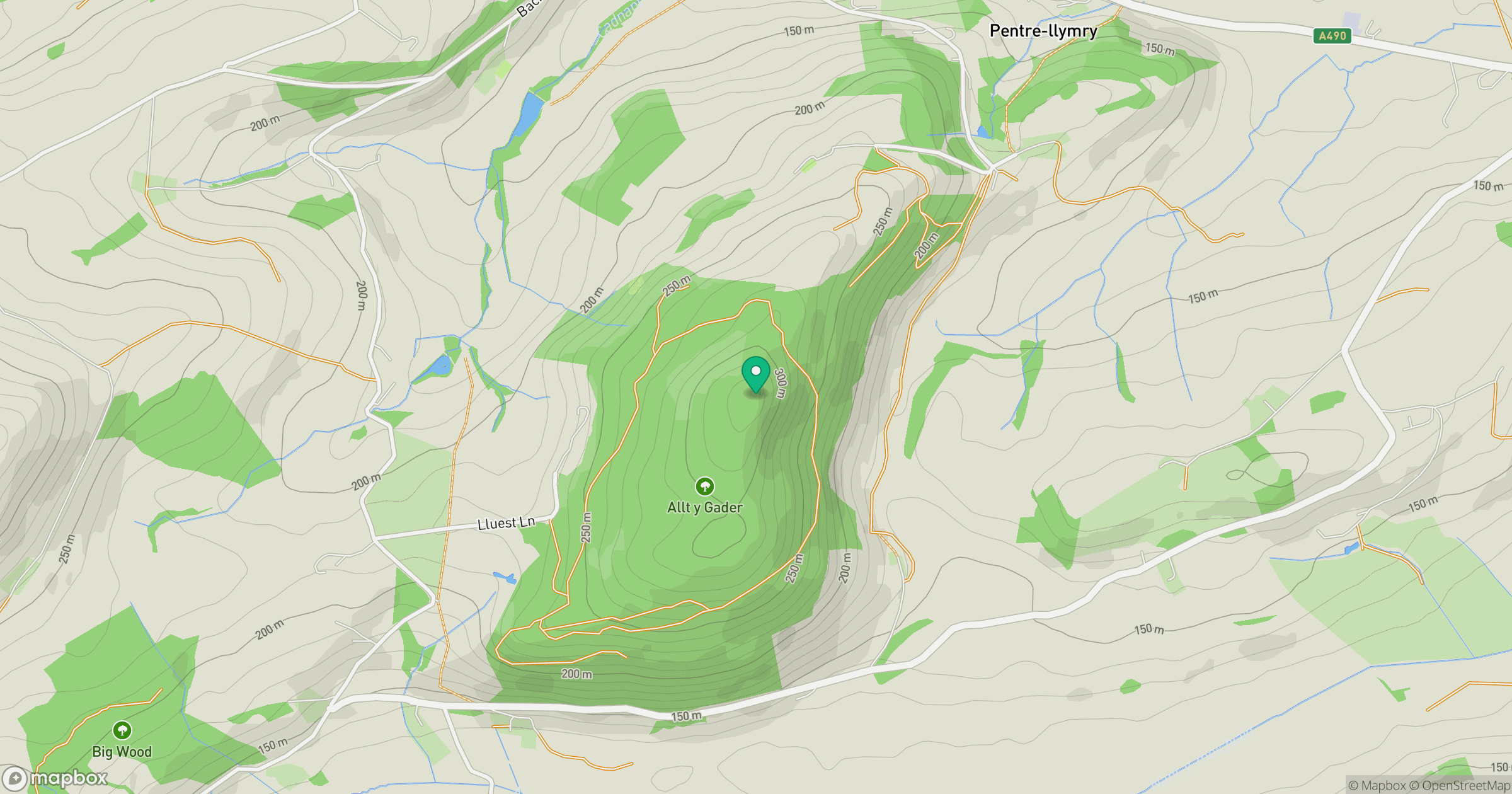
Grid reference: SJ148176
View on OpenStreetMapOpens a map in a new tab, centred on the hill.
Hills within 30 km
Straight-line distance, not a walking route or confirmation of access.
No comments yet. Be the first.