
Mynydd y Glyn
Good walks are even better shared.
Overview
Mynydd y Glyn
Mynydd y Glyn, rising at 611 meters, is a true gem of Snowdonia National Park. As you ascend, keep an eye out for the array of flora and fauna that populate this area. The mountain is known for its volcanic rock formations, a testament to the fiery past of North Wales.
The Route
The popular Mynydd y Glyn Loop is perfect for those seeking a moderate hike without chucking the entire weekend away. This 6.5 km circular route takes around 2.5 hours to complete, allowing ample time to soak in the views and snap a few well-deserved photos.
Summiting the Peak
Upon reaching the summit, adventurers are greeted by a trig point that feels like a rite of passage for every hiker. It’s a great spot for taking in the sweeping views of the Elan Valley. Legend has it that on a clear day, you may even spot a dragon… or perhaps just the Brecon Beacons in the distance!
Terrain and Weather
One might say the terrain is a bit of everything—grassy patches, rocky outcrops, and the occasional gorse bush that might give you a tufty surprise. As for the weather, it’s famously fickle in Wales, so come prepared for all seasons, just in case the sky decides to drop in unannounced.
Local Access
Parking can be a bit of a challenge, but with a little effort, you’ll find a cozy nook at the treatment works. Tregaron isn’t far off, making it an ideal pit stop for a cup of Welsh brew or to rest your legs after the hike.
History and More
Mynydd y Glyn isn’t just a pretty face; its name tells tales of valleys and ancient paths trodden by locals and livestock alike. With roots deep in Welsh folklore, this mountain retains a sense of history that adds to its allure.
In conclusion, Mynydd y Glyn is an inviting invitation to nature lovers and adventure seekers alike. So lace up your boots and prepare for an enchanting day in one of Wales' hidden treasures!
Happy hiking! 🥾
Explore routes near Mynydd y Glyn
Public walks starting within 80 km of this hill. Nearby does not mean a route reaches the summit; check its map and access before setting out.
Oswestry Walk with Men Walking & Talking
View route
Welshpool to Sweeps Bridge: Montgomery Canal and Belan Locks
View route
Llangollen to Horseshoe Falls: Canal Towpath from Market Street
View route
World’s End and back
View route
Route planning notes
These notes describe possible approaches, not verified navigable routes or permission to cross land. Check current paths, local access rules and conditions before setting out.
Mynydd y Glyn Loop
A circular route that takes you around the mountain, providing various viewpoints and a gentle ascent to the top.
Make a day of it, together
Find someone to share the walk with, or organise a day out along a route you like.
Hill facts and local notes
Classifications
Elevation
389m
1,276 ft
Prominence
131m
Coordinates
52.7911, -3.2567
SJ153222
OS Map
125
Explorer: 239
At the Summit
The summit is marked by a prominent trig point, a favourite for cracked selfies. The surrounding area is a mix of heather and rocky outcrops that give it that quintessential Welsh charm.
Terrain & Geology
Mynydd y Glyn is primarily composed of volcanic rock formations, offering a fascinating glimpse into the geological history of North Wales. Its rugged terrain includes ancient igneous intrusions and sedimentary layers, dating back millions of years.
Views & Scenery
From the summit, you can enjoy panoramic views of the Elan Valley, the peaks of the Cambrian Mountains, and on a clear day, even sites as far as the Brecon Beacons.
History & Heritage
Name Origin
The name 'Mynydd y Glyn' translates from Welsh to 'Mountain of the Vale', which is intriguingly fitting given its location overlooking lush valleys.
Historical Significance
The mountain has historic ties to local folklore and ancient trade routes, where herders would guide their flocks through the valleys surrounding it.
Getting There & Facilities
Check current local access restrictions, parking rules and transport timetables before travelling. These notes do not confirm public access to the summit.
Parking
There is limited parking at the nearby treatment works (SJ156225), but please park considerately. Additional spots can be found at the village of Bwlch y Groes.
Public Transport
The nearest bus service runs from Aberystwyth to the village of Tregaron, approximately 10 km away. Consider calling a local taxi for the final stretch.
Nearby Facilities
Facilities are quite rural; however, the nearest village offers a quaint café, public toilets, and a shop for any last-minute essentials.
Safety Information
Known Hazards
- Watch out for sudden weather changes, boggy patches in wet seasons, and steep drops on the northern slope.
General Safety Tips
- Check weather conditions before setting out
- Carry appropriate clothing and equipment
- Let someone know your planned route
- Take a map, compass, and GPS device
- Carry emergency supplies: food, water, first aid kit, torch
Hills
Some common questions about the hills answered
Are there group walks up Mynydd y Glyn?
Many walkers use Walkmates to join or organise walks with others. You can check for group walks around Mynydd y Glyn through the maps
Are there other walkers around Mynydd y Glyn?
Activity varies by location and time, but Walkmates lets you see whether others have shared walks or shown interest in this area. Find other people through the walking friends search walking friends for Mynydd y Glyn search or of course create your own walk for Mynydd y Glyn
Can I organise a walk to Mynydd y Glyn?
Yes. If there aren’t any walks listed already, you can create a walk and make it available for others to join.
If you're signed up to Walkmates, you can create a walk to Mynydd y Glyn.
How do I find a walk up this hill?
There are often multiple ways to walk this hill, depending on experience and route preference. Walkmates helps you explore walks and routes that others have shared.
Can I suggest a new route up Mynydd y Glyn?
Yes. You can suggest or create routes to share with others. Walkmates focuses on the social side of walking, so routes are used to help people organise walks and explore areas together, rather than as detailed navigation tools or route libraries.
Other uses really appreciate knowledgeable walkers sharing their routes. Share your favourite route to Mynydd y Glyn here
The is an error or something incorrect about this hill. How do I let you know?
We always strive to keep the information on Walkmates as accurate as possible. If you find an error, please let us know through the contact form and we'll aim to correct it as quickly as possible
Community Discussion
Comments
Location
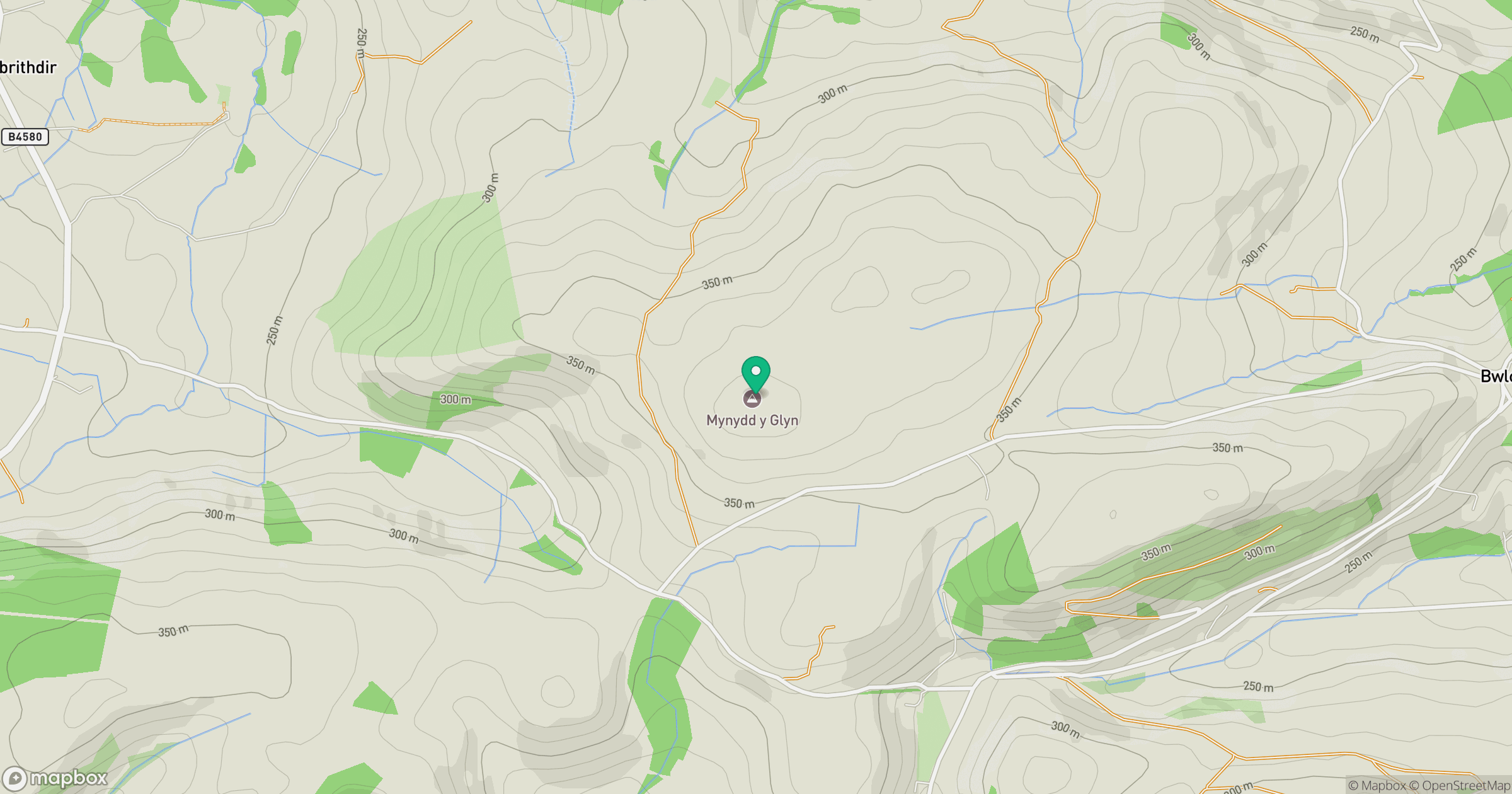
Grid reference: SJ153222
View on OpenStreetMapOpens a map in a new tab, centred on the hill.
Hills within 30 km
Straight-line distance, not a walking route or confirmation of access.
No comments yet. Be the first.