

Gallt y Goedhwch
Good walks are even better shared.
Overview
Gallt y Goedhwch
Gallt y Goedhwch, standing proudly at 538 meters, is a delightful Marilyn nestled within the enchanting Snowdonia National Park. Known for its stunning panoramas and serene walking trails, it's a perfect experience for both seasoned hikers and those looking to enjoy a day out in nature.
Geography and Geology
Draped in layers of history, this mountain is primarily composed of murky sedimentary rocks, with its landscape showcasing the effects of glacial activity over millennia. The neighbouring hills tell tales of ancient marine environments, highlighting how the geology is a doorway to understanding our planet's past.
Routes
The Gallt y Goedhwch Circular Route is the most popular path, covering around 8 km and taking roughly 3.5 hours to complete. Expect a moderate challenge that will surely reward you with gratifying views. Trails meander through grassy meadows and rockier bits—perfect for setting your boots to the test!
Summit Features
At the summit, hikers will find a cheerful little stone cairn. It’s a great spot to catch your breath (or your snack) while soaking in the breathtaking vistas around you.
Terrain
The terrain is intriguing, featuring a medley of grassy slopes and rugged surfaces that demand attention, especially after a good rain. So watch your step, unless you enjoy an unexpected tumble!
Views
The views from Gallt y Goedhwch are truly spectacular. On a clear day, you can see the Dyfi Valley unrolling beneath you like a well-laid carpet, with the sparkling Cardigan Bay to the west. Don’t forget your camera as this is one treat you’ll want to remember!
For the best sights, aim to visit in spring or autumn when the weather is often kinder, and let’s face it, photo ops are free!
Hazards
As with any hike, stay alert for potential hazards. The path can be quite slippery post-rainfall, and don’t be surprised if you encounter some fluffy sheep along the way. Let them pass—they have the right of way!
Access
Parking is available at a small car park near Llangynfelyn, making access fairly straightforward for those embarking on this adventure. Public transport can be a bit of a faff, with limited buses running from Machynlleth, but that just adds to the adventure, doesn’t it?
Facilities
After completing your hike, pop into one of the lovely cafes or the local pub in Llangynfelyn—the perfect spots to replenish your energy with some good food and perhaps a celebratory pint!
History
The name 'Gallt y Goedhwch' literally means 'the foothill of the little bush', which is befitting of the lush landscape you’ll walk through. Steeped in local folklore, the area invites visitors to explore the stories of communities that have thrived here for generations.
So, whether you’re an avid hiker or just looking for a lovely walk with some mates, Gallt y Goedhwch awaits you with open arms (and views). What more could you ask for?
Explore routes near Gallt y Goedhwch
Public walks starting within 80 km of this hill. Nearby does not mean a route reaches the summit; check its map and access before setting out.
Welshpool to Sweeps Bridge: Montgomery Canal and Belan Locks
View route
Oswestry Walk with Men Walking & Talking
View route
Llangollen to Horseshoe Falls: Canal Towpath from Market Street
View route
World’s End and back
View route
Route planning notes
These notes describe possible approaches, not verified navigable routes or permission to cross land. Check current paths, local access rules and conditions before setting out.
Gallt y Goedhwch Circular Route
A scenic circular route starting from the village of Llangynfelyn, taking in stunning views and a diverse landscape.
Make a day of it, together
Find someone to share the walk with, or organise a day out along a route you like.
Photo Gallery
View all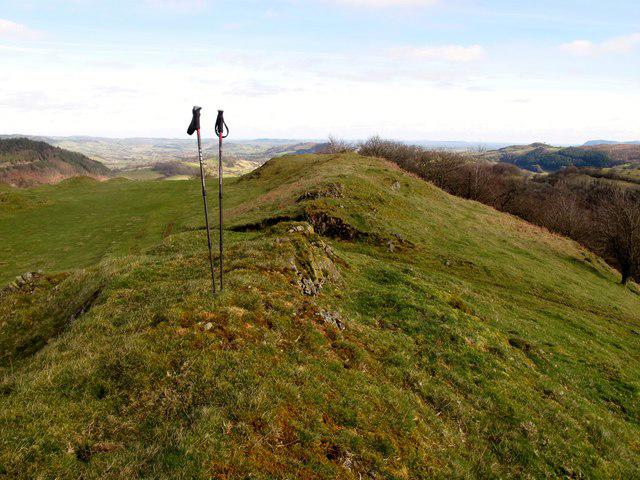 Photo could not load
SJ1315 : Gallt y Goedhwch
Rude Health
Hill facts and local notes
Classifications
Elevation
326m
1,069 ft
Prominence
115m
Coordinates
52.7341, -3.2794
SJ137159
OS Map
125
Explorer: 239
At the Summit
The summit is adorned with a small stone cairn, offering a perfect spot for a celebratory selfie or a rest to admire the views.
Terrain & Geology
The mountain is primarily composed of sedimentary rocks, specifically mudstone and sandstone, shaped by glacial erosion and weathering. The geology showcases the ancient history of the area, dating back to the Ordovician period.
Views & Scenery
From the summit, one can enjoy sweeping views of the Dyfi Valley, Cardigan Bay, and the rugged peaks of nearby Snowdonia.
History & Heritage
Name Origin
The name 'Gallt y Goedhwch' translates to 'the foothill of the little bush' in Welsh, hinting at its lush surroundings.
Historical Significance
The area is rich in local folklore and history, featuring tales of ancient settlements and connections to the local communities.
Getting There & Facilities
Check current local access restrictions, parking rules and transport timetables before travelling. These notes do not confirm public access to the summit.
Parking
There is a small car park at the end of the road leading from Llangynfelyn, with space for around 6-8 cars.
Public Transport
Limited bus service available from Machynlleth to Llangynfelyn, with a bit of a trek required from the village to the starting point.
Nearby Facilities
The nearby village of Llangynfelyn has a charming cafe and a pub, perfect for a warm meal or a refreshing drink after your hike.
Safety Information
Known Hazards
- Beware of slippery paths after rain, and be mindful of livestock, particularly sheep, that may share the trails.
General Safety Tips
- Check weather conditions before setting out
- Carry appropriate clothing and equipment
- Let someone know your planned route
- Take a map, compass, and GPS device
- Carry emergency supplies: food, water, first aid kit, torch
Hills
Some common questions about the hills answered
Are there group walks up Gallt y Goedhwch?
Many walkers use Walkmates to join or organise walks with others. You can check for group walks around Gallt y Goedhwch through the maps
Are there other walkers around Gallt y Goedhwch?
Activity varies by location and time, but Walkmates lets you see whether others have shared walks or shown interest in this area. Find other people through the walking friends search walking friends for Gallt y Goedhwch search or of course create your own walk for Gallt y Goedhwch
Can I organise a walk to Gallt y Goedhwch?
Yes. If there aren’t any walks listed already, you can create a walk and make it available for others to join.
If you're signed up to Walkmates, you can create a walk to Gallt y Goedhwch.
How do I find a walk up this hill?
There are often multiple ways to walk this hill, depending on experience and route preference. Walkmates helps you explore walks and routes that others have shared.
Can I suggest a new route up Gallt y Goedhwch?
Yes. You can suggest or create routes to share with others. Walkmates focuses on the social side of walking, so routes are used to help people organise walks and explore areas together, rather than as detailed navigation tools or route libraries.
Other uses really appreciate knowledgeable walkers sharing their routes. Share your favourite route to Gallt y Goedhwch here
The is an error or something incorrect about this hill. How do I let you know?
We always strive to keep the information on Walkmates as accurate as possible. If you find an error, please let us know through the contact form and we'll aim to correct it as quickly as possible
Community Discussion
Comments
Location
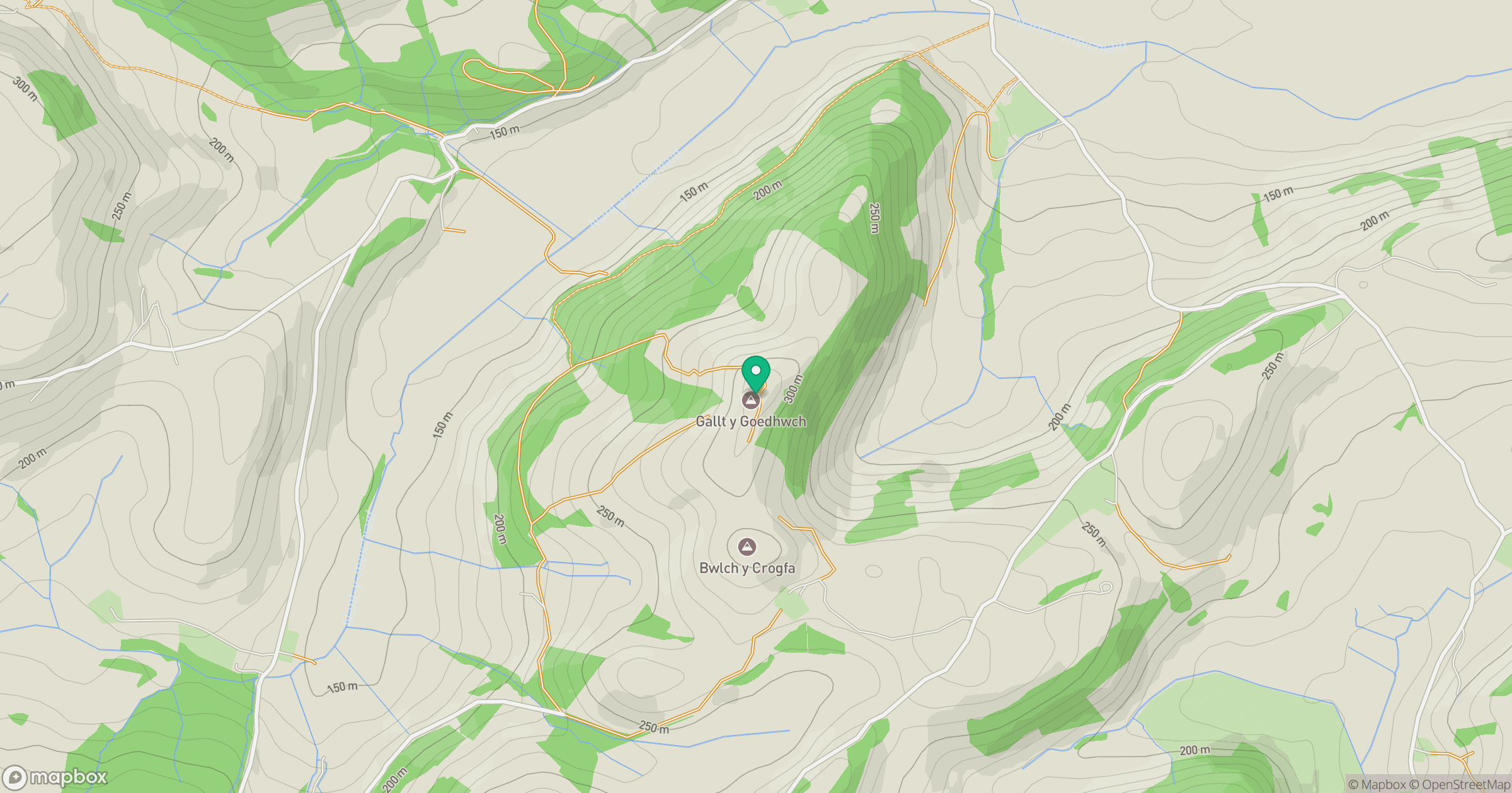
Grid reference: SJ137159
View on OpenStreetMapOpens a map in a new tab, centred on the hill.
Hills within 30 km
Straight-line distance, not a walking route or confirmation of access.
No comments yet. Be the first.