

Moel Fodiar
Good walks are even better shared.
Overview
Moel Fodiar
Overview
Moel Fodiar stands proudly at an elevation of 621 meters in the enchanting Snowdonia region. As a Marilyn mountain, it boasts prominent views and a challenge worthy for both seasoned hikers and those still finding their feet in outdoor activities.
Geology
Composed mainly of volcanic rock, Moel Fodiar showcases rugged terrain and impressive geological features that tell a story of the earth’s past. The landscape is also punctuated with glacially formed valleys and vibrant heather, truly a feast for the eyes. Remember to wear sturdy footwear; you never know what the terrain may toss your way.
Routes
One of the most accessible routes is from the A5 near Capel Curig. This well-trodden path takes approximately 2.5 hours round trip. It’s moderately challenging—ideal for a brisk stroll or a leisurely jaunt to clear the mind and exercise those legs.
Summit Features
Upon reaching the summit, you'll be greeted by a delightful stone cairn, an invitation to pause and take in the majestic views. Enjoy the serene surroundings as you watch the clouds dance above the peaks—nature’s version of a theatrical performance!
Views
From the top, you’re rewarded with breathtaking vistas of the surrounding valleys, the Carneddau mountains, and on particularly clear days, the reflective beauty of Llyn Ogwen. The best seasons to visit are spring and early autumn when the colours come alive.
Hazards
While trekking is all well and good, be wary of the capricious weather of Snowdonia. Sudden showers or gusts can sneak up on you—kind of like that unexpected bill at the end of a picturesque day out. And watch for grazing sheep; they are cunning navigators of the hills!
Nearby Summits
If you’re keen on exploring further, nearby peaks such as Moel Siabod and Carnedd Llewelyn offer additional hiking opportunities. Who said one mountain isn't enough?
Access
Getting to Moel Fodiar is a breeze with ample parking near Capel Curig. If you’re relying on public transport, hitch a ride from Betws-y-Coed to experience the journey without breaking a sweat.
Facilities
After your hike, Capel Curig has a few lovely cafes for a warm cuppa, along with essential facilities like toilets to help you freshen up.
History
The name 'Moel Fodiar' translates to 'Mound of the Pasture', hinting at its pastoral roots. Local folklore weaves tales of shepherds using this hill as a guidepost, making it a part of the community’s rich history.
Conclusion
In conclusion, Moel Fodiar is an excellent blend of adventure, geological wonders, and stunning views. It's a place where you can stretch your legs and fill your lungs with fresh Welsh air. Happy hiking!
Explore routes near Moel Fodiar
Public walks starting within 80 km of this hill. Nearby does not mean a route reaches the summit; check its map and access before setting out.
Dyserth to Prestatyn: old railway walkway return
View route
Conwy Quay to Llanfairfechan: the upland coast-path alternative
View route
Llyn Crafnant: Lakeside Circuit from the NRW Car Park
View route
Arenig Fach guided mountain walk
View route
Route planning notes
These notes describe possible approaches, not verified navigable routes or permission to cross land. Check current paths, local access rules and conditions before setting out.
From the A5 near Capel Curig
A relatively straightforward route taking you through picturesque landscapes to the summit.
Make a day of it, together
Find someone to share the walk with, or organise a day out along a route you like.
Photo Gallery
View all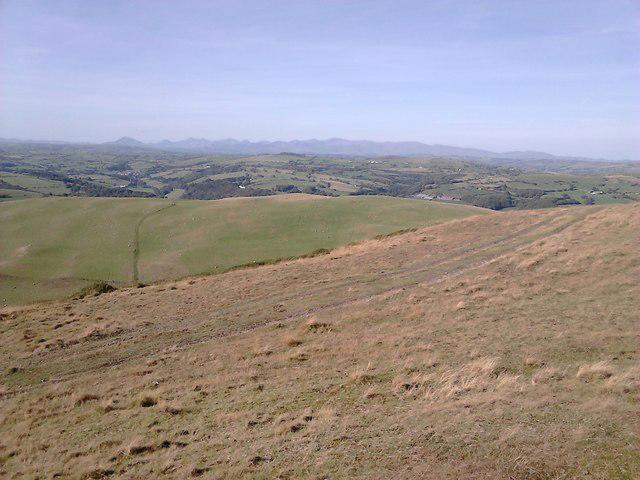 Photo could not load
SH9768 : Snowdonia from Moel Fodiar
Ron Williams
Hill facts and local notes
Classifications
Elevation
390m
1,280 ft
Prominence
117m
Coordinates
53.1993, -3.5309
SH978680
OS Map
116
Explorer: 264N
At the Summit
The summit features a simple stone cairn, offering a perfect spot for a 'selfie' while enjoying the views and pretending you're Bear Grylls.
Terrain & Geology
Moel Fodiar is primarily composed of volcanic rock, giving it a rugged charm. The surrounding area showcases a rich tapestry of glacial and fluvial geology, enhancing its striking landscape.
Views & Scenery
From the summit, you can gaze over the lush valleys of Snowdonia and spot the distant peaks of the Carneddau range. On a clear day, the shimmering waters of Llyn Ogwen can be seen, painting a serene backdrop.
History & Heritage
Name Origin
The name 'Moel Fodiar' translates roughly to 'Mound of the Pasture', a fitting title for this serene hill amid lush pastures.
Historical Significance
Historically, Moel Fodiar has been a landmark for local shepherds, guiding them through the rugged terrains of Snowdonia.
Getting There & Facilities
Check current local access restrictions, parking rules and transport timetables before travelling. These notes do not confirm public access to the summit.
Parking
There is a parking area at the A5 near Capel Curig which allows easy access to the trailhead. It's not free, but nothing beats a parking space close to adventure!
Public Transport
The nearest bus service runs from Betws-y-Coed, making it accessible for those relying on public transport.
Nearby Facilities
While there are no facilities directly on the mountain, Capel Curig has cafes and toilets to refresh yourself before or after your trek.
Safety Information
Known Hazards
- Beware of sudden weather changes, and the occasional sly sheep that may decide to join your hiking party!
General Safety Tips
- Check weather conditions before setting out
- Carry appropriate clothing and equipment
- Let someone know your planned route
- Take a map, compass, and GPS device
- Carry emergency supplies: food, water, first aid kit, torch
Hills
Some common questions about the hills answered
Are there group walks up Moel Fodiar?
Many walkers use Walkmates to join or organise walks with others. You can check for group walks around Moel Fodiar through the maps
Are there other walkers around Moel Fodiar?
Activity varies by location and time, but Walkmates lets you see whether others have shared walks or shown interest in this area. Find other people through the walking friends search walking friends for Moel Fodiar search or of course create your own walk for Moel Fodiar
Can I organise a walk to Moel Fodiar?
Yes. If there aren’t any walks listed already, you can create a walk and make it available for others to join.
If you're signed up to Walkmates, you can create a walk to Moel Fodiar.
How do I find a walk up this hill?
There are often multiple ways to walk this hill, depending on experience and route preference. Walkmates helps you explore walks and routes that others have shared.
Can I suggest a new route up Moel Fodiar?
Yes. You can suggest or create routes to share with others. Walkmates focuses on the social side of walking, so routes are used to help people organise walks and explore areas together, rather than as detailed navigation tools or route libraries.
Other uses really appreciate knowledgeable walkers sharing their routes. Share your favourite route to Moel Fodiar here
The is an error or something incorrect about this hill. How do I let you know?
We always strive to keep the information on Walkmates as accurate as possible. If you find an error, please let us know through the contact form and we'll aim to correct it as quickly as possible
Community Discussion
Comments
Location
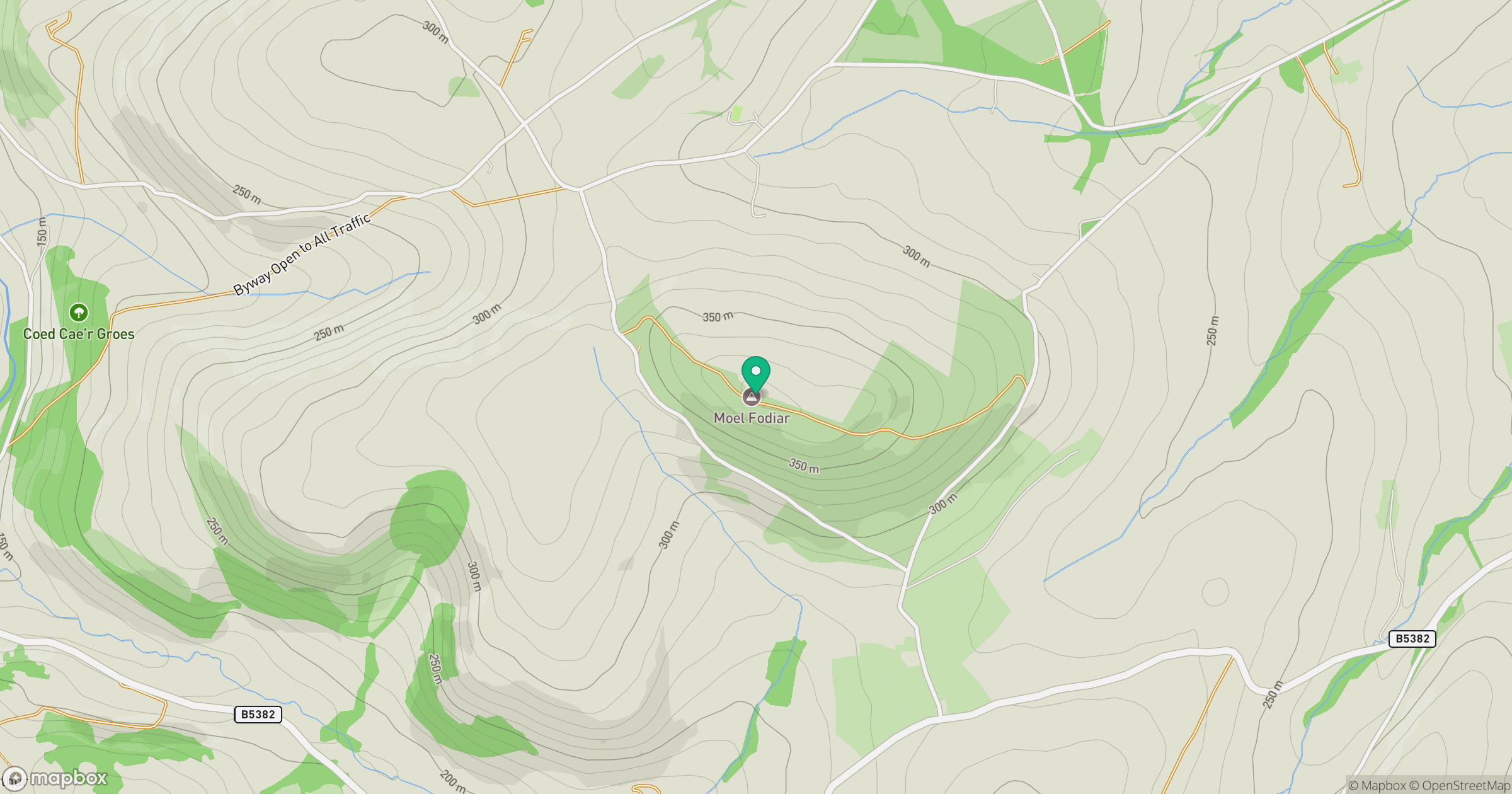
Grid reference: SH978680
View on OpenStreetMapOpens a map in a new tab, centred on the hill.
Hills within 30 km
Straight-line distance, not a walking route or confirmation of access.
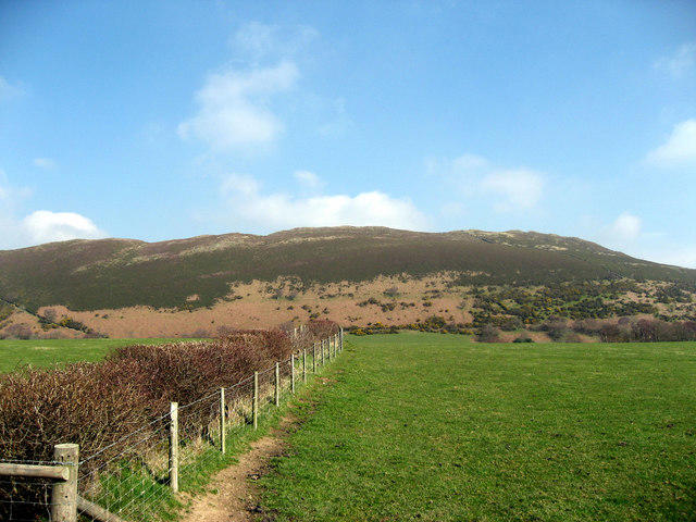
Mynydd Tryfan
402m
Moel Famau
555m
Great Orme [Y Gogarth]
207m
Carnedd Llewelyn
1,062m
Moelfre Isaf
317m
No comments yet. Be the first.