

Gorsedd Bran
Good walks are even better shared.
Overview
Gorsedd Bran
Introduction
Nestled within the stunning Snowdonia National Park, Gorsedd Bran offers hiking enthusiasts a blend of natural beauty and cultural significance. With an elevation of 442 meters, it might not top the charts of grandeur, but it rewards hikers with captivating views and a trail rich in history.
Geology
Gorsedd Bran is primarily made up of ancient volcanic rock. The visible layers tell tales of Earth's fiery history, where you can witness andesite and basalt formations. For those who appreciate the study of geology, this mountain serves as an excellent classroom out in nature!
Routes
The route from Llanarmon Dyffryn Ceiriog encompasses a total distance of 11.5 km, typically taking around 4.5 hours to complete. Hikers should prepare for some moderate challenges, with various terrain features such as gentle slopes and the occasional rocky outcrop. Keep your eyes peeled for the local wildlife along the path - you never know what might cross your path!
Summit Features
At the summit, you’ll find a cairn that marks the peak, along with a historical boundary stone. It’s a great spot to catch your breath and snap a few photos, ensuring you can brag about your feat to family and friends.
Views
From the top, the views are nothing short of spectacular. Over to the east, the Berwyn Mountains stretch majestically, while the west showcases the rolling hills of North Wales. And if you’re lucky enough to hike on a clear day, you might just spot Snowdon joining in on the festivities!
Hazards
As with any mountain, ensure you are well-prepared for rapidly changing weather conditions. Paths may become slippery when wet, so a sturdy pair of boots is recommended. Always keep your navigational skills sharp, as losing sight of your route can complicate matters faster than finding your keys after a long day.
Access
The nearest parking is found in Llanarmon Dyffryn Ceiriog. Make sure to respect designated parking areas to avoid feisty confrontations with local wardens. For those opting for public transport, regular bus services are available to Llanarmon—just check the schedule before you hop on!
Facilities
Not far from your parking spot, a charming local café awaits, serving refreshments perfect for recharging after a hike. Treat yourself to their delightful cakes and that ever-important cup of tea.
History
The name Gorsedd Bran, or 'Chair of Bran', offers a nod to Welsh mythology, possibly drawing connections to Bran the Blessed—a figure steeped in local legends. This cultural significance enhances the experience of hiking here, infusing a sense of historical wonder as you tread upon its slopes.
Conclusion
Gorsedd Bran invites you for an adventure filled with scenic views, intriguing geology, and a sprinkle of Welsh folklore. Whether you’re a seasoned hiker or a curious beginner, this mountain is a splendid choice for your next outing.
Happy hiking, and remember to keep those boots muddy!
Explore routes near Gorsedd Bran
Public walks starting within 80 km of this hill. Nearby does not mean a route reaches the summit; check its map and access before setting out.
Arenig Fach guided mountain walk
View route
Llyn Crafnant: Lakeside Circuit from the NRW Car Park
View route
Dyserth to Prestatyn: old railway walkway return
View route
Conwy Quay to Llanfairfechan: the upland coast-path alternative
View route
Route planning notes
These notes describe possible approaches, not verified navigable routes or permission to cross land. Check current paths, local access rules and conditions before setting out.
Llanarmon Dyffryn Ceiriog to Gorsedd Bran
This scenic route winds through picturesque valleys and ancient woodlands, providing a gentle ascent before challenging your stamina towards the summit.
Make a day of it, together
Find someone to share the walk with, or organise a day out along a route you like.
Photo Gallery
View all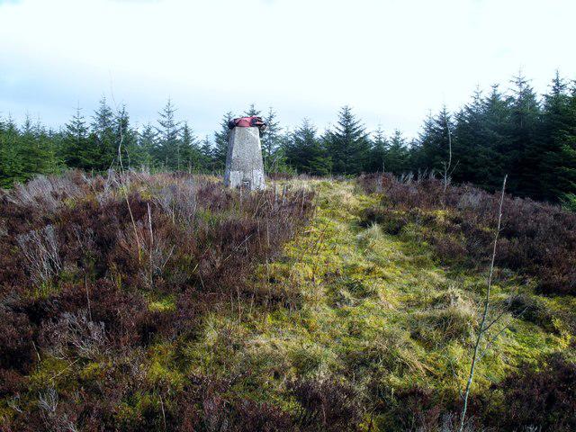 Photo could not load
SH9659 : Gorsedd Bran
Rude Health
Hill facts and local notes
Classifications
Elevation
518m
1,699 ft
Prominence
120m
Coordinates
53.1250, -3.5419
SH969597
OS Map
116
Explorer: 264S
At the Summit
The summit features a modest stone cairn, marking the peak. From here, you may spot the remnants of a historical boundary stone, giving you a taste of the local history.
Terrain & Geology
Gorsedd Bran is primarily composed of ancient volcanic rock, which offers an intriguing glimpse into the Earth's fiery past. The rugged terrain showcases various types of igneous rock, including andesite and basalt, making it a great spot for geology enthusiasts.
Views & Scenery
From the summit, you can see the stunning Berwyn Mountains to the east and the rolling hills of North Wales to the west. On a clear day, Snowdon itself might even peek through the clouds like a shy friend at a party.
History & Heritage
Name Origin
The name 'Gorsedd Bran' translates to 'the Chair of Bran', possibly referencing the ancient figure Bran the Blessed from Welsh mythology, giving the mountain a regal connection.
Historical Significance
The mountain holds cultural significance in local folklore, often associated with legends of the heroic Bran and his mythical adventures, adding a touch of magic to your hike.
Getting There & Facilities
Check current local access restrictions, parking rules and transport timetables before travelling. These notes do not confirm public access to the summit.
Parking
Llanarmon Dyffryn Ceiriog offers limited parking along the roadside. Look for designated parking bays to avoid any unwanted encounters with local traffic wardens.
Public Transport
Buses operate from nearby towns, with the closest bus stop being in Llanarmon Dyffryn Ceiriog. Check local schedules for the most up-to-date info.
Nearby Facilities
While facilities are limited in Llanarmon Dyffryn Ceiriog, you can find a delightful local café that serves a mean cup of tea and a slice of cake, perfect for post-hike recovery.
Safety Information
Known Hazards
- Keep an eye out for sudden weather changes, as they can be quite unpredictable in this region. Ridges may be slippery when wet, and visibility can drop quicker than you can say 'Where’s my compass?'.
General Safety Tips
- Check weather conditions before setting out
- Carry appropriate clothing and equipment
- Let someone know your planned route
- Take a map, compass, and GPS device
- Carry emergency supplies: food, water, first aid kit, torch
Hills
Some common questions about the hills answered
Are there group walks up Gorsedd Bran?
Many walkers use Walkmates to join or organise walks with others. You can check for group walks around Gorsedd Bran through the maps
Are there other walkers around Gorsedd Bran?
Activity varies by location and time, but Walkmates lets you see whether others have shared walks or shown interest in this area. Find other people through the walking friends search walking friends for Gorsedd Bran search or of course create your own walk for Gorsedd Bran
Can I organise a walk to Gorsedd Bran?
Yes. If there aren’t any walks listed already, you can create a walk and make it available for others to join.
If you're signed up to Walkmates, you can create a walk to Gorsedd Bran.
How do I find a walk up this hill?
There are often multiple ways to walk this hill, depending on experience and route preference. Walkmates helps you explore walks and routes that others have shared.
Can I suggest a new route up Gorsedd Bran?
Yes. You can suggest or create routes to share with others. Walkmates focuses on the social side of walking, so routes are used to help people organise walks and explore areas together, rather than as detailed navigation tools or route libraries.
Other uses really appreciate knowledgeable walkers sharing their routes. Share your favourite route to Gorsedd Bran here
The is an error or something incorrect about this hill. How do I let you know?
We always strive to keep the information on Walkmates as accurate as possible. If you find an error, please let us know through the contact form and we'll aim to correct it as quickly as possible
Community Discussion
Comments
Location
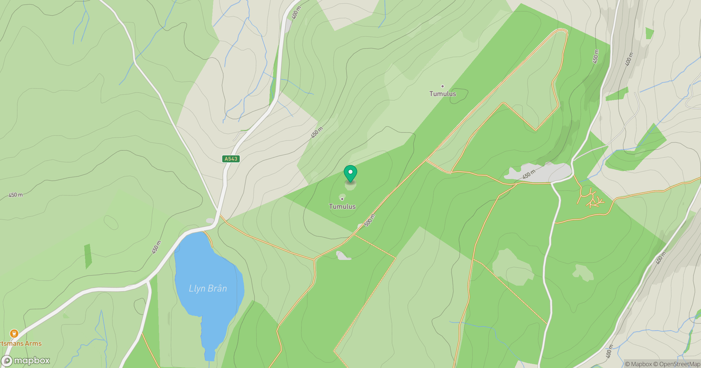
Grid reference: SH969597
View on OpenStreetMapOpens a map in a new tab, centred on the hill.
Hills within 30 km
Straight-line distance, not a walking route or confirmation of access.
No comments yet. Be the first.