

Moel Bentyrch
Good walks are even better shared.
Overview
Moel Bentyrch
Overview
Nestled in the serene surroundings of Snowdonia, Moel Bentyrch is a hill that begs to be explored. Standing at an elevation of 508 meters, this Marilyn provides impressive views and an accessible escape into nature. Whether you’re a seasoned mountaineer or just dipping your toes into hiking, Moel Bentyrch welcomes one and all into its embrace.
Geology
The rocky composition of Moel Bentyrch offers a glimpse into the ancient geological processes that have shaped this mountainous region. The predominant volcanic rock beneath your feet is a testament to tumultuous times long past, when molten materials erupted and cooled, laying the foundations for this majestic hill. Don’t worry, the only explosions you’ll experience today will be from your excitement!
Routes
One of the most popular routes is the Moel Bentyrch Circular Route. Spanning 6.2 km, this moderate trek takes you around the base and up to the summit, where you will be rewarded with captivating views. Expect to be out for around 2.5 hours—perfect for a brisk walk on a crisp morning or a leisurely jaunt with friends on a warm afternoon.
Summit Features
At the summit, hikers are greeted by a humble stone cairn. It is a tradition for many to place tiny flags or mementoes here, a silent testament to those who have shared this breathtaking view before you. It serves as both a beacon for climbers and a reminder of the camaraderie shared among those who conquer this hill.
Terrain
Moel Bentyrch's terrain can best be described as a mixed bag—mostly grassy, with rocky patches that add a dash of excitement. This makes for a delightful walking experience where every step holds the potential for discovery.
Views
The views from Moel Bentyrch are simply stunning. On a clear day, the sight of Snowdon and the undulating hills of Snowdonia stretching into the distance is akin to a postcard come to life. If you’re lucky, you might even catch a view of the Irish Sea on the horizon!
Best Seasons for Views
For those with an eye for beauty, spring and autumn are prime seasons for hiking here. You’ll find the former draped in blossoms and the latter offering a riot of colour as the leaves change. Just remember, the weather here can be as fickle as a cat deciding whether it wants to be indoors or outdoors, so plan accordingly!
Hazards
While Moel Bentyrch is relatively family-friendly, do keep an eye on the weather. It can turn quicker than a Tory politician at a Labour party! Winds and rain can make the paths slippery, so good footwear and a keen eye for conditions are advisable.
Access
Nearest Parking
You’ll find a small parking area at the end of the lane near Llangynfelyn. It’s worth a look, though don’t expect to find room for a coach!
Public Transport
For public transport users, there’s a bus stop in Llangynfelyn, but don’t blink or you might miss the next service! Plan ahead.
Nearest Town
Aberystwyth is your go-to for a proper town experience, where cafes await your weary feet and the local shops are perfect for grabbing supplies.
Facilities
If all this hiking has you parched, Aberystwyth has you covered with plenty of cafes and public toilets, so you can refresh before or after your adventure.
History
Name Meaning
The name Moel Bentyrch harks back to Welsh roots, translating roughly to 'Hill of the Bentyrch'. The name possibly carries stories woven into the very fabric of local legends.
Significance
Moel Bentyrch is steeped in the culture of Wales, offering hikers not just a natural retreat, but also a connect to the heritage of the land. It’s no wonder that it attracts locals and visitors alike!
In conclusion, whether it's a leisurely stroll or a vigorous hike, Moel Bentyrch is worth the jaunt. The landscape, rich history, and vibrant atmosphere make for an unforgettable outdoor experience. So lace up those boots and head to the hills, because adventure awaits!
Explore routes near Moel Bentyrch
Public walks starting within 80 km of this hill. Nearby does not mean a route reaches the summit; check its map and access before setting out.
Welshpool to Sweeps Bridge: Montgomery Canal and Belan Locks
View route
Waun-oer, Maesglase and Cribin Fawr guided mountain walk
View route
Aran Benllyn and Aran Fawddwy from LLanuwchllyn
View route
Hafren Forest: full Source of the Severn Trail
View route
Route planning notes
These notes describe possible approaches, not verified navigable routes or permission to cross land. Check current paths, local access rules and conditions before setting out.
Moel Bentyrch Circular Route
A scenic circular route starting from the base that offers beautiful views of the surrounding hills and valleys.
Make a day of it, together
Find someone to share the walk with, or organise a day out along a route you like.
Photo Gallery
View all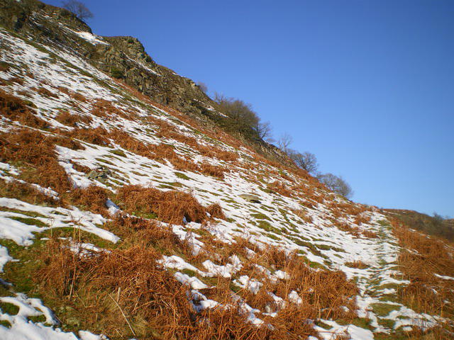 Photo could not load
SJ0509 : Footpath up the steep side of Moel Bentyrch
Richard Law
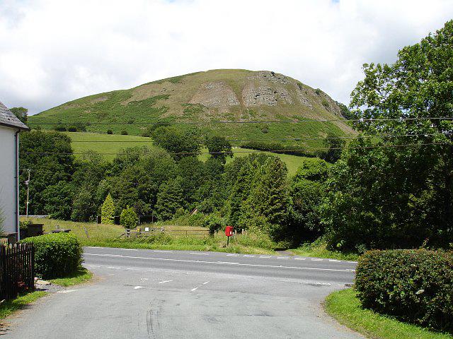 Photo could not load
SJ0509 : Moel Bentyrch from Four Crosses
Penny Mayes
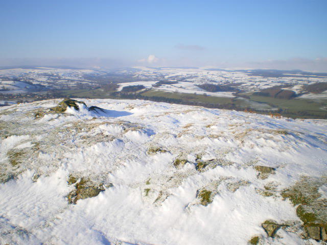 Photo could not load
SJ0509 : Moel Bentyrch summit cairn
Richard Law
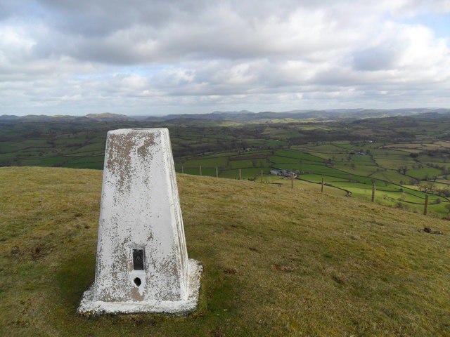 Photo could not load
SJ0509 : Trig point atop Moel Bentyrch
Martin Evans
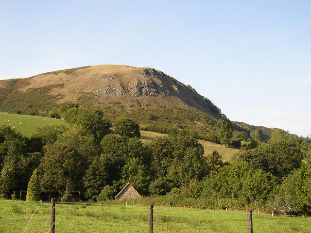 Photo could not load
SJ0509 : Moel Bentyrch.
Hefin Richards
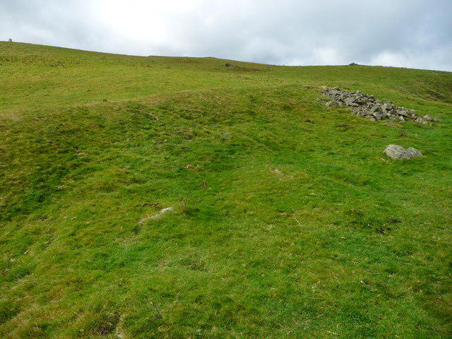 Photo could not load
SJ0509 : Earthworks on Moel Bentyrch
Jeremy Bolwell
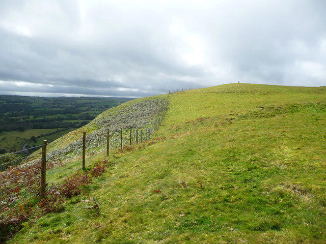 Photo could not load
SJ0509 : Approaching the trig point on Moel Bentyrch
Jeremy Bolwell
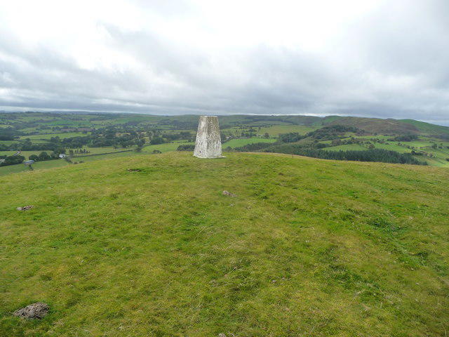 Photo could not load
SJ0509 : Moel Bentyrch trig point looking westwards
Jeremy Bolwell
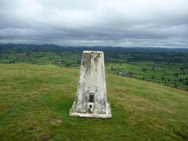 Photo could not load
SJ0509 : Trig point on Moel Bentyrch looking eastwards
Jeremy Bolwell
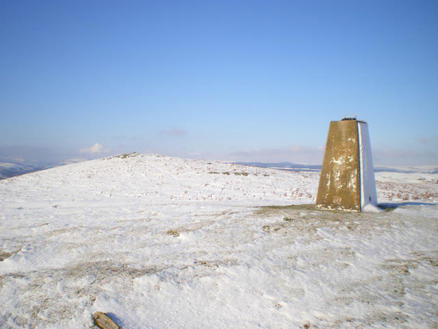 Photo could not load
SJ0509 : Moel Bentyrch summit
Richard Law
Hill facts and local notes
Classifications
Elevation
338m
1,109 ft
Prominence
141m
Coordinates
52.6751, -3.3984
SJ055095
OS Map
125
Explorer: 215E 239
At the Summit
The summit is marked by a small stone cairn, which is often adorned with a few colourful flags left by wanderers who have conquered its heights.
Terrain & Geology
Primarily composed of volcanic rock, Moel Bentyrch features remnants of ancient igneous activity that shaped this part of Snowdonia millions of years ago. The mountain's unique geological formations provide insight into the region's tumultuous history.
Views & Scenery
From the summit, hikers can enjoy panoramic views extending to the peaks of Snowdonia, including Snowdon itself, as well as the beautiful Dyfi Valley below.
History & Heritage
Name Origin
The name Moel Bentyrch translates to 'Hill of the Bentyrch', with 'Moel' meaning hill and 'Bentyrch' possibly stemming from local legends or historical mentioning.
Historical Significance
This mountain is a popular destination for both locals and visitors, offering a taste of Welsh culture and beautiful landscapes that have inspired poets and hikers alike.
Getting There & Facilities
Check current local access restrictions, parking rules and transport timetables before travelling. These notes do not confirm public access to the summit.
Parking
There is a small parking area at the end of the lane near the village of Llangynfelyn, suitable for a few cars.
Public Transport
The nearest bus stop is in Llangynfelyn, with services running sporadically from nearby towns.
Nearby Facilities
The nearest facilities, including cafes and public toilets, can be found in Aberystwyth, where you can fuel up before or after your adventure.
Safety Information
Known Hazards
- Be cautious of rapidly changing weather conditions; high winds and sudden rain can make the terrain slippery.
General Safety Tips
- Check weather conditions before setting out
- Carry appropriate clothing and equipment
- Let someone know your planned route
- Take a map, compass, and GPS device
- Carry emergency supplies: food, water, first aid kit, torch
Hills
Some common questions about the hills answered
Are there group walks up Moel Bentyrch?
Many walkers use Walkmates to join or organise walks with others. You can check for group walks around Moel Bentyrch through the maps
Are there other walkers around Moel Bentyrch?
Activity varies by location and time, but Walkmates lets you see whether others have shared walks or shown interest in this area. Find other people through the walking friends search walking friends for Moel Bentyrch search or of course create your own walk for Moel Bentyrch
Can I organise a walk to Moel Bentyrch?
Yes. If there aren’t any walks listed already, you can create a walk and make it available for others to join.
If you're signed up to Walkmates, you can create a walk to Moel Bentyrch.
How do I find a walk up this hill?
There are often multiple ways to walk this hill, depending on experience and route preference. Walkmates helps you explore walks and routes that others have shared.
Can I suggest a new route up Moel Bentyrch?
Yes. You can suggest or create routes to share with others. Walkmates focuses on the social side of walking, so routes are used to help people organise walks and explore areas together, rather than as detailed navigation tools or route libraries.
Other uses really appreciate knowledgeable walkers sharing their routes. Share your favourite route to Moel Bentyrch here
The is an error or something incorrect about this hill. How do I let you know?
We always strive to keep the information on Walkmates as accurate as possible. If you find an error, please let us know through the contact form and we'll aim to correct it as quickly as possible
Community Discussion
Comments
Location
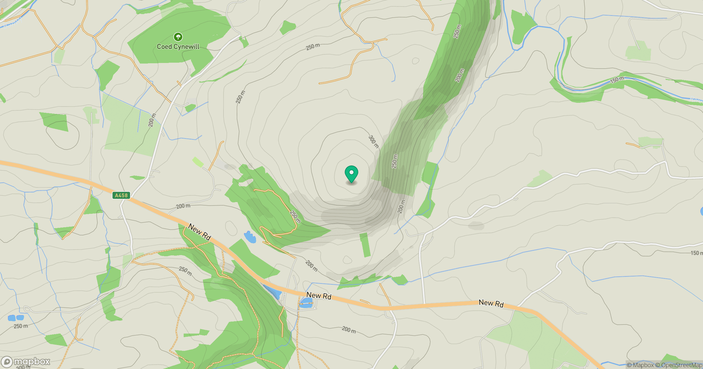
Grid reference: SJ055095
View on OpenStreetMapOpens a map in a new tab, centred on the hill.
Hills within 30 km
Straight-line distance, not a walking route or confirmation of access.
No comments yet. Be the first.