

Cyrniau
Good walks are even better shared.
Overview
Cyrniau: The Jewel of Snowdonia
Nestled in the heart of Snowdonia, Cyrniau is a gem of a hill that delivers both stunning views and a slice of quietude away from the hustle and bustle of life. Standing at 530 meters, it may not be the highest peak in the area, but what it lacks in elevation, it makes up for in character and charm.
Geology
Cyrniau's rugged terrain is primarily composed of ancient volcanic rock that offers hikers a glimpse into the geological history of the region. The surrounding hills, shaped by millennia of natural processes, provide a beautiful backdrop for a day’s adventure. Be prepared to navigate rocky outcrops and grassy slopes, whether you're strolling leisurely or tackling a more vigorous ascent!
Routes
There are a couple of popular routes to choose from:
- Cyrniau Circular: A scenic 8.5 km circuit that can be tackled in about 3.5 hours. It allows you to fully appreciate the beauty of the landscape, with breathtaking views at every turn.
- North Ridge Approach: If you're looking for a simpler ascent, this route is perfect, covering 5 km and taking approximately 2 hours.
Summit Features
Upon reaching the summit, you'll be greeted by a sophisticated little cairn - a pile of stones that not only marks your accomplishment but serves as an excellent place for the obligatory selfie. The panoramic views of the Snowdonia range are spectacular, particularly enchanting during sunrise, when the world seems to awake just for you.
Terrain Type
The area is a delightful mix of rocky sections interspersed with lush grassy spots and, if you’re lucky or perhaps not so much after rain, marshy patches - perfect for the adventurous soul seeking a little excitement.
Views
From the top, the views are simply magical. Look northward to see Snowdon rising majestically and, on exceptionally clear days, you might catch a glimpse of Cardigan Bay to the west.
Best Seasons
Spring and autumn are ideal for captivating views and vibrant colours. Summer, with its longer days, is perfect for enjoying the lush greenery that comes alive in warmer months.
Hazards
Though the beauty here is undeniable, do keep an eye on the skies. Snowdonia's weather can be as unpredictable as a cat on a hot tin roof, so prepare for sudden changes. Some of the paths can become quite slippery, particularly after rain, so sturdy footwear is recommended.
Access
Cyrniau is easily accessible from a small parking area on the A5. Buses from nearby towns like Betws-y-Coed offer some public transport options, although a bit of a trek to the trailhead is in store. The closest town, Bethesda, boasts public toilets and a friendly café for a well-deserved treat after your hike.
Facilities
A post-hike refreshment is a must, and you'll find all you need in Bethesda – from hot drinks to hearty meals.
History
The name Cyrniau translates to 'horns’ in Welsh, aptly describing the features that define this appealing hill. It has served as a landmark for local shepherds and is now a favourite among hikers seeking natural beauty.
In conclusion, whether you’re an experienced hiker or just looking to stretch your legs, Cyrniau may be just the ticket. With its stunning views, varied terrain, and rich history, you will surely stroll away with a heart full of memories and perhaps a bit of mud on your shoes. Happy hiking!
Explore routes near Cyrniau
Public walks starting within 80 km of this hill. Nearby does not mean a route reaches the summit; check its map and access before setting out.
Aran Benllyn and Aran Fawddwy from LLanuwchllyn
View route
Llangollen to Horseshoe Falls: Canal Towpath from Market Street
View route
World’s End and back
View route
Waun-oer, Maesglase and Cribin Fawr guided mountain walk
View route
Route planning notes
These notes describe possible approaches, not verified navigable routes or permission to cross land. Check current paths, local access rules and conditions before setting out.
Cyrniau Circular
A popular circular route taking in the scenic beauty of the surrounding hills.
North Ridge Approach
A straightforward ascent following the ridge, best suited for clear weather.
Make a day of it, together
Find someone to share the walk with, or organise a day out along a route you like.
Photo Gallery
View all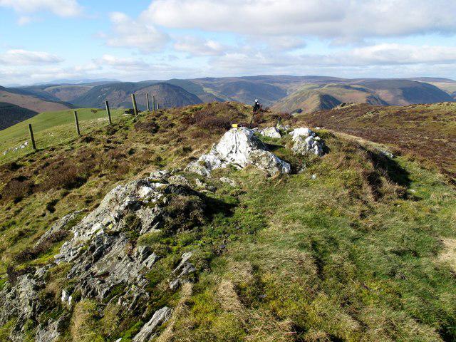 Photo could not load
SJ0625 : Cyrniau Summit
Rude Health
Hill facts and local notes
Classifications
Elevation
488m
1,601 ft
Prominence
106m
Coordinates
52.8160, -3.3916
SJ063251
OS Map
125
Explorer: 239 255
At the Summit
The summit is marked by a small stone cairn and offers panoramic views of the Snowdonia range, particularly stunning at sunrise.
Terrain & Geology
Cyrniau is primarily composed of ancient volcanic rock, providing a varied landscape with rugged ridges and deep valleys, evidence of the region's geological past.
Views & Scenery
From the summit, you can see the towering peaks of Snowdon to the north, and on a clear day, even the shimmering waters of Cardigan Bay in the distance.
History & Heritage
Name Origin
The name Cyrniau is derived from 'Cyrn' meaning ‘horns’ in Welsh, likely referring to its distinctive peaks.
Historical Significance
Cyrniau has been an important landmark for centuries, guiding local shepherds and now hikers wishing to experience its natural beauty.
Getting There & Facilities
Check current local access restrictions, parking rules and transport timetables before travelling. These notes do not confirm public access to the summit.
Parking
There is a small parking area at the base of the hill off the A5, suitable for about 10 vehicles.
Public Transport
Buses from nearby towns such as Betws-y-Coed regularly service the area, though a bit of a walk is involved to reach the trailhead.
Nearby Facilities
There are public toilets and a café in Bethesda, perfect for a pre- or post-hike treat.
Safety Information
Known Hazards
- Be cautious of sudden weather changes, especially in winter. Some paths can become slippery and boggy after rain.
General Safety Tips
- Check weather conditions before setting out
- Carry appropriate clothing and equipment
- Let someone know your planned route
- Take a map, compass, and GPS device
- Carry emergency supplies: food, water, first aid kit, torch
Hills
Some common questions about the hills answered
Are there group walks up Cyrniau?
Many walkers use Walkmates to join or organise walks with others. You can check for group walks around Cyrniau through the maps
Are there other walkers around Cyrniau?
Activity varies by location and time, but Walkmates lets you see whether others have shared walks or shown interest in this area. Find other people through the walking friends search walking friends for Cyrniau search or of course create your own walk for Cyrniau
Can I organise a walk to Cyrniau?
Yes. If there aren’t any walks listed already, you can create a walk and make it available for others to join.
If you're signed up to Walkmates, you can create a walk to Cyrniau.
How do I find a walk up this hill?
There are often multiple ways to walk this hill, depending on experience and route preference. Walkmates helps you explore walks and routes that others have shared.
Can I suggest a new route up Cyrniau?
Yes. You can suggest or create routes to share with others. Walkmates focuses on the social side of walking, so routes are used to help people organise walks and explore areas together, rather than as detailed navigation tools or route libraries.
Other uses really appreciate knowledgeable walkers sharing their routes. Share your favourite route to Cyrniau here
The is an error or something incorrect about this hill. How do I let you know?
We always strive to keep the information on Walkmates as accurate as possible. If you find an error, please let us know through the contact form and we'll aim to correct it as quickly as possible
Community Discussion
Comments
Location
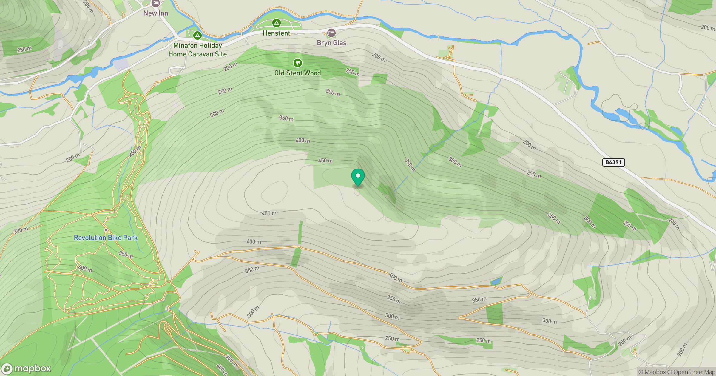
Grid reference: SJ063251
View on OpenStreetMapOpens a map in a new tab, centred on the hill.
Hills within 30 km
Straight-line distance, not a walking route or confirmation of access.
No comments yet. Be the first.