

Merbach Hill
Good walks are even better shared.
Overview
Merbach Hill
Merbach Hill, standing proudly at 265 meters, is a classic Marilyn that offers both stunning views and a delightful hike. Nestled in the picturesque landscape of Herefordshire, this hill may not be the tallest, but it sure packs a punch in terms of beauty!
Geology
Composed mainly of Old Red Sandstone, Merbach Hill recounts tales of geographic transformation over millions of years. Its reddish stones might have you pondering their ancient river journey while you trek.
Routes
The Merbach Hill Circular Walk is the go-to route for many outdoor enthusiasts. This 5 km loop starts at Newton and takes you through serene countryside, rewarding you with breathtaking vistas that will make your fellow walkers slightly envy the view.
Summit Features
On reaching the summit, you'll find a charming cairn complete with a trig point. This is a fab place to catch your breath, soak in the scenery, and perhaps implement a little 'summit dance' for the onlookers.
Terrain Type
The terrain is mainly grassy with a few rocky patches that can be cheeky, so watch your footing. It’s a well-behaved hill that usually doesn’t throw surprises your way!
Views
The views from the summit are nothing short of spectacular. To the north, the beloved Black Mountains stand sentinel while you gaze south over the rolling Herefordshire hills. Visit in late spring or autumn for the best chance of clear skies and vibrant scenery.
Hazards
As with any outdoor adventure, there are a few things to be aware of. Post-rain, muddy patches can appear, and local livestock might be about, so be respectful and remember to close gates behind you.
Nearby Summits
If you're feeling adventurous, consider tackling nearby summits such as Garn Goch and Cwm Taff, which will add a few more meters to your elevation tally!
Access
Parking can be found in a small layby on the B4230—be appalled at yourself if you forget the all-important post-hike snack in the car! For those relying on public transport, local bus services provide access to nearby villages. Hereford is the closest town, providing ample amenities.
Facilities
Head over to Hay-on-Wye after your adventure for a well-deserved coffee and cake. It’s a quaint town with several restaurants and public toilets!
History
The name 'Merbach' reflects its old Welsh roots, signifying both a hill and a boundary. It has historically provided navigation for trade routes, which might just add a sense of adventure to your own hike!
With its charming views and accessible routes, Merbach Hill is a jewel in the crown of Herefordshire, ready to welcome walkers and explorers with open arms. Just remember your snack packs as you head out to conquer this delightful Marilyn!
Explore routes near Merbach Hill
Public walks starting within 80 km of this hill. Nearby does not mean a route reaches the summit; check its map and access before setting out.
Capturing the Landscape: Art & Walking at Llanthony Priory
View route
Hereford Walk with Men Walking & Talking
View route
Croft Castle: Fishpool Valley and the Gothic pumphouse
View route
Berrington Hall: woodland, lake and Windmill Hill
View route
Route planning notes
These notes describe possible approaches, not verified navigable routes or permission to cross land. Check current paths, local access rules and conditions before setting out.
Merbach Hill Circular Walk
A scenic loop starting from the village of Newton, taking you through tranquil countryside and offering panoramic views.
Make a day of it, together
Find someone to share the walk with, or organise a day out along a route you like.
Photo Gallery
View all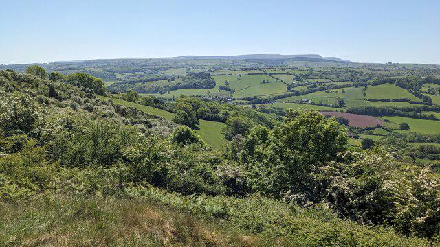 Photo could not load
SO3044 : The Black Mountains (Viewed from Merbach Hill)
Fabian Musto
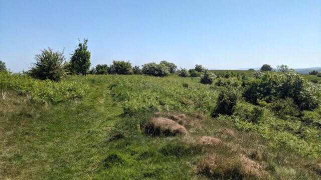 Photo could not load
SO3044 : Merbach Hill
Fabian Musto
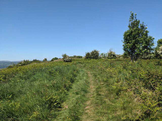 Photo could not load
SO3044 : Merbach Hill
Fabian Musto
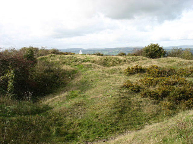 Photo could not load
SO3044 : The summit of Merbach Hill
David Purchase
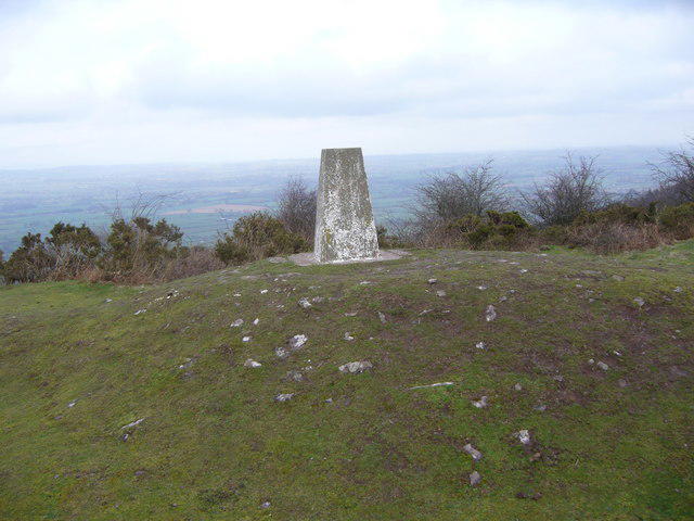 Photo could not load
SO3044 : Merbach Hill trig
Iain Macaulay
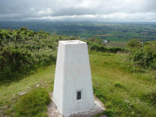 Photo could not load
SO3044 : Trig point on Merbach Hill
Jeremy Bolwell
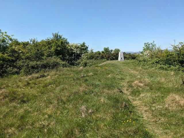 Photo could not load
SO3044 : Merbach Hill
Fabian Musto
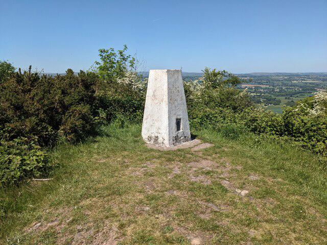 Photo could not load
SO3044 : Trig point on Merbach Hill
Fabian Musto
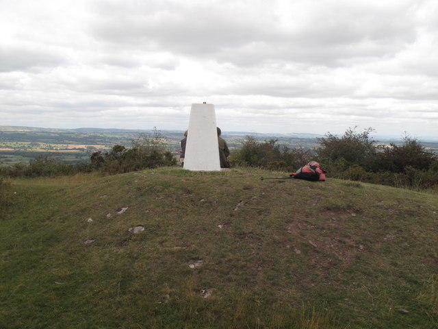 Photo could not load
SO3044 : Merbach Hill
Rude Health
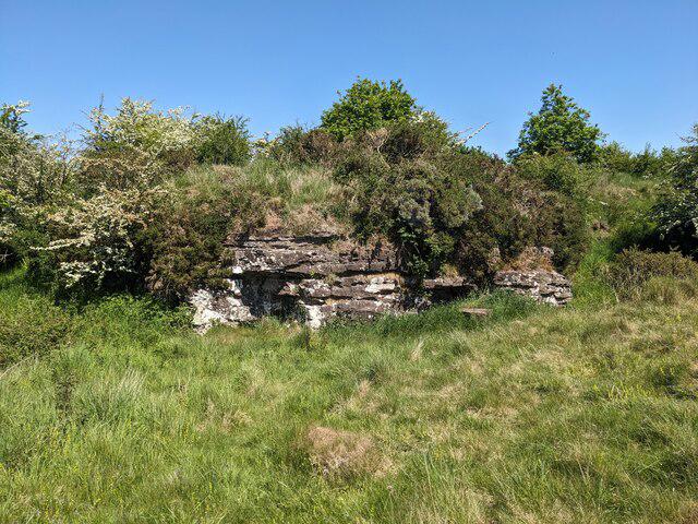
SO3044 : Old quarry at Merbach Hill
Fabian Musto
Hill facts and local notes
Classifications
Elevation
319m
1,045 ft
Prominence
145m
Coordinates
52.0962, -3.0179
SO303446
OS Map
148 161
Explorer: OL13N 201S
At the Summit
The summit features a modest cairn alongside a trig point, providing a perfect spot for a rest and to snap a few photos for the 'gram.
Terrain & Geology
Merbach Hill is primarily composed of Old Red Sandstone, characterized by its reddish hue and sedimentary features. This geological formation offers an insight into the ancient river systems that once traversed the area.
Views & Scenery
From the summit, you can see the Black Mountains to the north and the rolling hills of Herefordshire stretching out to the south.
History & Heritage
Name Origin
The name 'Merbach' is believed to derive from the Old Welsh words for 'hill' and 'boundary', indicating its historical significance as a landmark.
Historical Significance
Historically, Merbach Hill served as a navigational point for trade routes in the region.
Getting There & Facilities
Check current local access restrictions, parking rules and transport timetables before travelling. These notes do not confirm public access to the summit.
Parking
There is a small layby on the B4230 close to the hill for parking, but don’t forget the important snack provisions in your vehicle!
Public Transport
Buses run from Hereford to nearby villages; check local timetables for the best connections.
Nearby Facilities
In the nearby town of Hay-on-Wye, you'll find cafes, restaurants, and public toilets, perfect for a post-hike treat.
Safety Information
Known Hazards
- Beware of muddy conditions after heavy rain. Livestock may be present, so ensure to close gates behind you.
General Safety Tips
- Check weather conditions before setting out
- Carry appropriate clothing and equipment
- Let someone know your planned route
- Take a map, compass, and GPS device
- Carry emergency supplies: food, water, first aid kit, torch
Hills
Some common questions about the hills answered
Are there group walks up Merbach Hill?
Many walkers use Walkmates to join or organise walks with others. You can check for group walks around Merbach Hill through the maps
Are there other walkers around Merbach Hill?
Activity varies by location and time, but Walkmates lets you see whether others have shared walks or shown interest in this area. Find other people through the walking friends search walking friends for Merbach Hill search or of course create your own walk for Merbach Hill
Can I organise a walk to Merbach Hill?
Yes. If there aren’t any walks listed already, you can create a walk and make it available for others to join.
If you're signed up to Walkmates, you can create a walk to Merbach Hill.
How do I find a walk up this hill?
There are often multiple ways to walk this hill, depending on experience and route preference. Walkmates helps you explore walks and routes that others have shared.
Can I suggest a new route up Merbach Hill?
Yes. You can suggest or create routes to share with others. Walkmates focuses on the social side of walking, so routes are used to help people organise walks and explore areas together, rather than as detailed navigation tools or route libraries.
Other uses really appreciate knowledgeable walkers sharing their routes. Share your favourite route to Merbach Hill here
The is an error or something incorrect about this hill. How do I let you know?
We always strive to keep the information on Walkmates as accurate as possible. If you find an error, please let us know through the contact form and we'll aim to correct it as quickly as possible
Community Discussion
Comments
Location
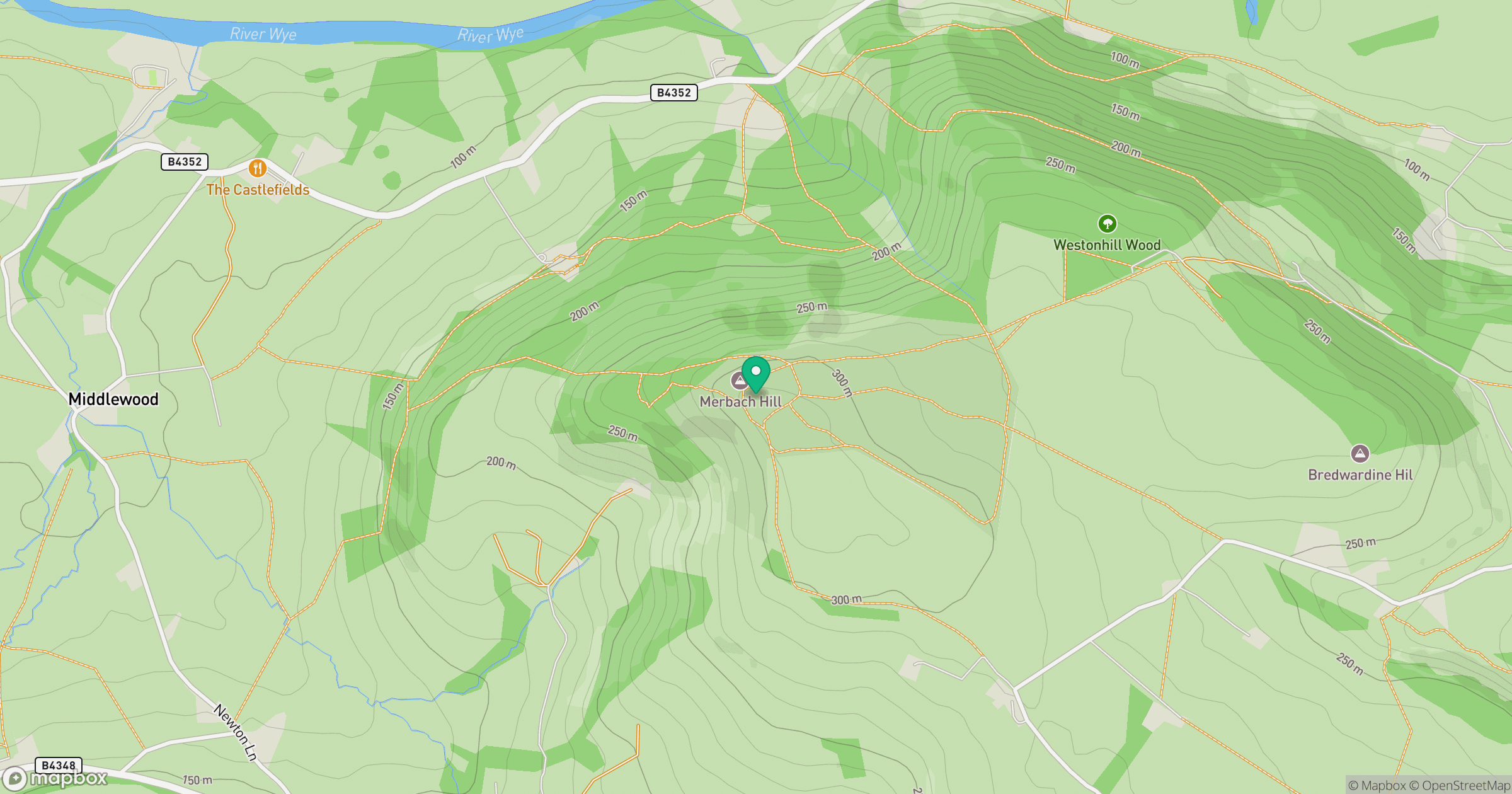
Grid reference: SO303446
View on OpenStreetMapOpens a map in a new tab, centred on the hill.
Hills within 30 km
Straight-line distance, not a walking route or confirmation of access.
No comments yet. Be the first.